

Ha Giang Loop Budget Backpacker Guide: Doing It on $25/Day or Less
Facebook X Reddit Table of Contents Learn more: Ha Giang Loop Tours Here is the good news, and I am going to

Thúy Kiều is a travel blogger and content contributor for Loop Trails Tours Ha Giang. She holds a bachelor’s degree in Sustainable Tourism from Vietnam National University, Hanoi, and has a strong passion for exploring and promoting responsible travel experiences in Vietnam’s northern highlands.
The Ha Giang Loop isn’t just another motorcycle route. It’s 300+ kilometers of mountain passes, minority villages, and scenery that’ll make your Instagram followers question if you used filters (you won’t). But here’s the thing: without understanding the route properly, you might end up taking wrong turns, missing the best viewpoints, or worse—riding in circles trying to find that homestay everyone raved about online.
I’ve watched too many riders pull up to Loop Trails Hostel looking frustrated because they followed outdated maps or relied on spotty GPS signals. That’s exactly why you need this guide. We’re breaking down the entire Ha Giang Loop map with actual waypoints, realistic distances, and the kind of details that only come from running these routes daily.

Learn more: Ha Giang Loop Trails

Learn more: Ha Giang Loop 4 Days 3 Nights
Most riders assume the “loop” part means you just follow one road until you’re back where you started. Not quite. The Ha Giang Loop is a network of routes through Dong Van Karst Plateau Geopark, and there are multiple ways to complete it depending on your time, experience level, and what you want to see.
The loop typically covers Ha Giang City, Quan Ba, Yen Minh, Dong Van, Meo Vac, and back through different valleys. Between these main points, you’re navigating mountain passes that can hit 1,500+ meters elevation, narrow roads carved into cliff faces, and intersections where GPS signals just vanish.
Here’s what makes mapping crucial: road numbers barely exist, signage switches between Vietnamese and minority languages, and that “shortcut” a random traveler mentioned might involve fording a stream on your Honda XR150. A proper route map isn’t just helpful; it’s the difference between an epic adventure and a frustrating mess.

Learn more: Ha Giang Loop 3 days 2 nights
The standard Ha Giang Loop can be done in 2, 3, or 4 days. Most riders pick the 3-day version as it balances time with actually enjoying stops instead of just rushing through. Here’s how the routes break down:
2-Day Express Loop (minimum recommended): Ha Giang → Quan Ba → Yen Minh → Dong Van → Ma Pi Leng Pass → Meo Vac → return via Quan Ba. You’re covering roughly 300 kilometers with limited stops. This works if you’re seriously short on time, but you’ll miss a lot.
3-Day Classic Loop: Ha Giang → Quan Ba → Yen Minh → Dong Van (Night 1) → Ma Pi Leng Pass → Meo Vac → Du Gia (Night 2) → Quan Ba → Ha Giang. This is the sweet spot. You get Ma Pi Leng at a reasonable pace, time for the Nho Que River boat ride, and can actually talk to locals at homestays instead of just collapsing after 8 hours of riding.
4-Day Full Experience: Adds extra stops including Lung Khuy Cave near Quan Ba, extended time at Lung Cu Flag Tower, a morning swim at Du Gia waterfall, and visits to weaving villages. The itinerary splits Dong Van and Lung Cu into separate focuses, and you overnight at Yen Minh, Lao Xa (near Dong Van), and Du Gia.
5-Day Ha Giang + Cao Bang Extension: This combines the classic loop with a ride east to Cao Bang Province, adding Ban Gioc Waterfall, Nguom Ngao Cave, and some of the most remote roads in northern Vietnam. You’re looking at 500+ kilometers total.
The route essentially forms a triangle with Ha Giang City at the bottom point, Dong Van at the top point, and Meo Vac at the right point. Most riders go counterclockwise (Ha Giang → Dong Van → Meo Vac → back), which hits Ma Pi Leng Pass in morning light and returns via easier roads.

Learn more: Ha Giang Loop Weather
Breaking down each day’s route with actual stops, distances, and what you’re really getting into:
Distance: Approximately 150km to Dong Van (120km to Yen Minh for 4-day loop)
Key Waypoints:
Bac Sum Pass: Your first real climb. The road switchbacks uphill about 30 kilometers from Ha Giang City. Views start getting serious here.
Heaven Gate (Quan Ba): The postcard shot you’ve seen everywhere. Two limestone karsts rising from valley floor that locals call the “Fairy Bosom Mountains” (seriously). There’s a viewpoint with vendors selling grilled corn. Pull over here; the photos are worth it.
Quan Ba Town: Small town with food options. If doing the 4-day loop and visiting Lung Khuy Cave, this is your detour point. The cave’s about 3 kilometers off the main route, requires a guide, and takes roughly 90 minutes total.
Tam Son Town: Lunch stop for most tours. Local restaurants serve simple pho and fried rice. Nothing fancy, but fuel is fuel.
Lung Tam Village: Weaving village where H’Mong women make traditional linen. You can buy direct from artisans here. It’s on the main route, so no detour needed.
Yen Minh: If you’re doing 4 days, you overnight here. Decent homestays, quieter than Dong Van. If doing 2-3 days, you push through.
Tham Ma Pass: Gets steep and curvy. The road quality varies; expect some rough patches. Views of terraced fields on both sides.
Dong Van Town: Your Night 1 destination for 2-3 day loops. Old quarter has stone houses, weekend market (Sundays), and plenty of homestay options. Everything’s walkable.
This first day is mostly about getting comfortable with mountain riding. The passes aren’t technically difficult compared to what’s coming, but they’re your warm-up.
Distance: 80-110km depending on Lung Cu detour
Key Waypoints:
Lung Cu Flag Tower (Optional Detour): 25 kilometers north from Dong Van to Vietnam’s northernmost point. The tower sits at the Chinese border. Most riders who do 4-day loops hit this on Day 2 morning. The road is good quality but includes Lo Lo Chai village visit on the way back.
Lo Lo Chai Village: Traditional stilt houses, beautiful architecture. The people are Lo Lo ethnic minority, one of Vietnam’s smallest groups. Morning light is best for photos.
Vuong Palace: Former residence of the H’Mong king from the opium trade era. It’s a fascinating piece of history with French-Chinese-Vietnamese architecture mixed together. Located just outside Dong Van on the way to Ma Pi Leng.
Ma Pi Leng Pass: This is it. The pass everyone comes for. You’re riding on road carved into cliff face with 1,000+ meter drops to Nho Que River below. The road surface is good (it was upgraded), but the exposure is intense. Fog can roll in quickly, especially morning or late afternoon.
Ma Pi Leng Skywalk: Glass platform jutting from the cliff. Costs extra but decent views if you’re into that. The best photos are actually from the road about 500 meters past the skywalk.
Nho Que River Viewpoint: Where you stop to arrange boat rides if you want them. The turquoise water cutting through the canyon is stunning. Boats cost extra and aren’t included in basic tour prices.
Tu San Canyon: One of Asia’s deepest canyons. You don’t go into it; you view from above while riding the pass. The scale is hard to photograph; it genuinely needs to be seen.
Meo Vac Town: Finish point for Day 2. Smaller than Dong Van but has good homestays and a Sunday market that’s worth timing your trip for.
Ma Pi Leng is the technical and scenic highlight. Take your time here. Riders who rush through always regret it later.
Distance: Approximately 140km
Key Waypoints:
Meo Vac Market (Sunday Only): If you’re there Sunday morning, the market is incredible. Minority groups come from surrounding mountains to trade. Colors, textiles, livestock trading—it’s the real deal.
M Pass: Named because the road literally forms an M shape when viewed from above. Multiple hairpin turns. Less famous than Ma Pi Leng but equally challenging to ride.
Lung Ho Viewpoint: Overlooks deep valley. Usually less crowded than Ma Pi Leng viewpoints.
Du Gia Village: Your final overnight if doing 3-4 day loop. Very peaceful, rice terraces everywhere, basic homestays. This is where you decompress from the big riding days.
Du Gia Waterfall: Morning swim option on Day 3 or 4 depending on itinerary. The water’s cold but refreshing. Not a huge waterfall, but nice for photos and cooling off.
Duong Thuong Valley: Remote H’Mong valley you pass through on return route. Fewer tourists here; it feels more authentic.
Quan Ba (Return): You’re looping back through Quan Ba on different roads than Day 1, approaching from the east instead of south.
Ha Giang City: Back where you started. Most riders are both exhausted and already planning their next trip.
Day 3 is less intense than Day 2 but longer distance. The roads are generally easier but still mountainous. You’re covering more ground with fewer “must-stop” landmarks.
The 4-day version splits content differently:
This spreads the riding more evenly and adds breathing room. You’re doing 80-120 kilometers daily instead of pushing 150 kilometers on Day 1.

Learn more: Ha Giang Loop 2 Days 1 Night
Let’s talk about what you’re actually riding on, because “mountain roads” means different things to different people.
Ma Pi Leng Pass: The road was upgraded in recent years, so the surface is mostly good quality asphalt. However, there are sections where erosion has created potholes, especially after heavy rain. The challenging part isn’t the road surface—it’s the narrow width (barely two vehicles) and the sheer drops. There are barriers on the cliff side, but they’re not everywhere. Ride this pass in daylight, and if fog rolls in, slow way down or wait it out.
Tham Ma Pass: Mix of good asphalt and rougher sections. Some hairpin turns have loose gravel on the edges. The elevation gain happens quickly, so if you’re on a scooter or smaller bike, expect to work the engine hard.
Chin Khoanh Pass: This one’s on the 2-day route but skipped on longer routes. It has 9 distinct hairpin turns (hence the name “nine corners”). Road quality is decent but narrow.
Heaven Gate (Quan Ba Pass): Wide, well-maintained. This is basically a tourist stop with good infrastructure. Easy riding.
General Road Surfaces: Main routes between towns are paved and maintained. However, sections through villages might be concrete, rough asphalt, or even dirt. If you’re on a self-drive tour, Honda XR150s or similar bikes handle everything fine. Automatic scooters struggle on steep climbs but can do it.
Rainy Season Considerations: Roads can get slippery, landslides happen on steeper sections, and visibility drops. The loop is rideable year-round, but June through September brings the highest rainfall. October through December is dry with clear skies (best time). January through March can be cold with occasional road ice above 1,500 meters.
The roads aren’t terrible by Vietnamese standards, but they demand attention. You’re not cruising on autopilot. Animals wander across roads, local traffic includes overloaded trucks on blind corners, and that vendor who set up a corn stand might be partially blocking your lane.

Learn more:Ha Giang Loop Easy Riders
Cell signal on the Ha Giang Loop is inconsistent at best. You’ll have coverage in main towns (Ha Giang City, Dong Van, Meo Vac) but expect dead zones on passes and between villages. Here’s what actually works:
Maps.me: Download the northern Vietnam region before leaving Hanoi or Ha Giang City. The offline maps show main roads accurately. The app isn’t perfect for finding specific homestays, but it’ll keep you on the right route.
Google Maps Offline: You can download map areas in Google Maps for offline use. The satellite view is helpful for verifying roads. However, Google’s routing sometimes suggests “shortcuts” that are basically footpaths. Stick to main roads unless you know what you’re doing.
Komoot: Popular with motorcycle tourists. You can plan routes in advance with waypoints. The offline maps work well, though the Vietnam coverage isn’t as detailed as more touristy countries.
Physical Map: Loop Trails Hostel provides route maps at the morning briefing. Keep this as backup. When your phone battery dies (and it will if you’re using GPS all day), paper doesn’t need charging.
GPS Coordinates for Key Points:
What Doesn’t Work: Real-time traffic apps like Waze. There isn’t enough user data in these rural areas. Also, don’t count on asking directions easily; many locals speak limited Vietnamese, let alone English.
Practical GPS Tips: Bring a power bank. Phone mounts that vibrate loose are common on rough roads—use rubber damping or check tightness regularly. Have screenshots of your route saved in photos as backup reference.
Most organized tours (easy rider or jeep tours with Loop Trails) mean you don’t need to navigate personally. The guides know every turn. Self-drive riders need to take GPS seriously.

Learn more: Combo Ha Giang Cao Bang 5 Days 4 Nights
The 5 days 4 nights Ha Giang + Cao Bang route extends the classic loop east into Cao Bang Province. This adds 200+ kilometers but includes some of the most untouched areas in northern Vietnam.
Route Overview: Ha Giang → Dong Van → Meo Vac → Bao Lac → Ha Quang → Trung Khanh → Ban Gioc → Cao Bang City
Key Additions:
Bao Lac: Hill town where you transition from Ha Giang to Cao Bang Province. The roads between Meo Vac and Bao Lac include multiple high passes with minimal traffic.
Khau Coc Cha Pass: 15 distinct curves descending into Xuan Truong Valley. This pass is less known than Ma Pi Leng but equally scenic. The valley below grows tea.
Na Tenh Pass: Less technical than Khau Coc Cha but beautiful views of limestone formations.
Pac Po Historical Site: Where Ho Chi Minh returned to Vietnam in 1941. Small museum and caves where he stayed. History buffs find it interesting; others find it a quick stop.
Ban Gioc Waterfall: Vietnam’s largest waterfall, straddling the Chinese border. The volume of water is impressive, especially wet season. You can take boat rides close to the falls.
Nguom Ngao Cave: Massive limestone cave system near Ban Gioc. Well-lit paths, multiple chambers, impressive stalactites. Takes about 90 minutes to tour properly.
Road Conditions: Generally good between major points but more remote. You might go 40 kilometers without seeing shops. Fuel planning becomes important.
This extension is for riders who want more adventure and fewer tourists. The villages between Bao Lac and Ban Gioc see far less traffic than the main Ha Giang Loop. You’re also adding elevation—some passes top 1,800 meters.
The tradeoff is time and increased difficulty. If you’re comfortable with 4 days of mountain riding and want to see less-traveled areas, it’s worth it. If you’re newer to motorcycles or short on time, stick with the classic loop.

Learn more: Ha Giang Cao Bang by Jeep and motorbike
This matters more than you might think. Your riding experience, confidence level, and what you want from the trip should determine which option you book.
Easy Rider (Driver + Passenger): You sit behind an experienced local driver on a semi-automatic bike. The driver handles all navigation, road conditions, and decisions. You’re free to take photos, enjoy views, and not stress about that truck coming around a blind corner.
Best For: First-time Vietnam riders, people uncomfortable with motorcycles, anyone who wants to focus on scenery over riding, photographers who need both hands free.
What You Need: Basically nothing. Show up, helmet is provided, hold on. No license required since you’re a passenger.
Cost: 3-day easy rider runs 4,390,000 VND per person. 4-day is 5,490,000 VND per person. 2-day option is 3,490,000 VND per person.
Self-Drive (You Ride): You’re given a motorcycle (usually Honda XR150 or similar) and ride yourself. Tours include guide vehicles you follow, but you control your own bike.
Best For: Confident riders who want the freedom of riding but with route support, people who’ve ridden motorcycles before (anywhere), travelers who want the skill-building experience.
What You Need: Technically you need an international driving permit with motorcycle category or Vietnamese motorcycle license. Enforcement varies, but you want proper documentation for insurance and checkpoint purposes.
Cost: 3-day self-drive is 3,590,000 VND per person. 4-day is 4,690,000 VND per person. Not available for 2-day tours.
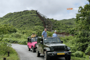
Jeep Tours (Private Vehicle): You’re in a 4×7 seater jeep driven by a guide. Can fit 1-4 passengers comfortably. Ride the entire route without touching a motorcycle.
Best For: Families, people who can’t ride motorcycles for medical/comfort reasons, small groups who want privacy, anyone doing the loop in rainy season and wanting more weather protection.
What You Need: Nothing beyond showing up. Safe for all ages.
Cost: Jeep pricing is per group, not per person. 3-day jeep for 1 pax is 8,990,000 VND. For 2 pax it’s 16,990,000 VND. For 3 pax it’s 19,990,000 VND. For 4 pax it’s 22,900,000 VND. The 4-day version runs 11,990,000 to 30,990,000 VND depending on group size.
What’s Included: All tour options include dorm accommodation at homestays, all meals (breakfast, lunch, dinner), guide services, and activities mentioned in itineraries. What’s NOT included: upgrade to private rooms (vs dorm beds), sleeper bus from Hanoi to Ha Giang and return, personal expenses.
Bus Transport Options: You can book buses separately from Hanoi, Ha Long, Cat Ba, Ninh Binh, or Sapa to Ha Giang. Bus types include VIP sleeper bus, cabin sleeper bus, limousine bus, or private car. After the loop, you can bus from Ha Giang to any of those cities, or if doing the Cao Bang extension, buses run from Cao Bang to major cities.
The honest answer? If you’ve never ridden a motorcycle, don’t make Ha Giang your learning experience. The roads demand skill. Easy rider or jeep tours let you enjoy the loop without risk. If you’re an experienced rider, self-drive gives you the freedom to stop whenever something catches your eye, which is often.

Learn more: How to get Ha Giang from Hanoi
Homestays are the standard accommodation throughout the loop. These are local family homes that have added guest rooms, usually with shared bathrooms and dorm-style sleeping. Here’s what to expect at each overnight location:
Yen Minh: If you’re doing the 4-day loop, this is Night 1. Homestays here are basic—mattresses on platforms, shared squat toilets, cold water showers. But the families are welcoming, and dinner is communal with other travelers. Upgrade to private rooms is possible at some homestays for extra cost.
Dong Van: Night 1 for 2-3 day loops, or Night 2 for 4-day loops. Dong Van has more options including actual hotels if you want them. Most tours use local homestays in the old quarter. Bathrooms are slightly better than Yen Minh, some have hot water. The town itself is walkable at night.
Meo Vac: Less developed than Dong Van. Homestays are similar to Yen Minh in quality. Sunday market makes this a fun night to stay, but book early as it fills up.
Du Gia: This is the most remote overnight. Basic homestays in minority villages. Electricity can be inconsistent, phone charging is hit or miss, and showers are often bucket-based. But the setting—surrounded by rice terraces with zero light pollution—makes up for it. This is where you sit on a porch, drink rice wine with locals, and actually disconnect.
What’s Provided: Bedding, mosquito nets (needed in warmer months), dinner, and breakfast. Homestays on organized tours include “happy water” (local rice wine) and sometimes local music or games in the evening.
Private Room Upgrades: Not all homestays offer private rooms. When available, expect to pay 100,000-200,000 VND extra per night. This gets you a room with a door, but still likely shared bathroom facilities.
What to Bring: Your own toiletries (homestays don’t provide them), toilet paper, hand sanitizer, headlamp or flashlight, and earplugs if you’re a light sleeper (dorms can be noisy).
Honestly, the homestays are part of the experience. They’re not luxury, but you’re staying with H’Mong, Tay, or Lo Lo families, eating home-cooked food, and sleeping in villages that barely existed on tourist maps a decade ago.

Learn more: Ha Giang Jeep Tours comlete guide
The Ha Giang Loop runs through a sensitive border region with China. You’ll encounter police checkpoints and permit verification points. Here’s what you need to know:
Required Documents: Vietnamese law requires foreign travelers to have their passport and a special permit to travel through Dong Van Karst Plateau Geopark. Most organized tour companies handle the permit paperwork for you—it’s included in tour costs. If you’re going fully independent, you need to arrange this at Ha Giang City police station yourself.
Where Checkpoints Appear: The main checkpoint is usually between Tam Son and Yen Minh on Day 1. Police verify your passport and permit. Another common checkpoint is near Dong Van. Occasionally there are random checks near border areas.
What They Check: Passport, permit, and sometimes motorcycle registration papers. If you’re self-driving, they might ask for your license. Foreigners sometimes get waved through quickly; other times they check everything carefully. It varies.
If You Don’t Have Permits: You can be turned back or fined. The fine amounts are inconsistent, but you’re better off having proper documentation than arguing with police in broken Vietnamese.
For Easy Rider & Jeep Tours: Your guide handles all checkpoint interactions. You just need your passport accessible.
Speed Traps: Not common on the loop itself, but they exist on the road from Hanoi to Ha Giang. Stick to posted limits or follow local traffic flow.
The permit system exists because you’re near the Chinese border and traveling through minority regions. It’s bureaucracy, but it’s also how they track tourists in remote areas. Organized tours make this painless.

Learn more: Best time to visit Ha Giang
The Ha Giang Loop is rideable year-round, but conditions change dramatically with seasons. Here’s what you’re getting into each time of year:
September-November (Best Overall): Clear skies, dry roads, comfortable temperatures (20-25°C daytime, cooler at night). This is peak season for good reason. October especially offers perfect riding weather. Rice terraces are golden after harvest, visibility is excellent for Ma Pi Leng Pass, and road conditions are ideal.
December-February (Cold but Clear): Temperatures can drop to 5-10°C at elevation, sometimes lower. Pack layers. Roads can have ice on shaded sections above 1,500 meters in January-February. Fewer tourists, which means less crowded homestays and more authentic interactions. If you’re okay with cold, it’s a great time. Bring proper riding gear.
March-May (Warming Up): Spring flowers bloom in minority villages. Weather is unpredictable—some days are beautiful, others bring sudden rain. The advantage is fewer tourists than fall, but you need to watch weather forecasts. Road conditions are generally good.
June-August (Wet Season): This is rainy season. Expect afternoon showers, occasional landslides on steep sections, and slippery roads. That said, the mountains are lush and green, waterfalls have more volume, and rice terraces are vibrant. If you’re okay with rain gear and slower riding, it’s still doable. Visibility on Ma Pi Leng can be poor due to fog.
Special Considerations: If you’re timing your visit for markets, Dong Van and Meo Vac both have Sunday markets. Plan your loop so you’re in one of those towns on a Sunday morning.
Buckwheat Flower Season: Late October through November sees pink-white buckwheat flowers covering hillsides. It’s stunning and draws photographers. Book tours early if you want this window.
The honest truth is that September-November and March-May are your best bets for balancing weather, road conditions, and scenery. Summer is manageable but wet. Winter is cold but has charm if you’re prepared.

Learn more: Ha Giang on September & October
People mess this up more than they should. Here’s what I see going wrong regularly:
Mistake 1: Following Outdated Blog Maps: A blog post from 2019 might show roads that have since been upgraded, or villages that aren’t homestay stops anymore. Routes change. Always verify maps are current or get guidance from tour operators who run the route weekly.
Mistake 2: Assuming GPS Works Everywhere: Your phone GPS might show a route, but if you’re following turn-by-turn directions through a dead zone, you’ll miss the turn. Download offline maps and have backup paper maps.
Mistake 3: Planning Unrealistic Distances: I’ve seen riders plan to do the full loop in 1.5 days because Google Maps says it’s only 300 kilometers. That’s not accounting for mountain roads, photo stops, actual lunch breaks, and the fact that you’re averaging 30-40 km/h on passes, not 80 km/h like highway riding.
Mistake 4: Trusting “Local Shortcuts”: Another traveler at your hostel might tell you about an amazing shortcut they took. Unless that person has done the route multiple times or knows the area well, their “shortcut” might be a rough village road that adds time instead of saving it.
Mistake 5: Not Checking Road Closures: After heavy rain, sections of the loop can temporarily close due to landslides. This is more common June-September. Tour operators get updates, but if you’re going independent, check with Ha Giang City authorities or local hotels before heading out.
Mistake 6: Ignoring Fuel Planning: Small towns have fuel. Villages don’t always. If you pass a gas station and your tank is below half, fill up. Running out of fuel 30 kilometers from the next town is a problem.
Mistake 7: Over-Relying on Smartphone Navigation: Bring a physical map or write down the major waypoints. Your phone can die, get damaged in a fall, or overheat in direct sun. Always have a backup.
Mistake 8: Following the “Fastest Route” Option: GPS apps often suggest time-saving routes that are terrible for motorcycles—rough dirt, extremely steep grades, or roads that require technical off-road skills. Stick to known main routes unless you’re very experienced.
Most of these mistakes are avoidable with a bit of preparation and realistic expectations. The loop is well-established; you don’t need to reinvent the wheel with routing.
Yes, you can rent a motorcycle in Ha Giang City and ride independently. However, you’ll need to arrange your own permit, navigation, and accommodation. Most independent riders use a combination of Maps.me and asking locals for directions. If you’re comfortable with remote motorcycle touring and speak basic Vietnamese, it’s doable. First-timers to Vietnam usually prefer the structure of a tour.
Sleeper buses run nightly from Hanoi to Ha Giang City. The journey takes about 6-7 hours. You can book VIP sleeper buses, cabin buses, or limousine buses depending on comfort level. Most depart Hanoi between 9 PM and 11 PM, arriving in Ha Giang early morning (5-7 AM). Prices range from 250,000 to 400,000 VND depending on bus type.
The roads themselves aren’t inherently dangerous, but they’re challenging. Narrow cliff-side sections, blind corners, and occasional livestock on roads require attention. The biggest risks are from: inexperienced riders going too fast, riding in poor weather without proper gear, and bike mechanical issues on remote sections. With proper preparation and realistic skill assessment, it’s safe. Thousands of tourists complete it annually without incident.
You ride in rain gear or wait out heavy downpours. Roads can get slippery, especially on painted road markings and metal drainage grates. Visibility drops in fog. Most tours continue in light rain but might adjust the schedule if conditions are severe. If you’re self-driving and uncomfortable with wet roads, you can always stay an extra night in town and wait for better weather.
Yes, but it’s not ideal. Scooters struggle with steep grades, especially loaded with luggage and a passenger. Semi-automatic motorcycles or manual bikes with gears (like the Honda XR150) handle the passes much better. If you’re on a scooter, expect slower speeds on climbs and more engine strain. Many tour operators don’t offer scooters for this reason.
Organized tours range from 3,490,000 VND (2-day easy rider) to 5,490,000 VND (4-day easy rider). Self-drive tours are 3,590,000 to 4,690,000 VND. Jeep tours range from 8,990,000 VND to 30,990,000 VND depending on group size and duration. These prices include accommodation, meals, and guide services. You’ll need additional budget for bus transport to/from Ha Giang, room upgrades if wanted, and personal expenses like drinks or souvenirs.
Legally, yes. You need either a Vietnamese motorcycle license or an International Driving Permit (IDP) with motorcycle category. Many rental shops don’t check, but police checkpoints sometimes do. More importantly, if you have an accident without proper license, your travel insurance likely won’t cover you. Get the proper documents; it’s worth the hassle.
If you’ve got less than 3 days total, do the 2-day loop. If you have 3-4 days and want the full experience without rushing, do the 3-day classic loop. If you have 4+ days and want a relaxed pace with more culture stops, do the 4-day extended route. The 5-day Cao Bang extension requires 5+ days available and interest in more remote areas. Match your available time to the route length, and remember that more time usually equals better experience.
On organized tours, major route changes are difficult because accommodation and meals are pre-arranged. Small detours or skipping optional stops is usually fine if you discuss it with your guide. If you’re going independent, you have full flexibility but need to manage permits and bookings yourself.
Dong Van and Meo Vac have ATMs, but they sometimes run out of cash or don’t accept foreign cards. Bring enough cash from Ha Giang City or Hanoi to cover your entire trip. Most homestays and restaurants only take cash. Small towns along the route don’t have banking.
Expect Vietnamese staples: pho, fried rice, stir-fried vegetables, grilled meat, and rice. Homestays serve family-style meals with whatever’s available locally. Vegetarians can manage but selection is limited. Food is simple but filling. Don’t expect fancy cuisine; you’re in rural mountain villages. Special dietary requirements need to be communicated in advance to tour operators.
Signal is available in main towns but drops out on passes and remote sections. Viettel has the best coverage in rural Vietnam. Don’t expect reliable signal the entire route. Download offline maps, inform family/friends you’ll be unreachable at times, and enjoy the digital detox.
Yes, but comfort level varies significantly by season. Best riding conditions are September-November and March-May. Summer (June-August) is wet but doable. Winter (December-February) is cold but rideable with proper gear. Road closures due to landslides occasionally happen in rainy season but are usually cleared within hours to a day.

Learn more: Ha Giang Motorbike Rental
The Ha Giang Loop isn’t just about ticking off kilometers or getting Instagram photos (though you’ll get plenty). It’s about riding mountain passes that test your skills, staying with families whose language you don’t speak but whose hospitality transcends words, and seeing landscapes that genuinely don’t exist anywhere else in Vietnam.
The map and route we’ve outlined above is your framework. The actual experience happens when you’re leaned into a corner on Ma Pi Leng Pass with Nho Que River 1,000 meters below, or when you’re sitting on a homestay porch in Du Gia watching the sun set over rice terraces while sharing rice wine with a H’Mong grandmother.
Loop Trails has been running these routes for years. We know every turn, every homestay, every checkpoint. Whether you choose easy rider, self-drive, or jeep tour, you’re getting guides who live this loop, not just ride it occasionally.
Check out our full tour options to see which Ha Giang Loop fits your schedule and riding comfort level. We’ll handle the permits, the navigation, the accommodation bookings, and all the details that let you focus on why you came here: the ride itself.
Got questions about routing, tour options, or how the map translates to actual riding? Message us on WhatsApp or book directly through our website. The loop is waiting.
Contact information for Loop Trails
Website: Loop Trails Official Website
Email: looptrailshostel@gmail.com
Hotline & WhatSapp:
+84862379288
+84938988593
Social Media:
Facebook: Loop Trails Tours Ha Giang
Instagram: Loop Trails Tours Ha Giang
TikTok: Loop Trails
Office Address: 48 Nguyen Du, Ha Giang 1, Tuyen Quang
Address: 48 Nguyen Du, Ha Giang 1, Tuyen Quang
Facebook X Reddit Table of Contents Learn more: Ha Giang Loop Tours Here is the good news, and I am going to
Facebook X Reddit Table of Contents Learn more: Ha Giang Loop Tours Most people come to Ha Giang for the adrenaline. The

Facebook X Reddit Table of Contents Learn more: Ha Giang Loop Tours Every few weeks someone messages us with a version of