
Ha Giang Airport: Is There One? How to Get There
Facebook X Reddit Table of Contents If you’ve been researching a trip to Ha Giang and typed “Ha Giang airport” into a

Thúy Kiều (Grace) is a travel blogger and content contributor for Loop Trails Tours Ha Giang. She holds a bachelor’s degree in Sustainable Tourism from Vietnam National University, Hanoi, and has a strong passion for exploring and promoting responsible travel experiences in Vietnam’s northern highlands.

Learn more: Ha Giang Loop Tours
Most Ha Giang Loop itineraries follow a well-worn script: Quan Ba Pass, Yen Minh, Dong Van, Ma Pi Leng, Meo Vac, Du Gia, home. It’s a great script. The famous stops are famous for good reason.
But Ha Giang Province is enormous, the road network is more extensive than most visitors realize, and the Loop — if you look at it on a map — is really just the main thread through a much larger tapestry. There are valleys, passes, and viewpoints that most travelers ride straight past without knowing they exist, simply because they’re not on the standard highlight reel.
M Pass and Lung Ho Valley are two of the best examples. Neither requires a massive detour. Both offer something genuinely different from the showpiece stops — less dramatic in some ways, more intimate in others, and almost always quieter. This guide covers what they are, where they are, and how to work them into a Loop trip that goes a little deeper than the standard circuit.

Learn more: Ha Giang Road Conditions 2026
The Ha Giang Loop became famous through a handful of iconic images: the hairpin bends of Ma Pi Leng, the turquoise ribbon of the Nho Que River far below, the Twin Mountains of Quan Ba rising from the valley floor. These images are real and they’re stunning in person.
But the Loop’s character isn’t just in the postcard moments. It’s in the texture between them — the small commune roads that branch off the main circuit, the valley floors you can only see by descending off the ridge, the passes that don’t have parking areas or entry fees but have views that stop you cold.
Experienced Ha Giang travelers — the ones who’ve done it more than once, or the guides who’ve ridden it hundreds of times — know that the best moments are often not on the tourist map. M Pass and Lung Ho are the kind of places that end up on someone’s highlight reel specifically because they weren’t on the itinerary.

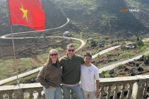
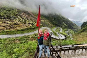
Both locations sit within the Yen Minh District area of Ha Giang Province, in the broader territory between Ha Giang City and Dong Van that forms the first major section of the Loop heading north.
M Pass (sometimes written as Đèo M or referred to by its Vietnamese name depending on the local guide) is a mountain pass that branches off or sits adjacent to the main Loop road in the Yen Minh area. It’s not a destination in itself in the way Ma Pi Leng is — there’s no ticket booth, no souvenir stand, no crowd waiting at the top. It’s a road with a view, known primarily by local guides and repeat visitors.
Lung Ho (Lũng Hồ Commune) is a valley community in Yen Minh District. The viewpoint associated with Lung Ho offers a perspective down into a deep, layered valley that most travelers pass near without knowing it’s there. The road to the viewpoint is a detour from the main Loop circuit — short enough to do without significantly affecting your day, long enough that the casual traveler doesn’t bother.
A note on specific GPS coordinates and access roads: Both locations are navigable with local knowledge, but access details and road conditions can change. If you’re traveling self-drive, the best approach is to ask your accommodation in Yen Minh or Ha Giang City for the current best approach, or use a local guide who knows the area. Coordinates shared online sometimes refer to slightly different access points depending on the source.

Learn more: Ha Giang Loop for Beginners
The approach to M Pass is part of what makes it worthwhile. Unlike Ma Pi Leng — where you ride a well-paved road with low barriers and a lot of other bikes — the road to M Pass has a raw, unfinished quality that feels more like northern Vietnam used to feel before the tourist infrastructure caught up.
The road narrows as you gain elevation. The surface may be rough in sections — conditions change with the seasons, and the pass sees less maintenance attention than the main Loop road. This is not a route for beginners on heavy bikes, and it’s worth asking locally about road conditions before heading up, especially during or after heavy rain.
What you won’t find at M Pass: tour buses, entrance fees, vendors selling tickets to a glass skywalk. What you will find: a mountain road with minimal traffic, the sound of wind, and occasionally a local farmer on a motorbike who gives you a look of mild surprise at seeing a foreign traveler up here.
The view from M Pass isn’t the same genre as Ma Pi Leng’s canyon drama. It’s more expansive — the kind of view where you can see multiple valley systems at once, with ridgelines stacking back into the distance and the Dong Van Plateau beginning to announce itself on the horizon.
On a clear morning, the light on the limestone karst is extraordinary. The rock in this part of Ha Giang has a particular grey-white color that catches low sun in a way that makes even a modest viewpoint look cinematic. In fog — which is common in the mornings, especially outside of peak dry season — M Pass has a different kind of atmosphere: you might see almost nothing, or you might emerge above the cloud layer and look down at a sea of white with peaks poking through.
Both are worth experiencing. They’re different moods, not better or worse.

Learn more: Ha Giang Cao Bang 5 Days
Lung Ho Commune sits off the main Loop road in Yen Minh District. The access road branches from the primary circuit and descends (or ascends, depending on your direction) into the valley. It’s a short detour — measurable in minutes rather than hours — but it feels like stepping into a completely different version of Ha Giang.
The road to the Lung Ho viewpoint is not signposted for tourists in the way that major Loop stops are. This is not an oversight. It’s just a place that hasn’t been packaged yet. Local guides know where to turn; self-drivers will want directions from someone who’s been there recently, or a GPS track from a reliable source.
Getting there on a motorbike is the right call — the road is too narrow and in some sections too steep for a jeep or larger vehicle to navigate comfortably. This is genuinely motorbike territory.

Learn more: Ma Pi Leng Pass
Lung Ho Valley is a long, deep valley enclosed by karst ridges. From the viewpoint, you look down into a patchwork of farmland — rice paddies, corn fields, vegetable plots — spread across the valley floor and climbing the lower slopes in terraces. Villages sit at intervals along the valley, small clusters of houses that look, from above, like they’ve grown naturally out of the landscape.
The scale of it is what gets you. Ha Giang’s big views — Ma Pi Leng, the Twin Mountains — are dramatic in a vertical, canyon-and-peak sense. Lung Ho is dramatic in a different way: horizontal, wide, quietly vast. You can see the whole shape of a mountain valley ecosystem in one glance — the farmland, the villages, the forest above, the cloud catching on the highest ridges.
In October and November, the rice harvest turns the valley floor gold. In spring, it’s vivid green. In winter, there’s a bare, stripped-back beauty to it — brown and grey and very still.
What you won’t see: other tourists. It’s almost always empty up here. A local might pass on a motorbike. A farmer might be working a field below. But the experience is largely solitary in a way that Ha Giang’s famous stops are increasingly not.
It’s not a competition — they’re not the same kind of experience. But for travelers who find themselves wanting something beyond the standard Loop circuit, here’s a rough comparison:
| Lung Ho Valley | Ma Pi Leng Pass | |
|---|---|---|
| Crowd level | Very low | Moderate to high |
| Scenery type | Wide valley, farmland, villages | Canyon, river, dramatic drop |
| Road to get there | Narrow, rough, requires directions | Well-paved main Loop road |
| Entrance fee | None (check locally) | None for road; Skywalk has fee |
| Best for | Slow travelers, photographers, off-the-beaten-path seekers | Everyone — iconic for a reason |
| Requires local knowledge | Yes | No |
The point isn’t that Lung Ho is “better” than Ma Pi Leng. It’s that it’s available — and most people who would love it never visit because they don’t know it exists.

Learn more: Ha Giang Loop 4 Days 3 Nights
Both M Pass and Lung Ho are located in the Yen Minh District area, which is the first major section of the Loop heading north from Ha Giang City. A typical first day on the anticlockwise Loop takes you from Ha Giang City through Quan Ba and on toward Yen Minh — this is the day when both stops are most naturally accessible.
The practical reality: if you’re doing the Loop in 3 days at a moderate pace, adding both M Pass and Lung Ho to your Day 1 requires starting early and not lingering too long at the main Quan Ba viewpoints. It’s doable, but tight. You’d want to be on the road by 7:30–8:00am from Ha Giang City.
If you’re doing 4 days — which is a better pace for the Loop regardless of side trips — the Yen Minh area day becomes more relaxed, and fitting in one or both stops is comfortable.
The key variable: you need to know exactly where to turn. Neither location is well-signposted. This isn’t a “follow the brown tourist signs” situation.
Here’s the argument for building extra time into your Ha Giang Loop itinerary:
The standard 3-day Loop gets you through the highlights. A 4-day Loop lets you breathe. A 5-day Loop lets you discover.
The places most travelers remember best from Ha Giang are rarely the ones on the brochure. They’re the unmarked viewpoint a guide pointed out, the valley you descended into on a whim, the village market that happened to be on that day. M Pass and Lung Ho are exactly that kind of discovery — and they’re only accessible to people who have enough time and flexibility to take the turn.
[→ Our Ha Giang Loop tours are available in 3, 4, and extended-day formats — see our tour options and choose the pace that suits you.]

Learn more: Ha Giang Loop Easy Rider
A few things worth knowing before you go:
Road conditions change Both M Pass and the access road to Lung Ho can be affected by rain, seasonal maintenance, and occasional landslides. Always ask locally about current conditions — what was passable last month may need a detour today. Your guesthouse in Yen Minh or Ha Giang City is the best source of current information.
There are no facilities at either location No cafés, no toilets, no vendors. Carry water, snacks, and make sure your fuel tank is not close to empty before heading up to M Pass. Basic preparation applies.
Go in the morning if possible Both viewpoints benefit from morning light — and morning is before the midday cloud build-up that often affects the views from late morning onward, especially in shoulder seasons.
These are real roads, not tourist paths M Pass in particular is used by local farmers and villagers, not just travelers. Ride carefully, give way to anything coming the other direction on narrow sections, and don’t mistake “remote” for “private.”
Check for new access requirements Ha Giang Province occasionally introduces or modifies access rules for specific areas, particularly near the Chinese border. While Lung Ho and M Pass are not near the border zone, it’s always worth asking your operator or accommodation whether anything has changed. Rules can shift — check local updates before assuming last year’s information still applies.

Learn more: Ha Giang Jeep Tours for groups & families
This is the practical question. Because M Pass and Lung Ho are off the main circuit, how you do the Loop determines whether they’re accessible to you at all.
Self-drive motorbike Best option for flexibility — you can stop, turn back, take detours, and follow a GPS track to an unmarked viewpoint without asking permission from anyone. The trade-off: you need to know where you’re going. Downloading a GPX track from a reliable source or getting specific directions from your accommodation is essential. Without local knowledge of exactly where to turn, you’ll ride straight past both.
[→ See our Ha Giang motorbike rental options — bikes suitable for the full Loop circuit including side roads.]
Easy Rider (guided, riding pillion) This is the most reliable way to reach places like M Pass and Lung Ho. A good local Easy Rider guide will know these spots, will know current road conditions, and will take you there as a natural part of the day rather than as a complicated detour you have to argue for. The limitation: not all Easy Rider guides include side trips like this in their standard route — ask specifically when booking whether the guide knows M Pass and Lung Ho and typically includes them. A guide worth hiring will know exactly what you’re talking about.
Jeep tour Depends on the road conditions and the specific jeep. Lung Ho’s access road may be too narrow for a larger vehicle in some sections. M Pass similarly requires a smaller, more agile vehicle for the upper sections. If you’re doing a jeep tour and want to include these spots, ask your operator directly whether they can access them — a good operator will be honest about which stops work with the vehicle they’re using.
| Loop format | Can access M Pass? | Can access Lung Ho? | Notes |
|---|---|---|---|
| Self-drive motorbike | Yes | Yes | Requires knowing where to turn |
| Easy Rider (local guide) | Yes — if you ask | Yes — if you ask | Best option; guide knows the roads |
| Jeep tour | Possibly | Possibly | Depends on road + vehicle; ask in advance |
[→ Not sure which format works for your group? Message us on WhatsApp — we can advise based on your dates and what you want to see.]

Learn more: Ha Giang to Cao Bang
M Pass (locally known by its Vietnamese name, sometimes called Đèo M by travelers) is a mountain pass located in the Yen Minh District area of Ha Giang Province. It’s an off-the-main-circuit viewpoint known for wide panoramic views over multiple valley systems. It’s not on standard tourist maps and doesn’t have facilities, which is part of what makes it worthwhile.
M Pass involves a mountain road that can be rough and narrow in sections — not recommended for first-time Ha Giang riders without local guidance. Lung Ho’s access road is more manageable but still requires a motorbike rather than a larger vehicle. Both are best approached with either local guidance or genuine off-road motorbike experience.
Lung Ho (Lũng Hồ) is a commune in Yen Minh District, Ha Giang Province. The viewpoint associated with Lung Ho looks down into a deep, wide valley of farmland, rice terraces, and small villages. It’s a short detour from the main Loop road but isn’t signposted for tourists — local knowledge or a GPS track is needed to find it easily.
Neither is a full-day detour — both are measured in hours rather than days. The exact time depends on your pace and how long you spend at each spot. Add them to your Yen Minh District day and plan to start your Loop riding day early (by 7:30–8:00am from Ha Giang City) to keep the day comfortable.
Not technically — but in practice, a local guide makes both significantly easier to access. The turnoffs aren’t well-marked. A local Easy Rider guide who knows the area will take you directly there; a self-driver needs a reliable GPS track or specific directions from someone who’s been recently.
Lung Ho is worth visiting year-round, but the valley is particularly beautiful during rice harvest season (October–November) when the fields below turn gold, and in spring (March–April) when new crops bring vivid green to the terraces. The dry season (October–April) also gives better visibility for the valley views.
At the time of writing, neither M Pass nor Lung Ho Viewpoint charges an entrance fee. This can change — always check locally before visiting, as Ha Giang Province continues to develop its tourism infrastructure.
Yes — both are in the Yen Minh District area and can be combined in the same Loop day. Start early from Ha Giang City (or from Quan Ba if you overnighted there), visit both stops in the morning, and continue on to Yen Minh or Dong Van for the night.
Two reasons: most standard Loop itineraries are built around the most-photographed highlights, and neither stop is easily accessible without knowing where to turn. As Ha Giang tourism has grown, the famous stops have gotten busier — the less-known spots have stayed quiet partly because they require more intentional effort to visit.
A good local guide will know both spots well — they’re not obscure to people from Ha Giang Province. When booking, ask specifically whether the guide includes or knows these locations. If they look confused by the question, that tells you something useful about their local knowledge. A guide who knows the Loop deeply will have no trouble identifying both.
Water, snacks, a full fuel tank, a warm layer (the pass is higher elevation and can be significantly colder than the valley road), and either GPS coordinates or specific directions from someone who’s been there recently. Don’t assume you’ll find refreshments on the way up.
The road requires care — it’s narrow, potentially rough in sections, and may have loose material on the surface. It’s not technically dangerous for an experienced mountain rider, but it demands attention. Don’t ride it fast, don’t ride it in the dark, and check conditions locally after rain.
Contact information for Loop Trails
Website: Loop Trails Official Website
Email: looptrailshostel@gmail.com
Hotline & WhatSapp:
+84862379288
+84938988593
Social Media:
Facebook: Loop Trails Tours Ha Giang
Instagram: Loop Trails Tours Ha Giang
TikTok: Loop Trails
Office Address: 48 Nguyen Du, Ha Giang 1, Tuyen Quang
Address: 48 Nguyen Du, Ha Giang 1, Tuyen Quang
Facebook X Reddit Table of Contents If you’ve been researching a trip to Ha Giang and typed “Ha Giang airport” into a
Facebook X Reddit Table of Contents Learn more: Ha Giang Loop Tours Most travelers discover Ha Giang through the photos — buckwheat

Facebook X Reddit Table of Contents Learn more: Ha Giang Loop Tours Running out of fuel on a mountain road in northern