
Vietnam UNESCO Global Geoparks Explained
Facebook X Reddit Table of Contents Learn more: Ha Giang Loop Tours The first time somebody told me the Ha Giang Loop

Thúy Kiều (Grace) is a travel blogger and content contributor for Loop Trails Tours Ha Giang. She holds a bachelor’s degree in Sustainable Tourism from Vietnam National University, Hanoi, and has a strong passion for exploring and promoting responsible travel experiences in Vietnam’s northern highlands.

Learn more: Ha Giang Loop Tours
Ask ten people who’ve ridden across Vietnam which route blew their mind and you’ll get ten different answers. Some swear by the coastal highway, waking up to the South China Sea every morning. Others went deep into the central highlands and never wanted to leave. A few did the northwest loop through Moc Chau and Dien Bien Phu and felt like they’d found something most tourists miss entirely.
Then there are the people who rode the Ha Giang Loop — and those conversations tend to go differently. Less “it was beautiful” and more “I didn’t expect it to feel like that.”
This isn’t a post about which route is the most popular. It’s about which ones are actually worth your time, which ones live up to the hype, and how to figure out where you fit. We’ve ranked six of Vietnam’s most-ridden motorbike routes — honestly, with real trade-offs, no travel brochure language.
Ha Giang is at the top. Here’s why — and here’s what else is worth considering.

Learn more: Ha Giang Cao Bang by Jeep and motorbike
Rankings like this are always going to be partially subjective. Two riders can do the same road and walk away with completely different impressions based on weather, bike, experience level, and what they were looking for.
So instead of a purely aesthetic ranking (“most beautiful”), we’re judging each route on five factors:
Each route gets a honest assessment on all five. No route is perfect. Some have significant drawbacks worth knowing before you commit.

Learn more: Ha Giang Loop Self-Drive & Rent a motorbike
Here’s what we’re looking at:
There are other routes worth mentioning — the Da Lat highlands, the road from Hue to Da Nang over Hai Van Pass — and we’ll reference them where relevant. But these six are the ones that come up most often when people ask about extended Vietnam motorbike trips, and they represent meaningfully different experiences.

Learn more: Ha Giang Jeep Tours
Scenery: ★★★★★ Road challenge: ★★★★☆ Cultural depth: ★★★★★ Accessibility: ★★★☆☆ Memorability: ★★★★★
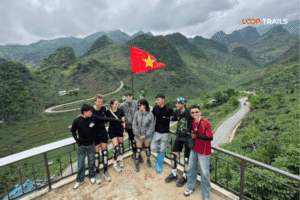
There’s a reason Ha Giang consistently tops every “best motorbike routes in Vietnam” list written by people who’ve actually done it. The landscape here is genuinely unlike anything else in Vietnam — and unlike most things in Southeast Asia, period.
The Ha Giang Loop traces a circuit through Vietnam’s northernmost province, covering the Dong Van Karst Plateau Geopark (a UNESCO Global Geopark), the narrow gorge of the Nho Que River, the switchbacks of Ma Pi Leng Pass, the border plateau near Lung Cu Flag Tower, the market town of Meo Vac, and the greener, waterfall-rich Du Gia valley on the return leg.
The total loop is roughly 300–350 kilometers depending on your exact route. Most riders and passengers do it over 3–5 days.
The short answer: everything stacks on top of itself here.
The karst plateau scenery is extraordinary — massive limestone formations that rise from the ground like something from another geography entirely. But it’s not just scenery. The communities you pass through — H’mong, Lo Lo, Pu Peo, and others — are some of the most culturally intact in all of Vietnam. Dong Van Sunday Market isn’t performing for tourists. The guesthouses on the loop are mostly family-run. The food is local. The pace is slow.
Then there’s Ma Pi Leng Pass. You’ve probably seen photos — the road carved into the cliff face, the gorge dropping hundreds of meters to the impossibly green Nho Que River below. The photos don’t capture the silence up there, or the way the scale keeps revealing itself the longer you look. It’s one of those places where you stop talking and just stare.
The combination of all this — dramatic landscape, living culture, remote roads, physical challenge — is what makes the Ha Giang Loop different from every other route in Vietnam. Other routes might match it on one or two dimensions. None stack them all the same way.

Learn more: Ha Giang Road Conditions 2026
The loop is not technically extreme, but it demands respect. Expect a mix of paved mountain roads, narrow switchbacks, occasional gravel patches (especially after rain), and elevation changes that can be significant. The road from Dong Van down to Meo Vac through Ma Pi Leng is in good condition for its character, but it requires concentration — particularly for self-drivers.
The loop is not recommended for beginners on motorbikes. If you’ve only ridden scooters in flat cities, you’re not ready for the Ha Giang mountain roads unsupported. If you have genuine experience riding in mountain conditions, you’re probably fine. When in doubt, there’s a better option — read on.

Learn more: Ha Giang Loop Easy Rider & Guide
Not everyone who wants to experience the Ha Giang Loop wants to or should be self-driving. Here’s how it breaks down:
Easy Rider (guided, you ride pillion) An experienced local guide drives, you enjoy the scenery. They handle navigation, know every good stop, often speak functional English, and can translate and contextualise the cultural moments you’d otherwise miss. For most first-time visitors to Ha Giang, this delivers the fullest experience with the least stress.
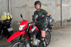
Self-Drive Motorbike Maximum freedom. You set the pace, stay longer where you want, and feel the road directly. The right choice for experienced riders. Always verify current license requirements with your rental provider before going — regulations for foreigners riding in Vietnam can change and vary by enforcement area.
Jeep Tour A 4WD jeep with a driver covers the full loop, stopping at all major viewpoints and points of interest. Comfortable, group-friendly, and accessible for people who aren’t on motorbikes. Increasingly popular with couples and small groups.
Thinking about which format fits your trip? Loop Trails runs Ha Giang Loop tours in all three formats — [browse the Ha Giang Loop tour options here] to compare itineraries, group sizes, and what’s included.

Learn more: Ha Giang to Cao Bang
Scenery: ★★★★★ Road challenge: ★★★★☆ Cultural depth: ★★★★★ Accessibility: ★★★☆☆ Memorability: ★★★★★
If the Ha Giang Loop alone is a five-star experience, adding Cao Bang turns it into a full chapter of a very good book.
Cao Bang Province sits to the east of Ha Giang, and the combined route connects Vietnam’s two most dramatic northern landscapes: the rocky karst plateau of Ha Giang and the forested, waterfall-laced mountains of Cao Bang — home to Ban Gioc Waterfall (one of the largest in Southeast Asia, straddling the Vietnam-China border) and the mysterious Nguom Ngao Cave nearby.
The Phia Oac – Phia Den National Park on the Cao Bang leg adds another dimension: a dense mountain forest that feels completely different from the bare limestone of the Ha Giang plateau. The contrast between the two provinces is actually one of the best things about combining them — you’re not getting “more of the same.”
Travelers with at least 7–10 days available for the combined loop. People who’ve heard about Ban Gioc and want to see it without doing a separate trip. Anyone who wants one of the most comprehensive northern Vietnam motorbike experiences available — with the depth that comes from spending extended time in genuinely remote places.
This is also the route where having a guide makes the most difference. Navigation between Ha Giang and Cao Bang isn’t complicated, but local knowledge — which roads, which stops, which guesthouses — transforms the experience significantly.
[Explore the Ha Giang + Cao Bang combine tour here] — Loop Trails runs this as a multi-day guided format designed specifically for international travelers.

Learn more: Ha Giang Loop route and itinerary
Scenery: ★★★★☆ Road challenge: ★★★☆☆ Cultural depth: ★★★☆☆ Accessibility: ★★★★☆ Memorability: ★★★★☆
The Ho Chi Minh Road — the old wartime supply route, now partially reconstructed as a scenic alternative to the coastal highway — is one of Vietnam’s great motorbike journeys. It runs roughly parallel to the coast through the central and southern highlands, passing through forested mountain areas, coffee plantations, highland market towns, and some of the most culturally rich minority communities in central Vietnam.
The section most riders focus on runs from roughly Phong Nha (in Quang Binh province) south through the highlands toward Da Lat, or from Hue inland — though “the Ho Chi Minh Road” covers multiple different branches and interpretations depending on who you ask.
The central highlands version gives you: good quality roads through stunning mountain scenery, cooler temperatures than the coast, access to communities like the Ede, Jarai, and Bahnar (among others), and the kind of riding that flows — long, winding descents, forested passes, quiet roads with almost no traffic in places.
Da Lat makes an excellent endpoint (or starting point) — a highland city with a completely distinct character from coastal Vietnam, good food, and plenty of routes radiating out from it.
Phong Nha is worth building in if you’re passing through — the cave systems there (Phong Nha Cave, Paradise Cave, Son Doong if you’re booking the world’s largest cave) are extraordinary.
The central highlands route, as beautiful as it is, lacks the concentrated wow-factor of Ha Giang. The scenery is green and lovely — but it’s the kind of lovely that’s easy to become accustomed to after a few days. There’s less of the “I need to stop and just stand here” quality that Ha Giang delivers almost constantly.
The cultural depth is real but requires more effort to access — minority villages here are more dispersed and less prominent on the route than the plateau communities of Ha Giang. It’s also a longer, more logistically complex route to plan for first-time Vietnam riders.
For experienced travelers doing a full north-to-south Vietnam motorbike trip, including the central highlands is a no-brainer. As a standalone week, it’s excellent but plays slightly below Ha Giang on the raw experience scale.

Learn more: Ha Giang Loop Photography guide
Scenery: ★★★☆☆ Road challenge: ★★☆☆☆ Cultural depth: ★★☆☆☆ Accessibility: ★★★★★ Memorability: ★★★☆☆
The coastal route — the main highway running south from Hanoi along Vietnam’s eastern seaboard — is the classic Vietnam motorbike trip in the popular imagination. Hanoi to Ho Chi Minh City, the full length, weeks of riding through every climate and landscape the country has to offer.
Let’s be honest about what this actually is before you romanticize it.
The coastal highway gives you Vietnam’s full spectrum: the rice paddies of the Red River Delta, the limestone scenery of Ninh Binh and Phong Nha, the UNESCO World Heritage city of Hoi An, the royal city of Hue, the beach towns of Da Nang and Nha Trang, and the dense urban energy of Ho Chi Minh City at the end.
As a way to understand the whole country — geographically, culturally, climatically — nothing covers the same ground. The south-to-north (or north-to-south) ride is a genuine adventure in the sense that you’re watching the landscape, food, people, and even language shift around you over weeks.
Some sections are genuinely beautiful. Hai Van Pass between Da Nang and Hue is dramatic — the road climbs a headland and the views over the bays on both sides are spectacular. The stretch through Phong Nha is lovely. Hoi An is worth slowing down for.
QL1A is a major national highway. Large sections of it carry heavy truck traffic, and the riding is less “scenic adventure” and more “getting from place to place while staying alive.” The coastal stretches between main towns can be repetitive — flat, industrial-corridor riding punctuated by tourist beach strips.
For motorbike touring specifically, the coastal highway is best when you use it selectively — joining it for the scenic sections and cutting inland (toward the Ho Chi Minh Road, or toward Da Lat) when the coastal road becomes a transport corridor. The travelers who have the best coastal rides tend to be those who treat it as a framework rather than the whole trip.
As a standalone dedicated motorbike route? It ranks below everything else on this list for the actual riding quality, even if the overall journey has its moments.

Learn more: Ha Giang Adventure
Scenery: ★★★★☆ Road challenge: ★★★★☆ Cultural depth: ★★★★☆ Accessibility: ★★★☆☆ Memorability: ★★★★☆
This is the route that doesn’t get the attention it deserves — and that relative obscurity is actually part of its appeal.
The northwest loop from Hanoi heads out through Hoa Binh into the mountains, climbs to Moc Chau (a plateau famous for its tea plantations, white plum blossoms in spring, and one of the best fresh milk regions in Vietnam), continues through Mai Chau valley, pushes deeper west through Son La province, and eventually reaches Dien Bien Phu — the site of the 1954 battle that ended French colonial rule in Indochina and changed the course of Southeast Asian history.
From Dien Bien Phu, many riders loop back through Lai Chau and Sapa, or descend into the Muong Te area for even more remote riding.
Riders who want something that genuinely feels off the standard circuit. The northwest loop has fewer foreign tourists than Ha Giang or Sapa, which means more authentic interactions, less tourist-infrastructure pricing, and a stronger sense of discovery.
The roads are demanding — some sections are genuinely challenging mountain riding — but the variety is excellent: open plateau riding at Moc Chau, deep valley descents through ethnic minority villages, wide river crossings, and the emotional weight of Dien Bien Phu’s historical landscape.
The Dien Bien Phu museum and the battlefield sites are genuinely moving if you have any interest in 20th-century history. Standing at the fortified French command post or visiting the Vietnamese army positions, with the valley spread out below you, gives the region a layer of significance that purely scenic routes can’t match.
The main drawback: it doesn’t have a single route centerpiece with the visual impact of Ma Pi Leng or Ban Gioc. The northwest loop is more of an accumulated experience — great throughout, stunning in moments, but never quite as dramatically concentrated as Ha Giang.

Learn more: SaPa vs Ha Giang 2026
Scenery: ★★★★☆ Road challenge: ★★★☆☆ Cultural depth: ★★★☆☆ Accessibility: ★★★★★ Memorability: ★★★☆☆
Sapa belongs on this list because many people ride to it from Hanoi, use it as a base for day rides into the surrounding valleys, or combine it with other northern routes. As a destination reached by motorbike and explored on one, it’s a legitimate option — just not the highest-ranking one.
The road from Lao Cai up to Sapa is scenic in the damp, misty way that highland Vietnam does well. The valley roads from Sapa toward Ta Van, Lao Chai, and Ban Ho are genuinely beautiful — rice terraces, stream crossings, narrow tracks through H’mong villages. Day riding from a Sapa base gives you good variety without extreme difficulty.
The honest issue with Sapa as a motorbike destination specifically: Sapa Town is increasingly developed and the most accessible trekking routes have become crowded and somewhat commercialized. You’re often sharing the “scenic” valley roads with tourist groups. The magic is there but you have to work slightly harder to find it than you once did.
For pure motorbike riding quality, Sapa functions better as a staging point for the northwest loop or as an add-on to a Ha Giang trip than as a standalone motorbike destination. That said, the Muong Hoa Valley on a clear morning with the terraces reflecting the sky is one of the more beautiful sights in northern Vietnam — regardless of how you get there.

Learn more: Northern Vietnam Itinerary
| Route | Scenery | Road Challenge | Cultural Depth | Accessibility | Memorability |
|---|---|---|---|---|---|
| Ha Giang Loop | ★★★★★ | ★★★★☆ | ★★★★★ | ★★★☆☆ | ★★★★★ |
| Ha Giang + Cao Bang | ★★★★★ | ★★★★☆ | ★★★★★ | ★★★☆☆ | ★★★★★ |
| Ho Chi Minh Road | ★★★★☆ | ★★★☆☆ | ★★★☆☆ | ★★★★☆ | ★★★★☆ |
| Coastal Highway | ★★★☆☆ | ★★☆☆☆ | ★★☆☆☆ | ★★★★★ | ★★★☆☆ |
| Northwest Loop | ★★★★☆ | ★★★★☆ | ★★★★☆ | ★★★☆☆ | ★★★★☆ |
| Sapa & Lao Cai | ★★★★☆ | ★★★☆☆ | ★★★☆☆ | ★★★★★ | ★★★☆☆ |

Learn more: Cao Bang Loop Tours Vietnam best kept secret
Alright — the ranking is clear, but the right choice depends heavily on your situation. Here’s how to match your profile to the route:
You want the most visually spectacular riding Vietnam can offer, and you have 4–7 days in the north → Ha Giang Loop No contest. Whether you ride pillion with a guide, self-drive, or take a jeep — this is the route. Concentrate your time here rather than spreading it thin across multiple destinations.
You have 8–12 days and want the definitive northern Vietnam motorbike adventure → Ha Giang + Cao Bang Adding Cao Bang gives you Ban Gioc Waterfall, a completely different landscape character from Ha Giang, and the depth that comes from spending real time in the far north. This is the extended version of the same chapter — not a different book entirely.
You’re doing a full north-to-south Vietnam trip by motorbike → Coastal highway as framework + inland detours Use QL1A to connect the dots between Hanoi, Hue, Da Nang, and the south, but cut inland for the Ho Chi Minh Road sections through the highlands. Combine this with a dedicated Ha Giang segment at the start of your trip if time allows.
You want something off the beaten track in the northwest and have riding experience → Northwest Loop Moc Chau, Son La, Dien Bien Phu. Less visited, historically rich, and the riding quality is genuinely excellent. Good choice for experienced riders who’ve already done Ha Giang and want something different.
You’re new to northern Vietnam, want mountain scenery, and aren’t confident on challenging roads → Sapa region day rides, or Ha Giang on an Easy Rider tour Sapa’s valley roads are accessible and beautiful. If Ha Giang calls but self-driving feels too much — the Easy Rider format means you experience every kilometer of the loop without being the one on the controls. That’s not a lesser experience; many people prefer it.
You want to ride in Ha Giang but need rental support and local guidance → [Check Loop Trails’ motorbike rental options in Ha Giang] We can help with bike selection, route briefing, and logistics for self-drivers, as well as fully guided formats for those who want support on the loop.

Learn more: Ha Giang Loop License
License and paperwork: Vietnam has regulations regarding foreigners operating motorbikes, and these do get enforced — particularly in some northern provinces and on routes closer to the Chinese border (including Ha Giang). Current requirements can change — always check with your rental provider or tour operator before you set out. Carrying an International Driving Permit alongside your home country license is generally the safest approach, but verify locally.
Bike selection matters more than most people realize: A semi-automatic or automatic scooter that works fine in Hanoi or Hoi An is not the right tool for mountain roads in Ha Giang or the northwest. If you’re self-driving a challenging route, you want a manual or semi-auto trail bike with enough power and ground clearance for mountain conditions. Talk to your rental provider about this specifically, not just price.
Cash on all routes: ATM availability drops sharply once you leave main towns on any of these northern routes. Stock up before you leave. This is especially true for the Ha Giang Loop and northwest routes.
Weather is the most important variable you can’t control: Northern Vietnam mountain routes can turn from perfect to dangerous quickly — rain, fog, and dropping temperatures happen on any day of the year, even in “good” seasons. Build flexibility into your schedule, carry rain gear always, and don’t ride in mountain fog if you’re not confident.
Travel insurance: Make sure your policy covers motorbike riding. Many standard policies exclude it, particularly for engine sizes above a certain cc threshold. Check the fine print before you go, not after.
Solo vs. group: On technically demanding routes like Ha Giang and the northwest loop, having at least one other person with you significantly reduces risk if something goes wrong with your bike or your health. Solo riding is done all the time — but have a plan, keep someone informed of your route, and know how to reach help.
Planning your Ha Giang section specifically? Loop Trails runs small-group Easy Rider tours, jeep tours, and can support self-drive riders in Ha Giang and on the combined Ha Giang–Cao Bang route. [Get in touch via WhatsApp] or [browse current tour options] — we’re straightforward about what’s involved and happy to help you figure out the right format for your trip.
For most travelers, the Ha Giang Loop is the top pick — it stacks dramatic scenery, genuine cultural depth, and challenging riding into one of the most concentrated and memorable experiences available anywhere in Southeast Asia. The Ha Giang + Cao Bang extension takes it further if you have the time.
License requirements for foreign riders in Vietnam are a real and evolving issue. The generally safe approach is to carry an International Driving Permit alongside your home country license — but requirements are enforced inconsistently and the rules can change. Always verify current requirements with your rental provider before heading out, particularly on routes near provincial borders or the Chinese border.
Self-driving the Ha Giang Loop as a beginner is not a good idea — the mountain roads require genuine experience, particularly in wet or foggy conditions. That said, the Ha Giang Loop is absolutely accessible for non-riders or beginners via Easy Rider (you ride pillion with an experienced guide) or jeep tour. These are genuinely excellent ways to do the loop — not consolation prizes.
Most riders cover the loop in 3–5 days, with 4 days being the sweet spot that allows you to ride properly and stop at the key points without feeling rushed. Some people extend to 5–6 days by adding the Quan Ba pass area, Pho Cao, or extra time in Meo Vac.
For the actual riding experience, yes — the Ho Chi Minh Road through the central highlands offers more scenic, quieter roads with more interesting terrain than the main coastal highway. Many experienced riders use QL1A to connect major towns and the Ho Chi Minh Road for the actual riding. They’re not mutually exclusive.
Ha Giang on an Easy Rider or jeep tour is excellent for couples — one partner doesn’t need to ride and both get the full experience. Sapa valley day rides and the coastal highway (in segments) are also well-suited to couples with mixed riding abilities. The northwest loop can work for two experienced riders traveling together.
You can rent motorbikes in Ha Giang City — no need to ride the 4–5 hours from Hanoi on a rented bike. Local rental options are available, with quality and selection varying by provider. Loop Trails can advise on rental options in Ha Giang for self-drivers.
September to November is peak season, and for good reason — roads are generally drier, the buckwheat flowers bloom in October–November, and the harvest light is exceptional. March to May is a strong second choice for the vivid green plateau scenery. Check local road conditions before any trip regardless of season.
Yes, for most travelers — especially if you have 7–10 days in the north. Ban Gioc is genuinely spectacular and the Cao Bang countryside around it has a completely different character from the Ha Giang karst plateau. Combining the two provinces gives you a much richer northern Vietnam experience than doing Ha Giang alone.
Costs vary significantly depending on how you do it: guided Easy Rider tour, jeep, or self-drive with rental. Check with tour operators for current pricing — rates vary by group size, season, and itinerary length. Self-driving with a rental bike is generally the cheapest format; full guided tours cost more but include accommodation, meals at stops, and local expertise that meaningfully affects the experience.
If self-driving, a trail-style bike with good ground clearance and enough power for extended mountain climbs is the right choice. Semi-automatic scooters are underpowered for mountain riding and not recommended for challenging sections. Talk specifically to your Ha Giang rental provider about what’s available and appropriate — not all rental fleets are equal.
Yes — and it works well. The typical route involves either going Hanoi → Ha Giang → return Hanoi → Sapa, or Hanoi → Sapa → return to Hanoi → Ha Giang. There’s no easy direct road between the two, so most travelers return to Hanoi in between. Allow 10–14 days for a comfortable combined trip.
Contact information for Loop Trails
Website: Loop Trails Official Website
Email: looptrailshostel@gmail.com
Hotline & WhatSapp:
+84862379288
+84938988593
Social Media:
Facebook: Loop Trails Tours Ha Giang
Instagram: Loop Trails Tours Ha Giang
TikTok: Loop Trails
Office Address: 48 Nguyen Du, Ha Giang 1, Tuyen Quang
Address: 48 Nguyen Du, Ha Giang 1, Tuyen Quang
Facebook X Reddit Table of Contents Learn more: Ha Giang Loop Tours The first time somebody told me the Ha Giang Loop
Facebook X Reddit Table of Contents Learn more: Ha Giang Loop Tours The first time I rode into Cao Bang I kept
Facebook X Reddit Table of Contents Learn more: Ha Giang Loop Tours Every week someone sends us a message that begins the