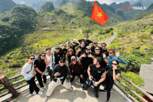


Thúy Kiều (Grace) is a travel blogger and content contributor for Loop Trails Tours Ha Giang. She holds a bachelor’s degree in Sustainable Tourism from Vietnam National University, Hanoi, and has a strong passion for exploring and promoting responsible travel experiences in Vietnam’s northern highlands.
Learn more: Ha Giang Loop Tours
If you’ve been dreaming about Vietnam’s limestone karst landscapes but thought you’d have to choose between regions, here’s the good news: you don’t. In one epic journey, you can explore both the Dong Van Karst Plateau Geopark in Ha Giang and the Non Nuoc Cao Bang Geopark in Cao Bang province. These aren’t just scenic loops you check off a bucket list. They’re two of Southeast Asia’s most dramatic geological wonders, and combining them creates an unforgettable adventure that most tourists miss.
I’ve spent enough time on these roads to know what works and what doesn’t. This guide will walk you through everything: the itinerary, costs, safety, which transport option suits you best, and real practical tips from people who’ve actually done it (not just theory).
Learn more: Ha Giang Loop 2 Days 1 Night
Let’s start with the geology, but I’ll keep it simple. Both geoparks are UNESCO-designated sites because their landscape tells the story of Earth’s evolution over hundreds of millions of years.
Dong Van Karst Plateau Geopark (Ha Giang province) is a 2,356 square kilometer expanse of dramatic limestone karst terrain. Think towering rock formations, hidden valleys, and dramatic mountain passes. The plateau sits at around 1,000–1,200 metres elevation, which means cooler temperatures and stunning views that change depending on where you stand. The landscape was shaped by ancient tectonic movements and erosion, creating the jagged peaks and sinkholes you see today.
Non Nuoc Cao Bang Geopark (Cao Bang province, about 200 km northeast) is equally dramatic but in a different way. Instead of high plateau, it’s characterized by spectacular waterfalls, deep gorges, and limestone cliffs. Ban Gioc Waterfall, the most famous feature, is Southeast Asia’s largest international waterfall (shared with China). The geopark covers 2,422 square kilometres and includes fascinating cave systems and river valleys.
Why are they UNESCO Geoparks? Because they showcase exceptional geological heritage and tell stories about plate tectonics, erosion, karst development, and the relationship between geology and human settlement. For visitors, what this means in practice: you’re seeing geology in action, not just pretty rocks.
Learn more: Ha Giang Loop 3 Days 2 Nights
Here’s the practical reason: they’re relatively close to each other (roughly 200–250 km apart) and combining them into one journey makes sense logistically. More importantly, they’re geologically distinct enough that back-to-back visits create a richer understanding of Vietnam’s landscape diversity.
Dong Van gives you: High altitude drama, winding mountain passes (especially Ma Pi Leng), minority culture encounters, and some of Vietnam’s most famous viewpoints. The experience is more rugged and remote.
Cao Bang gives you: Waterfall spectacle, cave exploration, and areas that are slightly more developed (easier to access) but still genuinely adventurous. The experience feels wilder in a different way because of the water features.
Together, they showcase two completely different geological stories. Doing both in one trip is like seeing the full exhibition rather than just one gallery. Plus, logistically, it’s only an extra day or two compared to doing them separately.
Learn more: Ha Giang Loop 4 Days 3 Nights
Most travellers allocate 5–6 days total for both geoparks combined. Here’s a realistic breakdown:
Start in Ha Giang town (northern Vietnam, roughly 5–6 hours from Hanoi by car). Your first day is an easy ride via the scenic Tham Ma Valley route. You’ll pass through local villages and ease into the landscape. Stop at viewpoints along the way. Arrive in Dong Van by late afternoon.
Distance: ~70 km
Driving time: 2.5–3 hours (assuming relaxed stops)
Highlight: Tham Ma Valley views, first taste of karst formations
This is the heavyweight day. You’ll tackle the most famous section of Dong Van Geopark. Start early. The circuit includes:
Distance: 60–80 km loop (starting and ending in Dong Van)
Driving time: Full day (5–7 hours including stops)
Highlight: Ma Pi Leng Pass, Nho Que River, minority settlements
A second day in Dong Van if you’re pacing slower, or a half-day exploring Lung Cu Flagpole (the northernmost point, right on the China border). You’ll see limestone cliffs, historical markers, and sweeping views.
Alternative: If you’re on a tight schedule, use this day to start driving toward Cao Bang. It’s roughly 150–180 km from Dong Van to Cao Bang town, taking 4–5 hours depending on route and stops.
Distance: Lung Cu is ~45 km from Dong Van town (round trip)
Highlight: Border views, Flag Tower, quiet plateau atmosphere
Learn more: Ha Giang Cao Bang 5 Days 4 Nights
Drive from Dong Van to Cao Bang town (or skip Lung Cu on Day 3 and go straight). Settle in Cao Bang. In the afternoon, head to Ban Gioc Waterfall, about 60 km away (roughly 1.5–2 hours drive). You’ll hike a short trail to the base. The waterfall is impressive year-round, but much more dramatic during rainy season (May–October).
Distance: Cao Bang town to Ban Gioc is ~60 km
Highlight: Southeast Asia’s largest international waterfall, photo ops, riverside walks
Explore the deeper parts of Non Nuoc Cao Bang Geopark. Depending on your interests:
Most of this day is spent exploring valleys and caves, so you’re less mobile than Day 2. Plan on guided visits or slower exploration.
Distance: Variable (30–50 km depending on what you visit)
Highlight: Cave exploration, limestone gorges, quieter landscapes
If you need to return to Hanoi, it’s roughly 260 km (6–7 hours). Alternatively, spend extra time in Cao Bang if you’re not rushed. Some travellers add a day here to explore Phia Den, Thac Bac waterfall, or just relax.
If you’re tighter on time:
Learn more: Ha Giang Motorbike Rental
Let me break down the key spots within Dong Van that shouldn’t be missed:
This is the star. The pass sits at 1,500 metres and features the most famous stretch of road in northern Vietnam. The road is well-maintained but narrow with dramatic switchbacks. On clear days, you can see down into the Nho Que River valley hundreds of metres below. There’s a viewpoint area at the top.
Why it’s special: It’s where geology meets engineering. The pass had to be carved through solid rock, and the views reward the effort. Photography is incredible at different times of day.
Practical note: The pass is open year-round. In fog or heavy rain, visibility drops significantly, which changes the experience but doesn’t close it. During wet season (May–September), roads can have temporary slippery sections. Check updates if visiting during monsoon.
A quiet village on the plateau, Meo Vac is where you’ll find authentic local life. There are some guesthouses and simple restaurants, but it’s genuinely underdeveloped compared to touristy areas. You’ll see H’Mong farmers, traditional houses, and peaceful landscapes.
Why visit: It’s a real place, not a tourist trap. Good for photography if you’re respectful, and a logical lunch or rest point on the loop.
Practical note: Don’t expect fancy amenities. Bring water and snacks. If you’re on a guided tour, your guide will know good local spots for food.
At the far northeastern edge of the plateau, Lung Cu marks Vietnam’s northernmost point. There’s a flagpole and a small stone tower. On clear days, you can see across into China.
Why visit: It’s a milestone moment. You’re literally at the top of northern Vietnam. The landscape around it is quiet and dramatic.
Practical note: The final road is steep and winding. Not difficult, but take it slow if you’re not confident in your riding or driving.
The river cuts through the karst landscape below the plateau. You’ll see it from various viewpoints (especially from Ma Pi Leng Pass). Some tours include a boat trip on the river if you want a closer perspective.
Why it matters: The river is what carved the valleys you’re seeing. Understanding this shapes how you experience the landscape.
Learn more: Cao Bang Loop 3 Days best kept secret
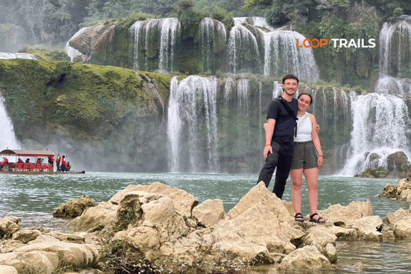
The centerpiece of Cao Bang Geopark. Ban Gioc is a 30-metre waterfall that forms the international border between Vietnam and China (the waterfall is shared). It’s the largest international waterfall in Southeast Asia.
What to expect: The waterfall is truly impressive, especially from May–September when water volume is highest. The main viewpoint is a short walk from the car park (about 10–15 minutes). There’s also a boat option that takes you closer.
Best time to visit: June–September has the most dramatic flow. March–May is clear but less water volume.
Practical note: The area is well-developed with guesthouses, restaurants, and shops. It’s more touristy than Dong Van, which is good if you want comfort, less romantic if you want wilderness.
These are dramatic limestone escarpments. Phia Oac has viewing areas that look down long valleys. Phia Den is famous for its bamboo forest and steeper terrain.
What to expect: Less crowded than Ban Gioc. Hiking trails are short to moderate. Views are expansive and less photographed than Ma Pi Leng, so they feel more remote.
Best for: Photography, quiet exploration, avoiding crowds.
A massive limestone cave that was used by the Viet Minh during the resistance war. You can enter the cave and explore its chambers. Some sections involve boat rides through underground water.
What to expect: Dark, cool, humid cave environment. The cave is lit but not over-developed. It feels wild and authentic.
Practical note: Cave access usually requires a guided tour. Bring a light jacket and wear non-slip shoes. If you’re claustrophobic, this might not be your thing, though the cave is quite spacious.
A scenic alpine lake with surrounding karst formations. Some tours include a boat trip here.
What to expect: Peaceful water views, minority villages nearby, less dramatic than waterfalls but beautiful in a quiet way.
Learn more: Best time to visit Cao Bang
Overall best window: October–April
October–November (Autumn): Clear skies, mild temperatures, low rain. This is many travellers’ favourite time. Visibility is excellent for photography.
December–February (Winter): Cooler and occasionally foggy, but still generally stable. Rarely below 5°C on the plateau, but it feels cold on a motorbike. Clear days are stunning.
March–May (Spring): Mild, flowers bloom, but increasingly humid as May approaches. Rain becomes more common toward late May.
May–September (Rainy/Monsoon): Heavy rainfall, especially June–August. Roads can be slippery. Waterfalls are at full power, which is spectacular, but visibility drops. Not ideal unless you enjoy riding in wet conditions. Some minor road sections can have temporary closures during extreme rain (rare but possible).
Temperature: Expect 10–15°C cooler on the plateau than in Ha Giang town. Bring layers even in warmer months.
Fog: Morning fog is common, especially November–February. It clears by late morning usually, but it affects early-morning photos and visibility.
Learn more: Ha Giang Loop Easy Rider
A guide drives a motorbike (you ride passenger) or you ride your own bike with an experienced driver leading. Covers Dong Van and Cao Bang.
Pros: Local knowledge, safety, someone handles navigation and road stress, cultural insight, photos taken while you focus on experience.
Cons: Less independence, shared vehicle with strangers (sometimes), higher cost than self-drive.
Best for: First-timers, nervous riders, people who want a hassle-free experience.
Typical duration: 5–6 days
Typical cost: USD 400–650 per person (depending on group size and lodging level)
Rent a motorbike in Ha Giang (XR150, semi-auto, or manual) and ride yourself. You book your own guesthouses and set your own pace.
Pros: Complete freedom, cheaper than guided tours, immersive experience, go at your pace.
Cons: You navigate yourself (roads are clear but some signs are in Vietnamese), responsible for bike maintenance and any incidents, less cultural context (depends on your confidence level).
Best for: Experienced riders, confident navigators, people on tight budgets, independent travellers.
Typical cost: USD 80–120 for bike rental (5–6 days) + your own lodging/food.
Bike options: XR150 (semi-automatic, beginner-friendly), manual bikes for experienced riders. Bikes are usually Chinese brands (decent condition but not luxury). Helmets and rain gear are provided.
Practical note: You’ll need an International Driving Permit (IDP) theoretically, though enforcement varies. A car or jeep hire from Ha Giang is also an option if bikes aren’t your preference.
A private jeep with driver. More comfortable than bikes, better for groups, air-conditioned.
Pros: Comfort, protection from weather, can fit 4–5 people, good for families or older travellers.
Cons: Most expensive option, less of an “adventure” feel (though still scenic), limited interaction with locals.
Best for: Groups, families, luxury experience, people uncomfortable on motorbikes.
Typical cost: USD 600–1,000+ for 5–6 days depending on group size and vehicle quality.
You rent a car and drive yourself. Possible but requires an International Driving Permit and comfort with Vietnamese traffic and roads.
Practical note: This is doable but less common for tourists. Roads are fine, but many prefer a local driver’s knowledge of safe stopping spots and road hazards.
Most tourists fly into Hanoi (3 million inhabitants, main hub) then travel north.
Hanoi to Ha Giang:

Learn more: Ha Giang Loop Price
Here’s a realistic budget for one person doing Dong Van + Cao Bang in 5–6 days. Prices are in USD and can fluctuate.
Total: USD 220–360 per person (excluding transport to/from Hanoi)
Total: USD 510–760 per person
Total: USD 700–1,000+ per person
Money-Saving Tips:

Learn more: Ha Giang Safety Tips
The roads in both geoparks are well-maintained compared to many rural areas in Southeast Asia. However, they’re not straightforward.
What to expect:
Safety practices:
Road closures: Temporary closures after heavy rain are rare but possible. During monsoon season (June–August), check conditions before departure if you’re on a tight schedule.
Learn more: Ha Giang Loop Mistake to Avoid
The issue: You rent a bike, and the rental shop claims damage you didn’t cause when you return it, trying to charge you extra.
How to protect yourself:
The issue: Some stations inflate prices for foreign riders or deliver less fuel than you pay for.
How to protect yourself:
The issue: You book a “Dong Van loop” tour from a random Hanoi travel agent without comparing prices. They’re often 30–50% marked up compared to booking in Ha Giang directly.
How to protect yourself:
The issue: You rent a bike that looks OK but has weak brakes, loose chains, or tire problems that emerge mid-trip.
How to protect yourself:
The issue: A tiny restaurant on the plateau charges foreign tourists 2–3× the local price for the same meal.
How to protect yourself:

Learn more: Ha Giang Loop by Wrangler Rubicon Jeep
Choosing the right transport method depends on several factors. Here’s a quick decision tree:
| Factor | Self-Drive Bike | Guided Bike | Jeep Tour |
|---|---|---|---|
| Cost | $$ | $$$ | $$$$ |
| Independence | High | Low | Low |
| Comfort | Low | Medium | High |
| Local Insight | Depends on you | High | High |
| Best for first-timers | No | Yes | Yes |
| Flexibility | High | Medium | Low |
| Physical demand | High (if riding) | Low | Low |
| Group vibe | Solo | Yes | Yes |
Learn more: Ha Giang Border Area Permit 2026
If you’re already in Ha Giang or nearby:
Pro: You pay the actual price, no middleman markup. Local guides and shop owners will give you honest recommendations.
Con: Requires being on the ground already.
Browse Viator, Klook, GetYourGuide, or the Loop Trails website directly.
Pro: Secure payment, review-backed, English communication, can book from home.
Con: 20–30% markup compared to booking locally. You’re paying for the platform convenience.
Contact tour operators in Ha Giang directly via WhatsApp (if you have their number) or email.
Pro: Direct communication, can negotiate, faster response than platforms.
Con: Requires a bit of research to find contact info.
If you’re looking for established, safety-conscious operators:
What to ask before booking:
What to ask before booking:
Learn more: Ha Giang Road Conditions 2026
The roads are safe compared to many other countries. The main risks are user error (going too fast, not wearing protective gear, poor riding skills) and weather (wet conditions increase danger). If you’re an experienced rider, you’re fine. If you’re nervous, a guided tour or jeep is better.
About 5–6 hours of actual driving time on backroads, depending on your route and number of stops. Most people split it into two days with an overnight stop.
Yes. Dong Van alone is a 3–4 day trip. Cao Bang alone is 2–3 days. But combining them is more efficient and gives you a fuller picture of the region’s geology.
Ha Giang Loop is a general term for the Dong Van Karst Plateau region. A Geopark tour specifically emphasizes geological sites and their significance. Most tours cover similar roads, but a Geopark-focused tour includes more education and specific UNESCO spots.
It’s the international border. The waterfall itself is shared between Vietnam and China. The best viewpoint for tourists is on the Vietnam side. The China side exists but isn’t as easily accessible to tourists.
Bring enough Vietnamese Dong (VND) for your entire trip. ATMs are in Ha Giang and Cao Bang towns, but not on the plateau. As a rough estimate, USD 300–500 in cash covers 5–6 days comfortably if you’re mid-range traveller.
Medical facilities are basic on the plateau but adequate for minor issues. Ha Giang and Cao Bang towns have hospitals and pharmacies. For serious injuries, you’d need to get to Hanoi (several hours away). Travel insurance is strongly recommended.
Yes, but it’s not ideal. June–August has heavy rain, reduced visibility, and slippery roads. Waterfalls are more dramatic, but photography and road safety are compromised. October–April is genuinely better.
Technically, you need an International Driving Permit (IDP). Enforcement varies. Most rental shops will rent without it, but if stopped by police, you could face a fine. Bring your home country license and IDP if you have it. Better safe than sorry.
Contact information for Loop Trails
Website: Loop Trails Official Website
Email: looptrailshostel@gmail.com
Hotline & WhatSapp:
+84862379288
+84938988593
Social Media:
Facebook: Loop Trails Tours Ha Giang
Instagram: Loop Trails Tours Ha Giang
TikTok: Loop Trails
Office Address: 54A Tran Phu, Ha Giang 2, Tuyen Quang
Address: 54A Tran Phu, Ha Giang 2, Tuyen Quang
Facebook X Reddit Table of Contents Learn more: Ha Giang Loop Tours Most people drive past the Quan Ba area twice on

Facebook X Reddit Table of Contents Learn more: Ha Giang Loop Tours The Ha Giang Loop has a reputation problem with older