
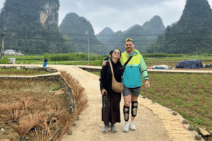
Cao Bang Loop Day 3: Phia Thap, Phuc Sen and God’s Eye Mountain
Facebook X Reddit Table of Contents Learn more: Ha Giang Loop Tours Day 3 is the one that surprises people. On paper
Thúy Kiều (Grace) is a travel blogger and content contributor for Loop Trails Tours Ha Giang. She holds a bachelor’s degree in Sustainable Tourism from Vietnam National University, Hanoi, and has a strong passion for exploring and promoting responsible travel experiences in Vietnam’s northern highlands.
Learn more: Ha Giang Loop Tours
The ride from Cao Bang City to Ban Gioc looks tiny on a map. Under 100 km, one main road, a waterfall at the end of it. Then you actually do it, and you arrive at your homestay after dark wondering where the day went.
That is the whole personality of Day 1 in Cao Bang. The distance is nothing. The stops are everything. Between the city and the waterfall you pass a limestone pass with a saddle shape, two villages where people are still hammering and rolling and drying things by hand, a mountain with a hole punched straight through it, a cave that goes deeper than you expect, and a river so unreasonably green that most people stop three times in ten minutes just to look at it again.
We run this road often, in both directions, on bikes and in jeeps. This guide is what we tell guests the night before: the route options, the stops that earn their time, the ones you can skip if you started late, and the honest road notes that matter when you are riding it yourself.
| Start | Cao Bang City |
| Finish | Ban Gioc Waterfall area (Dam Thuy, Trung Khanh) |
| Rough distance | Around 90 km on the direct route, more with detours |
| Main road | QL3 east, then the road north through Trung Khanh |
| Big stops | Ma Phuc Pass, Phuc Sen, Phia Thap, God’s Eye Mountain, Nguom Ngao Cave, Ban Gioc |
| Difficulty on two wheels | Easy to moderate. Sealed road most of the way, some rough patches |
| Suits | Couples, families, small groups, people who like villages more than nightlife |
Distances here are approximate and depend on which detours you take, so treat them as planning numbers rather than gospel. Check your own map app on the morning, because road works and diversions in this region are normal and they change.
Most people arrive one of two ways.
From Hanoi. Sleeper buses and limousine vans run north to Cao Bang City. The overnight option means you wake up more or less where you need to be, which is why we like it. Plan on roughly seven hours, and treat any schedule you read online as a starting point rather than a fixed timetable. Bus companies adjust departure times seasonally and during holidays.
From Ha Giang. This is the one people underestimate. If you have just finished the Ha Giang Loop, you are already in the northeast and Cao Bang is the obvious next move rather than backtracking to Hanoi. There is a limousine service running Ha Giang to Cao Bang and back, with morning departures around 08:00 in both directions. At the time of writing the fare sits at 400,000 VND per person. Prices and times drift, so confirm before you commit your day to it.
If you are travelling with us, this leg is usually built into the plan and we book it as part of your itinerary. If you are doing it independently, book the day before rather than the morning of, especially between September and November when the region is busy.
Quick tip: if you are choosing between Ha Giang and Cao Bang and cannot decide, the honest answer is that they are different rather than better and worse. Ha Giang is passes and altitude and rock. Cao Bang is water, forest and villages. Doing both back to back on the Ha Giang and Cao Bang combined tour is the version most guests end up wishing they had booked in the first place.
Learn more: Ha Giang Loop 2 Days 1 Night
There is no single Cao Bang to Ban Gioc route. There are two sensible ones and the choice sets the tone for your whole day.
Option A: the classic road through Quang Uyen and Trung Khanh. East out of the city on QL3, over Ma Phuc Pass, past the craft villages around Quang Uyen, then north through Trung Khanh to Ban Gioc. This is the direct line. It has the best surface, the most fuel stations and the craft villages. If you got a late start, if the weather is grim, or if anyone in your group is new to riding, take this one.
Option B: the northern loop through Tra Linh. Head northeast towards the Thang Hen lake area and God’s Eye Mountain first, then cut across to Trung Khanh and down to Ban Gioc. Longer, quieter, more beautiful in patches, and more likely to involve at least one stretch of road that makes you say something unrepeatable inside your helmet.
Plenty of riders combine them: Ma Phuc Pass and the craft villages in the morning, then swing north to God’s Eye Mountain before dropping into Trung Khanh. That is a full day. It works if you leave early and do not linger over lunch.
| Classic route | Northern loop | |
|---|---|---|
| Road surface | Mostly good | Mixed, some rough sections |
| Best for | First timers, late starts, wet weather | Confident riders, photographers |
| Big draw | Craft villages, Ma Phuc Pass | God’s Eye Mountain, empty roads |
| Time pressure | Comfortable | Tight if you start after 09:00 |
Three small things that save a lot of hassle later.
Fuel. Fill up properly in Cao Bang City. There are stations in Quang Uyen and Trung Khanh, and you will pass roadside sellers with bottles, but bottle fuel is a rescue plan, not a strategy. Top up whenever you are near half a tank rather than waiting for the light.
Cash. ATMs cluster in the city and in the district towns. Around Ban Gioc and the smaller villages, cash is simply easier, and some homestays and small kitchens do not take cards or transfers from foreign accounts. Bring more than you think you need in small notes.
Breakfast. Cao Bang City does a very good bowl of pho with the local sour bamboo and duck versions worth ordering at least once. Eat properly before you go, because the next few hours are villages and viewpoints rather than restaurants.
Also: put your passport in your bag, not in your luggage. You are riding towards an international border and you may want it.
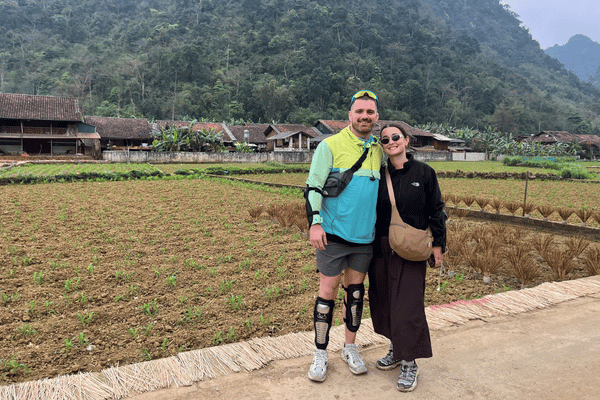
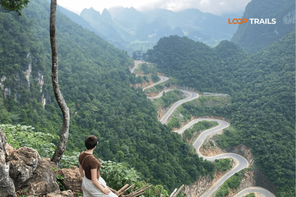
Twenty something kilometres out of the city, the road climbs and folds and delivers you to Ma Phuc Pass. The name refers to a horse kneeling, which makes sense the moment you see the twin limestone blocks sitting above the road like a saddle.
Stop at the top. There is space to pull in, and on a clear morning the valley below opens into that classic Cao Bang arrangement of jagged grey karst, green fields and one thin road threading through the middle of it.
It is also a good early temperature check. If the pass is fogged in, the rest of your day probably will be too, which is worth knowing before you commit to the longer northern route.
The corners here are wide and predictable by northern Vietnam standards, but they are also where riders on their first mountain road tend to discover that a loaded bike behaves differently. Take the first pass gently. There is a whole day of them.
Learn more: Ha Giang Loop 3 Days 2 Nights
This is where the day stops being a drive and starts being a trip.
Just past the pass, along the main road, you will hear Phuc Sen before you see it. The Nung An families here have been forging blades for generations, and they do it in open fronted workshops right at the roadside: charcoal, hammer, anvil, quench, repeat.
What makes it worth stopping is that nothing about it is arranged for you. Nobody performs. You can stand in the doorway, watch a blade get shaped from a strip of old leaf spring, and buy one for a fair price if you want a souvenir that will still be useful in twenty years. If you plan to fly home with a knife, it goes in checked luggage, obviously.
A short ride away, tucked off the main road, Phia Thap is quieter and prettier. Incense sticks dry in bundles outside the houses, fanned open like enormous pink and purple flowers. The sticks are made from bamboo and a binder from local leaves, and if you turn up while a family is working they will usually show you the process without any expectation attached.
Go slow through the village. Chickens, small children and drying racks all have right of way.
Also in the same cluster is a traditional paper making village where families still soak, beat and press bark into sheets on wooden frames. It is a five minute stop that most people ride straight past, and it is one of the more genuinely old things you will see in a day full of old things.
You do not need all three. If you are behind schedule, pick two and move on.
North of Quang Uyen, in the Tra Linh area, sits the strangest landmark in Cao Bang: a limestone mountain with a natural hole punched clean through the ridge. Locals call it the Angel’s Eye or God’s Eye. From the grassland below, with horses grazing and the lake shining behind you, it looks like something a set designer invented.
The area around it is part of the Non Nuoc Cao Bang UNESCO Global Geopark, and the Thang Hen lake system nearby rises and falls dramatically through the year. In the wet months you get water where in the dry months you get flat green grazing land. Both are good. They are just not the same photograph.
Getting there involves leaving the main road, and the final stretch is not always smooth. It is fine on a semi automatic bike ridden sensibly and completely fine in a jeep. If it has been raining hard, ask locally before committing, because the approach can turn sticky.
Budget an hour if you want to walk out towards the mountain rather than photograph it from the parking area. Most people wish they had budgeted two.
Learn more: Ha Giang Loop 4 Days 3 Nights
Trung Khanh is where the landscape softens. Karst peaks are still everywhere, but now they stand over rice fields and a river that does not look real.
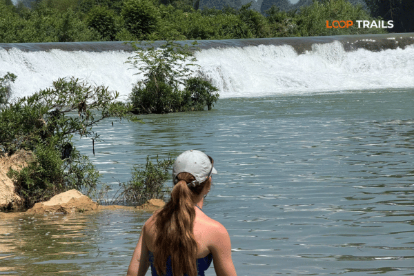
The Quay Son runs bright green through this district before dropping over Ban Gioc, and the stretch through Trung Khanh is one of the great underrated rides in the north. There is no single viewpoint. You just keep going and it keeps happening.
Two things worth knowing:
Chestnuts. Trung Khanh is famous across Vietnam for its chestnuts, roasted at roadside stalls in autumn. If you are here in the right season, buy a bag. If you are here in the wrong season and someone is selling chestnuts anyway, they are probably not local ones.
The countryside shortcut. Instead of following the main road all the way, there is a smaller route through Ngoc Con that runs beside the river and through villages. It is narrower, slower and considerably better. Local riders and guides use it. Some map apps will not suggest it. Nearby, the Pi Pha viewpoint gives you the valley from above if you are willing to walk up for it.
This is also the part of the day where you should reassess your timing. If it is already past 15:00 and you still want to do the cave and the waterfall properly, something has to give. Our suggestion: do the waterfall today and the cave tomorrow morning on your way out. The cave does not care what time it is. The waterfall does.
Learn more: Ha Giang Cao Bang 5 Days 4 Nights
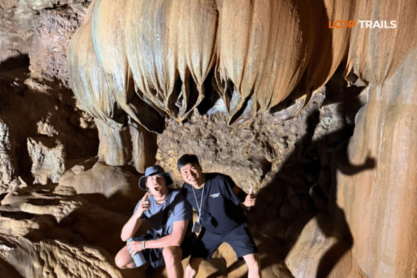
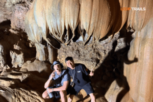
A few kilometres before Ban Gioc, Nguom Ngao is a genuinely large limestone cave with a lit walkway running through the main chambers. In the Tay language the name refers to a tiger, and there is a local story to go with it that your guide will tell better than this article can.
Practical notes:
There is a separate entrance ticket for the cave, and prices are adjusted from time to time, so check the board at the gate rather than trusting a number you read in a blog post from three years ago.
Learn more: Cao Bang Loop 3 Days best kept secret
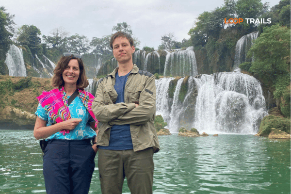
You hear it first. Then the road opens out and there it is: a wide, terraced curtain of water spread across the Quay Son, with Vietnam on one bank and China on the other. It is regularly described as the largest waterfall on any national border in Asia, and whatever the exact ranking, it is a serious piece of water.
Late afternoon light is generally the kindest, and the tour buses that arrive at midday have usually thinned out. That said, this is the one stop where arriving with plenty of time left is worth more than arriving at the perfect hour. Rushing Ban Gioc is a waste of a day of riding.
Bamboo rafts run out towards the base of the falls. You will get damp. Do it anyway. Standing at the front of a flat raft while several tiers of water fall in front of you is a completely different experience from watching it from the viewing lawn, and it is the shot everyone in your group will actually use.
Raft fees are separate from the site entrance ticket and are paid on the spot.
There is an entrance ticket for the waterfall site. Prices change, so buy at the gate and take the current rate as the current rate.
You are standing on an international border. Follow the marked boundaries, do not step over ropes or markers for a photo, and carry your passport with you. Rules in border zones can and do change, so if anything about access or permits is unclear on the day, ask at your accommodation or ask your guide rather than guessing. Nobody wants their Cao Bang story to be about a conversation with a border officer.
On the hillside above the falls sits a modern pagoda complex with a viewing terrace looking straight down the valley. The climb takes a few minutes and gives you the wide panorama that ground level cannot: the full curtain of water, the river bending away, the karst standing behind it. Go up around sunset if you have anything left in your legs.
The best option in the area is Khuoi Ky, the Tay stone village a couple of kilometres from the falls. The houses are built from stacked river stone, several run as homestays, and evenings there follow a familiar and very good pattern: a big shared dinner, someone produces a bottle of the local rice wine, someone else produces a guitar or a set of games, and the plan to have an early night quietly dies.
There are also hotels and guesthouses closer to the waterfall itself if you want a private room and a hot shower without negotiation. On our tours the standard rate covers dormitory style accommodation, with private room upgrades available if you want one, so tell us when you book rather than on the day.
Book ahead for weekends, national holidays and the autumn months. Ban Gioc is not a secret inside Vietnam.
Honest version, based on riding it regularly rather than on a press release.
None of this is exotic. It is just mountain road common sense, and the riders who get into trouble are almost always the ones who were running late.
Learn more: Ha Giang Cao Bang 6 Days 5 Nights
There is no bad month, but there are trade offs.
Roughly March to May. Warm, generally drier, good visibility. Fields are green. A comfortable time to ride.
Roughly June to September. The wet season. This is when the waterfall carries the most water and looks most dramatic, but heavy rain can turn it brown for a day or two and mountain roads are slipperier. Rice fields are at their greenest.
Roughly late September to November. The window most photographers choose. Rain eases, the river tends to regain its turquoise colour, the rice turns gold before harvest and the chestnuts arrive. It is also the busiest period, so book accommodation early.
Roughly December to February. Cold, sometimes seriously cold up on the passes, with fog and low cloud. Fewer visitors, moodier photos, and you will want real layers rather than the jacket you packed for Hanoi.
Weather in the northeast changes fast and forecasts here are more of a suggestion. Check a few days out, then check again the night before.
If you are riding yourself, whether on a self drive tour or a bike you rented independently, this section matters more than anything else in this article.
To ride legally in Vietnam as a foreign visitor you generally need:
The 1949 style International Driving Permit is not recognised in Vietnam. This catches people out constantly, because plenty of countries issue both and travellers assume any IDP is fine. It is not. Check which convention yours was issued under before you leave home.
Riding without the correct documents can result in a fine, and the figures we see quoted for this run in the range of 2,000,000 to 6,000,000 VND. Regulations and enforcement do change, so treat this as guidance and verify the current position rather than relying on an article.
The bigger issue is insurance. Many travel insurance policies exclude motorbike accidents if you were not legally entitled to ride, and a medical evacuation from a mountain province is not a bill you want to discover you are paying yourself. Read your policy wording. Actually read it.
Riding with a guide does not magically create a licence you do not have, but it does mean someone who speaks the language and knows the road is with you if anything goes wrong, from a police check to a puncture to a hospital run. That support is a real part of what you are paying for.
And if none of this appeals: take a jeep or ride pillion with an easy rider guide. No licence required, no paperwork anxiety, same road, same stops, same views
Learn more: Ha Giang Loop by Wrangler Rubicon Jeep
Most people arrive already leaning one way. Here is the honest breakdown.
Self drive is for you if you already ride at home, you have the correct licence and IDP, you like the freedom of stopping whenever you want, and you are comfortable making decisions in bad weather. The road to Ban Gioc is not technical, but it is a mountain road with traffic on it.
Easy rider is for you if you want to be on a bike but not responsible for it. You sit behind an experienced local rider, your bag is strapped down properly, and you can look at the scenery instead of the surface. It is the most popular choice among our guests and by a wide margin the one people are happiest with when they have not ridden much before.
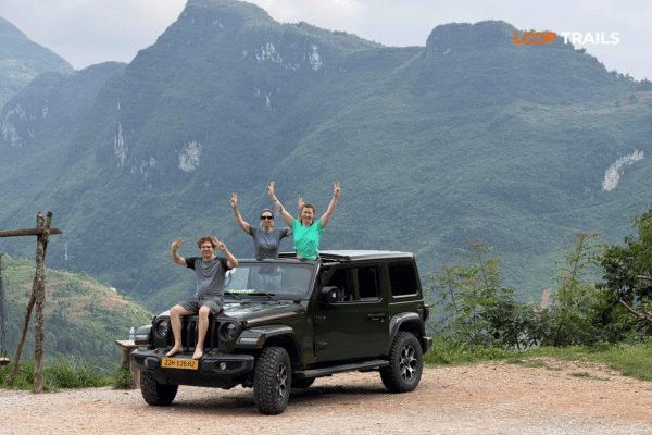
A jeep is for you if you are travelling as a couple or a family, you have someone in the group who does not ride, you want to do this in any weather, or you simply want to be able to talk to each other during the day. Everything folds down, the views are open, luggage is not a problem, and small children and grandparents are suddenly part of the trip rather than a reason not to take it. For the Ha Giang and Cao Bang route, the jeep is priced for the whole vehicle rather than per seat, so the more of you there are, the better it works out.
For reference, the current rates on our combined route look like this:
| Ha Giang and Cao Bang, 5 days 4 nights | Price |
|---|---|
| Easy rider, per person | 10,990,000 VND |
| Self drive, per person | 10,590,000 VND |
| Jeep, 2 guests, total for the vehicle | 31,990,000 VND |
| Jeep, 3 guests, total for the vehicle | 36,490,000 VND |
| Jeep, 4 guests, total for the vehicle | 40,990,000 VND |
These rates cover accommodation in dormitory style rooms and everything included on the tour itself. They do not include private room upgrades or the bus tickets to and from the start and end points. Prices were current when we published this page, so check the tour page for today’s rate before you plan a budget around it.
Once you have confirmed travel dates, book as early as you reasonably can. Most guests book one to three months ahead. Jeep availability in particular is limited, so early booking is what lets us arrange things properly rather than approximately.
Learn more: Ha Giang Cao Bang Packing List
Small list, all of it earned.
Treating it as a transfer. The most common one. People plan Cao Bang City to Ban Gioc as a two hour drive, arrive at lunchtime, look at the waterfall for forty minutes and leave feeling underwhelmed. The road is the point.
Overloading the day. The opposite error. Craft villages, God’s Eye Mountain, the cave and the waterfall in one day is possible only if you leave early and keep moving. Pick your priorities in the morning, not at 16:00 in a car park.
Renting the wrong bike. A fully automatic scooter can do this route, but a semi automatic or a manual bike handles hills and loose surfaces better and gives you engine braking on the descents. If you are not sure what you are comfortable on, that is a good sign you should not be finding out on a mountain pass.
Booking a bike with no support. Cheap rentals are cheap for a reason. What you want is a bike that has been checked, a phone number that answers, and someone who can reach you if it stops working two hours out of town. Ask what happens in a breakdown before you hand over a deposit rather than after.
Leaving the passport at the hotel. You are riding to a border. Bring it.
Assuming everything is open, running and priced as it was last year. Ticket prices, raft operations, road access and bus schedules all change here. Ask locally on the day. That is not a disclaimer, it is just how this region works.
Learn more: Ha Giang Motorbike Rental
Ban Gioc is not an endpoint. It is the halfway point of something better.
From the waterfall, most itineraries continue into the quieter half of Cao Bang: Nguom Ngao if you skipped it, the Quay Son river stretches, the craft villages around Phuc Sen if you missed them on the way in, and God’s Eye Mountain from the northern side. There is easily another two days of riding in this province before you have seen the good parts twice.
The version we run most often approaches it from the other direction entirely. Our Ha Giang and Cao Bang tour starts in Ha Giang with the passes: Bac Sum, Tham Ma, the Dong Van karst plateau, Lung Cu at the northernmost point of the country, Ma Pi Leng above the Nho Que river. Then it crosses east through Bao Lac and the Khau Coc Cha pass into Cao Bang, arriving at Ban Gioc from the far side and finishing in Cao Bang City. Five days, two provinces, and the two best roads in northern Vietnam back to back.
If you only have time for one, the Ha Giang Loop remains the classic and we run it as a 2 day, 3 day or 4 day trip by motorbike or jeep. If you have the extra days, add Cao Bang. Nobody has ever told us they regretted it.
Ready to ride it? Message us on WhatsApp with your dates and how many of you there are, and we will tell you honestly which version fits. If the dates do not work or a different route suits you better, we will say so.
Learn more: Best time to visit Cao Bang
Around 90 km on the direct route through Quang Uyen and Trung Khanh. The riding itself is not demanding, but with stops at the craft villages, the cave and a viewpoint or two, it fills a full day comfortably.
Yes, and plenty of people do, but you will spend most of it moving. Staying near the waterfall lets you see it in late afternoon light, sleep in a stone village homestay and continue deeper into Cao Bang the next morning instead of retracing your route
If you are riding yourself, you need your passport, a valid motorbike licence from home and an International Driving Permit issued under the 1968 convention. The 1949 style permit is not recognised in Vietnam. If you do not have the right documents, take a jeep or ride pillion with an easy rider guide instead.
It is one of the more manageable mountain routes in northern Vietnam: mostly sealed, wide corners, no extreme drops on the main road. The risks are trucks, livestock, fog and rain rather than technical difficulty. If you have never ridden a motorbike before, this is not the place to learn.
The waterfall carries the most water in the wet months, roughly June to September. Many visitors prefer late September through November, when the rain eases, the river often returns to a clearer turquoise and the rice fields turn gold. Winter is quiet and cold with frequent fog.
There is a ticket for the waterfall site and a separate fee for the bamboo rafts. Prices are adjusted periodically, so buy at the gate and check the current rate on the day rather than budgeting from an older article.
Bring it. The waterfall sits directly on the border with China, border zone rules can change, and having your passport with you avoids problems. Stay inside the marked boundaries and do not cross ropes or markers for photographs
Yes, and it is only a few kilometres from the waterfall so it costs you very little time. Allow around an hour, wear shoes with grip because the walkway gets wet, and expect good walking lighting rather than good photography lighting.
That is exactly what our 5 day route does. It starts in Ha Giang with the passes and the Dong Van karst plateau, crosses east through Bao Lac, then covers Cao Bang and finishes at Ban Gioc and Cao Bang City. It is the most efficient way to see both without doubling back to Hanoi.
There is a limousine service running between the two, with morning departures around 08:00 in each direction and a fare of 400,000 VND per person at the time of writing. On our combined tours you ride the route rather than take the bus, which is a large part of the appeal. Schedules change, so confirm before you rely on them.
Very. The viewing area is flat and easy to walk, the rafts are calm, and the drive is comfortable in a jeep. Families and travellers who do not ride tend to have a better day in a vehicle than trying to manage a bike on unfamiliar roads.
Once you have confirmed travel dates, book as soon as you reasonably can. Most guests book one to three months ahead. Jeep availability is limited compared with motorbikes, so early booking makes a real difference in the busy autumn months.
Contact information for Loop Trails
Website: Loop Trails Official Website
Email: looptrailshostel@gmail.com
Hotline & WhatSapp:
+84862379288
+84938988593
Social Media:
Facebook: Loop Trails Tours Ha Giang
Instagram: Loop Trails Tours Ha Giang
TikTok: Loop Trails
Office Address: 54A Tran Phu, Ha Giang 2, Tuyen Quang
Address: 54A Tran Phu, Ha Giang 2, Tuyen Quang
Facebook X Reddit Table of Contents Learn more: Ha Giang Loop Tours Day 3 is the one that surprises people. On paper
Facebook X Reddit Table of Contents Learn more: Ha Giang Loop Tours Day 1 in Cao Bang is the highlight reel. Passes,
Facebook X Reddit Table of Contents The first time I watched someone drop a rolled rice pancake into a bowl of hot