
Ha Giang Loop with Toddlers & Very Young Children: Family Jeep Guide
Facebook X Reddit Table of Contents Learn more: Ha Giang Loop Tours Most people picture the Ha Giang Loop as a motorbike

Thúy Kiều (Grace) is a travel blogger and content contributor for Loop Trails Tours Ha Giang. She holds a bachelor’s degree in Sustainable Tourism from Vietnam National University, Hanoi, and has a strong passion for exploring and promoting responsible travel experiences in Vietnam’s northern highlands.

Learn more: Ha Giang Loop Tours
Most travelers who make it to Ha Giang come back with the same look — somewhere between road-weary and completely lit up. Then someone mentions Cao Bang, and suddenly the question shifts from “was it worth it?” to “how do I do both?”
This guide is for that moment.
The Ha Giang Cao Bang combined tour is one of the most spectacular overland routes in Southeast Asia. It strings together two of Vietnam’s wildest northern provinces — Ha Giang’s raw limestone karst landscape and Cao Bang’s ancient valleys, forest waterfalls, and Chinese border edge — into one continuous journey that most travelers have no idea exists.
Here’s everything you need to plan it properly.

Learn more: Ha Giang Loop 2 Days 1 Night
At its core, this is a loop or more accurately, two loops connected into one longer circuit through Vietnam’s far north. You start in Ha Giang city, ride or drive the famous Ha Giang Loop through Dong Van Karst Plateau Geopark, then continue east into Cao Bang province to see Ban Gioc Waterfall, the Phia Oac mountain range, and other places most tourists never reach.
It’s not a standard itinerary. Most tour operators treat Ha Giang and Cao Bang as completely separate trips. The combined route takes more time, more logistics, and more genuine knowledge of the road which is exactly why it rewards people who commit to it.
Ha Giang gets the fame. The Nho Que River. Ma Pi Leng Pass. The buckwheat flower fields in October. These are genuinely extraordinary, and they deserve every bit of the hype.
But Cao Bang has something different: fewer tourists, denser forest, waterfalls that fall from 30 meters into misty valleys, and a sense of being completely off the map. Ban Gioc Waterfall alone — the largest waterfall in Vietnam and one of the largest on any international border — is worth the detour. Phia Oac National Park adds another dimension entirely: cloud forest, endemic wildlife, and mountain roads that nobody seems to talk about.
Together, the two loops cover landscapes that genuinely don’t repeat. Ha Giang feels exposed, dramatic, almost lunar in places. Cao Bang feels lush, enclosed, and ancient. If you only do one, you’re getting half the picture.
The honest answer: 9 to 12 days for a proper combined tour that isn’t rushed.
Some operators offer compressed versions in 7 days. It can be done, but you’ll be sacrificing stops, flexibility for weather, and the ability to actually sit somewhere and look around. The full loop is long and the roads demand attention — pace matters.
If you only have 5–6 days, do the Ha Giang Loop properly rather than trying to squeeze Cao Bang in. Rushing both serves neither.
")
Learn more: Ha Giang Loop 3 Days 2 Nights
The Ha Giang Loop typically runs Ha Giang city → Quan Ba → Yen Minh → Dong Van → Meo Vac → Du Gia → back to Ha Giang city, though the order can flip depending on your direction of travel.
Key stops:
Quan Ba (Heaven’s Gate / Twin Mountains): Your first taste of the karst landscape — rolling green hills with two perfectly rounded limestone mounds rising from the valley. It’s a bit photographic cliché now, but arriving here on the road and seeing it live is still something.
Yen Minh: A small market town often used as an overnight stop. Less dramatic scenery, but the pace is different here — good food, local guesthouses, early morning mist through pine trees.
Dong Van: The historic heart of the loop. Dong Van Old Quarter is one of the most authentically preserved minority trading towns in northern Vietnam — stone houses, French colonial-era architecture, and a Sunday market that draws Hmong, Dao, and Tay people from surrounding villages. The plateau around it is UNESCO-listed.
Ma Pi Leng Pass: The centerpiece of the loop and one of the greatest roads in Southeast Asia. The pass runs for about 20 kilometers along the edge of a 1,000-meter canyon carved by the Nho Que River. There’s a viewpoint midway that makes most people go completely quiet.
Nho Que River: The turquoise-green river at the bottom of the Ma Pi Leng gorge. You can hike down or take a boat in Meo Vac — the color of the water is disorienting in the best possible way.
Meo Vac: A market town perched on the canyon edge. Sunday morning here is genuinely one of the great market experiences in Vietnam — chaotic, colorful, and completely local.
Du Gia: The lesser-visited tail of the loop — waterfalls, swimming holes, rice terraces, and an evening that tends to be much quieter than Dong Van. Worth including if your schedule allows.
Lung Cu Flag Tower: Vietnam’s northernmost point, sitting right on the Chinese border. The flag tower itself is a bit of a tourist structure, but the surrounding landscape and the sense of being at the very edge of the country makes it memorable.
")
Learn more: Ha Giang Loop 4 Days 3 Nights
After completing the Ha Giang Loop, the route pushes east toward Cao Bang — roughly a half-day ride depending on your exact starting point and road conditions.
Ban Gioc Waterfall: Vietnam’s most impressive waterfall by volume. It sits on the border with China — literally, the international boundary runs through the middle of the falls. The Vietnamese side has the better viewing angles; the falls are widest and most dramatic during and just after the rainy season (August to October). In dry season they’re still worth the trip, just less thunderous.
Nguom Ngao Cave: Directly adjacent to Ban Gioc, this cave system runs for several kilometers and contains some of the most elaborate stalactite formations in northern Vietnam. Even if you’re not usually a cave person, this one earns its place on the itinerary.
Phia Oac National Park: One of the least-visited national parks in Vietnam and genuinely spectacular for it. The road up through the cloud forest to the mountain peak passes through multiple vegetation zones — you’ll go from subtropical forest to something that feels distinctly Himalayan within an hour’s ride. It’s cold up top. Take a layer.
Cao Bang City: The provincial capital and a useful logistics hub. Not a destination itself, but the market streets are lively and the local food scene — particularly the bánh cuốn and grilled mountain pork — is excellent.
Truc Lam Phuc Linh Pagoda: A modern Buddhist pagoda built dramatically into the cliffside above Cao Bang city. Worth a stop for the architecture and the views back across the valley.
The road between Cao Bang and Bac Kan: If your route loops south through Bac Kan before connecting back to Hanoi, you’ll pass through some of the most beautiful and completely undiscovered backcountry in northern Vietnam. Very little English is spoken. Roads are mixed quality. It’s excellent.
This is a representative framework — exact pacing should flex for weather and road conditions.
| Day | Route | Overnight |
|---|---|---|
| 1 | Hanoi → Ha Giang city | Ha Giang |
| 2 | Ha Giang → Quan Ba → Yen Minh | Yen Minh |
| 3 | Yen Minh → Dong Van (via Lung Cu) | Dong Van |
| 4 | Dong Van → Ma Pi Leng → Meo Vac | Meo Vac |
| 5 | Meo Vac → Du Gia (or rest/explore day) | Du Gia |
| 6 | Du Gia → Ha Giang → push toward Cao Bang direction | Transition |
| 7 | Arrive Cao Bang area, explore city, optional Truc Lam | Cao Bang |
| 8 | Ban Gioc Waterfall + Nguom Ngao Cave | Ban Gioc area |
| 9 | Phia Oac National Park | Phia Oac / Nguyen Binh |
| 10 | Return route south toward Hanoi | — |
Adjust Day 5–6 depending on your tour format and how much you want to push. Groups traveling by jeep can move faster than motorbike; self-drive riders need to account for extra buffer on unfamiliar mountain roads
")
Learn more: Ha Giang Cao Bang 5 Days 4 Nights
The short version: September to November and March to May are the sweet spots. But the longer version is more interesting.
January – February: Cold, sometimes very cold at altitude. Dong Van and Phia Oac can drop close to freezing at night. Roads are dry and quiet. The landscape is stark and beautiful. This is one of the most underrated times to visit if you’re prepared for the temperature. Lunar New Year (Tet) brings closures — plan around it.
March – May: Spring warmth arrives. Plum blossoms in February-March. Terraced fields start to flood for rice planting in April-May, which creates mirror reflections across the valleys. Increasingly popular — book ahead.
June – August: Hot in the valleys, but the highland elevation keeps things manageable. This is monsoon season — roads in Ha Giang and Cao Bang can become genuinely difficult, with landslides being a real possibility after heavy rain. Not the time to self-drive if you’re unfamiliar with the terrain. Tour guides who know the roads and can read the weather make a significant difference here.
September – October: The peak season, for good reason. Buckwheat flower season transforms the Ha Giang plateau into something almost psychedelic — pink and white blossoms carpeting the limestone karst. Ban Gioc waterfall is at maximum volume. The roads are usually clear. October in particular tends to hit a sweet spot of harvest color and manageable crowds.
November – December: The buckwheat fades. The light gets golden and low. Cao Bang’s forests turn. Fewer tourists. Still excellent riding weather during the day, cold nights. One of the better-kept secrets for Ha Giang timing.
")
Learn more: Ha Giang Loop Easy Rider
This is where a lot of travelers get stuck, because the right answer genuinely depends on your experience level, budget, and how much you want to think about logistics.
You ride pillion on the back of a motorbike driven by a local guide. Your guide speaks English, knows the roads, handles fuel and accommodation, and functions as a translator and cultural interpreter throughout.
Best for: First-time Ha Giang visitors, anyone uncomfortable with mountain driving, travelers who want context and conversation alongside the scenery, couples where one person isn’t a rider.
What you get: Someone who’s driven Ma Pi Leng hundreds of times and knows which pull-off gets the best angle. Someone who can take you into a Hmong village and actually explain what you’re looking at. Someone who notices the landslide risk before you do.
What you give up: The freedom of your own pace. Some travelers find being a passenger limiting. If you want to stop randomly for 20 minutes to photograph something, you can — but you’re negotiating it, not deciding unilaterally.
")
Learn more: Ha Giang Loop Self-Drive
You rent a motorbike in Ha Giang and ride the whole thing yourself.
Best for: Experienced riders who are comfortable on mountain roads, travelers who’ve done similar routes before, those who want complete flexibility.
What you need: Real riding experience — not “I rented a scooter in Bali” experience. The Ha Giang roads involve sustained mountain passes, steep descents, and occasional gravel or wet sections. A semi-automatic (like the Honda XR150) handles the terrain well, but you need to know what you’re doing.
Permits: Foreign nationals need to check current regulations regarding what driving license is required to legally ride in Vietnam. Rules apply and can change — verify before you book.
What you get: Your own timeline, your own music, the particular satisfaction of having navigated Ma Pi Leng under your own steam.
If you’re considering self-drive, [check our motorbike rental page] for current availability on XR150s and semi-automatics, plus honest advice on which bike suits which route.

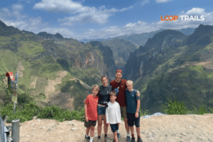
Learn more: Ha Giang Loop by Jeep for Families & Groups
A 4WD jeep with driver and guide, covering the same route.
Best for: Small groups (2–4 people), families, older travelers, those who want the scenery without the exposure of being on a motorbike, anyone visiting during or just after heavy rains when road conditions are unpredictable.
The underrated upside: You can carry more gear, you’re protected from weather, and the jeep can access some dirt tracks that larger vehicles can’t. Also — and this is real — the Ha Giang landscape is so visually dramatic that you don’t lose much by experiencing it from a vehicle rather than a bike. The Nho Que gorge looks extraordinary through a jeep window.
What you give up: The physical sensation of the road. Motorbike travelers often say the loop feels earned in a way that a vehicle tour doesn’t. That’s a valid feeling. It’s also a personal one.
Be honest with yourself here. The goal is to have a great trip, not to prove something.
Still not sure? [Message us on WhatsApp] and describe your situation. We’ll tell you honestly which format makes the most sense — even if that answer is “maybe just do the Ha Giang Loop first.”
")
Learn more: Ha Giang Cao Bang Ba Be Lake 6 Days 5 Nights
Pricing varies depending on tour type, group size, duration, and the time of year. Rather than give you numbers that may be outdated by the time you read this, here’s the honest framework:
What’s typically included in a guided tour:
What’s typically not included:
Budget benchmark (rough):
The combined Ha Giang Cao Bang tour covers significantly more ground than the Ha Giang Loop alone — factor in additional nights, fuel for extended distances, and guide time accordingly. For current package pricing, [visit our Ha Giang Cao Bang Combined Tour page] for transparent, up-to-date rates.
Self-drive travelers on a tight budget who handle their own accommodation can bring costs down considerably — but factor in the bike rental, fuel across a longer route, and the reality that guesthouses in Cao Bang’s more remote areas have fewer budget options than Ha Giang.

Learn more: Ha Giang Motorbike Rental
Let’s be straightforward here.
The Ha Giang and Cao Bang roads are mountain roads. They are genuinely beautiful and genuinely demanding. Accidents happen, mostly due to overconfidence, speed, or underestimating how tired you are after a long day in the saddle.
Ha Giang roads: The main loop roads are asphalted and in generally good condition on the popular sections. Ma Pi Leng is well-maintained. Some detour tracks toward Du Gia or remote villages are rougher — expect gravel, loose stones, narrow passes.
Cao Bang roads: More variable. The main road to Ban Gioc is manageable. Phia Oac involves mountain switchbacks that require careful technique. In wet season, any unpaved section can become slippery. Always check local conditions before heading out.
Safety basics:
Road conditions and regulations change. Always check for current local advisories, especially in and after rainy season.

Learn more: Ha Giang Homestay Guide
Accommodation on the combined loop ranges from family-run guesthouses to simple homestays in minority villages. You won’t find international hotel chains until you get back to a major city which is entirely the point.
Ha Giang Loop stays:
Dong Van: The best range of guesthouses on the loop. Some options are in restored traditional Hmong houses worth paying a little extra for. Book ahead in peak season (October especially).
Meo Vac: Fewer options but some genuinely good locally-run places with views over the valley. The town is small everything is walkable.
Du Gia: Basic but charming. Some homestay-style accommodation with local families, which tends to include dinner and is one of the better experiences on the loop.
Cao Bang stays:
Cao Bang city: The widest selection of accommodation in the province, including a few mid-range hotels with reliable hot water and Wi-Fi. Good base for day trips.
Ban Gioc area: Limited accommodation mostly small guesthouses near the falls. Book early if you’re visiting during a Vietnamese national holiday, when the falls are a popular domestic destination.
Phia Oac / Nguyen Binh: Very limited. This is genuine off-grid territory. Comfortable with basic? You’ll be fine. Expecting amenities? Manage expectations or plan to day-trip from Cao Bang city.
For guided tours through Loop Trails, accommodation is arranged and included which removes the single biggest logistical headache of the route.

Learn more: Ha Giang Food guide
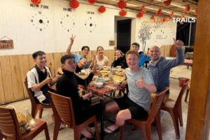
Food: The north Vietnamese highlands produce some of the best food in the country that tourists rarely talk about. Thắng cố — a traditional Hmong bone broth soup — is served at Sunday markets and tastes like nothing else. Grilled corn, smoked meat, honey wine, and simple rice dishes with whatever came from the mountain that morning are the road staples. In Cao Bang, look for bánh cuốn (steamed rice rolls) and the local sticky rice varieties that are specific to the region. You won’t go hungry, though vegetarians need to communicate clearly in more remote villages.
Fuel: Petrol stations exist in all main towns on both loops. There are longer stretches between stations in Cao Bang’s more remote sections — check your tank before leaving populated areas. Self-drive riders should know their bike’s range. On guided tours, your guide handles fuel.
Cash: ATMs are available in Ha Giang city and Cao Bang city. Not reliably elsewhere. Bring more cash than you think you’ll need before leaving Ha Giang. Many guesthouses and local food stalls don’t accept card.
Connectivity: Phone signal is surprisingly decent on the main Ha Giang Loop roads — Vietnamese telcos have reached most of the populated sections. Cao Bang gets patchier. A Viettel SIM tends to perform best in remote northern areas (check current coverage before your trip).

Learn more: Ha Giang Packing list
The longer combined loop means more days in remote terrain — pack with that in mind.
Riding gear:
Practical:
Clothing:
What to leave behind:

Learn more: Ha Giang Loop Mistake to Avoid
Underestimating the distance. The combined loop covers serious ground. Check the actual driving distances and time between stops before locking in a schedule. “We’ll just push through” is the most common regret.
Renting a bike without riding experience. The Ha Giang roads punish overconfidence. If your motorbike experience is limited to flat coastal roads or automatic scooters in tourist towns, take an Easy Rider tour instead. There’s no shame in it — experienced riders do Easy Rider tours because they want a local guide, not because they can’t ride.
Going in October without booking. Buckwheat flower season makes October the most beautiful and the most crowded month. Accommodation and spots on popular tours fill up weeks in advance. Book early or go in November when the crowds thin and the light is still excellent.
Skipping travel insurance. Mountain roads, motorbikes, remote locations. Travel insurance is not optional on this route — make sure yours covers motorcycle riding (many policies explicitly exclude it; check the fine print).
Booking last-minute from a guesthouse. Random “guides” who approach you in Ha Giang city vary enormously in quality. Some are excellent independent operators. Some are not. If you haven’t pre-booked with a vetted tour company, ask specifically about guide experience, bike quality, and what happens if something goes wrong on the road.
Not having cash. Already mentioned above, but worth repeating: ATMs in remote Cao Bang are not guaranteed. Come prepared.

Learn more: Ha Giang Loop for Beginners
Loop Trails runs small-group and private tours on the Ha Giang Loop, Cao Bang Loop, and the combined Ha Giang Cao Bang route. The options cover Easy Rider, self-drive with motorbike rental, and Jeep tours — all with guides who actually know both provinces.
Group sizes are kept small, bikes are maintained properly, and the itineraries are built with enough flexibility to adjust for weather and road conditions. The goal is a trip that actually matches the landscape’s quality — not a rushed conveyor belt.
To book or ask questions:
Deposits and booking conditions are laid out clearly on the tour pages. No hidden fees.
")
Learn more: Ha Giang Loop Solo Travel
Foreign visitors have historically needed a permit (a stamp added to your passport) to enter Ha Giang province. This is typically arranged by your guesthouse or tour operator in Ha Giang city. Regulations on permits can change — confirm the current requirements before your trip, as the rules have been periodically revised.
Yes, that’s exactly what the Easy Rider and Jeep options exist for. You don’t need to ride to experience the route. The scenery is the point, and you can take in Ma Pi Leng Pass just as effectively from the back of a guide’s motorbike or from a jeep window.
Absolutely. The Easy Rider format has one guide per rider, meaning one person can ride pillion if neither of them is a rider. Jeep tours accommodate couples comfortably. Self-drive works if both are comfortable on motorbikes.
Moderately demanding, particularly for self-drive and Easy Rider formats. Long days on a motorbike are tiring even when you’re not driving. For jeep tours, the physical demand is low. The altitude itself (Dong Van plateau sits at around 1,000–1,600m) is not extreme but can affect some people. Good sleep and hydration matter more than fitness.
Ha Giang and Cao Bang are considered among the safer regions of Vietnam for solo travelers, including women. The minority communities along the route are generally hospitable and accustomed to tourists. That said, solo travelers benefit significantly from booking a guided tour rather than navigating remote areas independently, for both safety and practical logistics.
The Ha Giang Loop covers Ha Giang province only the Dong Van Karst Plateau, Ma Pi Leng, Meo Vac, and surrounding areas. The combined tour extends east into Cao Bang province, adding Ban Gioc Waterfall, Phia Oac, and the broader Cao Bang landscape. It requires more days and covers significantly more terrain.
During and just after the rainy season August through October when the water volume is at its peak. The falls are still worth visiting in dry season, but they’re considerably smaller. October is generally considered the sweet spot: high water plus manageable crowds (compared to August’s peak domestic tourism season).
This depends on the rental company and the specific arrangement. Some operators allow one-way rentals; others require you to return the bike to Ha Giang. Clarify this before renting. [Our motorbike rental page] covers current options for multi-day and long-distance rentals.
Different rather than harder. Ha Giang has more sustained mountain passes and dramatic altitude changes. Cao Bang has more varied terrain some sections are straightforward, others (particularly around Phia Oac) are technical mountain roads. The overall difficulty is comparable; the character of the roads is different.
On the Ha Giang loop: thắng cố (Hmong bone broth stew), smoked buffalo meat, local honey wine (rượu mật ong), and whatever grilled things appear at Sunday markets. In Cao Bang: bánh cuốn, sticky rice dishes, and the local grilled pork. Both regions have excellent food that rarely appears on tourist menus in larger Vietnamese cities.
For October (buckwheat season), 4–8 weeks minimum. For other peak months (March-May), 2–4 weeks is wise. Off-peak months (January, February, June, July) have more flexibility, though booking ahead is always sensible for a multi-day guided tour.
Generally yes, though heavy monsoon season (June–August) adds logistical complexity, particularly on unpaved sections of the Cao Bang route. Experienced guides can navigate this, but itineraries may need to flex. We’ll always be transparent about current conditions before you book.
Contact information for Loop Trails
Website: Loop Trails Official Website
Email: looptrailshostel@gmail.com
Hotline & WhatSapp:
+84862379288
+84938988593
Social Media:
Facebook: Loop Trails Tours Ha Giang
Instagram: Loop Trails Tours Ha Giang
TikTok: Loop Trails
Office Address: 48 Nguyen Du, Ha Giang 1, Tuyen Quang
Address: 48 Nguyen Du, Ha Giang 1, Tuyen Quang
Facebook X Reddit Table of Contents Learn more: Ha Giang Loop Tours Most people picture the Ha Giang Loop as a motorbike

Facebook X Reddit Table of Contents Learn more: Ha Giang Loop Tours Riding the Ha Giang Loop during Tet is one of
Facebook X Reddit Table of Contents Learn more: Ha Giang Loop Tours Dong Van sits at the far northern tip of Vietnam,