
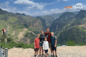
Ha Giang Loop with Toddlers & Very Young Children: Family Jeep Guide
Facebook X Reddit Table of Contents Learn more: Ha Giang Loop Tours Most people picture the Ha Giang Loop as a motorbike

Thúy Kiều (Grace) is a travel blogger and content contributor for Loop Trails Tours Ha Giang. She holds a bachelor’s degree in Sustainable Tourism from Vietnam National University, Hanoi, and has a strong passion for exploring and promoting responsible travel experiences in Vietnam’s northern highlands.

Learn more: Ha Giang Loop Tours
There’s a waterfall on the northern edge of Vietnam that most travelers have never heard of, and the ones who have tend to describe it the same way: bigger than expected, more beautiful than the photos, and almost disorienting in how remote it feels to actually stand in front of it.
Ban Gioc Waterfall is the largest waterfall in Vietnam and one of the largest waterfalls on an international border anywhere in the world. It sits in Trung Khanh district, Cao Bang province, roughly 90 kilometers from Cao Bang city, right on the edge of China. The international boundary runs through the falls themselves.
Getting there from Cao Bang is straightforward once you know your options. This guide covers the route, the practical logistics, what to do when you arrive, and how to fit Ban Gioc into a larger Cao Bang trip in a way that’s actually worth your time.
")
Learn more: Ha Giang Loop 2 Days 1 Night
Ban Gioc (sometimes written Bản Giốc) falls across three main tiers on the Quay Son River. At peak water season, the combined width of the falls stretches to roughly 300 meters across, with the tallest drop around 30 meters. Numbers don’t fully capture it: the scale only becomes real when you’re standing at the viewing bank watching the mist drift across the karst landscape behind.
The falls are genuinely impressive year-round, but the water volume changes dramatically between wet and dry seasons. August and September push the falls to their maximum width and power. February and March reduce them to something more intimate but still beautiful. The surrounding landscape, the border setting, and the Tay minority villages nearby mean there’s always something interesting regardless of season.
Ban Gioc sits directly on the Vietnam-China border. The Vietnamese side holds the better viewing angles and the majority of the tourist infrastructure. The Chinese side (known as Detian Falls) has its own visitor facilities, but you cannot cross between the two sides as a tourist without the appropriate paperwork.
On the Vietnamese side, certain photography directions are restricted and some areas of the riverbank are off-limits. A border guard presence is normal and consistent. None of this is a problem if you stay on the designated paths and follow local guidance. Your guide will brief you on this; if you’re arriving independently, pay attention to signage and don’t cross any marked boundaries near the river.
The border zone status also means that some regulations for access can change. Check for any current travel advisories for Cao Bang’s border areas before your trip, particularly if you’re visiting with any photography equipment beyond a standard camera or phone.

Learn more: Ha Giang Motorbike Rental
The distance from Cao Bang city to Ban Gioc Waterfall is approximately 90 kilometers by the main road. The journey takes around 2.5 to 3.5 hours depending on your transport, how often you stop, and road conditions on the day. There are several ways to make the trip, and the right one depends on your experience level, budget, and how much of the surrounding area you want to see.

Learn more: Ha Giang Loop 3 Days 2 Nights
Riding from Cao Bang to Ban Gioc on your own bike is the most flexible option and, for experienced riders, genuinely enjoyable. The road runs through Trung Khanh district, passing limestone formations, rice paddies, Tay village settlements, and river valleys before arriving at the falls.
The route is mostly paved and well-maintained on the main road. There are some narrower sections and the occasional rough patch, but it’s not technically demanding in the way that Ha Giang’s mountain passes are. What it lacks in drama it makes up for in scenery: the closer you get to the border, the more the landscape shifts into something quieter and more enclosed.
One practical point: if you’re renting a motorbike in Ha Giang and planning to ride to Ban Gioc as part of a larger circuit, check whether your rental agreement covers Cao Bang province. Some rental conditions are specific about where the bike can be taken. [Our Ha Giang motorbike rental page] has current information on long-distance rental terms.
Navigation is manageable with Maps.me or Google Maps, though signal can drop on some sections between Cao Bang city and Trung Khanh. Download the offline map before leaving the city.

Learn more: Ha Giang Loop 4 Days 3 Nights
Booking a guided day trip or multi-day tour from Cao Bang city to Ban Gioc means a guide who knows the road, handles any logistical complications at the border zone, and can take you to stops along the route that aren’t on any standard map.
The guided format is particularly useful for Ban Gioc because of the border zone context. At the falls themselves, a local guide understands exactly where you can go, what you can photograph, and how to navigate the boat ride operators and entrance systems in a way that saves time and avoids any confusion.
It’s also the format that best serves travelers who want Ban Gioc as part of a full Cao Bang Loop experience rather than just a there-and-back trip. [Browse our Cao Bang Loop Tour page] to see how Ban Gioc fits into the complete circuit.

Learn more: Ha Giang Cao Bang 5 Days 4 Nights
A private vehicle with a driver covers the same route with more comfort and the ability to carry more gear. For groups of two to four people, the cost per person often becomes comparable to other options, and the weather protection matters on a route where afternoon rain is common in the wetter months.
The jeep format also works well for travelers who want to stop frequently along the road, which on the Cao Bang to Ban Gioc route is genuinely worth doing: the rice field sections around Trung Khanh district are beautiful in late afternoon light, and several minority villages along the way are worth a brief stop.
Buses connect Cao Bang city to Trung Khanh district. From Trung Khanh you can take a xe ôm (motorbike taxi) to Ban Gioc itself, which is a few kilometers further. This is the cheapest option and perfectly doable if you’re comfortable navigating local transport without a fixed schedule.
The downsides are the ones you’d expect: fixed departure times, no flexibility for stops along the route, and the need to sort out the Trung Khanh to Ban Gioc connection yourself. For a simple visit to the falls and back, it works. For anyone wanting to see Nguom Ngao Cave and stop at points along the road, it becomes more complicated.
Check current bus schedules in Cao Bang city directly, as these change seasonally and are not reliably listed online.
The honest breakdown:
Still working out which fits your trip? [Send a message on WhatsApp] with your dates, group size, and experience level. We’ll tell you what makes the most sense without any pressure to book.

Learn more: Ha Giang Cao Bang Ba Be Lake 6 Days 5 Nights
The main road from Cao Bang city toward Trung Khanh and Ban Gioc is asphalted and in generally good condition. It’s a mountain road in character: winding, with occasional tight sections and a few climbs, but nothing that requires specific technical riding skills in dry conditions.
In wet season (June through September), some sections can develop surface water and occasional potholes after sustained rain. The road is passable throughout, but the time taken increases and confidence on a wet road matters more. Experienced riders handle it without issue. Less experienced riders should weigh this against the guided or vehicle options.
Road maintenance in rural northern Vietnam is ongoing and conditions can shift. If you’re traveling after heavy rain, a quick ask at your guesthouse about the current state of the road is always time well spent.
The road from Cao Bang to Ban Gioc is not just a transit route. Given the right pace, it’s a destination in itself.
Leaving Cao Bang city, the road initially passes through lowland rice farming country before the terrain starts to lift toward the limestone karst belt that defines this stretch of the border. Around the Trung Khanh area, the rice terraces become more pronounced and the karst towers start appearing in the fields, erupting from the flat paddies in a way that’s more surreal than dramatic.
Tay minority villages line parts of the road, often identifiable by the distinctive stilt house architecture and the lack of tourist infrastructure. These are working agricultural communities rather than heritage sites, and passing through them with a local guide adds genuine context. Independently, they’re interesting to ride past; with a guide, you might stop for a few minutes and actually understand what you’re seeing.
The approach to Ban Gioc follows the Quay Son River for the final section, and the sound and mist of the falls reach you before the view does on quiet mornings.

Learn more: Ban Gioc Waterfall Guide
The main viewing area on the Vietnamese side faces the falls across the Quay Son River. From here, the full width of Ban Gioc is visible, including the largest central drop and the flanking cascades on either side. This is the standard photo position and it’s a good one: the angle puts the mist, the water, and the Chinese karst mountains all in the same frame.
Arriving early in the morning is strongly recommended. By 9 or 10am, organized tour groups from both Vietnamese and Chinese sides start arriving in numbers, and the riverbank viewing area fills up. Before 8am on a weekday, the falls and the surrounding landscape are largely yours. The morning light on the water is better for photography, and the sound of the falls carries differently when it’s not competing with crowd noise.
Bamboo raft boats operate from the riverbank and take visitors out onto the river for a closer approach to the base of the falls. This is the part most travelers don’t fully appreciate until they’re on the water: the scale of Ban Gioc becomes much clearer from mid-river, and the spray reaches the boat on high-water days.
The boat ride is separately ticketed and takes roughly 15 to 20 minutes. It’s worth doing at least once, particularly during high water season when the power of the falls is most felt from the water level. Wear something you don’t mind getting slightly wet in wet season.
Operators are local and the boats are traditional bamboo craft. The experience is genuine rather than manufactured, which is worth appreciating in a region where tourism infrastructure can sometimes sanitize what it’s trying to show you.
")
Learn more: Nguom Ngao Cave
Nguom Ngao Cave is located approximately 3 kilometers from Ban Gioc, and most visitors do both on the same day. The cave system runs for several kilometers into the karst, with the tourist section covering around 1.5 kilometers of lit walkways through chambers containing some of the most developed stalactite and stalagmite formations in northern Vietnam.
The formations here are dense and varied: tall columns, broad curtains of calcite, and in some chambers, floor-to-ceiling structures that took tens of thousands of years to form. Even travelers who wouldn’t normally prioritize cave tourism tend to find Nguom Ngao worth the hour it takes.
Allow 1 to 1.5 hours including the walk in and out. Bring a layer: cave temperature stays cool year-round, which feels welcome in summer and cold in winter.
Entrance is ticketed separately from Ban Gioc. Current ticket prices and opening times should be confirmed locally, as these change.
For the waterfall itself, most travelers spend 1.5 to 2.5 hours: time at the viewing bank, a boat ride, and some unhurried looking around. Add Nguom Ngao Cave and you’re looking at a full half-day at the Ban Gioc site.
If you’re coming from Cao Bang city and returning the same day, budget the full day: the drive each way, time at the falls, and the cave. Trying to rush any of it defeats the purpose.
If you’re overnighting near the falls (which gives you the early morning advantage), you can be more relaxed about the schedule and take the afternoon to explore the surrounding village paths along the Quay Son River.

Learn more: Explore just the Cao Bang Loop
The timing question for Ban Gioc is more important than for many Vietnamese destinations, because the difference between peak water season and dry season is genuinely significant visually.
January and February: The quietest months. Water levels are low: the falls are narrower and the individual drops more distinct. The surrounding landscape is dry and the light is clean and cool. If you’re in northern Vietnam at this time, Ban Gioc is still worth visiting — it’s just a different experience from the high-water version. Tet holiday (late January or early February) brings increased domestic visitors for a brief period.
March and April: Water levels start to recover slightly. Warm days, cool mornings. The rice fields around Trung Khanh are being prepared for planting, which adds activity to the landscape along the road. Good months for photography: clear skies and manageable crowds.
May and June: The rainy season is starting to build. Water levels at Ban Gioc begin rising noticeably by June. The landscape turns intensely green. Roads can have some wet-weather variability. Still a good time to visit; expect warm, humid conditions.
July and August: Peak rainy season, peak water volume. The falls in August are at their widest and most thunderous. The experience is genuinely spectacular if you’re okay with the probability of rain during your visit and the roads being slower to travel. This period also coincides with Vietnamese summer holidays, bringing more domestic tourists to Ban Gioc on weekends.
September and October: The sweet spot. Water remains high from the rainy season, but the worst of the rain has typically passed. Days are clearer. The mist around the falls in the morning is at its most photogenic. October is generally considered the best single month to visit: water volume, weather, and light all align. This also overlaps with Ha Giang’s buckwheat flower season, making it the ideal time for the combined Ha Giang Cao Bang tour for travelers who want to do both.
November and December: Water levels drop. The surrounding forest starts to turn at Phia Oac nearby. Crowds thin significantly. The falls are less dramatic volumetrically but the experience is quieter and the autumn light across the karst landscape is excellent. Underrated months to visit.

Learn more: Ha Giang Homestay Guide
Overnight options near the falls are limited in number but fine in quality for what the area is. This is not a place with resort hotels or boutique guesthouses: it’s a quiet rural border area, and the accommodation reflects that.
Guesthouses near Ban Gioc: Several family-run guesthouses operate within a few kilometers of the falls, primarily in the Trung Khanh district villages. Rooms are basic to simple mid-range: clean, local, reliable hot water in most places, variable Wi-Fi. Breakfast is often included or available at a small additional cost.
The main practical reason to stay overnight near Ban Gioc: you get the falls in the early morning before any day-trip groups arrive. That early window — roughly 6:30am to 8:30am — is the best time at Ban Gioc by a significant margin. It’s worth a basic overnight to experience it.
Trung Khanh town: The district town of Trung Khanh has a slightly wider range of options and is a comfortable base for visiting Ban Gioc and Nguom Ngao Cave. A bit less atmospheric than sleeping closer to the falls, but more practical if you want a proper meal in the evening and a reliable bed.
Cao Bang city: If your priority is comfort and you’re willing to add driving time, basing in Cao Bang city and doing Ban Gioc as a day trip is a legitimate approach. You miss the early morning, but you have the widest accommodation options and the best food choices.
For guided tours through Loop Trails, accommodation near Ban Gioc is included and arranged as part of the itinerary, which removes the guesswork entirely.

Learn more: Corn wine “Happy Water” in Ha Giang
The food culture in Cao Bang province is one of the genuinely underappreciated aspects of visiting this part of Vietnam. It’s not a gastronomy destination in the way Hoi An or Hanoi gets marketed, but the local cooking is honest, ingredient-led, and distinctly different from what you get in lowland Vietnam.
Near Ban Gioc and Trung Khanh:
Simple restaurants and family kitchens serve what’s available locally: river fish from the Quay Son, grilled pork and chicken, sticky rice varieties specific to the border region, and fresh vegetables from the surrounding farms. The meals are not elaborate, but the quality of the ingredients tends to be good. Point at what other people are eating if the menu is only in Vietnamese.
In Cao Bang city:
The city has the range you’d expect from a provincial capital: Vietnamese standards (phở, bún, bánh mì), local Cao Bang specialties, and a handful of restaurants that cater to both Vietnamese tourists and the occasional foreign traveler.
Worth specifically seeking out:
Vegetarians and dietary restrictions: Communication is the main challenge. “Không ăn thịt” (no meat) is understood in most places, but pork fat is used in cooking in many rural kitchens without it being considered “meat” in the local culinary framework. Be specific and patient.
")
Learn more: Ha Giang Safety Tips
Ban Gioc charges an entrance fee to access the main viewing area and boat ride. Nguom Ngao Cave is separately ticketed. Prices are set by local authorities and can change: confirm current fees at the ticket booth or with your guide rather than relying on figures from travel blogs (this one included).
The border zone rules around Ban Gioc are consistent and applied: stay on marked paths, follow all local signage, and don’t approach the border markers near the river. Photography is generally permitted of the falls themselves, but pointing a camera toward the Chinese side’s military or border facilities is not. Use common sense and follow your guide’s briefing.
If you’re visiting independently, consider reading current travel advisories for Cao Bang’s border areas before your trip. Rules in Vietnamese border zones can be updated, and the local information on the ground is always more current than any online guide.
Cash: Bring everything you’ll need from Cao Bang city. There are no reliable ATMs near Ban Gioc or in Trung Khanh district’s smaller villages. Boat tickets, cave entrance, guesthouse stays, and meals near the falls are all cash transactions. Come prepared.
Phone signal: Variable between Cao Bang city and the falls. Viettel tends to have the most consistent coverage in remote northern Vietnam. Data speeds near Ban Gioc can be slow. For navigation, have your offline maps downloaded before leaving the city.
Fuel: Petrol is available in Trung Khanh town. If you’re on a motorbike, fill up there rather than relying on the stretch closer to the falls, where fuel availability is less certain.
Timing: Leave Cao Bang city early. Aim to reach Ban Gioc before 9am. The drive takes 2.5 to 3.5 hours depending on how you travel, which means departing by 6 to 6:30am for that early window. It’s early. It’s worth it.
")
Learn more: Visiting God’s Eye Mountain
This is the question most travelers arrive at after researching the area: is Ban Gioc worth a standalone trip, or should it be part of a longer circuit?
The honest answer is that Ban Gioc as a standalone day trip from Cao Bang is fine, but it’s genuinely not the best way to experience what Cao Bang province has to offer. Phia Oac National Park is a 2-hour ride away from Cao Bang city in a completely different direction, and it’s one of the most surprisingly beautiful places in northern Vietnam. The backcountry roads between Nguyen Binh and the provincial capital pass through landscapes that most travelers never see. The Cao Bang Loop ties these together into a coherent journey rather than a checklist of individual stops.
If you have 5 to 7 days, the Cao Bang Loop is the right framework for the trip, with Ban Gioc as its centerpiece. [See the full Cao Bang Loop guide] for how the route connects.
If you’re combining this with Ha Giang, the joined Ha Giang Cao Bang route makes Ban Gioc the logical eastern anchor of a trip that starts on Ma Pi Leng Pass and ends at the Chinese border falls, or vice versa. [The Ha Giang Cao Bang Combined Tour] handles the logistics of connecting both loops for travelers who want to do the full northern circuit.
If you genuinely only have one day and Ban Gioc is the specific goal: take it. It’s worth a dedicated trip. Just know what you’re not seeing while you’re there.
")
Learn more: Ha Giang Loop Weather
Loop Trails runs guided tours covering the Cao Bang to Ban Gioc route as part of the full Cao Bang Loop and the combined Ha Giang Cao Bang circuit. Options include Easy Rider guided motorbike tours, private jeep tours, and self-drive motorbike rental for experienced riders doing the route independently.
What we focus on: small groups, locally experienced guides, well-maintained vehicles, and itineraries that give you the early morning at Ban Gioc rather than the mid-morning rush. The logistics around the border zone, the boat ride operators, and the cave entrance are handled without fuss.
To get started:
All booking details and deposit terms are clearly listed on the relevant tour pages.

Learn more: Ha Giang Loop Hidden Gems
The distance is approximately 90 kilometers by the main road through Trung Khanh district. The journey typically takes 2.5 to 3.5 hours depending on your transport method, road conditions, and how many stops you make along the way.
Yes, and many travelers do. Budget a full day: the drive each way plus time at the falls and Nguom Ngao Cave adds up to roughly 8 to 9 hours if you’re moving at a reasonable pace. The main thing you miss on a day trip is the early morning, which is the best time at the falls. Overnighting near Ban Gioc solves this if you can spare the extra night.
Yes. Ban Gioc is an established tourist destination with a consistent visitor infrastructure on the Vietnamese side. The border zone context means there are restrictions to follow marked paths, photography guidelines, and no approaching border markers near the river but these are straightforward and well-signposted. Guided tours handle this without any complication.
Ban Gioc itself doesn’t currently require a separate permit beyond standard Vietnamese visa entry. However, it’s a border area, and regulations can be updated: check current travel advisories before your trip. Entrance fees for the viewing area and boat ride are paid at the site.
No. The border crossing at Ban Gioc is not open to general tourist traffic in either direction. The Vietnamese side and the Chinese side (where the falls are known as Detian Falls) are separate destinations accessed from their respective countries. Attempting to cross the border here is not permitted.
Nguom Ngao Cave is a large cave system about 3 kilometers from Ban Gioc, containing some of the most elaborate stalactite formations in northern Vietnam. It’s worth combining with a Ban Gioc visit: the cave tour takes around 1 to 1.5 hours and the two stops together make a natural full half-day at the site.
September and October offer the best combination of water volume, weather, and light. The falls are at or near peak flow from the rainy season but the weather is more stable than the peak monsoon months. October in particular tends to be the sweet spot. August offers maximum water volume but with a higher chance of rain during your visit.
The main road is less technically demanding than routes like Ha Giang’s mountain passes. It’s asphalted and winding rather than extreme. That said, any mountain road in northern Vietnam requires more experience than flat coastal riding, and wet season conditions add complexity. Beginner riders should consider a guided tour or private vehicle rather than self-driving, particularly outside the dry season months.
No reliable ATMs exist near Ban Gioc or in the smaller Trung Khanh villages. Bring all the cash you’ll need for the trip from Cao Bang city, including entrance fees, boat rides, cave tickets, meals, and accommodation if you’re overnighting.
The difference is real and significant. In wet season (August to October), the falls stretch to their full width with multiple tiers running at full power: loud, wide, and misty. In dry season (January to April), the falls narrow considerably, with more distinct individual drops and less volume. Both have their aesthetic merits, but travelers with flexible timing should aim for the September to October window for the most impressive version.
Motorbike rental options exist in Cao Bang city. As with any rental in northern Vietnam, confirm the bike’s condition, what the rental covers in terms of breakdown support, and whether the agreement covers the road to Trung Khanh and the border area. For long-distance rentals from Ha Giang that continue to Cao Bang, [check our Ha Giang motorbike rental page] for current terms on multi-day and cross-province rentals.
Absolutely. Phia Oac is one of the most underrated stops in northern Vietnam and sits within the same broader Cao Bang Loop circuit. Combining Ban Gioc and Phia Oac in a 5 to 7 day Cao Bang Loop gives you the full range of what the province offers: the waterfall border landscape in the northeast and the cloud forest mountain terrain in the west of the province. [The Cao Bang Loop guide] covers how both stops connect.
Contact information for Loop Trails
Website: Loop Trails Official Website
Email: looptrailshostel@gmail.com
Hotline & WhatSapp:
+84862379288
+84938988593
Social Media:
Facebook: Loop Trails Tours Ha Giang
Instagram: Loop Trails Tours Ha Giang
TikTok: Loop Trails
Office Address: 48 Nguyen Du, Ha Giang 1, Tuyen Quang
Address: 48 Nguyen Du, Ha Giang 1, Tuyen Quang
Facebook X Reddit Table of Contents Learn more: Ha Giang Loop Tours Most people picture the Ha Giang Loop as a motorbike
Facebook X Reddit Table of Contents Learn more: Ha Giang Loop Tours Riding the Ha Giang Loop during Tet is one of
Facebook X Reddit Table of Contents Learn more: Ha Giang Loop Tours Dong Van sits at the far northern tip of Vietnam,