

Thúy Kiều (Grace) is a travel blogger and content contributor for Loop Trails Tours Ha Giang. She holds a bachelor’s degree in Sustainable Tourism from Vietnam National University, Hanoi, and has a strong passion for exploring and promoting responsible travel experiences in Vietnam’s northern highlands.
Learn more: Ha Giang Loop Tours
The first time somebody told me the Ha Giang Loop runs through a UNESCO Global Geopark, I nodded like I knew what that meant. I did not. I assumed it was a nicer way of saying national park, and I carried on taking photos of limestone.
It took a few more trips, and one long conversation with a guide who grew up in Meo Vac, before the label started to make sense. A geopark is not a fenced reserve you buy a ticket for. It is an entire inhabited landscape, villages and schools and maize fields included, that UNESCO has recognised because the rock underneath it tells a story of international importance, and because the people living on top of it are doing something sensible with that story.
Vietnam has four of them. Two are in the far north and sit at the heart of the routes most adventure travellers come here for. One is a couple of hours from Hanoi and almost nobody visits. One is in the Central Highlands and is made of volcanoes instead of limestone.
This guide explains what the label actually means, walks through all four Vietnam UNESCO Global Geoparks in plain language, and gets specific about how you would travel each one. No geology degree required.

Learn more: Ha Giang Loop 2 Days 1 Night
A UNESCO Global Geopark is a single, unified geographical area where sites of international geological significance are managed with three goals at once: protection, education, and sustainable development for the people who live there.
That last part is the bit most travellers miss. Communities are not a complication inside a geopark, they are the point. A homestay owner in Du Gia is part of the management model, not an exception to it.
The programme label was formally established in 2015 under UNESCO’s International Geoscience and Geoparks Programme. As of 2026 the network covers 241 geoparks across 51 countries, spanning an area of more than 882,000 square kilometres.
Here is the part that surprises people: the title is not permanent. Every geopark is revalidated roughly every four years. A green card means you keep it. A yellow card means fix specific problems within two years. A red card means you lose the designation entirely.
This is not theoretical. Non Nuoc Cao Bang went through the process again in April 2026 and passed for the second time, receiving another green card at a ceremony in Paris. Dak Nong passed its first revalidation and was re recognised for the 2024 to 2027 cycle.
For a traveller this matters more than it sounds. It means the status is tied to how the place is actually being managed right now, not to a plaque somebody hung up years ago
Learn more: Ha Giang Loop 3 Days 2 Nights
Half the travel blogs online describe Dong Van as a “UNESCO World Heritage Site”. It is not one. All three labels come from UNESCO, and they do completely different jobs.
| Label | What it recognises | How it is protected | Vietnamese examples |
|---|---|---|---|
| UNESCO Global Geopark | Geological heritage of international significance, plus education and sustainable local development | Managed locally, revalidated every four years, can be lost | Dong Van, Non Nuoc Cao Bang, Lang Son, Dak Nong |
| World Heritage Site | Outstanding universal value, cultural or natural | Strict legal protection, no expiry, but can be listed as “in danger” | Ha Long Bay and Cat Ba, Phong Nha Ke Bang, Trang An, Yen Tu complex |
| Biosphere Reserve | Living laboratories for balancing biodiversity and human use, under the Man and the Biosphere programme | Zoned into core, buffer and transition areas | Cat Ba, Red River Delta, Cu Lao Cham and others |
A place can hold more than one label, and none of them is a ranking of beauty. World Heritage status is about universal value. Geopark status is about geology plus people plus livelihoods. If you want the short version: a World Heritage Site is something the world agrees must be preserved, and a Global Geopark is somewhere the world agrees is geologically remarkable and is being lived in well.
Vietnam currently has nine World Heritage Sites, the most recent being the Yen Tu, Vinh Nghiem, Con Son and Kiep Bac complex inscribed in 2025. Those are a separate list from the geoparks entirely.

Learn more: Ha Giang Loop 4 Days 3 Nights
| Geopark | UNESCO recognition | Where it is | Approximate size | Signature landscape |
|---|---|---|---|---|
| Dong Van Karst Plateau | 2010 | Far north, in the former Ha Giang province | About 2,356 km² | Limestone towers, canyons, high passes |
| Non Nuoc Cao Bang | 2018, revalidated 2026 | Northeast, Cao Bang province | About 3,000 km² | Waterfalls, caves, river valleys |
| Dak Nong | 2020, revalidated for 2024 to 2027 | Central Highlands, western Lam Dong | About 4,760 km² | Volcanic caves in basalt, crater lakes |
| Lang Son | Council vote 2024, certificate 2025 | Northeast, Lang Son province | About 4,842 km² | Fossil caves, valleys, temple landscapes |
Two of these, Dong Van and Non Nuoc Cao Bang, are within reach of each other overland and can be combined in a single trip. The other two are standalone journeys.
Learn more: Ha Giang Cao Bang 5 Days 4 Nights
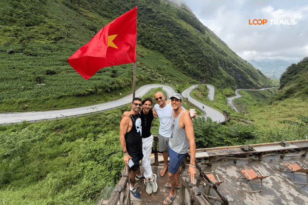
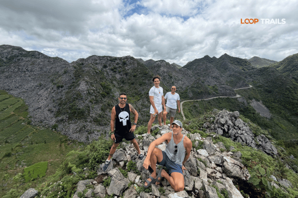
This was Vietnam’s first, designated in 2010, and it remains the one most international travellers actually experience, usually without realising the label exists. If you have ridden the Ha Giang Loop, you have crossed a UNESCO Global Geopark from end to end.
The plateau is roughly 60 percent limestone, and its geological record reaches back more than 550 million years to the Cambrian. Fossils found here include trilobites, corals, brachiopods, crinoids, ancient fish and conodonts. The rock also preserves evidence of two of the planet’s major extinction events, at the Frasnian and Famennian boundary around 360 million years ago, and at the Permian and Triassic boundary around 250 million years ago.
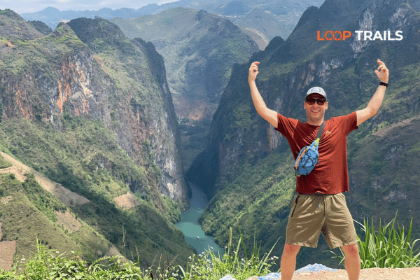
The headline feature is Tu San canyon, cut by the Nho Que river below Ma Pi Leng Pass. At roughly 700 to 800 metres deep it is among the deepest canyons in Southeast Asia. The highest point in the geopark is Mieu Vac Mount at 1,971 metres.
You do not need any of that to enjoy the ride. But it changes how the landscape reads. Those grey fins of rock people photograph from Quan Ba are not decoration. They are an ancient seabed, folded and lifted and dissolved by rain for longer than vertebrates have existed.
Working roughly north from Ha Giang city:
Markets run on fixed days and are one of the best cultural experiences in the whole region, but schedules do shift around festivals and holidays, so confirm locally before planning a day around one.
Learn more: Cao Bang Loop 3 Days best kept secret
On 1 July 2025, Vietnam reorganised its provinces and the former Ha Giang province was merged into an expanded Tuyen Quang province. The landscape, the roads and the geopark are all exactly the same. But maps, official documents and newer signage may say Tuyen Quang where older blogs and guidebooks say Ha Giang.
Nobody on the ground has stopped calling the route the Ha Giang Loop, and the UNESCO designation is unaffected. Just do not panic if your paperwork, bus ticket or insurance document uses a province name you were not expecting. Administrative details can keep evolving, so check the latest updates close to your travel date.
Planning to see this one properly? Most people give the Dong Van geopark three days and wish they had taken four. If you would rather not solve the logistics yourself, our Ha Giang Loop tours cover the route in 2, 3 and 4 day formats, with easy rider, self drive and jeep options.
There is no single entrance. You travel it the way locals do, along the road, and the mode you choose shapes the whole trip:
Whatever you pick, licence and insurance rules for foreign riders in Vietnam are strict and they do change. Check the current requirements and confirm with your own travel insurer before you commit to riding yourself. Do not rely on what a forum post said two years ago.
Learn more: Best time to visit Cao Bang
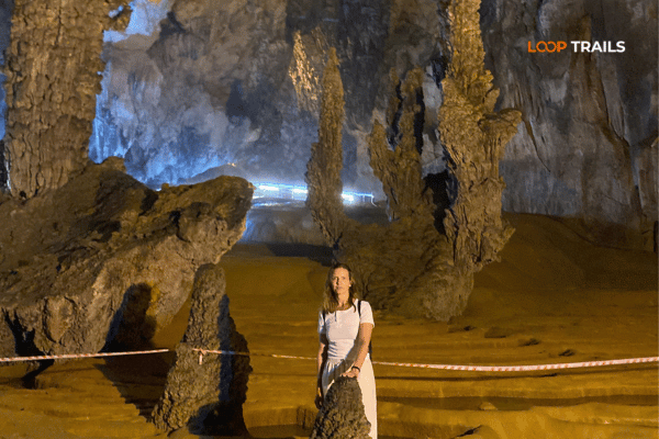
Vietnam’s second geopark, recognised in 2018, sits about 300 kilometres from Hanoi in the northeast. It covers roughly 3,000 square kilometres and is home to eight Indigenous groups, including Tay, Nung, Dao, Hmong and Lo Lo communities.
Where Dong Van is vertical and stark, Cao Bang is softer. More water, more green, wide river valleys between the karst rather than bare stone. If Ha Giang is a landscape you survive, Cao Bang is a landscape you sit in.
In April 2026 the geopark passed its second revalidation and received another green card from UNESCO, which is a decent signal that management here is being taken seriously.
Unlike Ha Giang, Cao Bang has been organised deliberately into themed touring routes, four of them, covering 57 destinations:
| Route | Theme | What it covers |
|---|---|---|
| North | Journey to the roots | Pac Bo relic site, Lenin stream, revolutionary history |
| West | Discovering Phia Oac | Phia Oac Phia Den National Park, old tungsten mining sites, tea and forest landscapes |
| East | Experiencing indigenous culture | Ban Gioc waterfall, Nguom Ngao cave, Thang Hen lake |
| South | Echoes of heroic years | Border history sites in the south of the province |
Most visitors with limited time do the eastern route, and it is the right call if you only have a couple of days.
Roads in Cao Bang are generally easier than the Ha Giang plateau, with fewer extreme gradients and more open valley riding. That makes it a good option for less confident riders, and an excellent jeep destination.
Most trips run out of Cao Bang city as a base, or as the second half of a longer journey from Ha Giang. Getting back to Hanoi by night bus is straightforward and takes most of an evening. Check current schedules, as departures change seasonally.
If you want to see the Cao Bang geopark without organising drivers, permits and stop order yourself, our Cao Bang Loop tours are built around the eastern and western routes.
Learn more: Best Adventure Activities in Vietnam
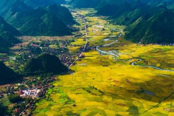
Lang Son is the newest of the four and the one almost no foreign traveller has heard of. The provincial geopark was established in 2021, the UNESCO Global Geoparks Council voted to recognise it in September 2024 during the Asia Pacific geoparks conference held in Cao Bang, and the certificate was formally presented in 2025.
At roughly 4,842 square kilometres it covers around 58 percent of the province and is one of the largest geoparks in Vietnam.
What makes it distinctive:
Honest assessment: Lang Son is early in its tourism development. English language interpretation is thin, few international operators run trips there, and you will be improvising more than you would in Ha Giang. That is either the appeal or the problem, depending on the traveller. It is, however, the easiest geopark to reach from Hanoi, which makes it a legitimate weekend option if you have already done the classic north.
Learn more: Vietnam Motorbike Routes Ranked
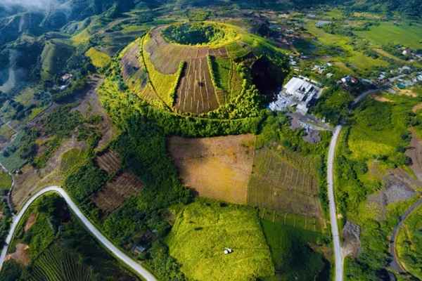
The odd one out, and the most geologically different of the four. Dak Nong sits in the Central Highlands, was recognised by UNESCO in July 2020, and passed its first revalidation for the 2024 to 2027 period.
Following the 2025 provincial reorganisation, it now lies within the western part of Lam Dong province, covering about 4,760 square kilometres across 22 communes and wards. Expect the same name confusion here as with Ha Giang: sources will say Dak Nong, Lam Dong, or both.
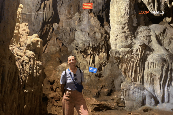
Everything north is limestone. This is basalt. Red volcanic soil, coffee country, and beneath it a network of nearly 50 lava caves formed inside basalt rock, one of the largest and most distinctive volcanic cave systems in Southeast Asia. The Krong No cave system has been recognised by the Japan Volcanic Cave Association as a regional record holder, and the surveyed passages run to many kilometres.
Above ground:
Practical note: lava cave access is not casual walk in tourism. Some caves require guides, equipment and permission, and access arrangements change as conservation work progresses. Check the current situation with a local operator before travelling specifically for the caves.
For most international travellers, Dak Nong makes sense as an add on to a Central Highlands trip based around Buon Ma Thuot or Gia Nghia rather than as a standalone destination. It does not connect logically to the northern loops.
Learn more: Ban Gioc Waterfall Guide
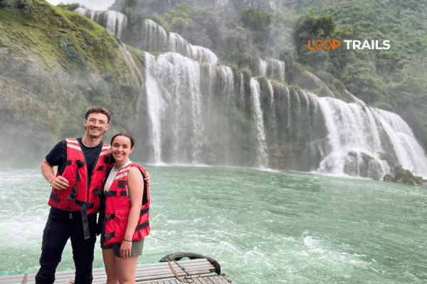
Here is something worth knowing if you are planning a longer trip. Cao Bang province has been developing a fifth tourism route, one that links Non Nuoc Cao Bang with the Dong Van Karst Plateau Geopark. It has been described as the first experiential route connecting two global geoparks anywhere.
Travellers have been doing an informal version of this for years, riding from the Ha Giang plateau east through Bao Lac and into Cao Bang, then continuing to Ban Gioc before returning to Hanoi. It is one of the best multi day overland journeys in Vietnam, and it is quiet by the standards of the classic loop.
The formal route is still being built out, so treat any specific promises about signage, interpretation centres or shared ticketing with patience and check for the latest updates. The road itself already works.
If that journey sounds like your kind of trip, our Ha Giang and Cao Bang combine tours run it in 5 and 6 day formats.
Learn more: Ma Pi Leng Pass
Short version:
Once you have picked the where, pick the how. This decides more about your trip than the itinerary does.
| You are… | Best choice | Why |
|---|---|---|
| Not a rider, or riding is not your idea of a holiday | Easy rider | You get the whole route, a local driver, and no responsibility |
| An experienced rider who wants control of the day | Self drive motorbike | Freedom to stop, detour and linger, with a guide leading |
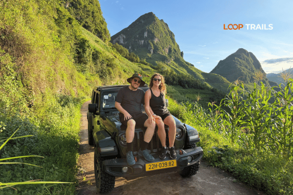
| A couple, a family, travelling with parents, or worried about weather | Jeep | Same stops, same villages, far less fatigue, works in rain |
| Travelling for photography or with heavy gear | Jeep or private car | Space, security, and easy in and out at viewpoints |
| Confident, self sufficient, on a longer trip | Motorbike rental | Ride your own route on your own schedule |
If you are somewhere between two of these, message us on WhatsApp and describe your group. We would rather talk you into the right format than sell you the popular one.
Learn more: Pac Bo Historical Site
Northern Vietnam has real seasons, and they change the geoparks a lot.
Typhoon season affects the north from roughly summer into autumn, and severe storms have caused significant damage in these provinces in recent years. Weather can close roads at short notice. Build a spare day into any tight itinerary and check forecasts and local road updates before you set out.
Learn more: Ha Giang Border Area Permit 2026
The whole point of the designation is that these landscapes stay intact and the people living in them benefit. A few things that actually matter:
Learn more: Ha Giang Loop Mistake to Avoid
Learn more: Ha Giang Packing list
For any of the northern geoparks, on two wheels or four:
Learn more: Ha Giang Motorbike Rental
Rough shapes rather than fixed schedules, since weather, markets and road conditions all move things around.
2 days 1 night: Dong Van taster Ha Giang city to Quan Ba and Yen Minh, overnight around Dong Van, then Ma Pi Leng and Meo Vac before returning. Fast, spectacular, slightly breathless.
3 days 2 nights: the classic loop The version most people mean when they say Ha Giang Loop. Adds time at Dong Van old quarter, the Lung Cu area, a proper stop at Ma Pi Leng and usually a Nho Que boat trip. The best balance of scenery and time.
4 days 3 nights: the loop with room to breathe Same route plus Du Gia and quieter valleys, an extra market or village stop, and evenings that are not spent riding in the dark.
5 days 4 nights: Ha Giang and Cao Bang combined The full northern arc. The Dong Van plateau, then east through Bao Lac into Cao Bang province, Ban Gioc and Nguom Ngao, and a night bus back to Hanoi. Two UNESCO Global Geoparks in one journey, which very few visitors to Vietnam manage.
6 days 5 nights: the unhurried version The same combination with an extra night, more time in Cao Bang’s eastern route, and fewer long days in the saddle.
Ready to put a date on it? Tell us your travel window and your group size on WhatsApp, or book directly if you already know the format you want. Most guests book one to three months ahead, and for jeeps in particular, availability is limited, so earlier is better.
Learn more: Ha Giang Loop by Wrangler Rubicon Jeep
Four: Dong Van Karst Plateau, recognised in 2010; Non Nuoc Cao Bang, 2018; Dak Nong, 2020; and Lang Son, voted through in 2024 with the certificate presented in 2025.
Yes. The classic loop runs through the Dong Van Karst Plateau Geopark for most of its length. There is no separate geopark ticket, you simply travel the road.
No. World Heritage recognises outstanding universal value and carries strict, permanent protection. Geopark status recognises geological heritage combined with education and local development, and it is reviewed every four years.
Lang Son. It is the closest, though it has the least developed visitor infrastructure for international travellers. Cao Bang and Ha Giang are both around 300 kilometres away.
Yes. Dong Van and Non Nuoc Cao Bang connect overland via Bao Lac and are commonly combined in a 5 or 6 day journey. A formal route linking the two is under development.
Not for the geopark itself. Individual sites may charge entrance fees, and border areas can require you to carry your passport for identity checks. Rules can change, so confirm locally before you travel.
No. Easy rider and jeep options exist precisely for people who do not ride, and you see exactly the same places. If you do want to ride yourself, check current licence and insurance requirements carefully first.
Water volume is highest after sustained rain, which generally means the middle of the year through early autumn, and the surrounding rice fields turn gold around September. In the dry months the falls are much smaller.
Both answers appear in current sources. Ha Giang province merged into an expanded Tuyen Quang province on 1 July 2025. The place, the roads and the UNESCO designation are unchanged, only the administrative name.
September to November for clear skies and rice harvest colour, March to May for green landscapes and fewer people. Winter is dramatic but often lost in mist, and summer is wet.
Yes, most commonly by jeep or private car. The stops are the same, the roads are the same, and you skip the physical toll of long riding days.
Once your dates are fixed, as early as you can. Most guests book one to three months ahead. Jeep availability in particular is limited, so early booking makes the logistics much easier to arrange properly.
Contact information for Loop Trails
Website: Loop Trails Official Website
Email: looptrailshostel@gmail.com
Hotline & WhatSapp:
+84862379288
+84938988593
Social Media:
Facebook: Loop Trails Tours Ha Giang
Instagram: Loop Trails Tours Ha Giang
TikTok: Loop Trails
Office Address: 54A Tran Phu, Ha Giang 2, Tuyen Quang
Address: 54A Tran Phu, Ha Giang 2, Tuyen Quang
Facebook X Reddit Table of Contents Learn more: Ha Giang Loop Tours Most people drive past the Quan Ba area twice on

Facebook X Reddit Table of Contents Learn more: Ha Giang Loop Tours The Ha Giang Loop has a reputation problem with older