

Thúy Kiều (Grace) is a travel blogger and content contributor for Loop Trails Tours Ha Giang. She holds a bachelor’s degree in Sustainable Tourism from Vietnam National University, Hanoi, and has a strong passion for exploring and promoting responsible travel experiences in Vietnam’s northern highlands.
Learn more: Ha Giang Loop Tours
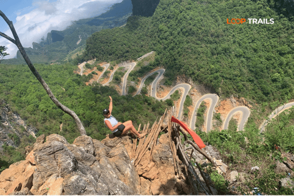
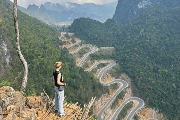
The first time you see Khau Coc Cha Pass properly is not from a saddle. It is from a hillside above it, after a walk that leaves you slightly out of breath, when the road below suddenly stops looking like a road and starts looking like something dropped on the mountain and left to unravel.
Photographs of it circulate constantly on Vietnamese social media, usually with a caption about conquering something. The photographs are not exaggerated. What they leave out is that the pass is short, that riding it is far less frightening than looking at it, and that the best part of the day is the walk to the viewpoint rather than the ride itself.
This guide covers what the pass is, where it sits, how to ride or drive it sensibly, how to reach the viewpoint, and how to build a trip that includes it without wasting two days getting there. We run guests over this road regularly on the route between Ha Giang and Cao Bang, so everything below is what we would tell you at the briefing.
Learn more: Ha Giang Loop 2 Days 1 Night
Khau Coc Cha is a short, steep pass in Xuan Truong, in the Bao Lac area of Cao Bang province, in the far northwest corner of the province close to the border with China. It runs roughly 2.5 kilometres, which is nothing, and packs an absurd amount of altitude change into that distance.
For years it has been the main road link between the Xuan Truong valley and Bao Lac town, which explains its shape. This was never built as a tourist attraction. It was built because people on one side of the mountain needed to get to the market, the clinic and the school on the other side.
You will see it signposted on National Highway 4A. Road numbering across the northern provinces has been reorganised more than once, so trust the signposts and your offline map rather than a road number you read in an old forum post.
This is the single most confusing thing about the pass online, so here is the short version.
The road has 14 hairpin bends, the tight kind Vietnamese riders call sleeve bends. Those 14 bends divide the climb into 15 tiers, which is why Vietnamese travellers almost always call it the 15 storey pass, or deo 15 tang. Both numbers are correct. They are counting different things.
The names multiply from there:
They all refer to the same 2.5 kilometres of road. If a guesthouse owner in Bao Lac corrects your pronunciation, take the correction and move on. Everyone up there understands what you are pointing at.
Before the road existed, this mountain was crossed by a horse and foot trail reported to be around 40 centimetres wide in places, which is the width of a large suitcase. People carried goods over it, walked children to school over it, and in bad weather simply did not cross.
The pass as you ride it now was built between roughly 2009 and 2011, widened to about five metres and surfaced with asphalt, with the hairpins opened out to make them passable for vehicles. Older residents in Bao Lac will tell you that before that, rain meant sleeping on the wrong side of the mountain and going home the next day.
Knowing this changes how the road feels. Those 14 bends are not a design flourish. They are the only way to get a truck up a cliff.

Learn more: Ha Giang Loop 3 Days 2 Nights
Khau Coc Cha is not somewhere you pass by accident. It sits in a corner of the northeast that most itineraries skip, which is exactly why it is still quiet. There are three sensible ways to reach it.
This is how most of our guests arrive, and it is the version we recommend. Once you have finished the Ha Giang Loop and reached Meo Vac, the road east toward Bao Lac takes you into Cao Bang province, and Khau Coc Cha lands neatly in the middle of that day.
It turns what most travellers treat as a boring transfer between two regions into one of the better riding days of the trip. Exact routing between Meo Vac and Bao Lac varies with roadworks and seasonal repairs, so confirm the current best option locally on the morning rather than committing to a line you drew on a map at home.
From the eastern side of the province, where Ban Gioc Waterfall and Nguom Ngao Cave are, the pass sits around 90 kilometres away in the northwest, following the Gam River valley. Mountain kilometres are slow kilometres, so treat this as a proper travel day rather than a morning excursion, and do not plan an evening activity at the far end.
This direction suits travellers doing a Cao Bang loop who want the pass as the wild card in the middle of a trip built around waterfalls and caves.
Public transport in this corner of the province is limited and not built around visitors. There are local buses and shared vans between Cao Bang and Bao Lac, and connections onward to Xuan Truong are irregular. Independent travellers usually end up negotiating a private car or a xe om for the last stretch, which works, but costs more than people expect and eats a lot of the day.
If you do not have your own transport, joining a tour or hiring a car with a driver is honestly the simpler answer here. This is the one part of the northeast where doing it yourself is not obviously cheaper.
One naming note: Vietnam reorganised its provinces and abolished the district level in 2025. Cao Bang kept its name, but you may now see the location written as Xuan Truong, Cao Bang rather than Bao Lac district. The road, the town and the pass are unchanged.
Working out how to slot this into your trip? Our Ha Giang and Cao Bang combined tours cross this pass on the transfer day, and our Cao Bang tours reach it from the eastern side. Send us your dates and we will tell you which direction makes more sense for the days you have.
Learn more: Ha Giang Loop 4 Days 3 Nights
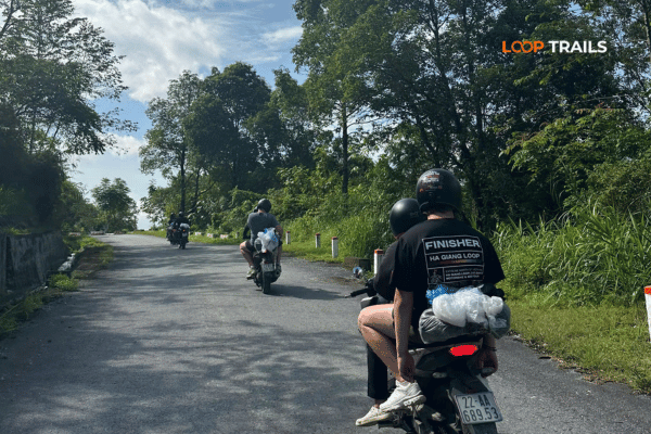
Riding the pass is fun. Seeing it is the reason to come, and you cannot see it from the road. From behind the handlebars you experience 14 corners in sequence and have no idea what you just rode. The view is from the hillside opposite.
Here is how it works. On the stretch between the Xuan Truong valley and the top of the descent toward Bao Lac, there is a small family run drinks and snacks stall with a wide yard. Everyone parks there, motorbikes and cars alike, and the owners are used to travellers asking about the walk. Buy a drink. It is the fairest way to thank the family who cleared and marked this path in the first place, back when it was their goat track.
From near the stall, a walking trail of roughly two kilometres climbs to the panorama point. The local authority upgraded the path in 2024, so it is a clearer and safer route than the scramble that earlier visitors describe, but manage your expectations:
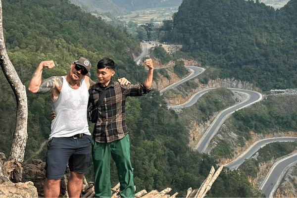
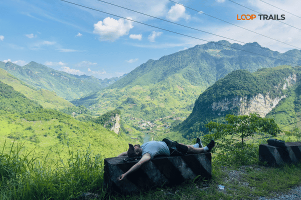
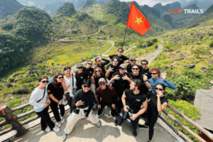
At the top there is a viewing spot with a simple built up ledge, and this is where the road finally makes sense: the full stack of bends folded down the mountainside, the valley behind, and usually a couple of Vietnamese photographers waiting for a truck to appear on one of the middle bends for scale.
Wear proper shoes for this. Not sandals, not new white sneakers, ideally something with ankle support and a real sole. It is the single most common thing people get wrong here.
Learn more: Ha Giang Cao Bang 5 Days 4 Nights
The internet calls Khau Coc Cha one of the most dangerous roads in Vietnam. That framing sells clicks. The truthful version: it is a well surfaced, reasonably wide modern road with a steep gradient and a lot of tight corners, and it is entirely manageable if you ride within your ability and do not treat it as a race track.
What actually makes it demanding is not the corners. It is the gradient, and what a long steep descent does to brakes and to concentration.
The descent is where care matters most.
Climbing is easier and less nerve testing than descending, though it is harder on the machine. Keep the revs sensible, stay in a gear that pulls without labouring, and give any vehicle ahead of you room rather than trying to pass on a bend.
If you are two people on one bike with luggage, expect the climb to feel slow. That is normal.
Check your brakes properly at the start of the day, front and rear. Check tyre condition. If you rented the bike and something feels vague or spongy, do not tell yourself it will be fine on a descent like this one. Swap the bike or get it fixed. Any decent rental operation, ours included, would rather fix it in the morning than get a phone call in the afternoon.
Learn more: Cao Bang Loop 3 Days best kept secret
Three honest profiles. Pick the one that describes you on an average day, not on your best day.
Easy rider, riding pillion behind a local driver. The right answer for most visitors. You get the full experience of the road, you can actually look at the valley on the way down, and someone who rides this pass regularly is handling the gradient. Also the best choice if you want photographs from the bike, because you have hands free and no responsibility.
Self drive. Good fun if you ride a manual or semi automatic bike regularly at home and are comfortable with steep descents, loose gravel at the edges and mountain traffic. This pass is not the place to learn hill starts or to discover how engine braking works. Be honest with yourself: experience on a flat island on an automatic scooter does not transfer to this.
Jeep. The pass is fully drivable in a 4×4, and this is the option for couples, families, non riders, anyone visiting in the wet months, and anyone who wants the viewpoint walk without a long ride beforehand. You lose the wind in your face and you gain a roof, a seat and somewhere dry to leave your bag while you walk up to the viewpoint.
Mixed groups work fine. We regularly run a day where two people ride, one rides pillion and the rest follow in a jeep, all stopping at the same places.
Learn more: Ha Giang Cao Bang 6 Days 5 Nights
September to November is the strongest window. Air is clearer, the light is sharper, the road is dry and the valley is at its greenest after the rains. This is also when the panorama shot works best, because haze is what usually ruins it.
March to May is the second choice: warm, mostly dry early in the period, with storms building toward the end.
June to August is green, dramatic and wet. The road itself handles rain well, but the viewpoint trail becomes slippery and cloud regularly sits on the ridge, so you can climb for an hour and see nothing. If you travel in these months, keep the day flexible and consider the jeep option.
December to February brings cold, fog and beautiful clear spells in between. Bring real layers. Riders underestimate how cold a long descent is at altitude in winter.
As for time of day: go in the morning. Light on the road face is better, haze builds through the afternoon, and you want the walk done before the heat. Weather in these mountains changes fast and locally, so check the forecast the night before and ask at your guesthouse in the morning.
Learn more: Ha Giang Loop Easy Rider
The mistake is treating Khau Coc Cha as a single photo stop and leaving. The area around it rewards a slower approach.
Learn more: Best time to visit Cao Bang
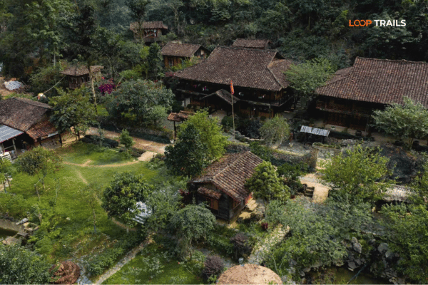
Accommodation is simple in this corner of the province and that is part of the appeal.
Food is Vietnamese home cooking: grilled meat, river fish, wild greens, sticky rice, noodle soup for breakfast. Vegetarians will manage but should say so clearly and early, and it helps to have the phrase written down in Vietnamese. Corn liquor appears at dinner in villages whether you asked for it or not. Enjoy it after the riding is done, not before.
Learn more: Ha Giang Cao Bang Packing List
Beyond your normal trip packing, this specific day asks for:
Leave the drone question until you have read the next section.
Learn more: Ha Giang Border Area Permit 2026
Two things travellers regularly get wrong up here.
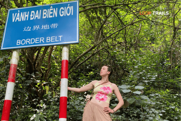
Border areas. Bao Lac sits in a border district facing China, and Vietnam regulates foreign access to border zones across the whole northern frontier. Ha Giang’s border area permit requirement has been enforced noticeably more strictly since 2026, and requirements elsewhere along the border can change with little notice. Ask your operator or guesthouse what applies to your exact route on your exact dates, and carry your passport rather than a photo of it. Rules change: check the latest updates before you travel rather than trusting any blog, including this one.
Drones. Vietnam regulates drone flight, and border regions are sensitive by definition. Do not assume that because you saw drone footage of this pass online, flying here is unrestricted or that permission was obtained. Check the current rules and ask locally before you launch anything. Getting this wrong turns a good day into a long conversation with people who are not interested in your content schedule.

Learn more: Ha Giang Motorbike Rental
On operators and prices, keep it simple rather than paranoid. Agree what is included before you pay, get the itinerary in writing, photograph any rental vehicle before you take it including existing damage, and be cautious about prices far below everyone else’s, because something has been removed to reach that number and it is usually maintenance or driver experience.
Learn more: Ban Gioc Waterfall Guide
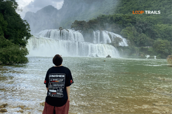
Option one: the Ha Giang and Cao Bang combination. Ride the Ha Giang Loop, cross east through Bao Lac with Khau Coc Cha as the highlight of the transfer day, then finish with Ban Gioc Waterfall, Nguom Ngao Cave and the quieter Cao Bang landscapes. This is the most efficient way to include the pass, because it is on the way rather than a detour. It typically needs five or six days from Ha Giang city.
Option two: a Cao Bang focused loop. Base the trip in Cao Bang province: waterfall and cave in the east, the pass and Bao Lac in the west, Phia Oac and Nguyen Binh in the middle. Fewer travellers, more forest and river, and a slower pace. Good for anyone who has already done Ha Giang and wants something different.
Either way, do not try to squeeze this pass into a trip that is already full. Travellers who add it to a packed schedule end up seeing it through a windscreen at speed, which is a strange thing to travel this far for.

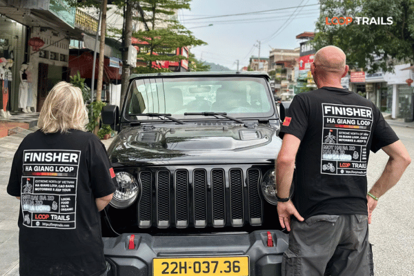
Learn more: Ha Giang Loop by Wrangler Rubicon Jeep
You can absolutely do this independently. If you ride confidently, have your own transport and a few flexible days, the information above is everything we would tell a friend before they set off.
Where we come in:
Tell us your dates, your riding experience and who is travelling with you, and we will tell you honestly which version fits, including when the answer is that your schedule is too tight to do this properly. Message us on WhatsApp at [insert WhatsApp number] or through the contact page.
Once your dates are confirmed, book early. Most guests book one to three months ahead, and jeep availability in particular runs out well before motorbike availability does.
It is in Xuan Truong, in the Bao Lac area of Cao Bang province, in the far northwest of the province near the Chinese border. It links the Xuan Truong valley with Bao Lac town and sits roughly 90 kilometres from Cao Bang city. Since the 2025 administrative reform you may see the address written without the district name.
Both numbers are right. The road has 14 hairpin bends, and those bends divide the climb into 15 tiers, which is why Vietnamese travellers call it the 15 storey pass. English listings use either count depending on what they are describing.
Yes. Khau Coc Cha is the local Tay name, Me Pia or Me Pja is the older and widely used alternative, and the 15 storey pass is the common Vietnamese nickname. All three refer to the same stretch of road.
It is steep with many tight corners, but the surface is modern and the road is reasonably wide. The real risks are overheated brakes on the descent, blind corners with oncoming trucks, and tired riders. Ride within your ability, use engine braking, and it is very manageable.
Yes. The pass was widened and paved specifically so vehicles could use it, and 4x4s cross it regularly. Larger vehicles need care on the hairpins, and this is the standard choice for non riders, families and anyone travelling in the rainy season.
Not from the road. Park at the family run stall near the top and walk the trail of roughly two kilometres to the hillside viewpoint opposite the pass. The path was upgraded in 2024, but it is uphill, rocky in places and slippery after rain, so wear shoes with grip and take water.
Allow a couple of hours if you want to walk to the viewpoint, take photographs and have a drink at the stall. If you only ride through, it takes minutes, which is exactly why so many travellers leave feeling they missed something.
September to November gives the clearest air and the best visibility for photographs. March to May is the next best. Summer is wet with a slippery trail and low cloud, and winter brings cold and fog with some beautiful clear windows.
Technically yes, realistically no. The distance and the mountain roads mean you would spend almost the entire day travelling for a short visit. It works far better as part of a route that continues west toward Bao Lac and Ha Giang, or as an overnight stop.
Bao Lac is a border district, and Vietnam regulates foreign access to border zones along the northern frontier. Requirements vary by area and have been enforced more tightly since 2026, so confirm what applies to your exact route and dates with your operator before you travel.
Vietnam regulates drone use and border regions are sensitive, so do not assume that footage you have seen online was filmed with permission. Check the current rules and ask locally before flying.
If you like mountain roads, yes, and especially if you combine it with the Ha Giang Loop so it sits on your route rather than being a detour. If your trip is already packed and you would only see it briefly from a moving vehicle, save it for a trip with more room in it.
Contact information for Loop Trails
Website: Loop Trails Official Website
Email: looptrailshostel@gmail.com
Hotline & WhatSapp:
+84862379288
+84938988593
Social Media:
Facebook: Loop Trails Tours Ha Giang
Instagram: Loop Trails Tours Ha Giang
TikTok: Loop Trails
Office Address: 54A Tran Phu, Ha Giang 2, Tuyen Quang
Address: 54A Tran Phu, Ha Giang 2, Tuyen Quang
Facebook X Reddit Table of Contents Learn more: Ha Giang Loop Tours This is the question that sits in almost every Ha
Facebook X Reddit Table of Contents Learn more: Ha Giang Loop Tours Most people drive past the Quan Ba area twice on