
Thúy Kiều (Grace) is a travel blogger and content contributor for Loop Trails Tours Ha Giang. She holds a bachelor’s degree in Sustainable Tourism from Vietnam National University, Hanoi, and has a strong passion for exploring and promoting responsible travel experiences in Vietnam’s northern highlands.
Learn more: Ha Giang Loop Tours
The first time I rode into Cao Bang I kept waiting for the traffic to start. It never did. Where the Ha Giang Loop has convoys of riders stacked three deep at every viewpoint, Cao Bang has an old man on a Honda Wave, a water buffalo that owns the road, and a valley of karst peaks that nobody is photographing but you.
This is the full Cao Bang Loop 3 days itinerary we actually run with guests, written the way I would explain it to a friend over a beer in Cao Bang City the night before you leave. Real distances, honest riding times, where to sleep, what to eat, and where the two or three genuine mistakes tend to happen.
Three days is the sweet spot here. Two days turns into a rush to Ban Gioc and back. Four days lets you add Phia Oac or Bao Lac at a slow pace. Three days gets you the waterfall, the cave, the passes and the river valleys without a single day that feels like a transfer.
Learn more: Ha Giang Loop 2 Days 1 Night
Cao Bang sits in the far northeast, up against the Chinese border, and most of the province falls inside the Non Nuoc Cao Bang UNESCO Global Geopark. That designation is not marketing fluff. The landscape here is limestone that has been dissolving for millions of years, which is why you get conical peaks rising straight out of flat rice fields, rivers that vanish underground and reappear a valley later, and caves that run for kilometres under the hills.
What it means for a traveller is variety. In three days you ride mountain passes, walk into a cave system, stand at the base of one of the largest waterfalls on any border in Asia, and eat dinner in a Tay stone village where the houses are built from river rock.
The other reason to give it three days is the pace. Cao Bang roads are generally wider and better surfaced than Ha Giang roads, with far less traffic. You cover ground faster and you stop more, because there is nobody behind you waiting to pass.
Learn more: Ha Giang Loop 3 Days 2 Nights
| Day | Route | Riding time | Sleep | Headline stops |
|---|---|---|---|---|
| Day 1 | Cao Bang City to Ban Gioc | Roughly 4 hours with stops | Khuoi Ky or Ban Gioc | Ma Phuc Pass, Thang Hen Lakes, Angel Eye Mountain, Trung Khanh |
| Day 2 | Ban Gioc area loop, then back west | Roughly 4 to 5 hours with stops | Cao Bang City or Phong Nam | Ban Gioc Waterfall, Truc Lam Pagoda, Nguom Ngao Cave, Phong Nam Valley |
| Day 3 | Cao Bang City to Pac Bo and back | Roughly 3 to 4 hours | Night bus to Hanoi, or onward | Pac Bo Cave, Lenin Stream, Karl Marx Mountain |
Total distance across the three days lands somewhere around 300 to 350 km depending on which Day 3 you choose. That is a comfortable amount on these roads, and it leaves real time off the bike.
Read the riding times as riding times only. Add the stops, the photos, the lunch, the twenty minutes you will spend watching ducks in the Quay Son River, and each day becomes a full but unhurried day.

Learn more: Ha Giang Loop 4 Days 3 Nights
Sleeper buses and limousine vans run daily from Hanoi to Cao Bang City, most of them from the My Dinh area, and the trip generally takes somewhere in the region of seven to eight hours. Night buses leave in the evening and put you in Cao Bang around dawn, which works perfectly with this itinerary because you can shower, eat breakfast and start riding by mid morning.
Schedules, operators and pick up points change often, so check the latest before you book, and take a photo of your ticket confirmation. If you would rather not deal with any of that, we can arrange your transfer as part of a tour booking.
Two practical notes. Sleeper buses have limited luggage space and you will be woken at the terminal, so keep valuables in a small bag on your body. And if you get motion sick, the road into Cao Bang has plenty of curves in the last two hours, so take something before you sleep rather than after you wake up.
This is the route more and more riders are taking, and honestly it is the best version of northeast Vietnam. You finish the Ha Giang Loop at Meo Vac, then continue east along the road through Bao Lac and Bao Lam into Cao Bang province, crossing the pass locals call the Great Wall of Cao Bang because of the way the road climbs in stacked switchbacks along a ridge.
It is a long riding day from Meo Vac to Cao Bang City, so it is normally split with a night in Bao Lac. Most travellers who want both regions book a combined Ha Giang and Cao Bang itinerary rather than trying to stitch two separate trips together, mostly because of the bike logistics at each end.
There is no train, no useful local bus network for the sights, and Grab coverage outside Cao Bang City is thin. Your realistic options are:
One thing to be clear about: Vietnam expects riders to hold a valid licence recognised locally, and both enforcement and insurance requirements change. Check the current rules and confirm what your travel insurance actually covers before you decide to self drive. If in doubt, an easy rider or a jeep removes the problem entirely.
Learn more: Ha Giang Cao Bang 5 Days 4 Nights
Route: Cao Bang City → Ma Phuc Pass → Thang Hen Lakes → Angel Eye Mountain → Trung Khanh → Khuoi Ky → Ban Gioc Distance: roughly 90 to 110 km depending on detours
Eat first. Cao Bang City has the best breakfast on the whole route and you will not find anything as good again until you come back. Look for banh cuon, the steamed rice rolls that here get served in a bowl of hot pork bone broth with a slice of gio sausage, which is a Cao Bang thing you will not find done this way in Hanoi.
Fuel up in town, then head east. Within half an hour of leaving the city the road starts climbing into Ma Phuc Pass, named after a rock formation that locals say looks like a horse. There is a pull off near the top with a view back down the valley. It is your first proper reminder that Cao Bang is a geopark, because the peaks below look artificial, like someone dropped a handful of cones onto a flat green table.
Take the layby. It is the kind of stop that seems minor until you look at your photos later.
Just beyond the pass, a side road runs to the Thang Hen lake system, a cluster of small karst lakes connected underground. Water levels rise and fall with the season, which means the lakes look completely different in September than in March, so do not judge them against whatever photo brought you here.
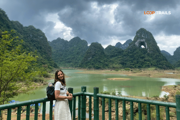
A short ride further sits Angel Eye Mountain, known locally as Mat Than, the mountain with a hole punched clean through it. In front of it stretches open grassland where horses graze and, depending on the rain, a shallow seasonal lake. It is one of the few places in northern Vietnam where you can walk freely across open ground with mountains on every side, and it is a popular camping spot with Vietnamese travellers on weekends.
Give yourself an hour here. Walk out toward the base rather than shooting from the parking area, because the scale only makes sense when you are standing under it
From here the ride to Trung Khanh drops you into farmland. This is chestnut country, and if you are riding in September or October you will see people selling hat de Trung Khanh, roasted chestnuts from a specific local variety that Vietnamese travellers make special trips for. Buy a bag. Eat them warm.
Past Trung Khanh the landscape shifts again as you meet the Quay Son River, which is the green thread that ties this whole trip together. The road follows it toward the border, past bamboo waterwheels, buffalo in the shallows and rice fields that are electric green in June and gold in late September.
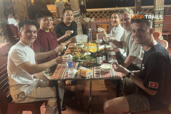
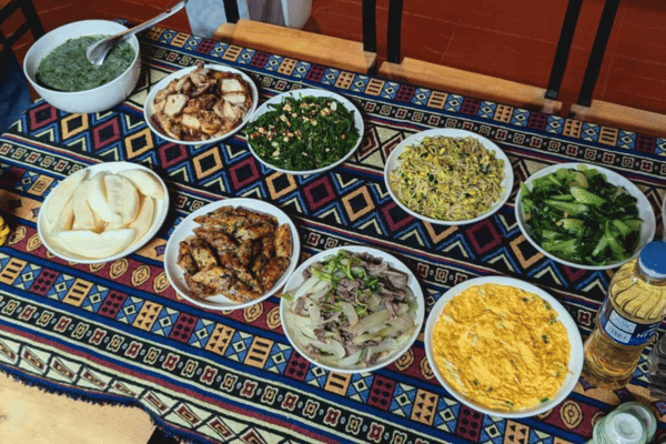
Sleep at Khuoi Ky if you can. It is a small Tay village a few kilometres short of the waterfall where the houses are built from stacked river stone on stilts, several of them now running homestays. Dinner is family style, usually a table of grilled river fish, wild greens, sticky rice and a bottle of corn wine that appears whether you asked for it or not.
The alternative is a hotel or resort right by Ban Gioc, which trades atmosphere for comfort and a shorter walk to the falls in the morning. Both work. The stone village is the one people talk about afterwards.
Planning this trip and not sure about the riding? Our Cao Bang Loop tours run this exact route with easy rider, self drive and jeep options, and a local guide who knows which viewpoints are worth the detour on the day. Message us on WhatsApp with your dates and we will tell you honestly what fits.
Learn more: Cao Bang Loop 3 Days best kept secret
Route: Ban Gioc Waterfall → Truc Lam Ban Gioc Pagoda → Nguom Ngao Cave → Phong Nam Valley → Cao Bang City Distance: roughly 100 to 120 km
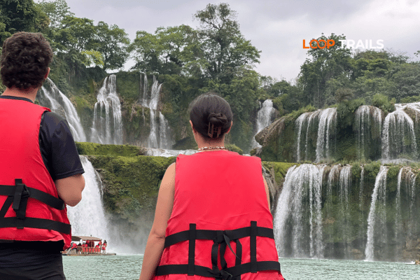
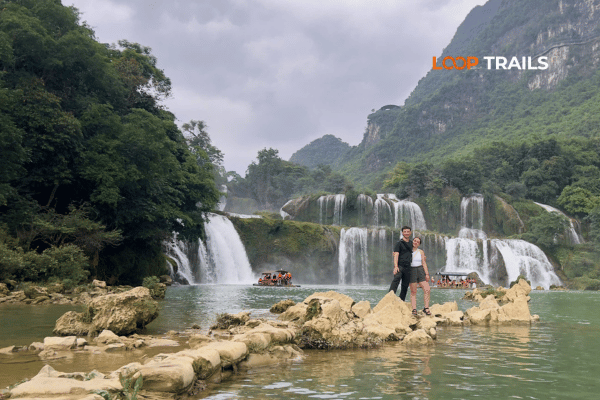
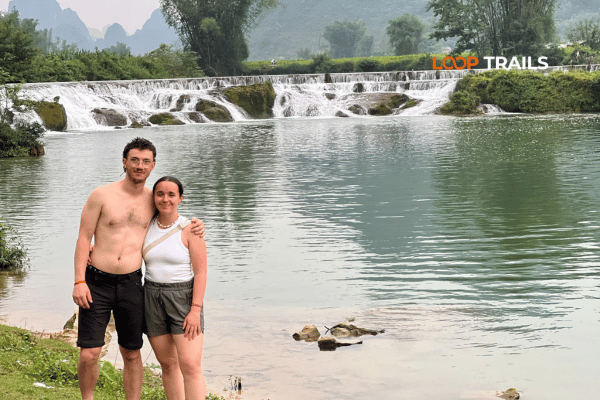
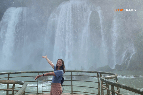
Ban Gioc is a wide, tiered waterfall on the Quay Son River, and the border between Vietnam and China runs straight through it. The Chinese side calls it Detian. From the Vietnamese viewing area you look across at both countries at once, which is a strange and quietly memorable thing.
Get there for opening. Two reasons. The first is light: morning sun hits the falls from the right angle and by midday the whole scene flattens out. The second is the tour buses, which arrive in waves from mid morning. An hour alone at Ban Gioc is worth more than three hours in a crowd.
Bring your passport. This is a border area and you should have it with you rather than locked in a room. Drone rules near the border are strict, so ask on site before you fly anything.
Small bamboo rafts run out from the Vietnamese bank toward the base of the falls, and this is the shot everyone comes for, a raft with a red and yellow flag drifting under a wall of white water. Agree the price and the duration before you step on, pay in cash, and expect to get wet.
The lower terraces are worth walking too. There is a path along the river below the main viewing area that most visitors skip entirely because they turn around at the rafts.
Ticketing, opening hours and the cross border visitor arrangements at Ban Gioc have changed more than once in recent years, so check the latest before you go rather than relying on an old blog post. If you are on a tour, your guide will handle it.
On the hillside above the falls sits Truc Lam Ban Gioc Pagoda, built in the last decade and notable as the first Vietnamese pagoda constructed in this border region. It takes twenty minutes to climb and it gives you the wide view of the whole waterfall and the valley behind it, which you cannot get from ground level.
Most riders skip it. Do not skip it. It is the best overview of Ban Gioc you will get without a drone.
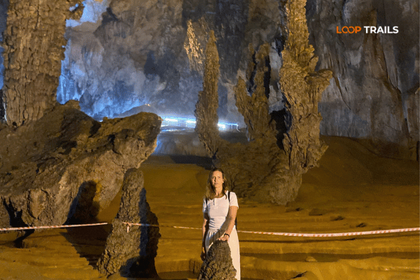
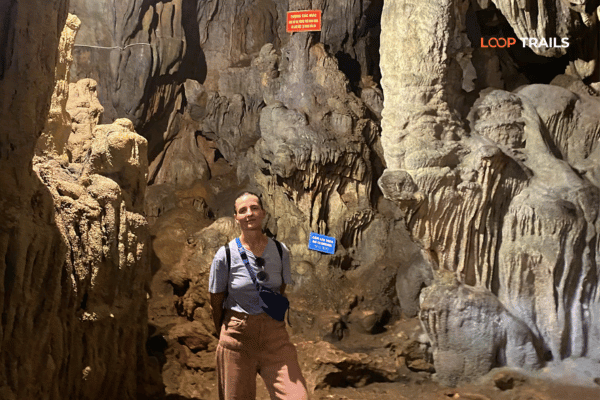
A few kilometres back toward Khuoi Ky is Nguom Ngao, a large cave system running under the hills. Only part of it is open to visitors, on a lit concrete walkway, and the walk takes most people well under an hour at a relaxed pace.
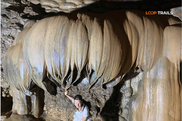
The formations are the reason to go. There are stalactite curtains, columns the width of a car, and one chamber where the mineral deposits have built into what looks like an upturned lotus. It is cool inside, roughly the same temperature year round, which makes it a genuine relief on a hot day and slightly chilly in winter.
Wear shoes with grip. The walkway is wet in places.
This is my favourite part of the whole three days, and it is the part most itineraries leave out.
Instead of retracing the main road, follow the smaller route back west through Phong Nam, a flat valley of rice fields ringed by karst towers with the Quay Son River running through the middle of it. There is no ticket, no gate and no viewing platform. You just ride into it, and at some point you stop the bike on the side of the road because the light has done something and there is nobody around to hurry you.
Time it for late afternoon. The valley faces the right way for golden hour and the low sun picks out every ridge on the peaks.
Two sensible options:
Learn more: Nguom Ngao Cave
Day 3 depends on where you are going next. All three versions work with a three day trip, so pick the one that matches your onward plan.
The standard finish. Pac Bo sits northwest of Cao Bang City near the Chinese border, and it is where Ho Chi Minh based himself after returning to Vietnam in 1941. He named the stream Lenin and the mountain above it Karl Marx, and the site today is a quiet park of forest paths, a small cave, a bamboo grove and water that is an unreasonable shade of blue green.
Historically it is one of the most significant sites in the country. Practically, it is a gentle two hours of walking on a good path, and the ride out through the Ha Quang valleys is lovely in its own right. You are back in Cao Bang City with time to eat before an evening bus to Hanoi.
Southwest of the city, in Nguyen Binh district, Phia Oac rises high enough to be a completely different climate. Mossy forest, mist, ruined French colonial villas slowly being taken back by the trees, and tea plantations on the slopes below. In deep winter it occasionally gets frost, which people travel from Hanoi to see.
Choose this one if you have already visited Pac Bo, if you love cold forest more than history, or if you are driving back toward Hanoi and want a stop that is roughly on the way. Take a jacket even in summer, because the temperature drop is real.
If you are heading to Ha Giang next, spend Day 3 riding west along the road to Bao Lac. It climbs through the stacked switchbacks of the Khau Coc Chay pass, drops into river valleys and passes villages that see very few foreign visitors.
Bao Lac makes a natural overnight, and from there it is another riding day to Meo Vac and the start of the Ha Giang Loop. This is exactly how our combined Ha Giang and Cao Bang tours are structured, in either direction, and it is the version I would choose if I had five or six days rather than three.
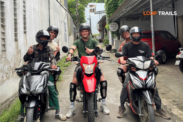
Learn more: Ha Giang Motorbike Rental
Use this the way you would use a fitting room. There is no wrong answer, only what matches your experience and your trip.
| You are… | Best option | Why |
|---|---|---|
| An experienced rider with a valid licence | Self drive motorbike | Cao Bang roads are wide and quiet, which makes this one of the better places in Vietnam to ride independently |
| Comfortable on a bike but new to Vietnam | Easy rider for Day 1, decide after | You see how the traffic behaves before committing to three days of it |
| A nervous rider or a non rider | Easy rider | You get the same route, the same stops and the same photos, with none of the risk |
| Travelling as a couple who want to sit together | Private jeep | Same itinerary, luggage in the back, conversation the whole way |
| Travelling with kids or parents | Private jeep | Air conditioning, seatbelts, flexible stops, and nobody gets rained on |
| Coming in December to February, or in heavy rain | Private jeep | Cao Bang gets genuinely cold and wet, and three days of that on a bike is miserable |
If you already know how you want to travel, our Cao Bang Loop tour pages list what is included for each mode. If you are not sure, tell us your dates and riding experience and we will tell you which one we would put our own family on.
Learn more: Best time to visit Cao Bang
There is no bad month, only trade offs. The one thing worth understanding is that waterfall volume and landscape colour peak at different times, so decide what you actually came for.
| Period | What it looks like | Trade off |
|---|---|---|
| March to May | Warm, mostly dry, green fields filling in | Waterfall is quieter than peak season |
| June to August | Hottest and wettest, rivers full, waterfall at its most powerful | Afternoon storms, humidity, occasional landslides on smaller roads |
| September to October | Rice turns gold, waterfall still strong, comfortable temperature | The most popular window, so book accommodation early |
| November to February | Clear skies, crisp air, best visibility | Cold, sometimes very cold at Phia Oac, and lower waterfall volume |
If you want one recommendation: late September into October. You get water in the falls and gold in the fields at the same time, which is the combination that makes Cao Bang photograph the way people expect it to.
Weather in the northeast mountains changes fast regardless of the month, so check the forecast in the days before you travel and pack a layer more than you think you need.
Learn more: Visiting God’s Eye Mountain
Cao Bang is easier riding than Ha Giang. The main routes between Cao Bang City, Trung Khanh and Ban Gioc are sealed, two lanes and generally in good condition, with far less tourist traffic than the Ha Giang passes.
What still deserves respect:
Wear the helmet you were given, or better, bring your own. And carry a physical copy of your accommodation address, because mobile signal drops out in valleys and screenshots do not help you when your battery dies.
Learn more: Cao Bang Travel
We will not quote numbers here that could be out of date by the time you read this, and you should be suspicious of any blog that does without a date attached. What matters more is knowing the categories so nothing surprises you.
Plan for:
Draw cash in Cao Bang City before you head out. ATMs exist in Trung Khanh but are limited, and homestays, rafts and roadside food are cash businesses.
For current tour and rental pricing, check the relevant tour page or message us directly, since rates change with season and group size.
Learn more: Ha Giang to Cao Bang
Three areas cover almost every version of this itinerary.
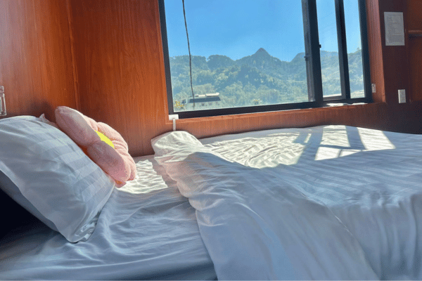
Khuoi Ky and the Ban Gioc area. Stone house homestays in the village, plus a handful of hotels and one large resort close to the falls. The homestays are simple, warm and social. The hotels are the choice if you want a private bathroom and reliable hot water after a cold day.
Cao Bang City. Standard Vietnamese city hotels, easy to book on short notice, walking distance to the best food on the trip. Practical rather than atmospheric.
Phong Nam and the Quay Son valley. A small but growing number of homestays and eco lodges in the middle of the rice fields. Quiet, beautiful, and a good choice for night two if you want to wake up in the landscape rather than in town.
In peak season, particularly September and October weekends, the good homestays near Ban Gioc fill up. Book ahead if you are travelling independently. If you book a tour with us, accommodation is arranged as part of the trip.
Learn more: Explore just the Cao Bang Loop
The food here is one of the genuine surprises of the trip, and it is different enough from Hanoi cooking to be worth paying attention to.
If you have dietary restrictions, tell your accommodation the day before rather than at the table. Rural kitchens cook one meal for everyone, and given notice they will happily work around you.

Learn more: Ha Giang Cao Bang Packing list
You are never far from a shop on this route, so pack light and cover the things that are hard to buy locally.
Leave the big suitcase at your hotel in Hanoi or at your Ha Giang accommodation if you are riding across. Three days of luggage should fit in one small bag.
Learn more: Ha Giang Loop Mistake to Avoid
Cao Bang is a relaxed, low pressure place to travel. The issues below are not specific to any operator, they are simply the patterns that catch travellers out in northern Vietnam generally.
Renting a bike with no paperwork. Whoever you rent from, ask what happens if the bike breaks down, whether there is any insurance, and get the agreement in writing. A cheap daily rate with no support behind it stops being cheap the moment something goes wrong.
Leaving your passport as a deposit. You should not need to hand over your passport to rent a vehicle. Offer a cash deposit or a copy instead. You will want the original with you anyway in this border region.
Assuming your travel insurance covers you. Many policies exclude motorbike incidents unless you hold the correct licence, and some exclude larger engine sizes entirely. Read the policy, not the summary, before you decide to self drive.
Not agreeing prices before the service. Rafts, parking, porters and roadside photo props. Ask first, in numbers, then pay after. This is normal practice, not confrontation.
Trying to do Ban Gioc as a day trip from Hanoi. People attempt it. It is a very long day of driving for a very short time at the waterfall, and you miss everything that makes Cao Bang worth visiting.
Underestimating winter. Northern mountain cold surprises travellers who have only experienced Vietnam in the south. In January, Phia Oac can be near freezing.
Riding after drinking. Corn wine at a homestay dinner is part of the experience. Riding the next morning with it still in your system is not.
Learn more: Ha Giang Loop Easy Rider
Most travellers arrive in northern Vietnam planning only the Ha Giang Loop, then hear about Cao Bang from someone in a homestay and start rearranging their plans. If you have the days, do it properly rather than as an afterthought.
The two regions complement each other rather than repeat. Ha Giang is high, dry and dramatic, all limestone plateau and the Ma Pi Leng Pass above the Nho Que River. Cao Bang is greener, lower and softer, built around rivers, waterfalls and caves. Riding from one into the other over the Bao Lac road is one of the best two day stretches of road in the country.
Five days covers both at a workable pace. Six days covers both without ever feeling rushed. Our combined Ha Giang and Cao Bang tours handle the part that is genuinely awkward to arrange independently, which is the bike and luggage logistics between two provinces that are a long way apart.
If you are already committed to Ha Giang first, look at our Ha Giang Loop tours for the first half, and tell us at the time of booking that you want to continue east. It is much easier to plan as one trip than to bolt on later.
Learn more: Pac Bo Historical Site
We run this route as a small group and private trip with three ways to travel it: easy rider, self drive motorbike, or private jeep. Same stops, same nights, different seat.
Once you have confirmed travel dates, book as early as you can. Most guests book one to three months ahead, and in the September and October window the good accommodation near Ban Gioc goes first. Jeep availability in particular is limited, so early booking lets us arrange everything properly.
Send us your dates, group size and riding experience on WhatsApp and we will come back with a straight answer about which version suits you, including telling you if a shorter or longer trip would be better. We would rather send you on the right trip than the expensive one.
Yes. Three days covers Ban Gioc Waterfall, Nguom Ngao Cave, the main passes and the Quay Son valleys without rushing. Four days lets you add Phia Oac or a slower ride toward Bao Lac.
It is roughly 90 km, which takes about two and a half to three hours by motorbike with a couple of stops. Almost nobody rides it directly, because the passes and lakes on the way are half the reason to go.
Vietnam expects riders to hold a valid, locally recognised licence, and both the rules and the insurance implications change over time. Check the current requirements and your policy wording before you commit, and choose an easy rider or jeep if there is any doubt.
The falls are most powerful in the rainy months of roughly June to August. Late September and October give you strong water plus golden rice fields, which is the best all round combination.
The roads are wider, better surfaced and much quieter than Ha Giang, so it is one of the friendlier northern routes. Beginners should still consider an easy rider for the mountain passes, where blind corners and livestock are the real hazards.
Yes, and the ride between them through Bao Lac is excellent. Allow five days minimum for both, six if you want a relaxed pace, and plan it as one booking so the bike and luggage logistics are handled.
Sleeper buses and limousine vans run daily and generally take around seven to eight hours. Night buses arriving at dawn work well with this itinerary. Schedules change, so check current departures or ask us to arrange a transfer.
Yes. Cards work at Cao Bang City hotels and very few other places. Homestays, entrance tickets, the bamboo raft at Ban Gioc and roadside food are all cash. Withdraw in Cao Bang City before heading out.
Yes, and it pairs naturally with Ban Gioc since it is only a few kilometres away. The lit walking route takes well under an hour and the formations are among the most impressive open to visitors in northern Vietnam.
Absolutely. A private jeep or car with a driver covers the same route and the same stops. It is the standard choice for families, couples and anyone travelling in the cold or wet months.
Rain jacket, dry bag, one warm layer, shoes with grip, sun cream, cash in small notes, a power bank and your passport. Add a second warm layer between November and February.
Carry it. Ban Gioc sits on the border with China and it is better to have your passport on you than in a hotel room. Border area rules and drone restrictions can change, so follow the signs and ask on site.
Contact information for Loop Trails
Website: Loop Trails Official Website
Email: looptrailshostel@gmail.com
Hotline & WhatSapp:
+84862379288
+84938988593
Social Media:
Facebook: Loop Trails Tours Ha Giang
Instagram: Loop Trails Tours Ha Giang
TikTok: Loop Trails
Office Address: 54A Tran Phu, Ha Giang 2, Tuyen Quang
Address: 54A Tran Phu, Ha Giang 2, Tuyen Quang
Facebook X Reddit Table of Contents Learn more: Ha Giang Loop Tours Most people drive past the Quan Ba area twice on

Facebook X Reddit Table of Contents Learn more: Ha Giang Loop Tours The Ha Giang Loop has a reputation problem with older