
Cao Bang Loop Day 3: Phia Thap, Phuc Sen and God’s Eye Mountain
Facebook X Reddit Table of Contents Learn more: Ha Giang Loop Tours Day 3 is the one that surprises people. On paper
Thúy Kiều (Grace) is a travel blogger and content contributor for Loop Trails Tours Ha Giang. She holds a bachelor’s degree in Sustainable Tourism from Vietnam National University, Hanoi, and has a strong passion for exploring and promoting responsible travel experiences in Vietnam’s northern highlands.
Learn more: Ha Giang Loop Tours
Day 1 in Cao Bang is the highlight reel. Passes, craft villages, a border waterfall that photographs itself. Day 2 is quieter, shorter on paper, and it is the one guests talk about six months later.
The distance is almost nothing. You wake up near Ban Gioc, walk through Nguom Ngao Cave before the coaches arrive, and then spend the rest of the day following the Quay Son river upstream into Phong Nam valley. Maybe 50 km of actual riding, spread across eight or nine hours, most of it at a speed where you can hear the water.
If Day 1 is about getting somewhere, Day 2 is about noticing where you are. Here is how to ride it properly, what to skip if you are short on time, and where the day can end depending on how many days you have left.
New to this route? Start with Day 1: Cao Bang City to Ban Gioc, then come back here.
Learn more: Ha Giang Loop 2 Days 1 Night
| Start | Ban Gioc or Khuoi Ky village |
| Finish | Phong Nam valley, Trung Khanh town or Cao Bang City |
| Rough riding distance | 40 to 70 km depending on where you end up |
| Big stops | Nguom Ngao Cave, Khuoi Ky stone village, Quay Son river, Ngoc Con, Phong Nam valley |
| Character | Slow, rural, river and rice fields rather than passes |
| Difficulty on two wheels | Easy, with narrow village lanes and some concrete tracks |
| Suits | Photographers, couples, families, anyone who found Day 1 rushed |
The riding is genuinely easy today. What makes the day long is that you keep stopping, which is exactly what it is for.
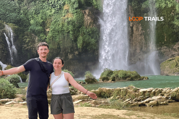
If you slept near the waterfall, go back to it first thing. Ban Gioc in the early morning is a different place: mist sitting on the water, the light coming across the terraces from the side, and almost nobody in the frame. Domestic tour groups tend to arrive later in the morning, so the first hour or two after the gate opens is usually the calmest.
Opening times shift with the season, so ask your homestay the night before rather than turning up hopefully at dawn.
If you already saw the falls properly on Day 1 and you would rather have breakfast slowly, that is a completely respectable decision. Nothing today has to be rushed
Three kilometres from the waterfall, in Gun village, Nguom Ngao is the second thing everyone comes to this corner of Cao Bang for and the first thing most people underestimate.
The name comes from the Tay language and refers to a tiger. Ask a local guide and you will get the story about the sound the wind makes moving through the entrance, which is either evocative or slightly unsettling depending on how you are feeling that morning.
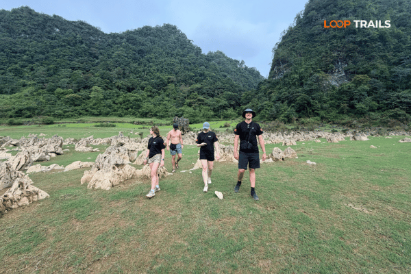
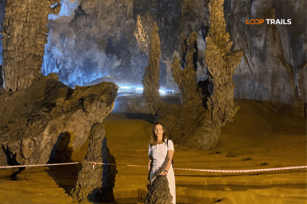
The cave is big. Reports put the full system at roughly two kilometres, with about a kilometre of it opened up for visitors on a paved and lit walkway. You enter through one mouth and come out through another, so it is a walk through rather than a there and back.
What you get is a series of chambers with proper scale to them: columns the size of trees, curtains of flowstone, and one well known formation that people describe as an upturned lotus. Some sections are open and cathedral like. Others narrow down enough that you notice the temperature drop and the sound of your own footsteps.
It is not a wild cave. There are handrails and coloured lights, and if you have done serious caving elsewhere you will find it tame. For everyone else it is genuinely impressive, and it is one of the few stops in Cao Bang that works in any weather, which makes it a good card to hold in reserve if the forecast is bad.
Learn more: Ha Giang Loop 3 Days 2 Nights
There is more than one entrance to the system, and the standard visitor route enters at one and exits at another. Staff will point you the right way. The practical consequence is that you may come out a short walk from where you parked, which surprises people who left a helmet on the bike and then could not remember which mouth they went in.
Between the cave and the waterfall sits Khuoi Ky, a Tay village where the houses are built from stacked river stone. Walls, fences, paths, all of it stone, some of it old.
You can ride through in four minutes. Do not. Park and walk. The village is small enough to cover on foot in half an hour, and walking is the difference between photographing houses and actually seeing anyone: women weaving, kids doing whatever kids do at nine in the morning, someone repairing a roof.
Several families here run homestays, and they are the best place to sleep in the whole Ban Gioc area if you like the version of an evening that involves a shared table, too much food, a bottle of the local rice wine appearing at the exact moment you say you are tired, and a plan for an early night that nobody keeps.
Basic manners apply and cost nothing: ask before photographing people, do not walk into houses without an invitation, and if a family offers you tea, sit down for ten minutes.
Not sure Day 2 belongs in your trip? It is the day that separates a rushed weekend from a real one. Our Cao Bang loop tours build this pace in on purpose, and if you would rather not think about routes and homestays at all, the Ha Giang and Cao Bang combined tour covers this ground with a guide who already knows which lane goes where.
Everything now follows water.
The Quay Son crosses into Vietnam in the Ngoc Khe and Ngoc Con area, near the Po Peo crossing, then works its way south and east through Trung Khanh before dropping over the terraces at Ban Gioc. Riding it in reverse, from the waterfall back upstream, means you spend the whole day getting closer to the quiet part.
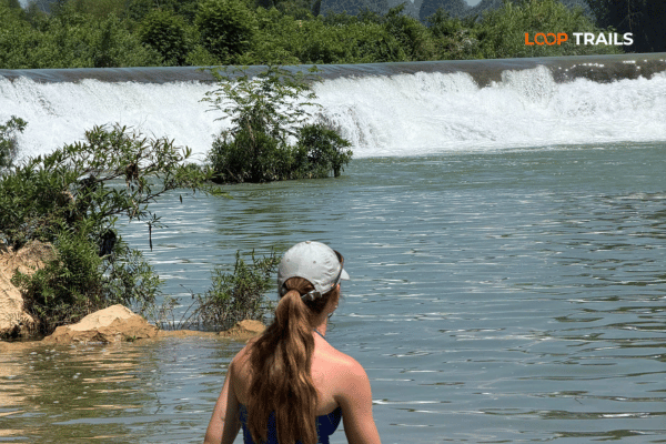
The colour is the thing. In good conditions the water is a deep jade green that does not photograph believably, running between limestone walls and rice fields with water buffalo standing in the shallows looking unimpressed by all of it.
There is no single viewpoint on this stretch and that is the appeal. You ride, you see something, you stop. Then two minutes later you stop again. Some of the best places to pull in are unmarked: a gravel shoulder where the river bends, a bamboo footbridge, a spot where a family has parked a boat. Look for the small tracks leading down towards the bank.
A few stretches worth slowing for:
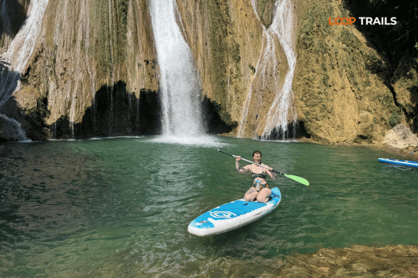
Locals swim in this river and so can you, with a few honest caveats.
Pick a calm, shallow section that people are already using. That is the single best safety filter available: if a family is in the water with children, it is probably fine. If a stretch is empty and fast, there is usually a reason.
Do not swim near the waterfall or in the fast channels above it. Water levels here change quickly after rain upstream, and a river that was ankle deep in the morning can be pushing hard by late afternoon in the wet season. Currents are stronger than they look from the bank.
There are no lifeguards, no signs and no rescue service. Use your own judgement, do not swim alone, and if you have been drinking, sit on the bank and take photos instead.
Also: parts of this river form the international boundary. Stay on the Vietnamese side, do not swim towards the far bank, and keep your passport with you. Border rules can and do change, so if anything looks official and unclear, ask rather than assume.
Learn more: Ha Giang Loop 4 Days 3 Nights
North of Ban Gioc, the road runs up through Ngoc Con and towards the area where the Quay Son enters Vietnam. It is a soft, pretty stretch: villages, chestnut trees, a river that keeps appearing on your right.
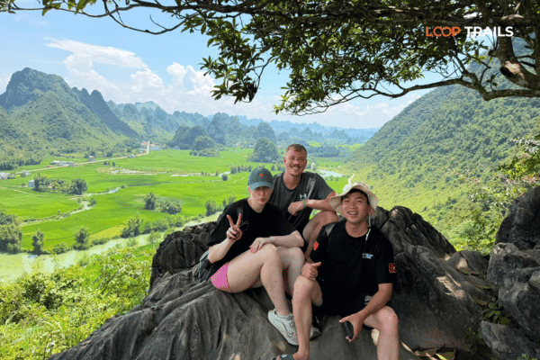
Nearby, the Pi Pha viewpoint gives you the valley from above if you are willing to walk up a rough path for it. Ask locally for the trailhead, because it is not signposted in any useful way and the entrance looks like somebody’s driveway.
This is border country. That mostly means nothing more dramatic than carrying your passport and staying on marked roads, but access rules in border zones are set locally and can change with no notice. If you want to go right up to a border marker, ask at your homestay or ask your guide first. It is a five second question that avoids a very slow afternoon.
Then the road climbs slightly, turns, and Phong Nam opens up underneath you.
It is a flat bowl of rice fields ringed almost completely by karst, with the river running through the middle of it and villages tucked against the base of the cliffs. Vietnamese travel writers have been calling it a hidden valley for a few years now, which means it is no longer hidden but is still, on a weekday, almost empty.
Learn more: Ha Giang Cao Bang 5 Days 4 Nights
There is a pull in on the hillside road above the valley that gives you the shot: the whole floor, the river curve, the ridge behind. It is the photo that ends up as somebody’s screensaver. Get there in the late afternoon if you can, when the light comes in low and one side of the valley falls into shadow.
Do not stop in the middle of the road to take it. This is a mountain lane with blind bends and there are trucks. Park properly.
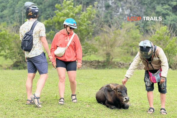
The better experience is going down into it. Concrete and packed dirt lanes run between the fields, past houses with drying racks and dogs and old men who will absolutely wave at you. Ride slowly. The lanes are narrow, they cross irrigation channels, and there is often a buffalo occupying the exact centre of the only available line.
Give yourself an hour or two down here without a plan. It is one of the few places on this loop where wandering is more rewarding than following a route.
The cliffs around the valley edge are limestone, which means caves. Several small ones sit at the base of the walls, and local families will point you towards the ones worth a look if you ask. None of them are set up like Nguom Ngao, so bring your own torch and do not go far inside if the ground is wet.
There are also bamboo water wheels on some of the channels, still doing the job they were built for. They are more photogenic in the growing season when there is water moving through the system.
A handful of homestays operate in and around Phong Nam and they are the reason to consider ending your day here rather than pushing on. Waking up inside the valley, with mist on the fields and nobody around, is a completely different experience from seeing it for ninety minutes in the afternoon.
Book ahead in autumn and around Vietnamese public holidays. There are not many rooms.
Learn more: Cao Bang Loop 3 Days best kept secret
Three sensible options, depending on how many days you have.
Option 1: sleep in Phong Nam or Trung Khanh. The best version if you have a full Day 3 available. Short ride, early finish, sunrise in the valley the next morning. Trung Khanh town has more rooms and restaurants if the valley homestays are full.
Option 2: ride back to Cao Bang City. Around 60 to 70 km depending on your route. Doable in an afternoon, and it sets you up to catch a bus onward or start a different loop the next morning. Leave enough daylight, because you do not want to be learning this road in the dark.
Option 3: keep going north. If you have three or four days in the province, Day 2 can end wherever you like and Day 3 heads towards Ha Quang, the Pac Bo historical site and the country up near the border, or west towards Bao Lac and the Khau Coc Cha pass. That western road is the one that connects Cao Bang to Ha Giang, and it is spectacular.
| If you have | End Day 2 at | Because |
|---|---|---|
| 3 or more days in Cao Bang | Phong Nam or Trung Khanh | Sunrise in the valley, unhurried Day 3 |
| Exactly 2 days | Cao Bang City | Easy onward travel the next morning |
| A longer route planned | Wherever you reach by 17:00 | Day 3 continues north or west |
Learn more: Ha Giang Cao Bang 6 Days 5 Nights
Day 2 is the easiest riding of the loop, with one caveat: the surfaces get smaller.
None of this is difficult. It just rewards a lower speed than you would use on the main road, which is fine, because you should be looking around anyway.
Learn more: Best time to visit Cao Bang
A shape that works, adjusted to taste:
| Time | What |
|---|---|
| Early morning | Ban Gioc in the mist, or a slow breakfast |
| Mid morning | Nguom Ngao Cave |
| Late morning | Walk through Khuoi Ky stone village |
| Midday | Lunch, then the Quay Son upstream with swim stops |
| Mid afternoon | Ngoc Con, Pi Pha viewpoint if you want the climb |
| Late afternoon | Phong Nam viewpoint, then down into the valley |
| Evening | Homestay in the valley, or continue to Trung Khanh |
Treat this as a shape rather than a schedule. Weather, water levels and how long you spend in the river will all move it, and the whole point of Day 2 is that nothing on it is urgent.
Roughly February to April. Cool and often misty. Fields are being prepared and flooded, which means reflections. Fewer visitors. Bring warm layers for the mornings.
Roughly May to July. Rice is green and growing. Hot in the middle of the day, which makes the river swimming a lot more appealing. Afternoon rain is common and it usually passes.
Roughly August to September. Wettest period. The river runs high and fast and can turn brown after heavy rain upstream. The waterfall is at its most dramatic, the fields are at their most vivid, and you will get wet at some point.
Roughly late September to October. The window most photographers plan around. Rice turns gold, the harvest starts, the river usually clears back to green and the Trung Khanh chestnuts arrive. Busiest time of year, so book rooms early.
Roughly November to January. Cold, quiet, often foggy. Harvested fields are brown and open. Beautiful in a bleaker way, and the cave is a good bad weather option.
Exact timings shift every year with the weather and the planting cycle. Ask locally a few days ahead rather than planning a whole trip around a photo you saw with a date on it.
Food. Trung Khanh town has the most choice. Around Ban Gioc and Phong Nam you are mostly eating at homestays and small family kitchens, which is not a downside. If you get the chance, try the Cao Bang style rolled rice sheets served with bone broth rather than dipping sauce, the sour noodle dish the region does well, and roast duck if someone has one hanging in the window. In autumn, buy the chestnuts.
Fuel. Fill up in Trung Khanh or before you leave the Ban Gioc area. Stations thin out in the valleys and roadside bottle sellers are a backup, not a plan.
Cash. ATMs are in the towns, not the villages. Homestays, cave tickets, rafts and lunch are all easier with cash in small notes.
Signal. Fine on the main roads, unreliable in the valley and useless inside the cave. Tell someone your rough plan for the day if you are riding independently.
Learn more: Ha Giang Loop by Wrangler Rubicon Jeep
Day 2 is where the three ways of doing this trip feel most different.
Self drive is excellent today. The roads are easy, the speeds are low, and being able to stop at a random gravel pull in because the river looked good is the whole reason people ride themselves. You need your passport, a valid motorbike licence from home and an International Driving Permit issued under the 1968 convention. The 1949 style permit is not recognised in Vietnam, which catches out a lot of otherwise well prepared travellers, and riding without the right documents can lead to a fine. Rules change, so verify the current position before you travel rather than trusting any article, including this one.
Easy rider suits Day 2 better than most days. You are not concentrating on a mountain pass, so sitting behind a local rider means you actually watch the valley go past instead of watching the road surface. Guides also know which unmarked lane leads to the good swim spot, which no map app will tell you.
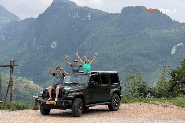
A jeep makes sense if you are a couple or a family, if someone in your group does not ride, or if it is the wet season and you would rather not spend the afternoon damp. The valley lanes are fine in a vehicle, luggage stops being a problem, and you can talk to each other, which sounds minor until you have spent three days communicating through helmet gestures.
For reference, our combined Ha Giang and Cao Bang route is priced like this:
| Ha Giang and Cao Bang, 5 days 4 nights | Price |
|---|---|
| Easy rider, per person | 10,990,000 VND |
| Self drive, per person | 10,590,000 VND |
| Jeep, 2 guests, whole vehicle | 31,990,000 VND |
| Jeep, 3 guests, whole vehicle | 36,490,000 VND |
| Jeep, 4 guests, whole vehicle | 40,990,000 VND |
Rates include dormitory style accommodation and everything on the tour itself. They do not include private room upgrades or the bus tickets to and from the start and end points. These were current when this page went up, so check the tour page for today’s number before you build a budget on it.
Once your dates are confirmed, book as early as you can. Most guests book one to three months ahead, and jeep availability is limited compared with motorbikes.
Learn more: Nguom Ngao Cave
Treating it as a travel day. The most common one. People do the cave, take a photo of the valley from the road and drive to Cao Bang City by 15:00, then wonder why Cao Bang felt smaller than expected. The valley floor is the experience, not the viewpoint.
Skipping the cave because they saw one in Ha Giang. Different scale, different formations, and it is three kilometres away. Go.
Swimming somewhere fast because it looked good. Pick a spot locals are using, check the water level, and stay well away from the falls.
Riding valley lanes at road speed. Concrete, moss, irrigation channels and livestock. The lanes are not the problem. Speed is.
Leaving the viewpoint until after dark. Phong Nam does not work as a night stop. Aim to be up on that hillside with at least an hour of light left.
Assuming ticket prices, opening hours and access are what a blog said last year. Everything here is subject to local change. Ask on the day.
Two days is enough to see Ban Gioc, the cave and Phong Nam properly and get back to Cao Bang City. It is a good weekend.
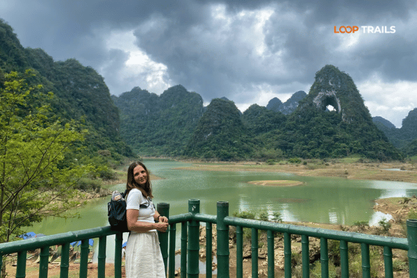
Three or four days lets you add the northern half of the province: Ha Quang, the Pac Bo historical site, the lakes and grassland around Tra Linh, and God’s Eye Mountain, the limestone peak with a natural hole punched through the ridge that most people only see in photos.
The version we run most often puts Cao Bang at the end of something bigger. Our Ha Giang and Cao Bang tour starts with the Ha Giang passes: Bac Sum, Tham Ma, the Dong Van karst plateau, Lung Cu at the northernmost point of the country and Ma Pi Leng above the Nho Que river. Then it crosses east through Bao Lac and the Khau Coc Cha pass into Cao Bang and finishes on exactly the ground this article covers. Five days, two provinces, and no backtracking to Hanoi in between.
If you only have time for one province, the Ha Giang Loop is still the classic and runs as a two, three or four day trip by motorbike or jeep. If you have the extra days, Cao Bang is the addition nobody regrets.
Planning this one? Send us a message on WhatsApp with your dates, your group size and whether anyone is riding. We will tell you honestly which version fits, including if the answer is that you should do something else.
Learn more: Visiting God’s Eye Mountain
Yes, and it is only about three kilometres from Ban Gioc so it costs you almost no travel time. Around a kilometre of the system is open on a lit walkway and the chambers are genuinely large. Allow an hour and wear shoes with grip, because sections of the walkway stay wet.
Most visitors walk it in about an hour at a relaxed pace. Add half an hour if you stop for photos or take a guide from the entrance. It is a walk through route, so you exit at a different mouth from the one you entered.
Locals do, and there are calm shallow sections that are fine for a swim. Choose a spot people are already using, avoid fast water and anywhere near the waterfall, and remember that levels rise quickly after rain upstream. There are no lifeguards anywhere on this river.
It sits in the Trung Khanh area of Cao Bang province, north west of Ban Gioc, with the Quay Son running through the middle of it. The classic view is from the hillside road that drops into the valley, and the better experience is riding the lanes on the valley floor.
If you have a spare day, yes. Sunrise with mist on the fields and no other visitors is a different thing entirely from an afternoon visit. There are only a handful of homestays, so book ahead in autumn and around public holidays.
Between roughly 40 and 70 km, depending on whether you finish in the valley, in Trung Khanh town or back in Cao Bang City. The riding is easy. The day is long because you stop constantly.
Carry it. Parts of the Quay Son form the international border and access rules in border zones are set locally and can change. Stay on the Vietnamese side, keep to marked roads and ask locally before going close to any border marker
Late September into October for gold rice and the harvest, May to July for deep green fields and warm swimming. Winter is quiet and often foggy, spring gives you flooded fields and reflections. Timings move each year with the planting cycle, so ask locally.
Yes. The main roads and the valley lanes are both fine in a vehicle, which is why this route suits families, couples and travellers who do not ride. You lose a little of the pull over anywhere freedom and gain shelter, luggage space and conversation.
If you are riding, you need your passport, a valid motorbike licence from home and an International Driving Permit issued under the 1968 convention. The 1949 style permit is not valid in Vietnam. Riding without correct documents can result in a fine, and rules change, so check the current position before you travel.
It is the easiest riding on the whole loop: low speeds, no big passes, short distances. The care needed is for concrete village lanes, livestock and wet surfaces rather than technical riding. Anyone comfortable on a bike in a town will manage it.
There is a limousine service running between the two with morning departures in each direction, and the fare was 400,000 VND per person at the time of writing. On our combined tours you ride the connecting route through Bao Lac instead, which is a large part of the appeal. Confirm schedules before you rely on them.
Contact information for Loop Trails
Website: Loop Trails Official Website
Email: looptrailshostel@gmail.com
Hotline & WhatSapp:
+84862379288
+84938988593
Social Media:
Facebook: Loop Trails Tours Ha Giang
Instagram: Loop Trails Tours Ha Giang
TikTok: Loop Trails
Office Address: 54A Tran Phu, Ha Giang 2, Tuyen Quang
Address: 54A Tran Phu, Ha Giang 2, Tuyen Quang
Facebook X Reddit Table of Contents Learn more: Ha Giang Loop Tours Day 3 is the one that surprises people. On paper
Facebook X Reddit Table of Contents Learn more: Ha Giang Loop Tours The ride from Cao Bang City to Ban Gioc looks
Facebook X Reddit Table of Contents The first time I watched someone drop a rolled rice pancake into a bowl of hot