

Thúy Kiều (Grace) is a travel blogger and content contributor for Loop Trails Tours Ha Giang. She holds a bachelor’s degree in Sustainable Tourism from Vietnam National University, Hanoi, and has a strong passion for exploring and promoting responsible travel experiences in Vietnam’s northern highlands.

Learn more: Ha Giang Loop Tours
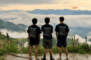
Some destinations look great on Instagram. Ha Giang looks like it was made for a camera — the kind of place where you stop every ten minutes because the light just changed and now the whole valley looks different.
The Ha Giang Loop cuts through Vietnam’s far north, threading between limestone karst mountains, terraced fields, and river gorges so dramatic they don’t look real until you’re standing at the edge. It’s consistently one of the most photogenic motorcycle routes in Southeast Asia, and for good reason: the landscape shifts constantly, the light is extraordinary, and there are zero resorts or tourist strips to ruin a frame.
This guide covers everything you need to plan a photography-focused trip around the loop — the best spots, when to be there, how to handle gear on a motorbike, and a few things that will save you from coming home with a card full of mediocre shots.

Learn more: Ha Giang Loop 2 Days 1 Night
The short answer: variety. In three or four days on the loop, you’ll shoot everything from mountain passes shrouded in morning cloud to open-air markets packed with ethnic minority traders in traditional dress. From neon-turquoise river bends to pine forests that look like they belong in Scandinavia. From crumbling French colonial architecture in Dong Van to bright red Lung Cu flag towers against a grey sky.
Most of the Ha Giang Loop sits on the Dong Van Karst Plateau Geopark — a UNESCO-recognised geological site that’s been shaped by 400–600 million years of geological activity. That means jagged limestone formations, deep river canyons, and elevation changes that create layered light throughout the day. For landscape photographers especially, it’s almost unfair.
The other thing worth mentioning: the loop is not overrun. You’ll occasionally pass other riders, but outside of a handful of viewpoints at peak season, you’re not competing with hundreds of tourists for the same shot. There’s still room to be the only person on a mountain road at 6am.

Learn more: Ha Giang Loop 3 Days 2 Nights
The light in Ha Giang is best — by a significant margin — in the first hour after sunrise and the hour before sunset. This isn’t groundbreaking photography advice, but the specific topography of the karst plateau makes golden hour here feel different. The mist that clings to the valleys in the morning gets lit from the side, turning whole gorges golden. Ridgelines catch the sun while the valleys stay in shadow. It’s the kind of light you can’t fake in post.
Approximate golden hour times vary by season, but as a rough guide:
Blue hour — the 20–30 minutes before sunrise and after sunset — is excellent for the valley towns. Dong Van’s old quarter lit in deep blue with warm lanterns is a very different shot from the midday version, and worth setting an alarm for.
This is the question that genuinely divides people.
Dry season (roughly October–April) gives you cleaner skies, more predictable light, and much easier riding. The terraced fields between Yen Minh and Dong Van are golden with buckwheat flowers from around October to November — one of the most photographed scenes on the entire loop. November and December are arguably the peak months for photographers who want colour and clarity.
Rainy season (May–September) is messier in every way — roads get slippery, clouds are unpredictable, and there are days when the mist just doesn’t lift. But it also produces dramatic moody images. Rice terraces are green and full of water. Waterfalls that barely exist in the dry season come roaring to life. And the clouds — when they part — create a completely different kind of light. If you like atmospheric and slightly unpredictable shooting conditions, May through early June or September can be genuinely rewarding.
The honest answer: for most photographers, October to December is the sweet spot. Great light, the buckwheat flowers, manageable weather, and spectacular visibility from the high passes.

Learn more: Ma Pi Leng Pass
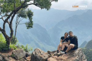
If you shoot one thing on the Ha Giang Loop, it’s this. Ma Pi Leng is a 20km mountain pass carved into sheer cliff faces above the Nho Que River — and it is, without exaggeration, one of the most dramatic road photos you can take in all of Southeast Asia.
The classic shot: looking back along the road from one of the pull-off points, with the cliff falling away on one side and the turquoise river far below. If you time it for early morning, you’ll often get mist rising off the river while the road itself sits in clean light. Late afternoon gives you side-lit karsts and long shadows across the switchbacks.
The most famous viewpoint is roughly at the midpoint of the pass — there’s a small pull-off area where most people stop. But the better frames are often found by walking 50–100m further along the road in either direction, away from where everyone else is standing.
Best timing: Early morning (7–9am) for mist and golden side-light. Avoid midday — harsh overhead sun kills the depth in the landscape.

Learn more: Tu San Canyon & Nho Que River Boat Trip
The Nho Que River has a particular turquoise-green colour that looks digitally enhanced even when it isn’t. The most photographed angle is from a viewpoint above Meo Vac — a tight river bend where the water glows against grey limestone walls. You can hike up to this viewpoint (it takes 20–40 minutes from the road) or take a motorbike taxi if you’re not up for the climb.
The river itself can also be photographed from boats — a short boat trip from Meo Vac takes you into the canyon, and the perspectives from water level, looking up at the cliff walls, are completely different from anything you get from the road.
Best timing: Midday actually works here — the overhead sun hits the water directly and makes the turquoise colour pop. Morning and evening produce more moodiness but less of that electric colour.

Learn more: Ha Giang Market Days
One of the most compelling portrait and documentary photography opportunities on the entire loop. Meo Vac’s weekly market (held on Sunday mornings) draws traders and families from the surrounding villages — many from H’mong, Dao, Lo Lo, and other ethnic minority groups — dressed in traditional clothing in vivid blues, reds, and embroidered patterns.
The market is active from early morning and winds down by midday. Arrive early for the best action: the livestock section, the food stalls, the groups of older women bargaining over textiles. Bring a zoom lens if you want to shoot without being intrusive. A 50mm or 85mm works well for environmental portraits if you take time to build rapport first.
A few markets also happen in Dong Van and smaller villages on different days of the week — ask locally or check with your guide if timing a specific market is important to your shot list.
Best timing: 6:30am–9:30am. The light is soft and directional, and the market is at its fullest.

Learn more: Dong Van Old Quater
Dong Van’s old town is a cluster of traditional stone houses built by the Lo Lo and H’mong communities — some of the structures date back over a century. It’s small but visually rich: wooden shutters, weathered stone walls, narrow alleyways, the smell of wood smoke in the morning.
The best architecture shots are in the early morning before the town wakes up — the light hits the stone facades cleanly and there are few people around to clutter the frame. The market square area and the surrounding alleyways are the main areas worth exploring with a camera.
At night, the town’s lanterns and warm-lit cafes give it a very different mood. If you’re staying the night in Dong Van (highly recommended), spend time shooting after dinner — it’s a different place entirely under low light.
Best timing: Early morning (6–8am) for architecture. After dark for atmosphere.

Learn more: Lung Cu Flag Tower Guide
Vietnam’s northernmost point sits at the top of a hill above Lung Cu village, marked by a large flag tower flying the national flag. The tower itself is visually striking — white concrete against blue sky or mountain fog — but the real photography reward is the 360-degree view from the top.
On a clear day you can see into China to the north and deep into the karst plateau to the south. The surrounding patchwork of rice paddies in the valley below, framed by mountains, is the shot most people go for. The walk up involves a staircase of several hundred steps — manageable, and worth it.
The Lo Lo Chai village at the base of Lung Cu hill is one of the most intact traditional villages on the loop, with stone and wood houses, corn drying racks, and a slower pace of life that rewards patience and quiet observation.
Best timing: Morning for clear views; cloud cover creates drama if you’re lucky with partial breaks.

Learn more: Ha Giang Loop 4 Days 3 Nights
Less famous than Ma Pi Leng but almost as dramatic, Tham Ma Pass has a key advantage: it faces west, making it one of the best spots on the loop for sunset photography. The road climbs through several switchbacks before opening up to a broad valley view — on clear evenings, the sky turns the whole basin orange and pink.
It’s a relatively short pass compared to Ma Pi Leng, and most riders move through it quickly. Give yourself time to stop and explore above the road — there are unofficial spots where you can position yourself above the traffic for a cleaner frame.
Best timing: 4:30–6:00pm for golden hour and sunset.

Learn more: Yen Minh Pine Forest
One of the more unexpected landscapes on the loop. The pine forest around Yen Minh sits at elevation and has a distinctly different feel from the bare karst terrain further north — cooler, greener, with shafts of light filtering through the trees on clear mornings.
It’s not a dramatic landscape in the way Ma Pi Leng is, but it photographs beautifully in soft light. Mist in the early morning turns the forest road into something almost fairytale-like. It’s also a good spot to break up the visual monotony of shooting nothing but big mountain landscapes.
Best timing: Early morning, especially after rain when mist lingers. Midday loses all character here.

Learn more: Du Gia Waterfall
The southern part of the loop around Du Gia has a softer, more pastoral character — rice paddies, bamboo groves, small wooden bridges, children on the roadside. It’s the kind of landscape that rewards slow riding and frequent stops rather than chasing specific viewpoints.
Du Gia Waterfall is a well-known stop here — a wide cascade through jungle, best visited in or just after rainy season when the flow is strong. Photographically it benefits from a wide-angle lens and a slow shutter speed to smooth the water (bring a small tripod or use a natural support).
The valley road between Du Gia and Yen Minh in the early morning — with the rice fields lit from the side and farmers already working — is one of the most satisfying shooting sequences on the loop, even if it doesn’t produce a single “hero” shot.
Best timing: 6:30am–9am. Late afternoon also works for rice paddy reflections.
Thinking about doing the loop as a photography trip specifically? Our guided Easy Rider tours let you set the pace — tell your guide where you want to stop and for how long. No rush, no rigid schedule. Check our Ha Giang Loop tour options →
")
Learn more: Ha Giang Cao Bang 5 Days 4 Nights
The aerial perspective of Ha Giang — the Nho Que River from above, the switchbacks of Ma Pi Leng seen from height, the patchwork valley floors — is genuinely stunning. But before you pack a drone, a few practical points.
Regulations: Vietnam has civil aviation regulations governing drone use, and these change. As of writing, recreational drone use in many areas requires prior notification and is restricted near military installations, border zones, and certain protected areas. The Ha Giang Loop borders China in the north, which adds complexity. Always check the latest regulations from the Civil Aviation Authority of Vietnam (CAAV) before bringing a drone, and check with your accommodation or local guides on what’s currently permitted in specific areas. Don’t assume what worked for someone else’s trip a year ago still applies.
Practical reality: Some travelers fly drones without incident; others have equipment confiscated. The level of enforcement varies by area and is unpredictable. Border zones around Lung Cu are particularly sensitive.
If you do fly: Early morning — before the wind picks up and before traffic builds — is the most practical window. The light is better anyway. Keep flights short and conservative, stay away from villages unless you have explicit local permission, and land immediately if anyone asks you to.
For most photographers, the ground-level perspectives are so strong that a drone is a nice-to-have rather than essential. Don’t let drone logistics become the main source of stress on your trip.

Learn more: Ha Giang Cao Bang Ba Be Lake 6 Days 5 Nights
The Ha Giang Loop is not a comfortable shooting environment. You’re on a motorbike for 5–8 hours a day, the dust is real, rain is possible, and bag space is limited. Here’s a practical take on what’s worth bringing.
What works well:
What to leave at home:
Protecting your gear: Keep your camera bag strapped to you on the front (chest bag) or in a small backpack with a rain cover. Don’t put it in a pannier bag — it’ll take more vibration and be harder to access quickly. A dry bag liner inside your camera bag is cheap and effective insurance against sudden rain.
")
Learn more: Ha Giang Motorbike Rental
Don’t. Seriously — don’t try to shoot one-handed while riding on mountain roads with no barriers and significant drop-offs. The Ha Giang Loop has some genuinely technical sections and the road demands your full attention, especially if you’re self-driving.
Instead: stop for your shots. The loop is not a race. Pull completely off the road, secure the bike, and take the time to frame properly. The best images from the loop almost always come from someone who stopped, climbed a small embankment, and waited five minutes for the light or for traffic to clear.
If you’re riding with a guide on an Easy Rider tour, you have a significant advantage — your guide can pull over anywhere, hold the bike, and you can walk ahead or back along the road to find the angle you want. Use that freedom.
Ha Giang’s ethnic minority communities are one of the most compelling subjects on the loop — and also one where a little thoughtfulness goes a long way.
A few principles that work in practice:
Ask first, shoot second. Learning “chụp ảnh được không?” (can I take a photo?) in Vietnamese gets a long way. Most people appreciate being asked rather than having a lens pointed at them from a distance. Many will say yes; some will say no. Respect both.
Don’t treat people as props. If the only reason you’re talking to someone is to get a photo, they’ll sense it. Spend a few minutes at a market stall, buy something, have a look around. The best portrait opportunities come organically, not from staging.
Money for photos: Some travelers offer money for portraits. This is a personal call, but in most community contexts on the loop it creates more problems than it solves — it can change community dynamics over time. Contributing by buying from local markets, staying at locally-owned homestays, and eating at small family restaurants is a better way to give back.
Children: Always ask a parent or guardian present before photographing children. In remote villages where tourism is newer, be especially conservative.

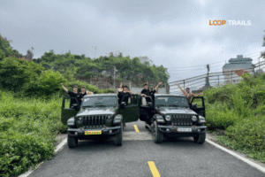
Learn more: Ha Giang Jeep Tours
The answer depends on how you like to work.
Easy Rider (Guided Motorbike Tour) The best option for photographers who want full flexibility without the stress of navigation. Your guide knows exactly where the best light hits, which viewpoints are worth the extra 10-minute walk, and when to get up early for specific conditions. You can set the pace — stop for as long as you need, leave as early as you want. For first-time riders on the loop or anyone who wants to focus on the camera rather than the road, this is the strongest choice.
Self-Drive Motorbike Rental Best for experienced riders who want complete independence — stop anywhere, stay as long as you want, make last-minute decisions based on conditions. The trade-off is that navigation takes mental bandwidth, and mountain roads require your full attention. If you’re a confident rider and a fairly systematic photographer, self-drive gives you maximum control over your itinerary.
Jeep Tour Good for photographers who can’t ride a motorbike, or traveling in a small group where sharing a vehicle makes sense. You can shoot from the jeep on easier sections and stop at all the main viewpoints. The limitation is that jeep access to some of the narrower roads is restricted — you won’t get the full “middle of the pass with no one else around” experience that’s possible on a motorbike.
For most photographers, Easy Rider is the strongest option — the combination of local guide knowledge and riding flexibility is hard to beat. But if you’re an experienced rider, self-drive is genuinely excellent.
Not sure which is right for you? Drop us a message on WhatsApp and we’ll help you figure it out based on your experience level and what you want to shoot. No pressure.

Learn more: Ban Gioc Waterfall Guide
Shooting only the “famous” spots. Ma Pi Leng is iconic for a reason, but the loop’s best images often come from the anonymous stretches in between — a village at the bottom of a valley, a road curving into mist, a roadside vendor in perfect light. Don’t rush between checkpoints.
Underestimating how long stops take. If you’re serious about photography, 3 days is tight. Build in a 4-day itinerary minimum, and ideally leave yourself some buffer days in case you hit a weather window you want to chase.
Shooting in bad light just to shoot. Harsh midday sun on bare limestone is flat and uninteresting. Some of the most experienced travel photographers on the loop spend midday eating, resting, or scouting, and shoot hard in the first and last 90 minutes of daylight. Protect your energy.
Over-editing toward “travel photography clichés.” The Ha Giang Loop doesn’t need orange-and-teal colour grading to look incredible. The real colours — the turquoise river, the red soil roads, the blue-green pine forests — are already there. Subtle edits tend to hold up better over time.
Not protecting gear from dust and vibration. The roads are unpredictable. One section of dust, a quick rain shower, or a rough patch at speed can damage unprotected equipment. Take the extra two minutes every morning to waterproof your bag.
Missing the markets. Meo Vac Sunday market, Dong Van market, and other weekly gatherings are among the most visually rich experiences on the loop — but they run on fixed days of the week. Plan your itinerary around at least one market day if human interest photography is important to you.

Learn more: Ha Giang Loop Solo Travel
October to December is the most consistent window — clear skies, buckwheat flowers in the fields, excellent visibility from the passes, and good golden hour light. November is particularly strong for landscape photography. March and April are a secondary peak with spring greenery and fair weather.
A mirrorless system with a versatile zoom (24–105mm range) and a wide prime handles almost everything. Keep your bag light, weatherproof, and strapped to your body rather than the bike. Lens cloths and a rain sleeve are worth more than any additional lens.
Drone regulations in Vietnam are specific and subject to change, and the northern border zone adds additional restrictions. Always verify current rules with the CAAV and local guides before flying. Some areas are explicitly off-limits.
Yes the turquoise-green colour is real and largely consistent in the dry season when the water runs clear. It’s most vivid from around October to April. During and after heavy rain, the colour becomes murkier. Midday light makes the colour pop most strongly.
Minimum 4 days if you want any serious shooting time. 5–6 days gives you much more flexibility to wait for light, revisit spots, and catch a market day. Most photography-focused travelers come away wishing they’d had one more day.
Meo Vac’s main weekly market is held on Sundays. It starts early — be there by 6:30–7am for the best activity and soft morning light. It winds down significantly by mid-morning.
Yes, with common sense. Pull completely off the road, make yourself visible to approaching traffic, and don’t stand on blind bends. The roads are narrow and fast in places. The risk isn’t dramatically high, but inattention is how accidents happen.
Very good. Morning golden hour brings side-lit karsts, mist in the river gorge, and soft shadows across the switchbacks. Evening is less predictable — the pass faces east-to-north, so the best sunset light tends to be indirect. Early morning (before 8am) is the stronger shooting window at Ma Pi Leng specifically.
Yes, and many people are happy to be photographed — especially if you ask politely and spend time at their stall. Learning a few words of Vietnamese helps enormously. Avoid photographing individuals who indicate they’d rather not, and be particularly thoughtful around children.
Technically yes, but the rainy season (June–August) brings unpredictable conditions some days are dramatic and beautiful, others are just grey and wet with poor visibility. If you have flexibility, avoid the peak of rainy season unless you specifically want that aesthetic.
Buckwheat (tam giac mach) flowers typically bloom from around late October through November, concentrated around the Dong Van Karst Plateau area. Exact timing varies year to year depending on weather — check recent reports from the area a few weeks before your trip.
For personal and editorial photography from public spaces, no special permits are required. Commercial photography (advertising, etc.) may require different permissions. For drone use, see above.
Contact information for Loop Trails
Website: Loop Trails Official Website
Email: looptrailshostel@gmail.com
Hotline & WhatSapp:
+84862379288
+84938988593
Social Media:
Facebook: Loop Trails Tours Ha Giang
Instagram: Loop Trails Tours Ha Giang
TikTok: Loop Trails
Office Address: 48 Nguyen Du, Ha Giang 1, Tuyen Quang
Address: 48 Nguyen Du, Ha Giang 1, Tuyen Quang
Facebook X Reddit Table of Contents Learn more: Ha Giang Loop Tours Vietnam looks manageable on a map. Then you drive it.
Facebook X Reddit Table of Contents Learn more: Ha Giang Loop Tours Most people ride Ha Giang the way you eat a