
Sung La Valley Ha Giang: Guide to the Most Photogenic Valley
Facebook X Reddit Table of Contents Learn more: Ha Giang Loop Tours Sung La doesn’t announce itself. You come around a bend

Thúy Kiều (Grace) is a travel blogger and content contributor for Loop Trails Tours Ha Giang. She holds a bachelor’s degree in Sustainable Tourism from Vietnam National University, Hanoi, and has a strong passion for exploring and promoting responsible travel experiences in Vietnam’s northern highlands.
")
Learn more: Ha Giang Loop Tours
Most travelers come to northern Vietnam for one thing: that road. The Ha Giang Loop isn’t really a single destination, it’s a thread of viewpoints stitched together by 350 km of mountain pass, river canyon, and karst plateau. Some you’ll see in every travel reel on the internet. Others are quieter, and you’ll be glad nobody pointed a drone at them yet.
This is a working rider’s guide to the Ha Giang Loop viewpoints that actually deserve a stop. Not the curated postcards. The real ones, in the order you’ll meet them if you ride clockwise from Ha Giang City. I’ll tell you where to pull over, when the light works, what to skip if you’re tight on time, and how each viewpoint changes between dry season and wet.
Bring patience. The best views on the Loop aren’t always the ones you planned for.

Learn more: Ha Giang Loop 2 Days 1 Night
Ha Giang province sits at Vietnam’s northern edge, pressed against the Chinese border. The geology here is unusual: a vast karst plateau, recognized by UNESCO since 2010 as the Dong Van Karst Plateau Geopark, threaded with limestone peaks, deep canyons, and tight valleys where ethnic minorities, mostly H’mong, Tay, Dao, and Lo Lo, still farm corn and buckwheat on slopes that look almost vertical.
What this means for you, the visitor: every fifteen minutes on the road, the landscape rearranges itself. You’ll go from pine forest to terraced rice in a single bend. You’ll round a corner and find a canyon dropping eight hundred meters below your boots. That density of scenery is why people remember the Loop more than any single sight in Vietnam.

Learn more: Ha Giang Loop 3 Days 2 Nights
Most riders go clockwise. You start in Ha Giang City, climb north to Tam Son (Quan Ba), continue to Yen Minh, then up to Dong Van and Lung Cu near the border, cross Ma Pi Leng Pass to Meo Vac, and either close the loop directly south or detour through Du Gia before returning. Three days of riding is the standard; four gives you breathing room.
The ten viewpoints below sit roughly in that order. Treat this as a route map, not a ranking. The famous ones (Ma Pi Leng, Nho Que River) live near the middle of the trip, which is why a rushed two day plan often clips them short. If you can manage three days minimum, do it. Four is better.
A quick visual cheat sheet:
| Day | Region | Key Viewpoints |
|---|---|---|
| Day 1 | Ha Giang → Yen Minh | Bac Sum Pass, Quan Ba Heaven Gate, Yen Minh Pine Valley |
| Day 2 | Yen Minh → Dong Van | Tham Ma Pass, Sa Phin Valley, Lung Cu, Dong Van Plateau |
| Day 3 | Dong Van → Meo Vac → return | Ma Pi Leng Pass, Nho Que River, Meo Vac Valley |
If you want our take on how to pace this exact route, the three days Ha Giang itinerary covers timing, stops, and where to sleep. Now to the viewpoints.

Learn more: Ha Giang Loop 4 Days 3 Nights
About thirty kilometers north of Ha Giang City, the road tilts upward and starts to fold back on itself. This is Bac Sum Pass, sometimes called the M shaped road for its switchback geometry. There’s a small viewing area near the top where most riders pull in, drink water, and finally understand what they signed up for.
What you’re looking at: the Tam Son valley spreads out below, green and quilted with rice paddies in the wet months, browner and starker in late autumn. The pass itself drops in long, wide curves. From the upper viewpoint, you can watch trucks crawling up the bends like ants.
Practical notes:

Learn more: Ha Giang Cao Bang 5 Days 4 Nights
Twenty minutes further on, the road crests at Quan Ba Heaven Gate (Cong Troi Quan Ba). There’s a signed viewing area, a small café, and the famous look down into Tam Son town and the two perfectly rounded hills locals call Núi Đôi, the Twin Mountains. The H’mong legend says a fairy left them behind for her infant son when she had to return to heaven. Whether or not you buy the legend, the symmetry is real.
The viewpoint is built for travelers, which means it can get crowded, especially in October and November when the buckwheat blooms pink across the valley below. Walk past the main railing if you want a cleaner angle: a footpath leads about fifty meters along the ridge to a quieter spot.
Things people miss here:
If you’re using this guide to plan and you’re still deciding between modes of travel, our Ha Giang Loop tours page explains how the easy rider, self drive, and jeep options each handle stops like this. A jeep can stop on the climb, a motorbike has more flexibility at narrow pullouts, and an easy rider lets you actually look at the view instead of the road.

Learn more: Ha Giang Cao Bang Ba Be Lake 6 Days 5 Nights
Between Tam Son and Yen Minh town, the highway dips into a long, mellow valley lined with pine trees. Pine, in northern Vietnam, is rare enough that you’ll do a double take. The air goes cooler, the road straightens out for a few kilometers, and you can actually relax on the throttle. Most tour groups pass through without stopping because there’s no signed “viewpoint” here. That’s the point.
Pull over anywhere along the straight stretch between roughly km 32 and km 40 (the kilometer markers shift, ride to your own sense of it). There’s no platform, no fence, no vendor. Just trees and silence, and if you’re early enough in the morning, mist hanging at the height of the lower branches.
This is the kind of stop that won’t end up on Instagram, but it’s the one you’ll remember at 2 a.m. six months later when you can’t sleep. Worth ten minutes.

Learn more: Ha Giang Motorbike Rental
Past Yen Minh, the road starts to climb again. Tham Ma Pass (Dốc Thẩm Mã) is the famous switchback section where the road folds back on itself nine times, climbing roughly a couple hundred meters in less than two kilometers of actual distance. You’ll have seen this on Instagram. It looks better in person.
The main viewing area is at the top of the climb, on the right hand side as you arrive from Yen Minh. There’s a small platform with a railing. Walk past the platform onto the upper ridge: that’s where the cleaner photo angle sits.
A note about the H’mong children at the top: you may see kids selling flowers or asking for photos. The honest take is mixed. They’re local kids, but the dynamic has been encouraged by tourism in ways that aren’t healthy. A small purchase of flowers is okay if it feels genuine; a posed photo for cash isn’t great. Read the moment.
Timing matters here:

Learn more: Ha Giang Loop Photography Guide
After Tham Ma, the road levels out across a high valley. About ten kilometers further on, you’ll start to see stone walls. Then more stone walls. Then a whole village built of stone, terraced into the slope, with the Vuong Family Palace (the so called H’mong King’s Palace) nestled at the bottom.
The palace itself is a paid attraction and worth a stop if you have time, but the real viewpoint is the approach. Park anywhere on the road as you come down into the valley and look back at how the village holds itself together against the karst. Stone walls, slate roofs, hundred year old trees in the courtyard. It’s one of the few places on the Loop where the architecture and the landscape are clearly speaking to each other.
Two practical notes:

Lear more: Lung Cu Flag Tower
From Dong Van, a spur road runs north to Lung Cu Flag Tower, the symbolic northernmost point of Vietnam. The tower itself is built on a small hill, and you climb a few hundred steps to reach the base. From the top, you can see into Chinese territory and across rolling karst country in every direction. On a clear day it’s striking. On a hazy day it’s just a flag.
The honest version: the tower is more a meaningful pin on the map than a knockout view. Most travelers come for the symbolism more than the panorama. What’s actually beautiful is the ride out and back. The road from Dong Van to Lung Cu cuts through some of the most isolated buckwheat country on the Loop, and the small village of Lo Lo Chai (a few hundred meters from the tower) is one of the best places to spend an unplanned afternoon.
If you’re short on time, you can skip the tower and still get the value by overnighting in Lo Lo Chai instead of Dong Van. The morning light across the village rooftops is the picture you actually want.
")
Learn more: Ha Giang Loop Mistake to Avoid
Between Dong Van Old Quarter and Ma Pi Leng Pass, the road threads through the heart of the Dong Van Karst Plateau. There’s no single named viewpoint for this one. The whole stretch is the view. Limestone outcrops rise like a city of broken teeth, and the road bends through them with corn growing in every patch of soil between the rocks. It looks more like a moonscape with a cornfield than anywhere else in Vietnam.
The best stops:
This is a section where having a guide who knows the pullouts makes a real difference. Our easy rider tour drivers stop in the same spots they’ve been stopping for years, not because the platforms are marked but because they know exactly when the karst opens up. A self drive rider gets there eventually, just slower.
")
Learn more: Ma Pi Leng Pass
If you only stop at one viewpoint on the whole Loop, make it this one. Ma Pi Leng Pass sits at roughly fifteen hundred meters elevation, connecting Dong Van and Meo Vac across one of the most dramatic gorges in Southeast Asia. The Nho Que River runs roughly eight hundred meters below, an unreal turquoise ribbon. The road clings to the cliff. The opposite wall is sheer karst.
There are several viewpoints along the pass, in roughly this order if you’re coming from Dong Van:
When to be here:
Weather changes this view more than any other on the Loop. In wet season, low cloud can sit in the canyon and you get a sea of fog with the karst peaks rising as islands. In dry season, you see clear down to the river. Both are good. Neither is guaranteed.

Learn more: Tu San Canyon & Nho Que River Boat Trip
The view from Ma Pi Leng looks down on the Nho Que. The view from the Nho Que looks up at Ma Pi Leng, and it’s a different kind of beautiful. From a pier accessible by a switchback road down from the main pass, small boats run upriver into Tu San Canyon, often described as the deepest canyon in Southeast Asia. The walls close in. The water turns deeper green. Sound disappears.
The boat ride takes around thirty to forty minutes round trip, depending on the operator. The water level changes by season: in dry months (roughly November through April), the river is calm and clear; in wet season the color can shift to a muddier blue and the boats sometimes pause if levels are too high.
Practical things to know:
This is the kind of stop where being on a jeep tour suddenly makes sense for travelers who don’t want to wrestle a heavy bike down a wet descent. If you’re traveling with a partner who isn’t a confident rider, or with kids, our Ha Giang Loop jeep options handle this section without the white knuckle moments.

Learn more: Ha Giang in September & October
The road south of Meo Vac is the part of the Loop most travelers see only through a tired windshield on the way home. It deserves better. The valley flattens, opens, and rice terraces stack up the hillsides in tiers. Small Tay and Lo Lo villages appear and disappear. Buffaloes cross the road without rush. There’s no signed viewpoint, no carpark, just twenty kilometers of road that quietly out beauties half the famous stops further north.
The Mau Due overlook, roughly forty kilometers south of Meo Vac (depending which route you take back), is the closest thing to a named stop. There’s a small pullout, no signage, but the view down into the valley with the river curving through it is genuinely good. Bring binoculars if you have them, the village layouts are interesting at this distance.
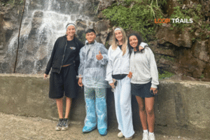
If you’ve added a fourth day to your itinerary and you’re routing through Du Gia, you’ll see even more of this softer Loop landscape. Du Gia waterfall is famous for swimming, less so for views, but the road in is its own reward. The four days extended Loop version includes this leg if you want to make a slower trip of it.
")
Learn more: Cao Bang Loop 3 Days best kept secret
A short, opinionated section, because most viewpoint photos from the Loop look the same and don’t need to.
Light direction matters more than you think. Northern light in Vietnam is harsh midday. The same Ma Pi Leng shot at 11 a.m. and at 5 p.m. looks like two different countries. Plan your day around being at the big viewpoints early or late.
Wide isn’t always right. Most viewpoints reward a wider lens (or your phone’s main camera held in landscape), but a tighter framing of one road curve, or one peak, often tells a better story than the whole panorama. Try the long zoom on Tham Ma or the Karst Plateau, you’ll see what I mean.
Skip the drone, sometimes. Drones are restricted in border areas (which much of the Loop sits inside). Rules can change; check current local regulations before flying. Even where it’s legal, half the famous shots are now drone footage, and the eye level shot from your hand is sometimes more honest.
Always shoot the people, ask first. The H’mong, Tay, Dao, and Lo Lo communities on the Loop are part of what makes it singular. They are also not props. A nod, a smile, a small purchase from a market stall is usually all it takes. Pointing a phone at a stranger’s face without acknowledgment is not photography, it’s rudeness.
Bring a microfiber cloth. Karst dust is unreal. Your lens or phone camera will go cloudy within a day. Wipe it every time you stop.

Learn more: Ha Giang Loop Weather
The Loop is rideable year round, but each viewpoint has a season that flatters it. Rough guide:
| Season | What’s good | What’s tricky |
|---|---|---|
| March to May (spring) | Wildflowers on Quan Ba and Sa Phin valleys, cool mornings, light haze | Some rain in late May; afternoon thunderstorms possible |
| June to August (summer / wet) | Green rice terraces around Meo Vac, dramatic cloud below Ma Pi Leng | Heavy rain, slick roads, the Nho Que turns muddy, landslide risk on passes |
| September to October | Rice turning gold around Du Gia and Meo Vac, clear air on the karst | Crowds peak; book ahead |
| November (buckwheat bloom) | Pink buckwheat across Sa Phin and Lung Cu, perfect light at Ma Pi Leng | Cold mornings; mountain temps can drop sharply |
| December to February (winter) | Crystal clear visibility across the canyon, golden afternoon light | Genuinely cold above Dong Van; occasional fog; layers essential |
If you’re picking a single month, late October into November is what most experienced Loop riders pick. The light is clean, the buckwheat is blooming, and the rain has mostly stepped back. For a deeper read on this, see when to visit Ha Giang.
")
Learn more: Ha Giang Loop by Army Jeep Tours
Honest comparison, no marketing fog. Every mode reaches every viewpoint on this list. The difference is in how much of the riding you do, how much you can look around while doing it, and how comfortable you’ll be at the end of each day.
Self drive motorbike. You ride your own bike. Total freedom, total responsibility. You stop where you want, you photograph what you want, you take a wrong turn and find the best lunch of your trip. You also pay full attention to the road, which means at Ma Pi Leng you’ll be looking at asphalt, not the canyon. Best for confident riders with off road experience and a Vietnamese or international permit valid in Vietnam (rules can change, check the latest before you travel). If this is your mode, look at our motorbike rental in Ha Giang options.
Easy rider (you ride pillion). A local driver handles the bike, you sit on the back and look around. This is the mode most international travelers pick for the Loop, and for good reason. You get the open air feeling without the navigation stress. At Ma Pi Leng you actually see Ma Pi Leng. The trade off is you don’t choose every stop, though good easy rider drivers know the best ones and stop more often than self drivers do. Our easy rider tour is built around this.
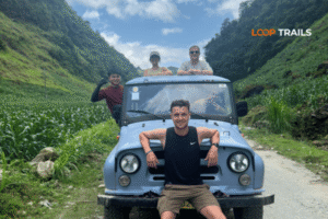
Jeep. Open or closed cab, depending on the operator. Best for couples and small groups who want comfort, families, travelers who don’t ride, and anyone visiting in shoulder season when rain is possible. You get a 360 degree view from a higher seat. Stops are easier; the jeep can pull over almost anywhere wider than a typical motorbike pullout. The downside is you’re slightly less nimble in tight villages. For most non riders this is the mode that lets you actually enjoy the viewpoints instead of surviving the ride to them.
Which option is best for you?
Use this as a quick gut check:
Still not sure? Message us on WhatsApp with your group size and dates, and we’ll suggest a mode in plain English, no upsell.

Learn more: Ha Giang Loop Easy Rider
Quick list. Each of these costs people the photo they came for.
If you want a real conversation about pacing and dates before you book anything, message us on WhatsApp. We’d rather help you plan a good trip than push a tour that doesn’t fit.

Learn more: Ha Giang Loop HoneyMoon Guide
The Loop will give you the famous shots. Ma Pi Leng will look the way you’ve seen it look online. The Twin Mountains will be there. So will the canyon, the karst, the flag tower at the border.
What surprises most travelers is the smaller moments between. The empty pine valley after Tam Son. The light over Lo Lo Chai at 6 a.m. The road south of Meo Vac, where the bus tourists never get out. Those are the ones you’ll talk about a year later.
Plan for the famous ten. Leave space for the eleventh.
Three days is the minimum that hits every named viewpoint in this guide without rushing. Four days lets you add Du Gia, take more time at Ma Pi Leng for both sunrise and golden hour, and ride the road south of Meo Vac in daylight.
Yes, with the right setup. The roads are mountainous but well maintained on the main Loop. Most first time travelers choose easy rider or jeep mode to avoid riding the passes themselves. Self drive is reasonable only for experienced motorcyclists with the right license; rules can change, check the latest before you travel.
Ma Pi Leng Pass at sunrise. The light moves across the canyon wall in a way it doesn’t at any other time of day. Set an alarm for 5 a.m. and you’ll have it nearly to yourself.
You can. Many do. A guide changes the experience: they know the unmarked pullouts, the right cafés, when to skip Lung Cu because of haze. If you want flexibility plus the local knowledge, an easy rider is the middle ground.
Late October into November. Buckwheat blooms across Sa Phin and Lung Cu, the light is clean after the wet season, and crowds are present but manageable.
Quan Ba Heaven Gate, Tham Ma Pass, and the main Ma Pi Leng platform get crowded at midday from late September through January. Early morning and late afternoon are quieter at every one of them.
Restrictions apply near border areas, which covers much of the upper Loop. Rules can change. Check current local regulations before flying, and ask your guide on site.
Yes, if the weather is good and you have the time. The view of Ma Pi Leng from water level is one of the trip’s best, and Tu San Canyon is genuinely unlike anything else in Vietnam. Skip it if the river is high or the day is short.
There are around three hundred and several dozen steps from the base. Anyone with reasonable fitness can manage them; take it slow if you’re not used to altitude.
Yes. Every viewpoint on this list is accessible by jeep, including the Nho Que River pier descent. A jeep tour is the most comfortable option for travelers who don’t ride.
Most travelers take a night sleeper bus or a daytime limousine van (around six to seven hours). Private transfers are available for groups. We can arrange transport with any of our tours; ask when you book.
The Loop runs in light rain without issue, especially on a jeep. In heavy rain we sometimes adjust the order of stops so the safer sections of road are ridden on the wettest day. Refund and reschedule policies vary by tour; ask us directly.
Contact information for Loop Trails
Website: Loop Trails Official Website
Email: looptrailshostel@gmail.com
Hotline & WhatSapp:
+84862379288
+84938988593
Social Media:
Facebook: Loop Trails Tours Ha Giang
Instagram: Loop Trails Tours Ha Giang
TikTok: Loop Trails
Office Address: 48 Nguyen Du, Ha Giang 1, Tuyen Quang
Address: 48 Nguyen Du, Ha Giang 1, Tuyen Quang
Facebook X Reddit Table of Contents Learn more: Ha Giang Loop Tours Sung La doesn’t announce itself. You come around a bend

Facebook X Reddit Table of Contents Learn more: Ha Giang Loop Tours Most honeymoon lists send couples to the same five beach
Facebook X Reddit Table of Contents Learn more: Ha Giang Loop Tours The Ha Giang Loop is a lot of things. It’s