
Tipping in Ha Giang: How Much for Guides and Drivers?
Facebook X Reddit Table of Contents Learn more: Ha Giang Loop Tours You are standing in the courtyard of Loop Trails Hostel.
Thúy Kiều (Grace) is a travel blogger and content contributor for Loop Trails Tours Ha Giang. She holds a bachelor’s degree in Sustainable Tourism from Vietnam National University, Hanoi, and has a strong passion for exploring and promoting responsible travel experiences in Vietnam’s northern highlands.
Learn more: Ha Giang Loop Tours
Almost everyone who rides to Ban Gioc crosses Ma Phuc Pass, and most of them do not stop. Almost nobody turns off it towards Thang Hen at all.
That is a shame on both counts, because the pass is one of the more interesting bits of rock in northern Vietnam once you know what you are looking at, and the lake behind it is a system of thirty six connected basins that drain and fill through the mountain itself. Between them they make the best half day in the western half of Cao Bang.
They also sit on the same road, twenty minutes apart, which is why this guide covers them together.
Learn more: Ha Giang Loop 2 Days 1 Night
Ma Phuc is the gateway. The road east out of Cao Bang City climbs over it, and everything beyond, Quang Uyen, Trung Khanh, Ban Gioc, is on the far side. You cannot really do the province without crossing it.
Thang Hen is the turn most people miss. A little past the top of the pass, a provincial road branches north towards Tra Linh, and the lakes are about ten kilometres up it. Nothing about the junction announces that there is a lake system behind it.
If you have half a day, do both. If you only have an hour, stop properly at the pass. If you have a full day, add God’s Eye Mountain, which sits on the same road past the lakes.
Learn more: Ha Giang Loop 3 Days 2 Nights
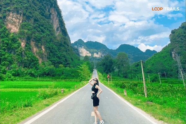
The pass sits roughly 22 km east of Cao Bang City on QL3, and it is about three and a half kilometres of road climbing to around 700 metres at the top.
The name means a horse kneeling, and it makes sense the moment you see it: two blocks of limestone stand either side of the road at the summit like a saddled animal folded down onto its front legs. Vietnamese travellers photograph it from the road. Foreign riders usually go straight through.
This is where the pass gets more interesting than a viewpoint.
Ma Phuc is a recognised geosite inside the Non Nuoc Cao Bang UNESCO Global Geopark, and the interpretation there explains why: the rock the road cuts through was formed by submarine volcanoes that were active in this area around 260 million years ago. What you are riding through is the inside of an old sea floor, lifted up and cut open by a road crew.
Once somebody tells you that, the walls either side stop being scenery and start being a cross section. You can see the layering in the cut faces, and the difference between the volcanic rock and the limestone that surrounds it.
There are interpretation panels at the top. They are not always in perfect English and they are worth five minutes anyway.
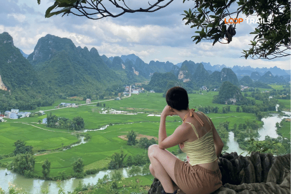
There is space to pull in at the summit, and on a clear day the valley opens out below with the classic Cao Bang arrangement: grey karst teeth, green fields between them, one thin road winding through the middle.
Roadside stalls sell whatever is in season, which through the year runs from corn to fruit to Trung Khanh chestnuts in autumn. Buying something is the cheapest way to make a stop feel less like a photo raid.
Morning and late afternoon are both good. The light comes from opposite sides, which means the pass photographs completely differently depending on which direction you are travelling, so it is worth stopping on both the outbound and the return.
Riding the province rather than reading about it? Ma Phuc is the first thing you cross on the way out to Ban Gioc, and Thang Hen is the turn most independent riders miss entirely. Our Cao Bang loop tours cover the pass on both the way out and the way back, and if you want the lakes and God’s Eye Mountain in the same trip, that is worth saying when you book.
By northern Vietnam standards this is an easy one. Wide corners, decent surface, no serious exposure.
What to watch for:
It is a good first pass for a nervous rider, and a good place to discover that a loaded bike behaves differently before you get to anything harder.
The eastern descent drops you into the Quang Uyen area, which is where the craft villages are: the blacksmiths at Phuc Sen forging blades from recycled steel at the roadside, the incense yards at Phia Thap, the paper makers.
That matters for planning. If you are coming from Cao Bang City with a full day, you can take the pass, drop down the far side, spend the late morning in the villages and be at Ban Gioc by mid afternoon. If instead you turn north for the lakes, you are choosing the lakes over the villages for that day. Both are good. You cannot sensibly do both plus the waterfall.
There is a market in the Quang Uyen area that runs on a rotating local schedule rather than a fixed day, which is normal across this region. If your dates land on one, go. Ask at your accommodation the night before, because nobody publishes these reliably.
A short distance past the top, a provincial road branches north towards Tra Linh. The lakes are roughly ten kilometres along it.
The turn is easy to miss and the road narrows quickly, running through farmland and karst with very little traffic. It is a pleasant ride in its own right and it is where the day stops feeling like a transit.
Learn more: Ha Giang Loop 4 Days 3 Nights
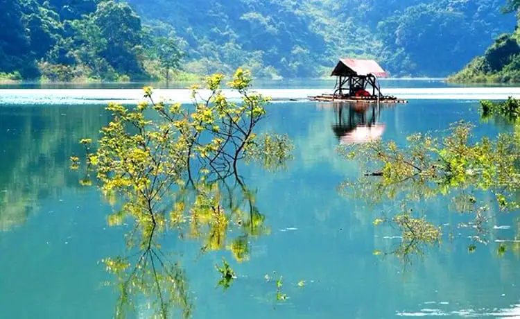
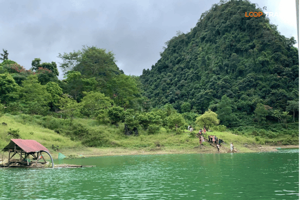
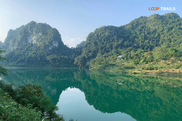
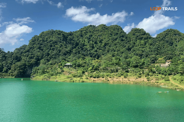
You arrive at a bowl of water sitting in limestone, forest running down to the waterline, cliffs standing over the far shore. When the basin is full it is a proper lake, jade green and still. When it is not, it is something else entirely, which is the interesting part.
Thang Hen means bee’s tail in Tay, from the shape of the main lake seen from above. There is a local legend attached to how the lakes came to be, involving a young man from Tra Linh, and any homestay owner will tell it better than a blog can.
Thang Hen is not one lake. It is the largest of a system of thirty six, spread across a valley and connected to each other through caves, underground rivers and channels running inside the karst.
Most visitors see only the main basin, because it is the one with the road, the boats and the accommodation. The others are scattered through the valley a few dozen to a few hundred metres apart, with their own local names, and walking between some of them is the best way to spend an unhurried afternoon here.
The whole area is inside the Non Nuoc Cao Bang UNESCO Global Geopark and has been recognised as a national scenic area for a long time, which is a useful reminder that this place is well known inside Vietnam even though it is invisible to most foreign itineraries.
Worth understanding, because it explains everything else about the place.
Limestone dissolves in slightly acidic rainwater. Over a very long time, water working through cracks in a limestone massif carves out passages, and those passages grow into cave systems and underground rivers. That is how you get Nguom Ngao, an hour and a half east of here, and it is how you get the whole karst landscape of Cao Bang.
What happens next at Thang Hen is that the roof of one of those underground channels gives way. The ceiling collapses, daylight gets in, and what was a cave passage becomes an open basin with steep walls and water in the bottom. Do that in enough places along the same underground system and you get a valley full of separate lakes that are all quietly connected to one another out of sight.
Which is why the walls around the basins are so steep, why the lakes sit at different levels, and why the water can leave. They were never sealed bowls. They are holes in the roof of something bigger.
The thing that makes Thang Hen unusual is that the water moves.
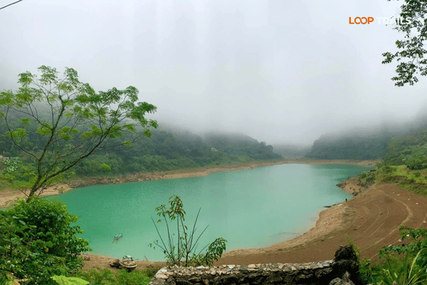
Because the lakes drain into and out of a network of underground channels, levels change: through the year with the season, and locals describe them shifting on a shorter cycle than that too. In the wet months the basins fill and you get deep water with steep green walls around it. In the dry season some of them empty out substantially and become grass, with a stream running through where a lake was.
Water enters the main lake from a cave at its head, and it holds its colour better than the surrounding basins. After heavy rain, when other lakes in the system turn brown with runoff, Thang Hen often stays green.
Neither version is the wrong one to see. They are just completely different photographs, and it is worth knowing which one you are turning up for.
When the water is up, boats and kayaks are usually available at the main lake. Availability depends on season and demand rather than a published timetable, so ask on the day rather than planning your afternoon around it.
An hour on the water is the best way to see the place, because from the surface you get the scale of the cliffs and you can reach shoreline that the road does not go near.
There are walking routes around the main lake and through the valley towards the other basins. Nothing is waymarked in a way you would recognise from a national park elsewhere, so ask locally or take a guide if you want to go further than the obvious shoreline path.
Camping and glamping have appeared at the lake in recent years, which is a genuinely good way to experience it: the early morning, before anyone arrives, with mist sitting on the water, is when this place is at its best. Operations change, so check what is running before you plan a night around it.
Most people take one photograph from the car park and leave, which produces the picture everyone else already has.
Three things that work better. Get above it, even slightly: the shape of the basin is the whole point and you cannot see a shape from the shoreline. Get on the water, because from a boat you get the cliffs at full height with something in the foreground for scale. Go early, because mist on the surface before the day warms up is the single best condition here and it is gone within a couple of hours.
The drained version is worth photographing too, and almost nobody does. A basin with grass on the floor and a waterline still visible on the rock is a stranger and more interesting image than another blue lake.
Overcast is not a problem here. Flat light on jade water is fine, and the cliffs read better without hard shadow.
Continue past the lakes and you reach the grassland below God’s Eye Mountain, the limestone ridge with a natural hole punched clean through it. It is the other reason to come up this road and it is covered properly in our Day 3 guide.
The two work well together: the lakes in the middle of the day, then the mountain in the late afternoon when the low sun rakes across the grass and puts the ridge into silhouette. Doing it the other way round wastes the best light of the day.
Learn more: Ha Giang Cao Bang 5 Days 4 Nights
If you have a morning or an afternoon rather than a full day, this shape works.
| Time | What |
|---|---|
| Leave Cao Bang City | Fuel up before you go, stations thin out past Tra Linh |
| First stop | Ma Phuc Pass. Twenty minutes at the top, panels and stalls |
| Then | North on the provincial road towards Tra Linh, ten kilometres of quiet riding |
| Around two hours in | Thang Hen. Walk the shoreline, get on the water if boats are running |
| If you have longer | Continue to the grassland below God’s Eye Mountain |
| Back | Same road, stopping at the pass again for the light from the other side |
Treat it as a shape rather than a schedule. The only part with a real timing constraint is God’s Eye Mountain, which wants late afternoon.
Learn more: Ha Giang Cao Bang 6 Days 5 Nights
| Roughly | Thang Hen | Ma Phuc Pass |
|---|---|---|
| Mar to May | Filling, green, comfortable | Clear, good light, easy riding |
| Jun to Sep | Fullest water, deepest colour, wettest roads | Green valley, slippery bends after rain |
| Sep to Nov | The best window: full basins, clear air | The best window, and the busiest |
| Dec to Feb | Low water, some basins drained to grass | Cold, morning fog on the climb |
If the full lake is what you came for, aim for the second half of the wet season into autumn, roughly September and October. If you would rather see the strange drained version, come in winter.
Conditions change year to year. Ask at your accommodation the night before rather than committing to a photograph you saw with a date on it.
Learn more: Homestay in Cao Bang
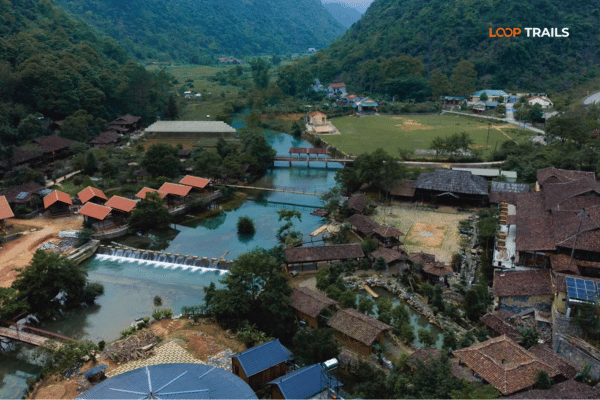
At the lake, there is accommodation by the water including camping and glamping style options, which is the choice if you want early morning mist without a drive.
In Cao Bang City, the full range of hotels and guesthouses, about an hour away, which is the practical base if you are treating this as a half day.
Around Trung Khanh or near Ban Gioc, if you are continuing east afterwards rather than returning.
Book ahead in autumn and around Vietnamese public holidays. There are not many rooms at the lake and domestic travel fills them.
Learn more: Things to do in Cao Bang
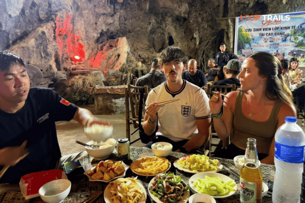
Food. There is food at the lake and in Tra Linh, and roadside stalls at the pass through the day. Between those points there is not much, so eat when you see somewhere rather than when you get hungry. Down the eastern side of the pass, the Quang Uyen area has the widest choice on this route.
Fuel. Fill up in Cao Bang City. There are stations along QL3 and in the district towns, but the provincial road north towards the lakes and on towards the grassland is where people get caught out, because it runs away from everything.
Cash. ATMs are in the city and the district towns, not at the lake. Any local access fees, boat hire, food and accommodation up there are all easier in small notes, and card payment is not a realistic expectation.
Signal. Fine on QL3 and patchy in the valley around the lakes. Download offline maps before you leave the city, particularly if you plan to continue past Thang Hen towards the grassland.
Learn more: Cao Bang Loop 3 Days best kept secret
On the standard three day loop, you cross Ma Phuc on day one heading out to Ban Gioc, and again on the last day heading back. Thang Hen and God’s Eye Mountain usually come on that final day, on the way home, which is why the three day itinerary puts the mountain in the late afternoon.
As a half day from Cao Bang City, the pass and the lakes work well on their own if you have a spare morning before a bus, or a day at the start of a trip.
As a full day, add God’s Eye Mountain and you have one of the best days in the province without going anywhere near the waterfall.
What does not work is treating the lakes as a quick stop on the way to Ban Gioc. The turn adds distance in the wrong direction and you will arrive at the waterfall late. Do them on a different day.
Learn more: Ha Giang Loop by Wrangler Rubicon Jeep
Self drive is straightforward here. The pass is easy, the road up to the lakes is quiet, and the only rough surface is further on towards God’s Eye Mountain. You need your passport, a valid motorbike licence from home and an International Driving Permit issued under the 1968 Vienna Convention. The 1949 style permit is not recognised in Vietnam, and rules change, so check the current position. The paperwork guide covers it, and we handle motorbike rental in Ha Giang if you want a bike without a tour.
Easy rider suits this half day well, mostly because the interesting parts are things somebody has to tell you. Riding past a road cut is scenery. Being told it was a sea floor with volcanoes in it is a different afternoon.
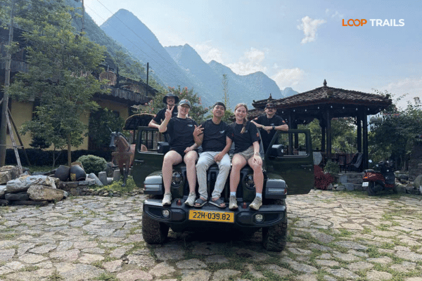
A jeep makes sense for families, for anyone who does not ride, and in winter when the fog sits on the pass in the mornings. Everything here works from a vehicle, including the walk down to the lake and the track towards God’s Eye Mountain.
Book once your dates are set. Most guests book one to three months ahead and jeep availability is tighter than motorbikes.
Learn more: Ha Giang Motorbike Rental
Do not ride over the pass without stopping. It takes ten minutes and it is the only geosite on your route with an explanation attached.
Do not plan the lakes as a detour to Ban Gioc. Different direction, different day.
Do check which season you are getting. Full basin and drained basin are not the same destination.
Do not rely on boats being available. Ask on the day.
Do bring cash in small notes. Access arrangements and any local fees are set locally and card payment is not realistic up there.
Do leave the afternoon light for God’s Eye Mountain if you are doing both. The lakes photograph fine at midday. The mountain does not.
Do ask about conditions before heading up after heavy rain, particularly if you plan to continue to the grassland.
Planning this into a trip? Message us on WhatsApp with your dates and how many days you have in Cao Bang. We will tell you honestly whether the lakes fit or whether your days are better spent in the Quay Son valley.
Learn more: Best time to visit Cao Bang
It is in the Tra Linh area of Cao Bang province, roughly 25 km from Cao Bang City. You reach it on QL3 over Ma Phuc Pass, then north on the provincial road towards Tra Linh for about ten kilometres.
The name comes from Tay and is usually translated as bee’s tail, after the shape of the main lake seen from above. There is also a local legend about how the lakes were formed, which homestay owners will tell you better than any article.
Thirty six, spread across a valley and connected to one another through caves, underground rivers and channels inside the karst. Thang Hen is the largest and the only one most visitors see, since it is the one with the road and the accommodation.
Because the lakes drain into and out of underground channels rather than sitting in sealed basins. Levels shift with the season and locals describe them moving on a shorter cycle too, so the same lake can be deep water in autumn and partly grass in the dry season.
Around September and October, at the end of the wet season, when the basins are full and the air is clearing. Winter gives you the drained version, which is stranger and quieter but not what most people picture when they search for the lake.
Boats and kayaks are usually available when the water is up, but it depends on season and demand rather than a fixed schedule, so ask on the day. An hour on the water is the best way to appreciate the scale of the cliffs around the basin
About three and a half kilometres of road, climbing to around 700 metres at the top, roughly 22 km east of Cao Bang City on QL3. It is an easy pass by northern Vietnam standards, with wide corners and a good surface.
The name means a horse kneeling, from the two limestone blocks standing either side of the road at the summit, which together look like a saddled animal folded onto its front legs. There are interpretation panels at the top.
Yes, and for a reason most people ride past. It is a recognised geosite in the Non Nuoc Cao Bang UNESCO Global Geopark, and the rock the road cuts through was formed by submarine volcanoes active in this area around 260 million years ago.
Not comfortably. The lakes are north off the main road while Ban Gioc is east, so the detour adds distance in the wrong direction and you will reach the waterfall late. Do the lakes on a different day, usually the last one
If you have a spare half day, yes, particularly combined with God’s Eye Mountain further up the same road. If you have only three days in Cao Bang, prioritise Ban Gioc, the Quay Son valley and the craft villages first.
No, both are easy to reach independently. A guide changes the pass in particular, since the geology is the interesting part and none of it is obvious from the saddle of a bike without somebody explaining it.
Contact information for Loop Trails
Website: Loop Trails Official Website
Email: looptrailshostel@gmail.com
Hotline & WhatSapp:
+84862379288
+84938988593
Social Media:
Facebook: Loop Trails Tours Ha Giang
Instagram: Loop Trails Tours Ha Giang
TikTok: Loop Trails
Office Address: 54A Tran Phu, Ha Giang 2, Tuyen Quang
Address: 54A Tran Phu, Ha Giang 2, Tuyen Quang
Facebook X Reddit Table of Contents Learn more: Ha Giang Loop Tours You are standing in the courtyard of Loop Trails Hostel.
Facebook X Reddit Table of Contents Learn more: Ha Giang Loop Tours The route from Ha Giang to Cao Bang by Jeep
Facebook X Reddit Table of Contents Learn more: Ha Giang Loop Tours If you are a UK traveler planning to ride a