
Ha Giang Indigo Dyeing: H’Mong Textile Workshop Guide
Facebook X Reddit Table of Contents Learn more: Ha Giang Loop Tours The first thing you notice is the hands. You will

Thúy Kiều (Grace) is a travel blogger and content contributor for Loop Trails Tours Ha Giang. She holds a bachelor’s degree in Sustainable Tourism from Vietnam National University, Hanoi, and has a strong passion for exploring and promoting responsible travel experiences in Vietnam’s northern highlands.
")
Learn more: Ha Giang Loop Tours
Most Ha Giang Loop guides talk about the views. Very few talk about the actual roads underneath those views, which is strange because the roads are the entire reason the trip exists.
If you’re researching the Ha Giang Loop roads specifically, you’re probably planning to ride self drive, or you’re a confident pillion passenger who wants to know what the route is like before you book, or you’re just doing your homework. Good. Most of the avoidable problems on this loop come from travelers who showed up without a real picture of what the riding looks like.
This guide goes segment by segment through the standard loop, plus the side trips most operators include. We’ll cover surface conditions, hazards by stretch, what’s changed recently, and how to think about road difficulty depending on whether you’re driving, riding pillion, or sitting in a jeep. No fake numbers, no “perfectly paved” marketing language, no promises about traffic laws or licenses we can’t verify.
Use this article as a planning tool. Then make your booking decision with realistic expectations.

Learn more: Ha Giang Loop 2 Days 1 Night
A small but important caveat. Ha Giang Loop roads change. Sections get repaved, monsoons cause landslides, new viewpoints add new pull outs, and authorities periodically restrict or open stretches. What we describe here is the general state of the road network as a baseline, written from years of guiding the route. Always check the latest updates with your operator the morning of your ride for any closures, weather impacts, or detours.
We won’t pretend to give you precise distances at hairpin level or guaranteed travel times. Mountain roads don’t work that way, and any blog claiming otherwise is making numbers up. What we will give you is a useful, honest picture of what each section feels like.

Learn more: Ha Giang Loop 3 Days 2 Nights
The Ha Giang Loop runs primarily on QL4C (Quoc Lo 4C), the main road that climbs north from Ha Giang City through Quan Ba, Yen Minh, Dong Van, and Meo Vac. It’s the spine of the loop. Most of the loop’s famous views, including Ma Pi Leng Pass, sit on this road.
From Meo Vac, the standard modern itinerary loops south on smaller provincial and district roads through Mau Due, Du Gia, and back to Ha Giang City. The southern half of the loop is less famous but often more peaceful, with quieter villages and fewer trucks.
A few branches matter:
Your operator picks the exact combination based on weather, road conditions that week, and group preferences.

Learn more: Ha Giang Loop 4 Days 3 Nights
The honest answer: most of the Ha Giang Loop roads are paved, in reasonable condition, and ridden safely by foreigners every day of the year. They are not, however, European A roads or American highways. Expect mountain reality.
What that means in practice:
The good news: QL4C, including the entire Ma Pi Leng section, has been substantially upgraded over the years. The pavement is generally smooth and the road width allows two way traffic for most of its length. Quan Ba, Yen Minh, Dong Van, and Meo Vac sit on solidly paved road.
The reality: Even paved sections have patches with broken asphalt, gravel spills from drainage runoff, and occasional potholes. Some smaller branch roads are rougher. After heavy rain, dirt and gravel wash onto the asphalt on hairpins. Repairs happen but take time.
The honest part: Conditions vary year to year. A road that was perfect last September might have a landslide scar this April. A stretch that was rough two years ago might be freshly paved today. Don’t trust outdated forum posts. Ask your operator about current conditions when you book.

Learn more: Ha Giang Cao Bang 5 Days 4 Nights
Below is the standard counterclockwise loop most quality operators use, broken into the segments your day will actually run on. Distances are approximate.
The first stretch out of Ha Giang City climbs steadily north on QL4C, including the well known Bac Sum Pass. Surface is generally good, with some long sweeping curves and a few tight corners on the climb. Traffic near Ha Giang City is the heaviest you’ll see all trip; trucks heading to construction sites and local commuters share the road. It thins out as you climb.
This is also where most riders’ first nerves settle. The road is paved, the curves are manageable, and within an hour you’ve crossed into proper mountain country. Tam Son is the first market town on the loop and a common lunch stop or coffee break.
Vibe: Easy mountain ride. A good warm up.
After Tam Son, the road continues climbing through karst landscapes, eventually entering the Yen Minh pine forest stretch. Surface is generally solid, traffic light, gradients moderate. This section is one of the more relaxed riding stretches of the loop.
Watch for cattle, kids walking home from school in the afternoon, and the occasional truck transporting timber. Visibility is generally good but mountain weather can roll in quickly.
Vibe: Forested, peaceful, fewer hairpins than later sections.
After Yen Minh, the road shifts character. More dramatic mountain sections, more switchbacks, more views that demand a stop. Surface remains generally good on QL4C. The famous Tham Ma Pass falls in this stretch, with its zigzag of hairpins climbing the side of a mountain.
This section also passes the Vuong Family Mansion (a side stop most tours include) and starts to feel “remote” in a way the earlier stretches don’t.
Vibe: Real mountain riding starts here. Switchbacks, viewpoints, photo stops.
The road up to Lung Cu Flag Tower is some of the best riding on the loop in terms of pure switchback density. Surface is generally good, traffic is light, and the views over karst hills toward China are excellent.
It’s a side trip, not part of the main loop, so most itineraries do it as an out and back from Yen Minh or Dong Van. Worth the extra hours.
Vibe: Switchback heaven, classic mountain riding.
The headline section. The road from Dong Van east to Meo Vac runs along Ma Pi Leng Pass, carved into the side of a near vertical canyon with the Nho Que River 800 meters below. Surface is solid, the road has been substantially improved over the years, and the views are genuinely on the global short list.
Ride this stretch slowly. There are several pull outs (some informal, some with cafes built right on the cliff edge), and the temptation to keep stopping is strong because every angle is different. Photo discipline is hard here, and that’s fine.
A few specifics: the road has been widened in places to allow safer passing, but trucks and tour buses still use it, and meeting one on a tight section requires patience. Don’t try to overtake on blind corners. There’s no prize for finishing first.
Vibe: The reason you came. Drama, scale, photo stops every 200 meters.
After Meo Vac, the road turns south and the character changes again. Smaller roads, more forest, river crossings, fewer trucks, more buffalo. Surface is mostly paved but with rougher patches than QL4C. Some stretches have narrower lanes and tighter visibility.
This is where the loop’s “secret” reputation lives. Travelers who only do the northern half miss this entire section, which is a shame because the scenery and riding here are fantastic in their own right.
Vibe: Quieter, more rural, more variable surfaces.
The final day. Quiet roads, more rural landscapes, a few last passes before the loop closes back at Ha Giang City. Surface varies; some smooth sections, some patchy. Traffic stays light until you get close to the city.
This stretch is the shortest riding day of most 4 days tours and the easiest in terms of difficulty. A good wind down before you finish.
Vibe: Mellow, scenic, easy enough to enjoy without concentrating hard.
Soft pitch, no pressure: if these road descriptions have you thinking about which format suits you, browse our Ha Giang Loop tours to compare easy rider, self drive, and jeep options. If you’re confident on a bike, our motorbike rental in Ha Giang page has the current fleet.
")
Learn more: Ha Giang Cao Bang Ba Be Lake 6 Days 5 Nights
A few sections get name dropped in every Ha Giang Loop blog. Here’s what’s actually special about them as roads, not just as views.
The famous one. A road carved into a near vertical canyon, with hairpin turns and viewpoints that look directly down on the Nho Que River. As a road, it’s well paved, moderately wide, and not technically difficult for any rider with mountain experience. The challenge is psychological more than technical: the drop offs are real, and weather (especially fog) can change the riding experience completely.
Best ridden in clear weather, morning or late afternoon. Midday sun flattens the canyon visually. If your itinerary lets you choose, prioritize this section in good light.
A photogenic stretch of switchbacks in the Yen Minh to Dong Van section. Often photographed from above. As a road, the surface is generally good and the curves are wide enough to ride confidently. Tour groups often stop at the top for photos.
The first real climb after leaving Ha Giang City. Long, sweeping, paved well. A nice introduction to mountain riding in the province without throwing you into the deep end immediately.
The pass just before Quan Ba town. Includes the Heaven’s Gate viewpoint, looking down on the Twin Mountains. As a road, it’s solid and well graded. Worth a stop at the viewpoint to set the tone for the rest of the trip.

Learn more: Ha Giang Road Conditions 2026
Most accidents on the Ha Giang Loop roads come from a small set of recurring hazards. Knowing them in advance prevents most problems.
Cattle and water buffalo on the road. Especially around villages and at dawn/dusk. Always assume something is around the bend that wasn’t there last time. Slow down on blind corners.
Gravel and dirt spills after rain. Mountain runoff dumps loose material onto the road, especially on hairpins. Looks like dry tarmac, isn’t. Take it easier on the day after heavy rain.
Trucks and tour buses on tight sections. They move slowly but they take their lane, sometimes more. Don’t overtake on blind corners. Wait for a clear straight.
Fog patches on passes. Visibility can drop from 500 meters to 20 meters in seconds, especially on Ma Pi Leng. If you hit fog, slow right down, turn on your headlight, stay in your lane, and ride conservatively until you’re through.
Kids and chickens around villages. Both run into the road without warning. Both rural realities, both demand caution near settlements.
Sand and slick patches at intersections. Where dirt tracks meet the main road, sand often gets dragged onto the asphalt. Tighten up before crossings.
Construction zones. Road improvements happen seasonally. Sometimes a stretch is reduced to one lane with workers managing traffic. Slow down, follow signals, don’t get impatient.
Sun glare on east west sections in early morning or late afternoon. Sounds minor, isn’t. Sunglasses and a tinted visor help.
Loose gravel on freshly resurfaced sections. New asphalt is great. Brand new asphalt with loose chip on top is not. Watch for signage and surface color changes.
Uneven shoulder drop offs. Some sections have a sudden drop from the road edge to the dirt shoulder. Be careful when pulling over for photos.

Learn more: Ha Giang Loop Weather
The same Ha Giang Loop roads behave very differently depending on when you ride.
January and February: Cold, sometimes very cold, especially around Dong Van and Meo Vac. Fog rolls in thick on Ma Pi Leng, occasionally limiting visibility hard. Roads themselves are usually dry and in good condition. Pack proper cold weather gear and expect some slow riding through fog.
March to May: Generally excellent road conditions. Light rain possible but not constant. Visibility usually good. The classic “pleasant” riding window.
June to August: Wet season. Heavy rain triggers landslides on certain stretches; entire sections occasionally close. Roads stay rideable most of the time but expect mud, gravel runoff, and reduced grip. Build a buffer day into your trip and don’t book a same evening flight out of Hanoi.
September to November: Peak. Roads usually in their best condition of the year (post monsoon repairs done, dry weather). Visibility excellent. Most popular time for a reason.
December: Cold but dry. Roads in good shape. Riding is sharp and clear, photos are excellent.
Quick tip: regardless of season, check road conditions with your operator the morning of your ride. Rules around closed sections and weather impacts shift without warning. A 30 second message can save a 4 hour detour.

Learn more: Ha Giang Motorbike Rental
Same roads, very different experiences depending on how you’re traveling them.
Mountain riding with weather, gravel, and the occasional truck. Not technically extreme but not casual. Real motorbike experience matters; new riders or scooter only riders should reconsider self drive on this loop. Manual transmission only riders especially should consider a semi automatic instead.
The key skill is reading the road: anticipating gravel on hairpins after rain, slowing for blind corners, not overtaking on tight sections. None of this is exotic motorbike skill; it’s just basic mountain riding discipline applied consistently for 4 days.
If you’re confident, you’ll have a great time. If you’re uncertain, take an easy rider tour or jeep tour. Better safe than evacuating from a remote homestay.
Roads stop being a difficulty question because someone with thousands of loop kilometers under their belt is operating the bike. Your job is to lean with the bike in corners, hold on properly, and not panic when a truck appears. The roads themselves are scenic background for you.
Easy rider passengers occasionally ask whether certain sections are “scary.” Honest answer: Ma Pi Leng has real exposure and some travelers feel it. If you have a fear of heights, look at the road ahead rather than the canyon below. The exposure is more dramatic visually than mechanically; you’re well inside the road, not at the edge.
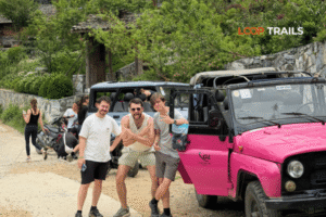
Comfort all the way. The same roads carry trucks daily, so a 4×4 with a competent driver is more than comfortable. The only thing to know: winding mountain roads can trigger motion sickness in some travelers. Sit in the front if you’re prone, take medication before symptoms appear, and don’t read on the bike.
Jeeps stop wherever motorbikes do. You see the same views from a slightly different angle, with windows you can roll down.

Learn more: Ha Giang Loop by Jeep for Families & Groups
Ha Giang Loop roads have been improving for years. Stretches that were rough a decade ago are now smooth pavement. The Ma Pi Leng section in particular has seen significant upgrades.
That said, road conditions are not static. Recent years have included:
The point: don’t trust a 2019 blog post telling you a specific stretch is “in poor condition.” Don’t trust a 2026 blog post (this one included) saying everything is perfect either. Check current conditions with your operator before you ride.

Learn more: Ha Giang Food guide
Practical info you actually need.
Petrol stations: Available in Ha Giang City, Quan Ba, Yen Minh, Dong Van, Meo Vac, and most market towns. Spaced enough that you don’t need to obsess about fuel, but not so frequent that you can ignore your gauge entirely. Top up at every opportunity, especially before any longer stretch like the Ma Pi Leng section.
Mechanics: Available in larger towns. Smaller villages often have someone who can patch a tire or fix basic issues. If you’re on a guided tour, your guide has contacts. Self drive riders should know the basics: how to fix a flat, how to read fuel and oil levels, what a normal idle sounds like.
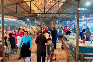
Coffee and food: Roadside coffee stops dot the entire loop. Some are excellent. Some have surprisingly good views (the cliffside cafes on Ma Pi Leng are now famous). Don’t skip these; they’re part of the experience.
Toilets: Available at petrol stations, restaurants, and most shops. Bring tissue and hand sanitizer; not all are stocked.
ATMs: Reliable in Ha Giang City, sometimes available but not guaranteed in Dong Van and Meo Vac. Withdraw cash before you leave Ha Giang City and you won’t have to think about it.

Learn more: Ha Giang Loop Self-Drive
A few habits that make you a better road citizen on the loop.
Use your horn proactively, not aggressively. A short tap before a blind corner or when passing tells other road users you’re there. Standard local practice. Don’t lean on the horn out of frustration.
Don’t ride three abreast. Stay in single file, especially on narrower stretches. Photo stops happen at pull outs, not in the lane.
Pull all the way off the road for photos. Stopping in the lane for “just a quick photo” is how accidents happen. Use formal pull outs when you can.
Wave back at kids. They wave at every foreign rider. It’s free goodwill and it costs you nothing.
Don’t rev engines through villages. Locals live there. Treat the road through a village like the street outside your own house.
Yield to trucks on narrow sections. They have less room to maneuver and less ability to stop. You have a motorbike or a small vehicle that can pull aside more easily. Yield.
Don’t litter. Snack wrappers, water bottles, anything. Pack out your trash to the next bin.
")
Learn more: Cao Bang Loop 3 Days best kept secret
If you’re extending your loop east into Cao Bang province, the roads change character somewhat. The Ha Giang to Cao Bang stretch isn’t a casual day; it includes some longer transit sections on rougher provincial roads, and the routing requires planning.
Cao Bang’s own road network is generally good around the major attractions (Ban Gioc Waterfall, Phia Oac National Park) but quieter than Ha Giang’s main loop. Less developed, less tourist traffic, more of a “local” feel.
The honest version: the Ha Giang to Cao Bang transit is a real ride, not a quick hop. We typically run this as part of a Ha Giang and Cao Bang combine tour with overnight stops planned around the longer riding days, or as a standalone Cao Bang loop for travelers who fly into the route fresh.

Learn more: Ma Pi Leng Pass
Quick decision tree based on the road realities above.
| You are… | Recommended option |
|---|---|
| New to motorbikes or scooter only experience | Easy rider tour |
| Confident rider with manual or semi auto experience | Self drive |
| Experienced rider but solo and don’t want to navigate | Self drive guided group |
| Family or older travelers wanting comfort | Jeep tour |
| Photographer prioritizing access in any weather | Jeep tour |
| Couple where one rides and one doesn’t | Easy rider for both |
| Worried about license or insurance | Easy rider or jeep |
| Adding Cao Bang and want continuity | Combine tour, your choice of format |
If you’re still uncertain, message us with your dates, group size, and riding experience. We’d rather talk you into the right format than upsell the wrong one.

Learn more: What to wear on Ha Giang Loop?
We’re a small team based in Ha Giang. We ride these roads constantly, every season, every year. We know which sections were repaved last month and which stretches got chewed up after the last big rain.
We run Ha Giang Loop tours in three formats (easy rider, self drive, jeep), keep group sizes capped on purpose, and maintain our own bikes between every trip. We also offer motorbike rental in Ha Giang for independent riders, plus combine tours linking Ha Giang with Cao Bang.
What we promise is plain. Bikes are maintained between every trip, not just between fatal failures. Guides are local riders who actually know these roads, not Hanoi imports. Group sizes are capped on purpose. Schedules run on time. If something goes wrong on the road, we pick up the phone.
The fastest way to plan: message us on WhatsApp with your travel dates, group size, and riding experience. We come back the same day with options and a clear quote, no pressure, no follow up sales pitches.
The Ha Giang Loop roads aren’t extreme, but they’re real. Treat them with the respect they deserve, pick the format that matches your skill level, and you’ll come home with stories instead of regrets.
See you up north.

Learn more: Ha Giang Loop Hidden Gems
Most of the main loop, including QL4C through Ma Pi Leng, is paved and in reasonable condition. Some smaller branch roads and southern stretches have rougher sections. Conditions change seasonally, so check current updates with your operator before you ride.
For experienced motorbike riders, yes, with normal mountain riding caution. The roads are generally well maintained, traffic is light outside cities, and most accidents come from rider inexperience or weather, not road quality. New riders should consider easy rider or jeep tours.
Moderate mountain riding for confident riders. Not technically extreme, but long days, switchbacks, weather, and the occasional truck require focus. If you’ve never ridden mountain roads, this is harder than you might expect.
There’s no single “worst” stretch; the southern half of the loop and some smaller branch roads tend to be rougher than QL4C. Conditions vary by season and recent weather. Ask your operator about current conditions before you ride.
Yes. The road across Ma Pi Leng has been substantially upgraded over the years and is now paved with road widening in places. It’s well maintained and rideable safely by any rider with mountain experience.
Yes, especially during the wet season (June to August). Heavy rain occasionally triggers landslides on certain stretches and roads can close temporarily. Build a buffer day into your itinerary if you’re riding in summer.
A semi automatic or manual motorbike with enough power for mountain climbs. Beach scooters and underpowered bikes struggle on the longer climbs. Most rental shops in Ha Giang stock bikes specifically suited to the loop. Loop Trails maintains our rental fleet for these roads specifically.
Yes. The road north to Lung Cu has some of the best switchback density on the loop, with light traffic and good views. Even ignoring the symbolic value of the flag tower itself, the ride is worth doing.
Slower than you think. Mountain roads, blind corners, animals, and weather all argue for restraint. The trip isn’t a race. Riding at 60% of your perceived limit leaves margin for the unexpected and is also more enjoyable.
Yes, Vietnam has speed limits, though signage and enforcement vary. Always ride within reasonable limits for the conditions, regardless of posted signs. Specific rules can change, so check current local updates.
Yes, but slow down significantly. Wet roads, gravel runoff, and fog all increase risk. If a serious storm hits, stop and wait it out at a coffee shop or homestay. The pass will be there tomorrow.
Use it as a backup, not your primary navigation. Phone signal drops on passes, GPS distance estimates on mountain roads are wildly optimistic, and following Google’s “shortest” route can take you onto rough back roads. A guided tour or experienced lead rider is more reliable.
Contact information for Loop Trails
Website: Loop Trails Official Website
Email: looptrailshostel@gmail.com
Hotline & WhatSapp:
+84862379288
+84938988593
Social Media:
Facebook: Loop Trails Tours Ha Giang
Instagram: Loop Trails Tours Ha Giang
TikTok: Loop Trails
Office Address: 48 Nguyen Du, Ha Giang 1, Tuyen Quang
Address: 48 Nguyen Du, Ha Giang 1, Tuyen Quang
Facebook X Reddit Table of Contents Learn more: Ha Giang Loop Tours The first thing you notice is the hands. You will
Facebook X Reddit Table of Contents Learn more: Ha Giang Loop Tours Let me save you a small disappointment before it happens.

Facebook X Reddit Table of Contents Learn more: Ha Giang Loop Tours Most travelers come to Cao Bang for the waterfall. Then