
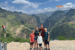
Ha Giang Loop with Toddlers & Very Young Children: Family Jeep Guide
Facebook X Reddit Table of Contents Learn more: Ha Giang Loop Tours Most people picture the Ha Giang Loop as a motorbike

Thúy Kiều (Grace) is a travel blogger and content contributor for Loop Trails Tours Ha Giang. She holds a bachelor’s degree in Sustainable Tourism from Vietnam National University, Hanoi, and has a strong passion for exploring and promoting responsible travel experiences in Vietnam’s northern highlands.

Learn more: Ha Giang Loop Tours
The Ha Giang Loop is one of those routes that gets shared on Instagram before most travelers know what it actually is. The short answer: it is a circular ride through Ha Giang Province in the far north of Vietnam, hugging the Chinese border, weaving past karst peaks, terraced valleys, and tiny Hmong villages where the road sometimes feels personal. People come for the photos. They leave talking about the silence between the passes.
This guide is for travelers who want the route explained properly: how long it really is, what you ride through on each day, where the good stops are, what the road feels like under a tire, and which version of the loop fits which kind of trip. No gloss. No filler.
")
Learn more: Ha Giang Loop 2 Days 1 Night
The Ha Giang Loop is a road circuit in the northernmost province of Vietnam. You start in Ha Giang City (around 6 to 7 hours by night bus from Hanoi) and ride a clockwise or counter clockwise loop through the Dong Van Karst Plateau Geopark, finishing back in Ha Giang City three to four days later.
The defining stops along the way are Quan Ba, Yen Minh, Dong Van, Lung Cu Flag Tower, Ma Pi Leng Pass, Meo Vac, and (if you have an extra day) Du Gia.
The route covers roughly 320 to 400 km depending on which detours you take. That sounds short. Mountain riding warps time. A 100 km day on a flat highway is two hours. A 100 km day on the Loop, with switchbacks, photo stops, lunch in a village hall, and the inevitable road work, can stretch from 8 in the morning to 5 in the afternoon.
Most riders run the route in 3 days, 2 nights. The 4 days, 3 nights version adds Du Gia, a quieter Tay valley to the south, and gives you breathing room.

Learn more: Ha Giang Jeep Tours
A quick reference before we get into the daily detail.
| Detail | 3 Days Loop | 4 Days Loop |
|---|---|---|
| Start / End | Ha Giang City | Ha Giang City |
| Total distance | ~320 to 350 km | ~380 to 420 km |
| Riding time per day | 5 to 7 hours | 4 to 6 hours |
| Overnight stops | Yen Minh, Dong Van | Yen Minh, Dong Van, Du Gia |
| Highest pass | Ma Pi Leng (~1,500 m) | Same |
| Difficulty | Moderate | Moderate |
The number that matters is not km, it is hours in the saddle. On a 100 km mountain day expect to be moving for 4 to 5 hours, plus 2 to 3 hours of stops (food, viewpoints, a flat tire, photos that take longer than they should). That is your day.
If you have ridden in Bali, in Thailand, or anywhere in mainland Southeast Asia at altitude, the Ha Giang Loop is a step up in scenery and a step up in switchback density. It is not technical in a dirt bike sense. It is just long, exposed, and slow.
Most groups ride clockwise: Ha Giang to Tam Son (Quan Ba), then Yen Minh, Dong Van, Meo Vac, then Du Gia or back to Ha Giang. The reason is dramaturgy. You ease in through rolling karst valleys, you hit the Tham Ma switchbacks on Day 2, the Hmong King’s Palace, the flag tower, and Ma Pi Leng Pass on Day 3 when you have the rhythm of mountain riding under you.
Counter clockwise works fine and a few experienced riders prefer it, mainly because Ma Pi Leng arrives early when you still have fresh legs. The road is identical either way. Group tours almost always go clockwise for logistical reasons (homestays expect you in a certain order).
Ha Giang City is where you sleep the night before, where you pick up your bike, and where you finish the loop. From Hanoi you have three realistic options to get there:
A practical note: most accommodations and operators in Ha Giang City will store your large bags free of charge while you ride the loop. You only carry what fits on the bike, usually one small daypack, layers, and rain gear.
Quick CTA: If you would rather skip the Hanoi logistics, our Ha Giang Loop tours include the night bus and pickup. You wake up, eat breakfast, and the bike is already waiting.

Learn more: Ha Giang Loop 3 Days 2 Nights
This is the route 80% of travelers ride. It is short enough to feel intense, long enough to feel earned.
Distance: ~100 km · Riding time: 4 to 5 hours moving · Total day: 7 to 8 hours with stops
Day 1 is the warm up. You leave Ha Giang City around 8 or 9 in the morning, ride QL4C north, and within 40 km you hit Quan Ba Heaven’s Gate (Cong Troi Quan Ba), a viewpoint over the Twin Mountains and Tam Son town below. Pull over, drink a cup of coffee at the roadside stand, take ten minutes. The view is the reason this is a famous stop.
From Tam Son you climb steadily through pine forest and corn fields to Yen Minh, a small market town that does not blow anyone’s mind on its own but is positioned exactly where you want to sleep for night one. Most riders arrive in late afternoon, drop bags at a homestay, and walk to the noodle place on the corner.
If you are riding strong and the weather is clear, some itineraries push on to Dong Van on Day 1 instead. We do not recommend it. Day 2 has the best scenery and you want fresh eyes for it.
Distance: ~75 km · Riding time: 3 to 4 hours moving · Total day: 7 to 9 hours with stops
This is the day people quietly remember as their favorite. The riding distance is short on paper. The number of times you stop is the catch.
Out of Yen Minh you climb into the Dong Van Karst Plateau proper. The road tightens. The limestone gets jagged. Around 30 km in you reach Tham Ma Pass, a wall of nine switchbacks carved into the mountain. There is a viewpoint at the top where Hmong children sometimes pose for photos in traditional dress. A small donation is appropriate if you take a portrait.
From Tham Ma you descend into Sung La Valley, where stone walled houses and buckwheat fields (in autumn) and yellow rapeseed (in late winter) make the valley look like a watercolor. Lung Cam Cultural Village is here. Stop, walk in, buy a tea.
A few km on, the Hmong King’s Palace (Vuong Palace) sits behind a stand of old cypress trees in Sa Phin commune. Entry is a small fee, the building is smaller than you expect, the cypress courtyard is the part that stays with you.
From there it is a short ride to Lung Cu Flag Tower, the symbolic northernmost point of Vietnam. The road in is paved and the climb to the tower itself is around 800 stone steps. On clear days the view runs all the way into China. On foggy days it runs about ten meters. Both are memorable in their own way.
You drop down into Dong Van Old Quarter by late afternoon. This is your sleep for night two. The old market square has a Saturday night atmosphere even on weekdays in season. Eat thang co or a hotpot, buy a Tuyet Son apple wine if you are feeling brave, sleep early. Day 3 is the headliner.
Distance: ~150 km · Riding time: 6 to 7 hours moving · Total day: 9 to 10 hours with stops
Day 3 is where the loop earns its reputation. Twenty km out of Dong Van you climb onto Ma Pi Leng Pass, the road literally cut into the cliff above the Tu San Canyon, with the turquoise Nho Que River running 800 meters below. Pull over at the main viewpoint. Walk a short way along the cliff path. Take longer than you planned.
If you have an extra hour, drop down the side road to the Nho Que River boat dock and take a 1 hour boat ride through the canyon. The boat angle is the photo people associate with the loop. Bring 100k VND for the boat.
After Ma Pi Leng you reach Meo Vac, a market town that holds a famous Sunday “love market” (Khau Vai) once a year and a regular Sunday market every week. Eat lunch.
From Meo Vac you have two ways back to Ha Giang City on a 3 days route:
Either way you are back in Ha Giang City by 6 in the evening. Shower. Eat. Sleep. The bus to Hanoi leaves at 9 or 10 at night for most travelers.

Learn more: Ha Giang Loop 4 Days 3 Nights
The 4 days version is a real upgrade if you have the time. Day 1 and Day 2 are identical. Day 3 changes.
Distance: ~80 km · Riding time: 4 hours moving
Instead of pushing all the way back to Ha Giang on Day 3, you ride from Meo Vac south to Du Gia village, a Tay community in a quiet valley with a small waterfall, swimming holes, and homestays where the family eats with you. Du Gia is the part of the loop where the noise of the road falls off and you remember why you came in the first place.
The riding to Du Gia is the rougher section of the whole loop. Some stretches are unpaved or under repair. The detour through the rice valley is also where the road gets most photogenic.
Distance: ~70 km · Riding time: 3 to 4 hours moving
A short morning ride out of the valley, back through forested hills, and into Ha Giang City by lunch. You eat, pack, hand the bike back, and either catch the afternoon bus to Hanoi or stay one more night to recover. The 4 days route is the version we actually recommend if your travel calendar allows it.
")
Learn more: Ha Giang Cao Bang 5 Days 4 Nights
The route is the framework. The stops are the trip. Here are the ones that matter, in clockwise order.
The first viewpoint, ~40 km from Ha Giang City. The Twin Mountains (Co Tien, “fairy bosom” in local legend) rise out of the rice basin below. Best in late morning when the haze burns off. There is a small viewing tower a few minutes’ walk above the road.
Nine switchbacks climbing the side of a mountain between Yen Minh and Sung La. Photos do not capture the scale. Stop at the top viewpoint, not the bottom one. Ten minutes, a coffee, a photo. Move on.
Vuong Palace was built in the early 20th century by the Vuong family, an opium era Hmong dynasty that controlled this stretch of the border. The architecture is a strange and beautiful mix of Hmong and Chinese influences. Sung La Valley around it is the calendar photo Vietnam: stone walls, terraced fields, smoke rising from kitchens.
The symbolic northernmost point. The flag is the size of a small apartment. The view from the top is China. There is a short stair climb. Not skippable on a first loop.
Your night two sleep, but also a real place. Old Hmong market buildings, French era houses, small cafes with rooftops that catch the morning sun. The Sunday market is the local color event of the week if your timing aligns.
The headline. Ride it slowly. Pull over more than once. If the weather lets you take the boat through Tu San Canyon, take it: the cliff walls are 700 to 800 meters high and the canyon is the deepest in Southeast Asia.
If you pick the 4 days route, this is the reward. Waterfall swim, dinner with the homestay family, less English than the rest of the loop, more of what you actually came for.

Learn more: Ha Giang Cao Bang Ba Be Lake 6 Days 5 Nights
The honest version: 80 to 90% of the loop is paved tarmac. The rest is patchy, cracked, gravel, or under repair. Conditions change month to month and rules can change too, so check local updates before you ride.
What to expect on the route:
The loop is not technically difficult. It is long, exposed, and unforgiving when conditions go bad. If you are a confident rider in a city, you can ride it. If you have never ridden a manual or semi automatic bike before, do not learn here.

Learn more: Ha Giang Loop Weather
The Ha Giang Loop has four real seasons, each with its own riding character. Weather can swing fast in the mountains, so treat any single forecast as a guide, not gospel.
| Season | Months | Character |
|---|---|---|
| Spring | March, April | Cherry and plum blossoms, mild temps, occasional fog |
| Early summer | May, June | Green rice terraces, hot days, afternoon storms |
| Monsoon | July, August, September | Heavy rain, landslide risk, dramatic skies, fewer crowds |
| Autumn | October, November | Buckwheat flowers, golden rice, the famous “best month” |
| Winter | December, January, February | Cold (single digit C nights), thick fog, dry roads |
The honest “best” time is late September to mid November if you want the postcard version. Early October is the buckwheat peak. Late October is the harvest gold. November is cooler and emptier.
If you are tied to summer travel, ride between rainstorms and bring serious waterproofs. If you ride in winter, bring real layers, the highlands get genuinely cold.
For a deeper month by month breakdown, see our best time to visit Ha Giang post.

Learn more: Ha Giang Loop Easy Rider
There are three real ways to do the Ha Giang Loop route. None is “the right one”. The right one depends on you.
You sit on the back. The guide handles the bike, the route, the photo stops, and the road. You look around. This is the option for travelers who want to see everything without the mental load of riding mountain switchbacks for 7 hours a day.
It is the most popular option for first time visitors to Vietnam. It is also the safest. Anchor your expectations: you are riding pillion, not driving, so the experience is about the views and the conversations with your guide, not about the bike itself.
You rent a bike (semi automatic 110cc, manual 150cc, or sometimes a Honda XR or similar) and ride the loop with or without a group. This is the option for confident riders who want full control of pace, photo stops, and detours.
Be honest with yourself about your riding level. The loop has rewarded careful riders for years and punished overconfident ones for the same number of years. If you have never ridden a manual gearbox, do not start on a mountain pass.
If you want to compare bike options and rates for self drive, our motorbike rental in Ha Giang page has the current fleet.
You sit inside or on top of an open air jeep with a driver, alongside up to 4 to 6 other travelers. This is the option for non riders, couples where one rides and one does not, families with older travelers, and anyone who wants to ride the loop in any weather.
You see exactly the same stops. You miss none of the route. You skip the wet jacket and the sore wrists. Counter to a common assumption, jeep travelers often have more time at the viewpoints because they are not the ones managing the bike.
Which one fits you? If you have never ridden a motorbike before and are coming with a partner, the easy rider or jeep option is the call. If you ride at home and want full control, self drive. If the weather forecast is rain, jeep wins by default.

Learn more: Ha Giang Loop Mistake to Avoid
After years running this route, the patterns of where trips go wrong are pretty predictable. Most are easy to avoid.

Learn more: Motorbike License IDP Guide 2026
This part deserves a careful answer because the rules can change and enforcement is uneven. We will not give you a yes or no that pretends to be legal advice.
What we can say:
The practical interpretation: many riders still ride the loop without a Vietnam recognized license, and many do not have an issue, and some do. We will not pretend this is fine. The policy reality and the on the ground reality often differ. Check the latest official guidance before you ride and make your own choice with eyes open.
If the paperwork question is making you nervous, the easy rider option sidesteps it entirely (your guide drives), and so does the jeep option.

Learn more: Ha Giang Packing list
The rule on the loop: pack for one full season colder than the city forecast. Highlands run cooler than Ha Giang City by 5 to 10 degrees Celsius, more on the passes.
Essentials:
For a more thorough breakdown by season, we have a separate Ha Giang packing list post.

Learn more: Ha Giang Loop Price
Costs change with the season and the brand. The numbers below are realistic ballparks based on what most international travelers spend on a 3 days run, riding mid market. Always check current rates with your operator before booking.
| Item | Rough range (USD per person) |
|---|---|
| 3 days loop tour, easy rider | $130 to $200 |
| 3 days loop tour, self drive | $130 to $180 |
| 3 days loop tour, jeep | $200 to $280 |
| Motorbike rental only (3 days) | $25 to $45 |
| Hanoi to Ha Giang sleeper bus | $12 to $18 |
| Homestay if booking yourself | $8 to $15 a night |
| Meals | $3 to $7 a meal |
| Nho Que River boat | ~$5 |
| Vuong Palace entry | ~$1 |
| Lung Cu flag tower entry | ~$1 |
Add a buffer of $30 to $50 for unexpected things: extra coffee stops, a souvenir, a rainy day taxi, a flat tire repair.
If you want our exact current rates for the route, the easiest way is to send us a message on WhatsApp or jump straight to the Ha Giang Loop tours page.
")
Learn more: Cao Bang Loop 3 Days best kept secret
If you have more than four days, the natural extension from the Ha Giang Loop is east, into Cao Bang Province. The terrain shifts from karst plateau to limestone valleys and rivers. The headline stops are Ban Gioc Waterfall (the second largest natural waterfall on a national border in the world), Nguom Ngao Cave, and the Phia Oac National Park area.
The combined loop ride, Ha Giang plus Cao Bang, is typically a 5 days, 4 nights or 6 days, 5 nights itinerary. You ride or jeep through Bao Lac, a small frontier town between the two provinces, and cross from one geological story into another.
We run combined tours specifically for travelers who want both: see our Ha Giang and Cao Bang combined tours page or our Cao Bang Loop standalone option if you have already done Ha Giang on a previous trip.

Learn more: Ha Giang Motorbike Rental
Quick decision tree based on the most common cases.
Still on the fence? Send us a message on WhatsApp with your dates and group size. We will tell you straight which option fits, including when none of ours do.

Learn more: Ha Giang Loop Photography Guide
Three things to lock in before booking:
When you are ready, the cleanest way to start is the Ha Giang Loop tours page (compare durations and modes side by side) or the motorbike rental in Ha Giang page if you want to ride independently.
If you would rather ask a person, we are on WhatsApp during business hours. Send your dates, your group size, and whether anyone in the group is not a confident rider. We will reply with the route that fits.
The loop has been here for a long time. It will still be here next year. But the version you ride this season, with this weather and this group, only happens once. Plan it well. Then go.
The standard loop runs about 320 to 350 km on the 3 days version, and 380 to 420 km if you add the Du Gia detour for the 4 days version. Distance is short on paper, but mountain riding stretches it.
3 days, 2 nights is the most common. 4 days, 3 nights is the version we recommend if your schedule allows. 2 days is possible but rushed and not advisable for first time visitors.
The road itself is paved for most of the loop and not technically demanding. What makes it tough is the length, the switchbacks, and the unpredictable weather. Confident urban riders handle it fine. Beginners should not learn to ride a manual on this loop.
Officially, no. Vietnam recognizes only 1968 Vienna Convention IDPs and Vietnamese licenses. Enforcement varies, and rules can change. If you want to skip the question entirely, the easy rider or jeep option does not require any license from you.
Late September through mid November is the consensus best season: clear skies, buckwheat flowers, golden terraces. March and April are also strong for spring blossom and mild weather. July through September is rainy with landslide risk.
Most riders go clockwise (Quan Ba, Yen Minh, Dong Van, Meo Vac, back). The scenery builds better in this direction and group tours run on this rhythm. Counter clockwise works if you want Ma Pi Leng earlier in the trip.
The loop starts and ends in Ha Giang City, which is around 6 to 7 hours from Hanoi by night sleeper bus. Most operators store your large luggage in Ha Giang City while you ride.
Yes. Open air jeeps run the same route with the same stops and drivers do the driving. It is the popular choice for non riders, families, couples where one rides and one does not, and anyone riding in the rainy season.
Riding the loop solo is doable for experienced riders, but most travelers we work with prefer at least a small group for safety on the passes and for breakdowns. Solo riders should never ride at night and should always carry a power bank and a paper map backup.
Most guests book 1 to 3 months ahead. October and November are peak and book up first. Jeep availability is more limited than motorbike, so jeep tours need earlier booking, often 4 to 8 weeks out.
Light rain does not stop the loop. Heavy rain or landslide warnings can shift the schedule by half a day. Tour operators monitor conditions and reroute or pause when needed. Always pack a poncho and dry bag.
Yes. The standard extension is the Ha Giang plus Cao Bang combined tour, usually 5 days or 6 days, riding from Meo Vac east through Bao Lac into Cao Bang Province for Ban Gioc Waterfall and Nguom Ngao Cave.
Contact information for Loop Trails
Website: Loop Trails Official Website
Email: looptrailshostel@gmail.com
Hotline & WhatSapp:
+84862379288
+84938988593
Social Media:
Facebook: Loop Trails Tours Ha Giang
Instagram: Loop Trails Tours Ha Giang
TikTok: Loop Trails
Office Address: 48 Nguyen Du, Ha Giang 1, Tuyen Quang
Address: 48 Nguyen Du, Ha Giang 1, Tuyen Quang
Facebook X Reddit Table of Contents Learn more: Ha Giang Loop Tours Most people picture the Ha Giang Loop as a motorbike

Facebook X Reddit Table of Contents Learn more: Ha Giang Loop Tours Riding the Ha Giang Loop during Tet is one of
Facebook X Reddit Table of Contents Learn more: Ha Giang Loop Tours Dong Van sits at the far northern tip of Vietnam,