
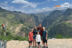
Ha Giang Loop with Toddlers & Very Young Children: Family Jeep Guide
Facebook X Reddit Table of Contents Learn more: Ha Giang Loop Tours Most people picture the Ha Giang Loop as a motorbike

Thúy Kiều (Grace) is a travel blogger and content contributor for Loop Trails Tours Ha Giang. She holds a bachelor’s degree in Sustainable Tourism from Vietnam National University, Hanoi, and has a strong passion for exploring and promoting responsible travel experiences in Vietnam’s northern highlands.

Learn more: Ha Giang Loop Tours
Most articles about Ha Giang trekking start by telling you it’s a hidden gem for hikers. They show you a photo of a Hmong woman walking a buffalo through rice terraces, list a few generic trail names, and quietly skip the part where they explain what trekking here actually means in 2026.
This isn’t that article.
Ha Giang is one of the most beautiful corners of Southeast Asia. People do trek here. Some routes are genuinely excellent. But the honest truth, after years of running trips through this region, is that Ha Giang is not Sapa. It is not a trekking-first destination with a network of marked trails, dedicated trekking lodges, and porters waiting at trailheads. The product here is mountain riding through karst landscapes, and trekking is a thing you weave into that, not a thing you replace it with.
If that sounds like a let-down, stay with us. The walking that does exist in Ha Giang is some of the most rewarding you’ll do in Vietnam, precisely because it isn’t packaged. You’re not following a numbered trail. You’re walking on the actual paths Hmong, Tay, and Dao families use to get between villages, fields, and markets. That changes the experience in ways that matter.
Here’s the real guide.

Learn more: Ha Giang Loop 2 Days 1 Night
Before any route descriptions, three things you should know.
One. Ha Giang has very few formally marked trekking routes. There’s no equivalent of the Tour du Mont Blanc or even the established Sapa village circuits. What exists are local paths, jeep tracks, and connecting trails between villages, walked daily by people who live there. You can absolutely trek on them. You usually need a guide to find them, especially the good ones.
Two. Most international travelers who say “I want to trek in Ha Giang” actually want a few hours of walking per day in a stunning landscape, with a homestay night, a real meal with a family, and the rest of the trip on a motorbike or in a vehicle. That’s a combo experience, and it’s what we run most often. If you want to walk 6 to 8 hours a day for a full week with a backpack, Ha Giang isn’t optimized for that. Sapa or Pu Luong is.
Three. The terrain is mostly karst. Limestone hills, narrow paths, rocky underfoot, slippery in rain. Trail surfaces are not maintained. There are no boardwalks, no benches, no signposted distances. Bring real shoes.
If those three things sound fine to you, the rest of this article is going to be useful. If you were imagining alpine huts and yellow blazes on trees, adjust accordingly.

Learn more: Ha Giang Loop 3 Days 2 Nights
Yes, with an asterisk.
Ha Giang province is mountainous, sparsely populated, and crossed by paths that connect hundreds of small ethnic minority villages. You can walk between many of them. Some valleys have homestays at both ends, which means you can do real point-to-point treks with sleeping arrangements built in. Du Gia is the most famous example.
What Ha Giang doesn’t have, in the Sapa or Nepalese sense, is a dedicated trekking economy. There are not 40 agencies in Ha Giang City selling 5 day treks to a list of named summits. There are not commercial porters. There aren’t trail signs in English. The infrastructure is set up around motorbike loops, not trekking circuits.
This isn’t a flaw. It’s the reason Ha Giang’s walks still feel uncommercial. The path you’ll be on hasn’t been widened for tour groups. The family hosting your homestay isn’t running their twentieth booking that week. Things are still happening at the scale of a real place.
So when we say “Ha Giang trekking,” what we mean is: walking, sometimes for half a day, sometimes for a full day, sometimes for two or three days in a row, through a landscape where your guide knows the paths and the families along them. That’s the realistic frame.
")
Learn more: Ha Giang Loop 4 Days 3 Nights
This comparison comes up so often it’s worth being explicit.
| Ha Giang | Sapa | |
|---|---|---|
| Trail infrastructure | Informal, local paths | Established trekking circuits |
| Marked routes | Rare | Common |
| Trekking agencies | Few specialized, mostly tour combos | Many, dedicated to trekking |
| Homestay density | Moderate, growing | High, mature network |
| Crowds on the trail | Low | Higher in peak season |
| Ride vs walk balance | Ride-led, walking woven in | Walk-led |
| Best route type | Day walks + village stays | Multi-day point-to-point |
| Karst landscape | Yes (dominant) | No (different terrain) |
| Cultural variety | Higher (more groups, more isolation) | Hmong / Dao / Tay focus |
If your trip is built around walking and you don’t care about the riding, Sapa is honestly the better fit. If you want to see the most dramatic landscape in northern Vietnam, with walking as part of the experience but not the whole thing, Ha Giang wins.
A lot of travelers do both. Three days in Sapa for the walking, three days in Ha Giang for the ride and the views. They’re complementary, not interchangeable.

Learn more: Ha Giang Cao Bang 5 Days 4 Nights
Five areas where the walking is genuinely good. Distances and times we’ll keep deliberately loose because terrain, season, and pace shift them more than published numbers suggest.
If Ha Giang has a “trekking capital,” it’s Du Gia. The valley is wider and greener than the central plateau, with a slower river running through it and a network of paths between Hmong, Tay, and Dao villages. Walks here can be done as half-day loops out of a homestay or as 2 to 3 day point-to-point treks linking villages.
Du Gia is also where you’ll find the famous waterfall and natural pool that gets shared on every Ha Giang reel. You can walk to it, swim, walk back, eat dinner with the family hosting you. As an entry point to the trekking experience, it’s the most forgiving and the most rewarding for the first-time hiker.
Most riders skip Du Gia or pass through quickly because it’s a detour off the main loop. That’s exactly why it’s good for walking. Less traffic, more space, paths that haven’t been widened for tour buses.
The first major district north of Ha Giang City. The Twin Mountains (Nui Doi) are the famous photo from Heaven’s Gate viewpoint. Below them is a wide green basin with Hmong villages stitched along the edges. Walks here are mostly half-day affairs, looping out from a homestay or guesthouse, and the terrain is gentler than what you’ll find further north. Good for travelers easing in.
There’s also the lesser-known walk up the smaller hills behind Tam Son town, which gives you the Twin Mountains from a different angle, away from the tour bus crowd.
This is the karst plateau at full intensity. Walking here is dramatic, sometimes harsh, often otherworldly. The terrain is rocky, paths narrow, and you’ll be moving past stone-walled fields where Hmong families grow corn out of what looks like pure rock.
Trail options near Dong Van include short walks out to nearby Hmong hamlets, the climb up to Don Cao (a French-era fort behind Dong Van Old Quarter, gives you a wide view at sunset), and longer connector walks toward villages tucked behind the main road. Most of these are best done with a local guide because the paths are not marked and the landscape, while beautiful, is genuinely easy to lose your bearings in.
Lung Cu itself, the northernmost point of Vietnam, has a short climb to the flagpole at the top. Not really trekking, more of a steep set of stairs, but worth doing if you’re already in the area.
East of Dong Van, Meo Vac sits at the bottom of Ma Pi Leng Pass. The walking around here is some of the best in the province because the villages are scattered across slopes and the views shift with every climb. Routes connect Hmong hamlets that don’t see vehicle traffic at all. You’re walking on paths that have been there for generations.
There’s a great half-day walk that drops down toward the Nho Que River from the upper villages. You’re moving through working farmland, past stone houses with thatched roofs, into the canyon. It’s not technically difficult, but the elevation change adds up and you’ll feel it in your legs.
Two slightly off-the-beaten-track stops that pair walking with caves and unusual landscapes. Lung Khuy Cave sits about 10 km off the main loop, accessed by a moderate uphill walk through a Hmong village to the cave entrance. Inside, it’s a long karst cave system with stalactites and chambers.
Sung La is a small valley known for its triangular buckwheat fields in November. The valley floor is walkable, with paths between Hmong houses (including the one used as a filming location for a famous Vietnamese movie). It’s not strenuous walking but it’s some of the most photogenic in the province.
Want walking built into your trip? Most of our Ha Giang itineraries include morning or afternoon walks at homestays and villages. If you’re specifically interested in heavier walking days with shorter ride distances, message us before booking and we’ll customize the routing. Our standard Ha Giang Loop tours already include 1 to 2 walking sections by default.

Learn more: Ha Giang Cao Bang Ba Be Lake 6 Days 5 Nights
Weather makes a bigger difference for trekking than for riding because you’re exposed to it longer and you’re walking on surfaces that change with rain.
October to early December. The best window for most travelers. Skies are usually clear, temperatures are mild, paths are dry. Late October catches the rice harvest gold. November brings the buckwheat flower fields around Lung Cu and Sung La, which are unforgettable if your timing is right. By early December, mornings are cold but the air is crisp.
December to February. Cold, sometimes very cold at altitude. Mist clings to the valleys, which can be beautiful but also limits visibility. Trails are usually dry but slippery on shaded sections. Tet (Lunar New Year) typically falls in late January or early February, and many homestays close for a week, so check the lunar calendar before locking in dates.
March to April. Underrated. The pink wild peach blossoms hit in early March, the air is mild, rain is still light. Photographers prefer October but trekkers often prefer this window because the trails are still dry and the landscape is greening up.
May to early September. The wet season. Rice terraces fill with water and look spectacular, especially in late August and early September. The trade-off is that paths get muddy, leeches show up in some forested sections, and afternoon storms shorten walking days. Trekking is still doable, especially in the morning, but expect to adjust around weather.
September. A transition month that can go either way. Late September is often dry and beautiful, early September can still be wet.
If we’re picking a single window for a first-time Ha Giang trekker? Late October through mid November. Dry, cool, scenery at its best.

Learn more: Ha Giang Motorbike Rental
The most useful question to ask before booking. Three honest options.
Pure trekking. Possible but limited. You’ll need to base yourself in Du Gia or another village, organize a local guide, and accept that your trip will cover less ground than a riding tour would. You’ll see one valley well rather than three valleys briefly. Some travelers want exactly this.
Pure riding (motorbike, easy rider, or jeep). The classic Ha Giang Loop format. Most stops include a 20 to 60 minute walk to a viewpoint, village, or cave, but the rhythm is dominated by saddle time. Best if you came for the landscape and the cultural exposure, less so if walking specifically is your priority.
Combo (ride + walking days). The format that works for most international travelers. You ride between regions on motorbike, easy rider, or jeep, and you build in 1 to 2 walking days where you stay longer in one place and explore on foot. You get the dramatic distance the loop offers, plus real time on the trail.
We run all three formats. The combo is the most popular by a wide margin, and it’s what we recommend for first-time Ha Giang travelers. You don’t have to commit to one mode; the trip can shift between them.

Learn more: Ha Giang Loop Self-Drive
Three realistic itinerary frames, with deliberate flexibility because routing depends on conditions and your group’s pace.
Best for travelers who only want a taste of trekking, or who are tight on days.
Day 1. Transfer from Ha Giang City to Du Gia (or Quan Ba, depending on your preference). Lunch at the homestay. Afternoon walk through the valley, maybe 2 to 3 hours, ending at a waterfall or a viewpoint. Dinner with the family.
Day 2. Morning walk on a different path (most homestays have several loop options out of their door). Lunch back at the homestay. Transfer back to Ha Giang City in the afternoon, or onward to your next destination.
This isn’t a hard trip. It’s an introduction to the landscape and the rhythm of village life. Good for travelers who want to balance a riding tour with a slower section.
The format we run most often. You’re moving but you’re not always on a bike.
Day 1. Ride from Ha Giang City through Quan Ba and Tham Ma Pass to your first homestay near Yen Minh. Riding is the focus. Short walks at viewpoints.
Day 2. Either ride a shorter section to a second homestay area (often Lung Cu or Dong Van), or pivot to a half-day walking section before continuing. Afternoon village walk near your accommodation.
Day 3. Final ride day, including Ma Pi Leng Pass and Meo Vac, with a longer walk on the lower slopes around Meo Vac before returning to Ha Giang City via Du Gia.
You’re getting the iconic ride, two homestay nights, and 4 to 6 hours of total walking spread across the days. Most travelers find this the right balance.
For travelers who want more time on foot.
Days 1 to 2. Ride to Du Gia (often via Quan Ba and Yen Minh, including Tham Ma Pass and a stop near Heaven’s Gate). Settle into a homestay in Du Gia. Day 2 is a full walking day in the Du Gia valley.
Day 3. Walk to a second village within the valley, sleeping at a different homestay. Pure trekking day, no bike.
Day 4. Ride out of Du Gia toward Dong Van and the upper plateau. Catch Ma Pi Leng on the way. Sleep in Dong Van or near Meo Vac.
Day 5. Return to Ha Giang City via the southern leg of the loop, with one or two walking stops along the way.
This format gives you 2 full walking days, including a real point-to-point trek between homestays, and still includes the headline scenic stretches of the loop. It’s our recommended option for active travelers who want the trekking experience without giving up the ride.

Learn more: Ha Giang Loop Weather
Honest version, no flattering language.
Surface. Most trekking paths in Ha Giang are earth, rock, or rough flagstone. Some sections are loose gravel on slope. After rain, expect mud, especially on shaded paths. There are very few flat sections that stay flat for long. You’re either going up, going down, or about to start one of the two.
Elevation change. Day walks typically cover 200 to 600 meters of total ascent and descent, depending on routing. The plateau itself sits between 1000 and 1600 meters, so even moderate climbs can feel a bit harder than at sea level if you’re not used to altitude. Nothing approaches alpine scale, but underestimating it is a common mistake.
Stream crossings. Most paths bridge or step across small streams without issue. After heavy rain, some crossings get tricky and routes adjust. Local guides know which paths flood first.
Marking. As mentioned above, almost none of the paths are marked. You’re following local knowledge, not signs. A few well-trodden village-to-village trails are intuitive once you’re on them, but figuring out which one is which from a satellite map is hard.
Weather exposure. Most paths are open to sun and wind. There’s not much forest cover on the karst plateau. Sun protection matters even on cool days. Wind chill at altitude can be sharp, especially November through February.
Wildlife. Nothing to worry about. Buffalo crossing your path is the most common encounter. Dogs at homestays are friendly. Leeches show up in some wet-season forested sections, but they’re avoidable.
If you can do a 4 hour walk on uneven trails at home, you’ll be fine on most Ha Giang routes. If not, start with a half-day walk on Day 1 and build from there.

Learn more: Ha Giang Loop Solo Travel
Strong opinion: get a guide.
This isn’t a sales pitch. It’s because the trekking experience in Ha Giang is fundamentally different with one. A few specific reasons.
Navigation. Paths aren’t marked, and Google Maps in this region is unreliable for anything off the main roads. Tracks shown on satellite often don’t exist on the ground. Local guides actually know which fork to take.
Language. Most homestay families and villagers speak some Vietnamese plus their own ethnic language. Almost no English. A guide makes the difference between sitting silently at a family dinner and actually talking to your hosts.
Permits and access. Some paths cross permit zones, and some villages welcome guided groups but are uneasy about random foreign walkers showing up alone. A guide handles the logistics and the social side.
Safety. Twisted ankle on a remote path with no cell signal is a different problem than the same injury back home. A guide carries a phone with local SIM, knows the nearest road access, and can call for help.
Cultural depth. This is the real reason. The villages along these paths are home to Hmong, Tay, Dao, and Lo Lo families with histories most travelers never get a glimpse into. A guide who grew up in the region, or who has been working it for years, opens conversations and explanations that you simply won’t get on your own.
If you want to walk alone, you can do short out-and-back routes from a homestay (most hosts will tell you “go up that hill, come back the same way”) and that’s fine. For anything longer or more interesting, take the guide.

Learn more: Ha Giang Homestay Guide
Trekking accommodation in Ha Giang is mostly homestays, with occasional small guesthouses in larger villages.
Homestays. Family homes that have added a guest section. Mattresses on raised platforms, mosquito nets, blankets. Bathrooms vary: older homestays have shared bathrooms with cold or limited hot water, newer ones have private en-suite. Dinner is family-style, usually with the host family present, often including local rice wine if the conversation is going well. The experience is the point. They’re not luxury.
Guesthouses (Du Gia, Dong Van, Meo Vac). Slightly more privacy. Private rooms with en-suite bathrooms, hot water, sometimes air conditioning. Smaller scale than the homestays of Sapa. Less of the cultural immersion, more comfort.
Hotels (Ha Giang City). Standard 2 to 3 star hotels for the start and end nights. Reliable but unremarkable.
For a 3 days combo, you’ll typically have 1 night in a Hmong or Tay homestay, 1 night in a guesthouse, 1 hotel night. For a 4 to 5 days deeper trek, you’ll likely have 2 to 3 homestay nights total. If you specifically want all-private rooms or all-hotel accommodation, we can usually arrange that, but you’ll lose the family dinner element which most travelers say is the best part.
")
Learn more: Ha Giang Loop Price
Real talk on costs. Prices change. We’ll talk in ranges.
A guided trekking-focused trip in Ha Giang sits in the same general range as a guided Loop tour of equivalent length. Sometimes a touch lower because there’s less fuel and bike maintenance, sometimes a touch higher because guides for trekking are more specialized.
What’s typically included in a guided trek:
What’s typically not included:
DIY costs less, in the same way DIY costs less for most things. You’ll save on guide fees and group logistics, you’ll pay full retail on accommodation, food, and transport. You’ll spend a lot of time figuring out which trail is which.
For a current quote, message us with your dates, group size, and rough preference (trek-focused, ride-focused, combo). We’ll come back with itemized numbers, not a “starting from” placeholder

Learn more: Ha Giang Packing list
Pack light, especially for trekking days. Big backpacks make narrow paths harder.
Essentials
Documents
Things you don’t need
If you forget something in Hanoi, Ha Giang City has a couple of outdoor shops with the basics. Don’t count on finding specialty items.

Learn more: Ha Giang Loop Insurance
This section we have to write carefully because rules change.
Permits. Lung Cu Flagpole and a few border-adjacent areas require a permit for foreign travelers. If you’re on a guided tour, the operator handles the paperwork. If you’re doing it yourself, you’ll need to apply at the immigration office in Ha Giang City, with your passport. The process is straightforward but takes time.
Trekking permits specifically. As of late 2025 and early 2026, there is no single “trekking permit” for Ha Giang in the way Nepal has one for the Annapurna or Everest regions. Access to villages is generally open. What you may need permits for is being in border zones or near the China frontier. Rules and enforcement shift periodically. Check current requirements before you travel, or let a tour operator handle it.
Insurance. Standard travel insurance usually covers walking and hiking, but many policies have altitude limits or exclusions for “remote area trekking.” Read the fine print. Ha Giang’s altitudes are moderate (no policy should refuse coverage on altitude grounds alone), but the “remote” definition is what to watch.
Guide certification. There’s no universal trekking guide license system in this region. Reputable operators work with guides who have years of local experience and (usually) some English ability. Cheap freelance guides found at the bus station are a gamble. Choose accordingly.
If any of this sounds like a pain to handle, that’s literally what you’re paying for when you book through an operator.
")
Learn more: Ha Giang Loop Mistake to Avoid
Patterns we see, season after season.
Booking the wrong trip type. Telling an agency “I want to trek in Ha Giang” without specifying what you mean. Some travelers want long full-day hikes, some want a 90 minute village walk in the afternoon. Different itineraries, different operators, different prices. Be specific when you inquire.
Wearing the wrong shoes. Sneakers without grip on wet karst stone is a recipe for a slip. Bring shoes with proper tread.
Treating Ha Giang like Sapa. Showing up with a Sapa-style trekking expectation and being mildly disappointed there are no waymarks. Reset expectations and you’ll enjoy the trip.
Underestimating heat in the dry months. October and November are cool, but midday sun on exposed karst is real. Hydrate, bring sun cover.
Overestimating heat in winter. December and January get genuinely cold at altitude. Travelers from tropical countries underpack. Bring a warm layer regardless.
Skipping Du Gia. The most common regret. People stick to the main loop, see the headline viewpoints, and miss the valley where the walking is best.
Solo trekking without a guide on multi-day routes. Doable for short walks. Risky for longer routes where you don’t know the path network or the language. We’ve helped find lost travelers a few times. It’s stressful for everyone.
Booking too late in peak season. The best homestays in Du Gia, Dong Van, and Meo Vac fill up 4 to 6 weeks ahead in October and November. Book early for those months.

Learn more: Ha Giang Jeep Tours
Quick decision frame, based on what we hear from travelers most often.
You’re a casual hiker, not a serious trekker, and you want to mix walking with a beautiful ride. Book a 3 days motorbike + walking combo. You’ll see the headline landscape and get real walking time. This is what most LoopTrails customers choose.
You’re traveling as a couple where one of you doesn’t want to ride. Book the jeep version of the Ha Giang Loop with a 1 day walking section in Du Gia. You both walk together, you both see the views, no one has to negotiate the saddle.
You’re a regular hiker and you want walking to be the main event. Book the 4 to 5 days deeper trek and ride mix, or contact us about a customized itinerary that’s heavier on Du Gia and lighter on the loop.
You want pure trekking, no riding. Honestly, consider Sapa or Pu Luong instead. If you specifically want Ha Giang’s landscape and you want to walk through it, base yourself in Du Gia for 3 to 4 days with a local guide and walk daily. We can set this up but it’s less common.
You have only 2 days and want a taste of both. Book a 2 days light trek + homestay in Du Gia or Quan Ba. Skip the loop this trip; come back for it.
You’re a confident rider who wants the freedom to ride your own bike but with walking days planned in. Rent a motorbike from us and book a custom itinerary, or do the self-drive option of the Loop with a guide leading.
One easy step. Message our team on WhatsApp with your dates, your fitness level, and what you want the balance of walking-to-riding to look like. We’ll send back an itinerary draft and a clear quote. Most travelers go from first message to confirmed booking in under 24 hours. Plan your Ha Giang trip with LoopTrails here.
Whichever way you cut it, the walking in this part of Vietnam is some of the most honest you’ll do anywhere. You’re not on a curated path; you’re crossing through living villages, on tracks people use to get to school and to market and to family. That’s worth a slightly muddy boot.

Learn more: Cao Bang Loop 3 Days best kept secret
Yes, with realistic expectations. Ha Giang is excellent for short to medium walks through karst landscapes and ethnic minority villages, especially in Du Gia, Quan Ba, and around Dong Van and Meo Vac. It’s not a Sapa-style trekking destination with waymarked multi-day routes, so plan accordingly.
Short walks out and back from a homestay are usually fine on your own. Multi-day or village-to-village treks really need a local guide, because paths aren’t marked, navigation apps are unreliable in the mountains, and language barriers are significant in remote villages.
Late October to mid November is the standout window: dry weather, cool temperatures, rice harvest then buckwheat blooms. March and April are an underrated alternative. Avoid June and July if possible, as wet season makes paths muddy and afternoon storms cut walking days short.
Sapa has more established trekking infrastructure, marked routes, and a denser network of trekking-focused homestays. Ha Giang has more dramatic karst landscapes, smaller crowds, and a stronger ride-plus-walk culture. For pure trekking, Sapa is usually better. For overall experience, many travelers prefer Ha Giang.
Du Gia valley is the most popular for actual trekking, with multiple homestays and a network of village paths. Quan Ba is gentler and easier for beginners. Meo Vac and Dong Van offer more dramatic but harder walking through karst landscapes.
Most routes are moderate. Day walks typically include 200 to 600 meters of climbing on uneven paths. There’s no technical climbing or scrambling. If you can do a 4 hour walk on rough trails at home, you’ll handle most routes here.
Most areas don’t require special permits, but border-adjacent zones (such as around Lung Cu) do. Tour operators handle permits as part of bookings. Independent travelers can apply at the immigration office in Ha Giang City. Rules can change, so check current requirements before traveling.
Proper walking shoes or hiking boots, a waterproof jacket, layers (mornings get cold even in summer), long pants, sunglasses, sunscreen, a buff for sun and wind, a power bank, a refillable water bottle, and a headlamp. Pack light. You’ll be moving with your bag on most multi-day treks.
Yes, and it’s the format most international travelers choose. A 3 days motorbike + walking combo gives you the iconic ride plus 4 to 6 hours of walking spread across the trip. A 4 to 5 days version adds full trekking days, usually in Du Gia.
Yes. Hmong, Tay, and Dao family homestays are scattered through the trekking-friendly valleys, especially Du Gia, Quan Ba, and around Meo Vac. They offer mattress accommodation, family-style dinners, and basic facilities. Newer ones have private rooms and en-suite bathrooms.
Guided trekking trips run in a similar per-day range to motorbike Loop tours. Final cost depends on duration, group size, accommodation type, and whether you want a private trip or join a group. DIY is cheaper but requires significantly more planning. Get a current quote from your operator.
Trail safety is generally good. The main risks are slippery paths after rain, occasional remote areas with no cell signal, and minor missteps on uneven terrain. Going with a guide reduces almost all of these. Make sure your travel insurance covers walking and trekking.
Contact information for Loop Trails
Website: Loop Trails Official Website
Email: looptrailshostel@gmail.com
Hotline & WhatSapp:
+84862379288
+84938988593
Social Media:
Facebook: Loop Trails Tours Ha Giang
Instagram: Loop Trails Tours Ha Giang
TikTok: Loop Trails
Office Address: 48 Nguyen Du, Ha Giang 1, Tuyen Quang
Address: 48 Nguyen Du, Ha Giang 1, Tuyen Quang
Facebook X Reddit Table of Contents Learn more: Ha Giang Loop Tours Most people picture the Ha Giang Loop as a motorbike
Facebook X Reddit Table of Contents Learn more: Ha Giang Loop Tours Riding the Ha Giang Loop during Tet is one of
Facebook X Reddit Table of Contents Learn more: Ha Giang Loop Tours Dong Van sits at the far northern tip of Vietnam,