
Mu Cang Chai and Ha Giang: The Rice Terrace Trip
Facebook X Reddit Table of Contents Two of the best landscapes in northern Vietnam sit about a province apart, and most people

Thúy Kiều (Grace) is a travel blogger and content contributor for Loop Trails Tours Ha Giang. She holds a bachelor’s degree in Sustainable Tourism from Vietnam National University, Hanoi, and has a strong passion for exploring and promoting responsible travel experiences in Vietnam’s northern highlands.
Learn more: Ha Giang Loop Tours
Nobody comes to Vietnam expecting to be cold. Then you ride up out of Nguyen Binh, the temperature drops with every switchback, the trees start wearing moss like fur coats, and by the time you are near the top of Phia Oac you are in a white fog with frost on the branches, wondering where the tropics went.
Phia Oac National Park is the strangest landscape in Cao Bang and the one almost no foreign traveller sees. It sits about 70 km west of Cao Bang City, in the opposite direction from Ban Gioc, which is exactly why it stays empty: everyone turns right towards the waterfall and nobody turns left.
This is what is up there, when to go, and how to fit it into a trip without wrecking your schedule.
Learn more: Ha Giang Loop 2 Days 1 Night
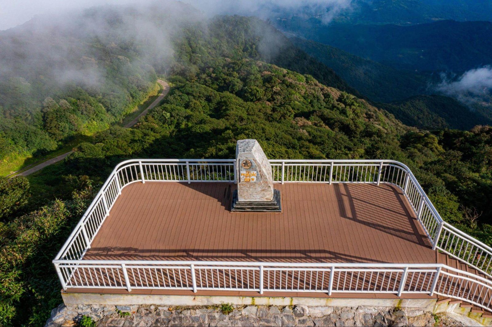
The full name is Phia Oac and Phia Den National Park, after the two peaks it is built around. Phia Oac is the higher of them at roughly 1,930 metres, which makes it the western roof of the province and one of the highest points in this corner of Vietnam. Phia Den, lower down at around 1,390 metres, gives the park the second half of its name and most of its farmland.
It was given national park status in January 2018, upgraded from an existing nature reserve, and it was the first national park in Cao Bang province. The protected area runs to just over 10,000 hectares across several communes of Nguyen Binh district, and it sits inside the Non Nuoc Cao Bang UNESCO Global Geopark, along with Ban Gioc, Nguom Ngao and the lakes at Thang Hen.
The geology is a mixture: sedimentary rock, limestone and granite pushed up together, which is unusual for this region and is why the mountain holds minerals that limestone country normally does not. That mixture also explains the vegetation, which is nothing like the karst forest you see on the rest of the Cao Bang loop.
Official surveys list well over a thousand plant species inside the park, along with a long list of animals, some of them on national and international protected lists. You will not see most of them. That is normal for a cloud forest and it is not the reason to go.
Learn more: Ha Giang Loop 3 Days 2 Nights
Four reasons, all of them practical.
It is the wrong way. Cao Bang’s tourism runs east and north, towards Ban Gioc and the Quay Son. Phia Oac is west. On a three day loop, going there means giving up something else.
It is high and it is cold, and most people arriving in northern Vietnam have packed for a warm country.
There is very little built for visitors. No visitor centre operation of the kind you would recognise from a national park elsewhere, limited signage, few marked trails and not much English anywhere.
The best thing about it is weather, and weather cannot be booked. On a clear warm afternoon it is a pleasant forested mountain. On a cold foggy morning it is one of the strangest places in the country. The difference is luck and season.
None of this makes it a bad destination. It makes it a destination for a particular kind of traveller: somebody with a spare day, warm clothes and no need for the trip to be efficient.
Learn more: Ha Giang Loop 4 Days 3 Nights
This is the reason to go.
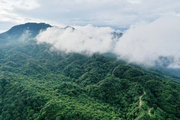
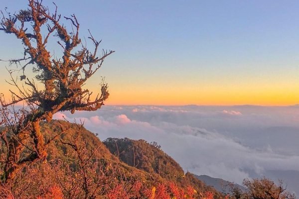
At altitude, the forest changes into what botanists call a cloud forest or moss forest, and locals just call rừng rêu. Constant fog means constant moisture, and everything grows a coat: trunks, branches, rocks, fallen logs, the ground itself. In the right conditions the whole forest is green and grey and soft, with moisture dripping steadily out of the canopy and visibility down to a few metres.
Walking into it is genuinely disorienting. Sound goes strange, the fog eats the light, and the trees are shaped by wind and cold into forms that do not look like anywhere else in Vietnam. If you have seen photographs of Ta Xua or the higher parts of Hoang Lien, it is that family of landscape, and Phia Oac has a version of it that almost nobody has photographed.
Orchids and rhododendrons grow through the upper forest, and in the right months there is flowering on the higher slopes. Ask locally about timing rather than planning a trip around it, because it moves with the year.
Practical note. Everything up there is wet, which means everything is slippery: rock, roots, moss, boardwalk if there is any. Wear real shoes with grip and accept that you will get damp regardless.
Adding a day to a Cao Bang trip? Phia Oac is not on the standard three day loop, which runs east towards Ban Gioc and the Quay Son valley. If you want it, it works as a fourth day or as a detour on the western road, and it needs to be planned in rather than improvised. Message us with your dates and we will tell you honestly whether it fits, or see what the standard Cao Bang loop covers first.
Learn more: Ha Giang Cao Bang 5 Days 4 Nights
Vietnam gets ice in very few places. Phia Oac is one of them.
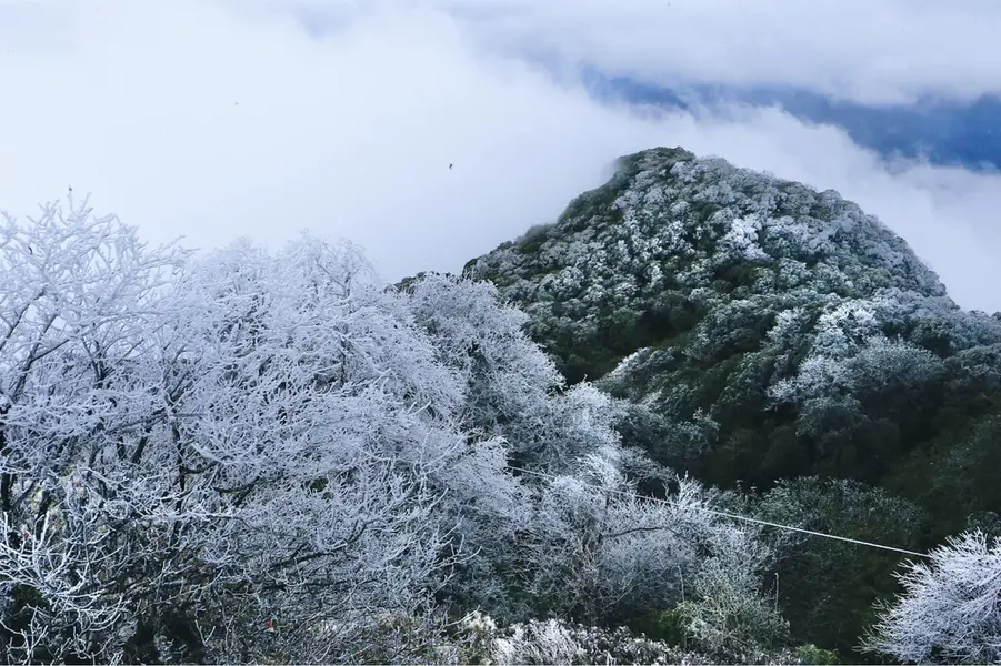
In deep winter, when a cold front pushes down from the north, temperatures on the upper mountain drop far enough that frost forms on the vegetation and, in the coldest spells, ice coats the branches and the grass. Occasionally there is snow. When it happens it makes the national news, and Vietnamese travellers drive a long way at short notice to see it, which is worth knowing if you are hoping for a quiet mountain that week.
It cannot be predicted more than a few days out. If ice is what you want, watch Vietnamese weather reporting in December and January and be prepared to move quickly. If you simply want cold and fog, winter delivers that reliably.
Take the cold seriously. People arrive from Hanoi in a light jacket and are genuinely uncomfortable within an hour of gaining altitude, and riding a motorbike in fog at low temperature is colder still. Layers, gloves, and something waterproof. This is the one place in Cao Bang where being underdressed stops being a joke.
Scattered across the upper slopes are the remains of villas built by the French in the early twentieth century, when this mountain functioned as a hill station and a mining base. What is left are stone shells: walls, fireplaces, doorways and window openings, standing in the forest with moss growing over the masonry.
They are not restored, not signposted in any comprehensive way and not fenced. Some are easy to reach from the road, others take a walk. Locals and homestay owners know where they are and will point you at the good ones.
Walking around them in fog is the most atmospheric thing on the mountain, and it is also the thing to be sensible about: these are unmaintained century old structures, so do not climb on walls and do not go inside anything that looks like it is deciding whether to stand up much longer.
Learn more: Cao Bang Loop 3 Days best kept secret
The reason the French were here at all was minerals. The granite in this mountain carries tin and tungsten, along with traces of other metals, and Tinh Tuc, the town at the edge of the park, grew up as a mining settlement.
Mining still shapes the area, and it gives the landscape a texture you do not get elsewhere in Cao Bang: working sites, spoil, old workings on hillsides, a town that exists because of what is under it rather than because of the view. It is worth an unhurried look on the way through, and it is a useful corrective to the idea that mountain Vietnam is all terraces and homestays.
Do not wander into active or abandoned workings. That is not local colour, it is a hole.
Lower down, around the Phia Den side, the land opens into farmland and this is where the human landscape is.
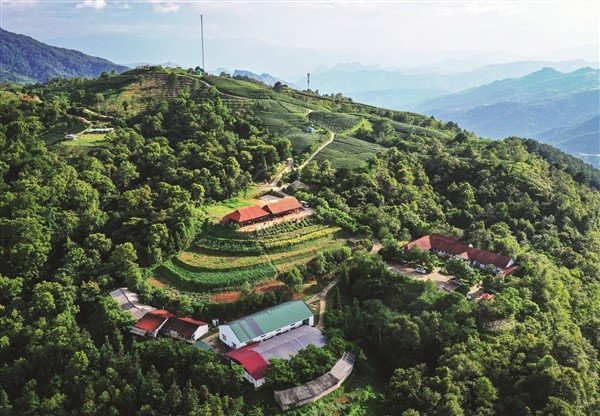
The altitude and the climate suit things that do not grow well in the rest of the province: tea on the slopes, temperate vegetables, flowers, and fruit that belongs to cooler places. There is a tea plantation operation with accommodation and a farm set up for visitors, and there are smallholdings all around it. In the right season the hillsides are green tea rows in mist, which is a completely different photograph from anything else in Cao Bang.
It is also where you are most likely to sleep, since the mountain itself has essentially nothing.
A short distance from the park, still in Nguyen Binh district, is Tran Hung Dao forest, the site where the Vietnam Propaganda Liberation Army, the direct ancestor of today’s Vietnamese army, was founded in December 1944 under Vo Nguyen Giap.
It is a national historic site and a place of real significance in Vietnam, and it takes maybe an hour. Vietnamese visitors come here in numbers on anniversaries. Foreign visitors almost never do, partly because almost nothing about it is presented in English.
Go respectfully. This is not a curiosity, it is somewhere people bring their families.

Learn more: Ha Giang Cao Bang 6 Days 5 Nights
Phia Oac sits roughly 70 to 75 km west of Cao Bang City. The route runs out on QL34 towards Nguyen Binh, then up on the provincial road towards Phia Den and the park.
| From | Route | Note |
|---|---|---|
| Cao Bang City | QL34 west to Nguyen Binh, then up towards Phia Den | The standard approach |
| Ban Gioc area | Back through Cao Bang City, then west | A long day. Better as a separate day |
| Bao Lac, coming from Ha Giang | QL34 east, Phia Oac is on the way in | The efficient version if you are riding between provinces |
That last row is the one worth thinking about. QL34 is the western road between Cao Bang and Bao Lac, and Bao Lac is the town on the connecting route to Ha Giang. If you are riding between the two provinces rather than taking a bus, Phia Oac is not a detour at all. It is on your road.
Check the route on a map on the day. Road works and diversions in this province are normal, and the smaller roads change condition season to season.
Learn more: Best time to visit Cao Bang
The main road out to Nguyen Binh is fine. The road up the mountain is where it gets interesting.
If it has been raining hard, ask locally before committing to the climb. Anyone in Nguyen Binh or at your accommodation will give you a straight answer.
Learn more: Things to do in Cao Bang
| Roughly | What you get |
|---|---|
| Dec to Feb | Cold, heavy fog, frost, occasional ice or snow. The strangest version, and the busiest with domestic visitors when ice is forecast |
| Mar to May | Cool, misty mornings, flowering on the upper slopes, comfortable riding |
| Jun to Aug | Green and wet. Heaviest rain, slippery roads, landslide risk on mountain sections |
| Sep to Nov | The best all round window. Clearer air, dry ground, cold mornings without the worst of winter |
The moss forest is at its best when there is moisture in the air, which means fog rather than sunshine. A bright clear day is better for riding and worse for the thing you came to see. That trade off is real and worth deciding on before you go.
Weather up here changes fast and forecasts for Cao Bang City tell you very little about conditions at 1,900 metres. Ask locally the night before.
Learn more: Homestay in Cao Bang
Options are limited, which is part of the character.
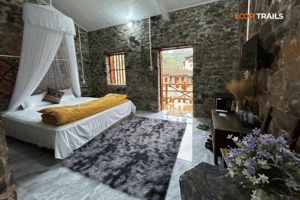
At Phia Den, at the foot of the mountain, there is accommodation attached to the tea and farm operation, plus a small number of local guesthouses and homestays in the surrounding communes.
In Nguyen Binh town, basic guesthouses, which is the practical choice if you arrive late.
In Cao Bang City, the full range, if you would rather treat Phia Oac as a long day out rather than an overnight.
Staying up there is better if you want the mountain in the early morning, which is when fog and frost are at their best. Book ahead in the winter ice season and around Vietnamese public holidays, because the small number of rooms fills fast when the weather makes the news.
Learn more: Best Adventure Activities in Vietnam
Three honest ways to use it.
As a fourth day. Ride the standard three day loop east and north, then take a fourth day west to Phia Oac and back. This is the cleanest option and it needs the extra day, not a squeezed afternoon.
As a stop on the road between provinces. If you are riding from Cao Bang towards Bao Lac and on into Ha Giang, Phia Oac is on the western road rather than off it. This is the version that costs you the least time.
As a standalone trip from Cao Bang City. Doable, but you will spend most of it moving, and you will probably arrive in the middle of the day when the fog has lifted and the mountain looks ordinary.
What does not work is trying to add it to a three day loop without adding a day. Something has to give, and what usually gives is Phong Nam or the craft villages, both of which are better uses of an afternoon for a first visit.
Our standard three day Cao Bang loop covers the eastern half of the province, and the Ha Giang and Cao Bang combined route crosses between the two provinces on the western road. If you want Phia Oac added to either, it is a conversation rather than a checkbox, so tell us early.
Learn more: Ha Giang Loop Easy Rider
Self drive works if you already ride and you are comfortable with a long climb, a long descent and fog. Take a semi automatic or manual rather than a fully automatic scooter, because engine braking matters on this mountain more than anywhere else on the Cao Bang loop. You need your passport, a valid motorbike licence from home and an International Driving Permit issued under the 1968 Vienna Convention. The 1949 style permit is not recognised in Vietnam. Rules change, so check the current position, and the paperwork guide covers what you need. If you want a bike without a tour, we handle motorbike rental in Ha Giang.
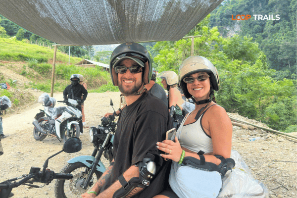
Easy rider is a good call here specifically because of the weather. Riding a cold, foggy mountain road while trying to navigate is not much fun. Riding pillion while somebody who knows the road does that part is a great deal more fun, and you can actually look at the forest.
A jeep is the obvious answer in winter. You stay dry, you stay warm, the descent is not a concern, and the moss forest is exactly as good through a window that opens. For families and for anyone who does not ride, this is the version that makes Phia Oac realistic rather than theoretical.
Book once your dates are set. Most guests book one to three months ahead and jeep availability is tighter than motorbikes.
Learn more: Ha Giang Cao Bang Packing List
Do not treat it as a quick detour. It is a mountain, in the opposite direction from everything else, in weather that slows you down.
Do not chase ice. If it is forecast, go, but do not build a trip around a phenomenon that lasts a few days and cannot be predicted a month out.
Do not underdress. The single most common mistake here, and the one that ruins the day.
Do not go inside the ruins. Look at them, photograph them, stay out of them.
Do not wander into mine workings, active or abandoned.
Do not expect infrastructure. No cafe at the top, no ranger explaining things in English, no marked loop trail with distances. That absence is the appeal and it is also the reason to plan properly.
Do ask locally about conditions before riding up after heavy rain. It is a thirty second question with a real answer.
Want it in your itinerary? Message us on WhatsApp with your dates, your group and how many days you have. Phia Oac is a genuine addition rather than a standard inclusion, so we will tell you straight whether it fits your trip or whether you are better off spending that day in the Quay Son valley.
It is in Nguyen Binh district, roughly 70 to 75 km west of Cao Bang City, reached on QL34 and then the provincial road towards Phia Den. That is the opposite direction from Ban Gioc, which is why almost no foreign visitors reach it.
Cloud forest with moss growing over every surface, winter frost and occasional ice, ruined French villas from the early twentieth century, and a mining history in tin and tungsten. It is also the coldest place most travellers will find in Cao Bang.
It was granted national park status in January 2018, upgraded from an existing nature reserve, making it the first national park in Cao Bang province. It sits inside the Non Nuoc Cao Bang UNESCO Global Geopark.
The Phia Oac summit is around 1,930 metres, which makes it one of the highest points in Cao Bang and is often described as the western roof of the province. Phia Den, the second peak the park is named after, is around 1,390 metres.
Frost is common on the upper mountain during winter cold spells, ice forms in the coldest periods and snow happens occasionally. It cannot be predicted far ahead, and when it is forecast Vietnamese visitors travel a long way at short notice, so accommodation fills quickly.
September to November is the best all round window for clear air and dry roads. December to February gives the coldest, foggiest and strangest version of the forest, which is what most people actually want to see. Summer is green, wet and the least comfortable for riding.
If you have a spare day, warm clothes and an interest in landscapes that look nothing like the rest of Vietnam, yes. If you have only three days in Cao Bang, spend them on Ban Gioc, the Quay Son valley and the craft villages first, and save Phia Oac for a return trip or a longer itinerary.
Yes, and the road up is a sustained climb with switchbacks, variable surfaces and frequent fog. Take a semi automatic or manual bike rather than a fully automatic scooter, because engine braking matters on the descent. Ask locally about conditions after heavy rain before committing.
Arrangements for access and any fees are set locally and can change, so ask at your accommodation or in Nguyen Binh rather than budgeting from an article. Bring cash in small notes either way, since card payment is not realistic in this district.
There is accommodation at Phia Den attached to the tea and farm operation, along with a small number of local guesthouses and homestays nearby, plus basic guesthouses in Nguyen Binh town. Staying up there is worth it if you want the mountain early, when the fog is at its best.
Best as a fourth day, since the standard three day loop runs east towards Ban Gioc and the Quay Son. It also fits naturally if you are riding west towards Bao Lac and on to Ha Giang, because it sits on that road rather than off it.
Warmer layers than you expect in any month, plus waterproofs, gloves and shoes with grip. The mountain is far colder than Cao Bang City, fog makes everything wet even without rain, and riding in cold fog is colder again.
Contact information for Loop Trails
Website: Loop Trails Official Website
Email: looptrailshostel@gmail.com
Hotline & WhatSapp:
+84862379288
+84938988593
Social Media:
Facebook: Loop Trails Tours Ha Giang
Instagram: Loop Trails Tours Ha Giang
TikTok: Loop Trails
Office Address: 54A Tran Phu, Ha Giang 2, Tuyen Quang
Address: 54A Tran Phu, Ha Giang 2, Tuyen Quang
Facebook X Reddit Table of Contents Two of the best landscapes in northern Vietnam sit about a province apart, and most people

Facebook X Reddit Table of Contents Short answer: mostly no, and it depends entirely on what you mean by two days. That
Facebook X Reddit Table of Contents Twelve days is the length at which northern Vietnam stops being a highlights tour and starts