
Thúy Kiều is a travel blogger and content contributor for Loop Trails Tours Ha Giang. She holds a bachelor’s degree in Sustainable Tourism from Vietnam National University, Hanoi, and has a strong passion for exploring and promoting responsible travel experiences in Vietnam’s northern highlands.
Most people arrive in Cao Bang with two things on their list: Ban Gioc Waterfall and Nguom Ngao Cave. Both are worth it. Both are also where everyone else goes.
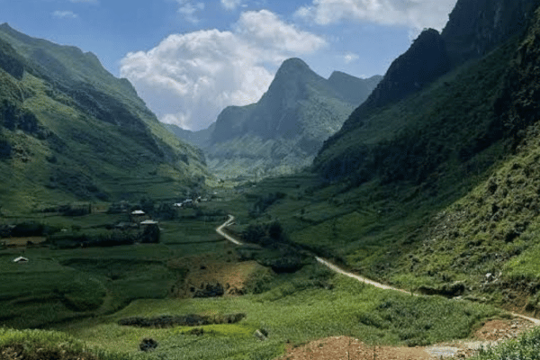
Xuan Truong Valley sits at the other end of the province, a couple of hours of mountain road west of the main tourist trail, and it has almost none of that traffic. What it does have is one of the most photographed staircases of road in Vietnam, a valley floor of rice and corn ringed by limestone, and villages where a foreign face is still worth a second look.
This guide covers what’s actually there, how to reach it, when to go, and how to slot it into a Ha Giang and Cao Bang trip without wrecking your schedule.
Learn more: Ha Giang Loop Tours
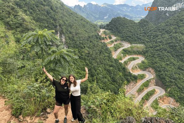
Xuan Truong is a commune of small villages roughly 20 kilometres from Bao Lac town, in the western part of Cao Bang province. The road in climbs the Khau Coc Cha pass, also known locally as Me Pia, a 2.5 kilometre concrete ribbon stacked into 14 hairpin bends up the mountainside.
You come here for the pass, the valley views, the Lo Lo and Tay villages, and the fact that you can stand at a viewpoint with nobody else on it. You do not come here for restaurants, nightlife or a long list of attractions. If that trade sounds good, keep reading.
Learn more: Ha Giang Loop 2D1N
Bao Lac is the anchor town. It sits on QL34, the road that links Cao Bang City with the western side of the province and continues toward Ha Giang. Published distances put Bao Lac roughly 130 kilometres from Cao Bang City along QL34, and around 70 kilometres from Meo Vac on the Ha Giang side. Mountain roads being what they are, treat those numbers as distance, not time. Check current road conditions before you set out, especially in the rainy months.
From Bao Lac, Xuan Truong is a short run west and up. That’s the whole geography: one small town, one pass, one valley.
Three reasons. First, it’s not on the fastest route between anywhere and anywhere. Travelers heading from Ha Giang to Ban Gioc usually push straight through Bao Lac without turning off. Second, there’s very little tourist infrastructure, so it rarely appears in package itineraries. Third, most people simply don’t know it exists.
That’s changing slowly, mainly because of photographs of the pass. Go now rather than later if the emptiness is part of the appeal.
Learn more: Ha Giang Loop 3 Days 2 Nights
In the Tay language “Khau” means pass, and Coc Cha refers to a tree that grows at the top. Locals also call it Me Pia, and you’ll see both names on maps and signs.
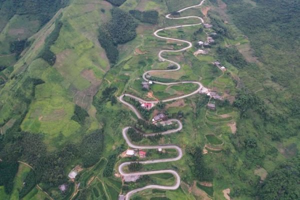
It was a narrow footpath until the road was widened and concreted around 2011. Today it’s about 2.5 kilometres of road with 14 hairpin bends, sometimes described as 15 storeys because of the way the levels stack above each other. The gradient is serious in places, and the bends are tight enough that you’re turning almost back on yourself.
Riding up, you barely see the shape of it. That’s the trick of Khau Coc Cha: from the saddle it’s just another steep climb. The famous view only exists from above.
To see the pass properly you walk. There’s a trail leading up through the trees from near the top, and from the viewpoint the whole stack of bends unfolds below you with Xuan Truong Valley spread out behind.
It isn’t a long walk, but it’s uphill on rough ground, and it’s slippery after rain. Wear shoes with grip, not flip flops. Give yourself time to sit up there rather than snapping a photo and running back down: the light shifts, cloud moves through the valley, and the view keeps changing.
This is the single best viewpoint in the area, and on our Ha Giang and Cao Bang route it’s a scheduled stop rather than a maybe.
A few honest notes for riders:
Planning a Cao Bang trip around places like this? Our Ha Giang and Cao Bang combine tour crosses this exact corner of the province, with the Khau Coc Cha hike built into the day rather than treated as an optional extra. Not sure it fits your dates? Message us on WhatsApp and we’ll tell you straight.
Learn more: Ha Giang Loop 4 Days 3 Nights
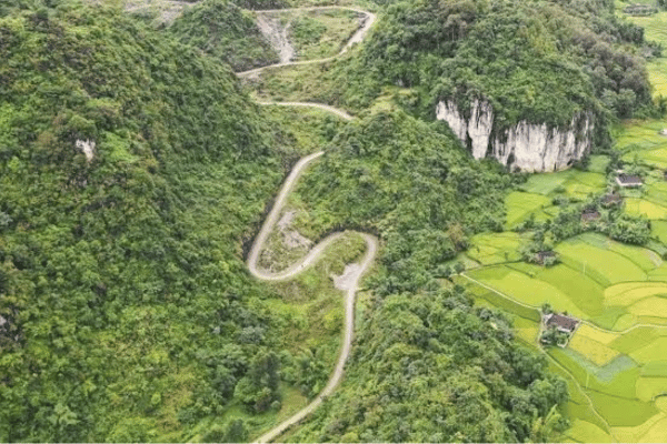
Not far from Khau Coc Cha, toward Ha Quang, sits Na Tenh pass. The name translates roughly as “high field” in Tay, and it’s the opposite experience: around 20 long, open bends winding down through terraced fields and corn, with none of the vertical drama of Khau Coc Cha.
If Khau Coc Cha is the one you photograph, Na Tenh is the one you enjoy riding. Together they make a good pairing for a day, and both appear on our Ha Giang and Cao Bang route between Bao Lac and the Pac Bo area.
Learn more: Ha Giang Cao Bang 5 Days 4 Nights
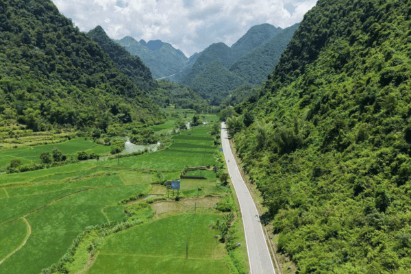
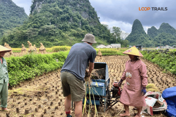
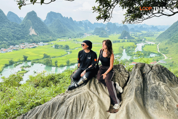
Xuan Truong is farming country. The valley floor is a patchwork of rice and corn depending on the season, cut by streams, with wooden and earth houses scattered along the edges and limestone ridges closing it in on both sides.
The sound is what strikes most visitors. Water, chickens, a distant motorbike, someone calling across a field. Compared to the Ha Giang Loop in high season, it’s silent.
Best light is early and late. Mid morning mist burning off the valley floor is the classic shot, and if you’re staying nearby, get up for it.
Late autumn is when this area gets its brief burst of attention. Buckwheat flowers bloom across parts of the northern highlands then, and the Bao Lac area has become known for its buckwheat fields and associated festival events.
Flowering depends on planting and weather, and festival dates move from year to year, so check locally before planning a trip around them. Plenty of travelers arrive expecting fields of pink and find harvested stubble instead.
Outside that window the valley still has colour: green rice through summer, gold at harvest, and in winter a dry, pale landscape with mist in the mornings.
Learn more: Ha Giang Cao Bang 6 Days 5 Nights
The wider Bao Lac area is home to Tay, Nung, H’Mong, Dao, San Chi and Lo Lo communities. The Lo Lo are one of the smallest ethnic groups in Vietnam, and the Black Lo Lo village of Khuoi Khon is the best known community near Xuan Truong.
Traditional houses, stilt construction, hand embroidered clothing worn by older women on market days and at festivals: it’s a genuinely different culture from the H’Mong villages you meet on the Ha Giang Loop. Some families here host guests, which is by far the best way to experience the place.
Bao Lac’s market runs on a rotating cycle rather than every day, traditionally every five days on the lunar calendar. On market mornings the town fills with people from the surrounding hills, buying, selling, eating and catching up.
Market days are the best single reason to time a stop here. Ask your guide or homestay host for the next one, since the cycle shifts against the western calendar.
Xuan Truong sees few foreign visitors, which makes how you behave here more important, not less.
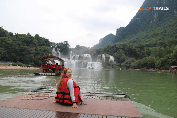
Learn more: Ban Gioc Waterfall
Two hours, passing through: ride the pass, walk up to the viewpoint, take your photos, look over the valley, carry on. This is what most tours do, and it’s better than skipping it.
Half a day: add a slow loop through the valley on smaller roads, a stop in a village, and lunch in Bao Lac. Time it for a market morning if you can.
One night: stay in a homestay near Bao Lac or in the valley, catch the evening and the early mist, and ride out the next morning. If you like photography or you’re tired of moving every day, this is the version worth building a trip around.

Learn more: Ha Giang Loop by Wrangler Rubicon Jeep
Here’s the thing most people miss: Xuan Truong isn’t really a detour. If you’re travelling overland from the Ha Giang Loop to Ban Gioc, you pass through Bao Lac anyway. Adding the pass and the valley costs you a couple of hours, not a day.
That makes it one of the best value stops in the northeast. The road does most of the work for you.
On our Ha Giang and Cao Bang 5 day tour, the third day runs from Meo Vac through the passes to Bao Lac for lunch, then up Khau Coc Cha for the hike and the viewpoint, into Xuan Truong Valley, over Na Tenh pass, and on to the Pac Bo area for the night before the Ban Gioc day that follows.
We built the day that way deliberately. You arrive at the pass in the afternoon, which is when the light on those bends is at its best, and you finish in a quiet area rather than a town.
If you’re based in Cao Bang City and only have the Cao Bang side, Xuan Truong is a long way west along QL34. It’s doable as a full day out, better as an overnight, and it’s the kind of distance where a guide or a jeep makes more sense than a rental scooter and a phone map.
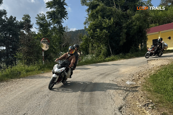
Learn more: Ha Giang Loop Easy Rider
QL34 between Cao Bang and Bao Lac is a mountain road: winding, mostly paved, with rough patches and occasional roadworks. The pass itself is concrete and in reasonable condition, but it’s steep and narrow.
Rain changes everything here. In the wet season, landslides and washed out sections are a real possibility across the northeast. Ask locally the morning you ride, and don’t plan a tight schedule.
Fill up in Bao Lac. Fuel stations thin out fast once you leave the main road, and small village sellers with bottles aren’t guaranteed.
Bring cash in Vietnamese dong. Homestays, markets and small restaurants here are cash businesses, and ATMs are a Bao Lac thing, not a valley thing.
Phone signal exists in patches and drops out in the folds of the valley. Download offline maps before you go.
Options are limited and that’s part of the charm: homestays in and around Xuan Truong and Khuoi Khon, and guesthouses in Bao Lac town. Standards are simple. Expect shared bathrooms, firm beds and thin walls, plus the best dinner conversation of your trip.
Book ahead in buckwheat season and around festivals, when the small number of rooms fills quickly.
Local, simple and good: rice, grilled and braised pork, river fish, bamboo shoots, forest vegetables, sticky rice, corn wine at dinner if the household is in the mood. Vegetarians can eat well here, but say so early in the day so someone can shop for you.
Learn more: Best time to visit Cao Bang
| Season | What it’s like | Worth knowing |
|---|---|---|
| September to November | Clear skies, harvest gold, buckwheat in late autumn | Best overall window, and the busiest, which here still means quiet |
| December to February | Cold, misty mornings, pale landscape | Pack proper layers, mountain cold is real |
| March to May | Green, mild, fewer visitors | Good riding weather, occasional haze |
| June to August | Lush and dramatic, heavy rain | Landslide season, build slack into the plan |
Weather in the northern mountains changes fast. Check forecasts and local road updates a couple of days before you travel, and again the morning you ride.

Learn more: Cao Bang Travel Guide
Learn more: Ha Giang Loop Self-Drive
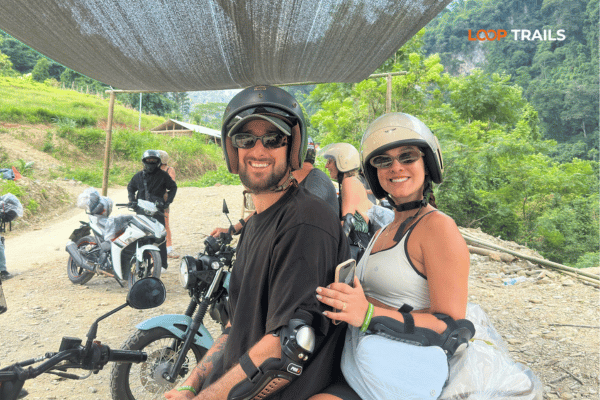
You ride on the back with an experienced local driver. On roads like Khau Coc Cha that means you can actually look at the valley instead of the next bend, and you don’t need a motorcycle licence. For most travelers doing Ha Giang and Cao Bang overland, this is the easiest way to see this area well.
You ride your own bike, following a guide. It suits riders who are genuinely comfortable on steep hairpins and rough surfaces.
Paperwork matters: you need your passport, your home motorcycle licence and an International Driving Permit issued under the 1968 convention. IDPs issued under the 1949 convention are not valid in Vietnam. Riding without the correct documents can mean fines, reported in the range of 2,000,000 to 6,000,000 VND, and it can invalidate your travel insurance. Riders from some ASEAN countries, including Singapore and Malaysia, have their national licences recognised here under a regional agreement. Rules change, so confirm the current requirements for your own licence before you travel.
You travel in a Jeep Wrangler Rubicon with a driver, on the same route and with the same stops. For families, older travelers, non riders and anyone visiting in the rainy season, this is the comfortable way to reach a place like Xuan Truong. Jeep availability is limited, so most jeep guests book one to three months ahead.
Jeep prices are the total for your group in one vehicle. Motorbike prices are per person. All tours include dorm accommodation and everything in the itinerary. Private room upgrades and bus tickets to and from the start or end point are extra.
| Tour | Jeep, 1 guest | Jeep, 2 guests | Jeep, 3 guests | Jeep, 4 guests | Easy Rider (per person) | Self Drive (per person) |
|---|---|---|---|---|---|---|
| Ha Giang and Cao Bang 5D4N | 27,990,000 VND | 36,990,000 VND | 41,990,000 VND | 46,990,000 VND | 10,990,000 VND | 10,590,000 VND |
| Ha Giang and Cao Bang 6D5N | 36,990,000 VND | 44,990,000 VND | 49,990,000 VND | 54,990,000 VND | 13,990,000 VND | 13,490,000 VND |
| Cao Bang Loop 3D2N | 14,990,000 VND | 19,990,000 VND | 24,990,000 VND | 31,990,000 VND | 6,490,000 VND | 5,990,000 VND |
| Ha Giang Loop 3D2N | 15,990,000 VND | 19,990,000 VND | 23,990,000 VND | 25,990,000 VND | 4,490,000 VND | 3,790,000 VND |
| Ha Giang Loop 4D3N | 19,990,000 VND | 25,990,000 VND | 30,990,000 VND | 34,990,000 VND | 5,890,000 VND | 4,990,000 VND |
Prices are in Vietnamese dong, so convert at the rate on the day rather than trusting a figure in a blog post. Jeep tours use a Jeep Wrangler Rubicon, except the Cao Bang Loop, which runs in an army style jeep.
Want Xuan Truong in your itinerary? The simplest way is our Ha Giang and Cao Bang 5 day tour, which crosses this area on day three. Travelling with family or anyone who doesn’t ride? Look at the jeep version. Riding your own bike from Ha Giang? See motorbike rental in Ha Giang, or send us your dates on WhatsApp and we’ll sort out the route with you.
Learn more: Ha Giang Cao Bang Packing list
We run tours that cross Xuan Truong Valley and Khau Coc Cha as part of the Ha Giang and Cao Bang route, by jeep, Easy Rider or self drive. We don’t run a standalone Xuan Truong day trip, and we’re not going to pretend the valley is a full itinerary on its own.
If what you want is one night in a Lo Lo homestay and two days of wandering the valley with nothing scheduled, say so when you message us. That’s a private arrangement rather than a set tour, and we’d rather tell you that up front than sell you the wrong thing. [OPERATOR TO CONFIRM: whether a private extension with an overnight around Bao Lac or Xuan Truong can be arranged, and roughly what it costs. Replace or delete this note before publishing.]
Learn more: Ha Giang Motorbike Rental
Xuan Truong Valley won’t be the biggest thing you see in northern Vietnam. Ma Pi Leng is more dramatic, Ban Gioc is more impressive, Nho Que is more photogenic from a boat.
What Xuan Truong has is space. A viewpoint with nobody on it, a valley that’s still farming country first and scenery second, and villages where tourism hasn’t yet rewritten the routine. For a lot of travelers that turns out to be the part of the trip they talk about afterwards.
If your route from Ha Giang to Ban Gioc passes through Bao Lac, and it probably will, give this corner the extra two hours. Better still, give it a night.
It’s in the western part of Cao Bang province, roughly 20 kilometres from Bao Lac town. The road in climbs the Khau Coc Cha pass.
A steep concrete road about 2.5 kilometres long with 14 hairpin bends, also known as Me Pia. It links Bao Lac with the Xuan Truong area and is best viewed from a trail above the road.
If you like quiet places, mountain roads and villages with little tourism, yes. If you want restaurants, nightlife and a long list of attractions, no.
Overland via Meo Vac and Bao Lac. Published distances put Meo Vac to Bao Lac at roughly 70 kilometres of mountain road. Most travelers pass through on a Ha Giang and Cao Bang tour.
Yes, along QL34, but it’s a long way west. It works better as an overnight than as a day trip, and better with a guide than solo.
Usually in late autumn, though timing shifts with planting and weather, and festival dates change each year. Check locally before planning a trip around the bloom.
It’s steep with tight blind hairpins, and slippery when wet. Experienced riders handle it fine. If you’re not confident on steep bends, choose an Easy Rider or jeep tour.
Homestays in the valley and around Khuoi Khon, plus guesthouses in Bao Lac town. Facilities are simple, and rooms are limited in peak season.
No. Withdraw cash in Cao Bang City or Ha Giang and top up in Bao Lac. The valley runs on cash.
Tay, Nung, H’Mong, Dao, San Chi and Lo Lo communities live in and around Bao Lac. Khuoi Khon is the best known Black Lo Lo village near Xuan Truong.
Yes. Our Ha Giang and Cao Bang 5 day route crosses Khau Coc Cha and the valley on day three, including the hike to the viewpoint.
Only if you’re riding yourself. Self drive requires your home motorcycle licence plus an IDP under the 1968 convention. Easy Rider and jeep guests have no licence requirement.
Contact information for Loop Trails
Website: Loop Trails Official Website
Email: looptrailshostel@gmail.com
Hotline & WhatSapp:
+84862379288
+84938988593
Social Media:
Facebook: Loop Trails Tours Ha Giang
Instagram: Loop Trails Tours Ha Giang
TikTok: Loop Trails
Office Address: 54A Tran Phu, Ha Giang 2, Tuyen Quang
Address: 54A Tran Phu, Ha Giang 2, Tuyen Quang

Facebook X Reddit Table of Contents Learn more: Ha Giang Loop Tours The Ha Giang Loop has a reputation problem with older

Facebook X Reddit Table of Contents The passes get the photos. The homestay nights get the stories. Ask anyone who’s done the