
Mu Cang Chai and Ha Giang: The Rice Terrace Trip
Facebook X Reddit Table of Contents Two of the best landscapes in northern Vietnam sit about a province apart, and most people

Thúy Kiều (Grace) is a travel blogger and content contributor for Loop Trails Tours Ha Giang. She holds a bachelor’s degree in Sustainable Tourism from Vietnam National University, Hanoi, and has a strong passion for exploring and promoting responsible travel experiences in Vietnam’s northern highlands.
Learn more: Ha Giang Loop Tours
Most travellers heading to Vietnam’s far north point straight at Ha Giang and never look east. That is a mistake, and a lucky one if you make the opposite choice, because Cao Bang is quieter, greener, and just as wild. At its heart sits the Non Nuoc Cao Bang Geopark, a UNESCO protected landscape of thundering border waterfalls, cathedral sized caves, and rock that has been sitting here for over 500 million years.
This is the complete guide: what the geopark actually is, the sites worth your time, when to come, how to get there, what it costs, and how to see it without rushing. We run trips through this corner of the country, so we will be honest about the practical stuff and point you the right way when it helps.
Learn more: Ha Giang Loop 2 Days 1 Night
Non Nuoc Cao Bang became a UNESCO Global Geopark in 2018, only the second in Vietnam after the Dong Van Karst Plateau over in Ha Giang, which earned the title back in 2010. If you have ridden or are planning to ride the Ha Giang Loop, think of Cao Bang as its geological cousin to the east: same ancient limestone story, different mood.
The numbers give you a sense of the scale. The geopark covers more than 3,000 square kilometres, close to half of Cao Bang province, which makes it the largest of Vietnam’s UNESCO geoparks. Inside it are over 130 geological heritage sites of international value, more than 200 caves, five major river systems, and dozens of lakes. Eight ethnic groups live across this landscape, among them the Tay, Nung, H’Mong and Dao, and their villages, markets and crafts are as much a part of the geopark as the rock.
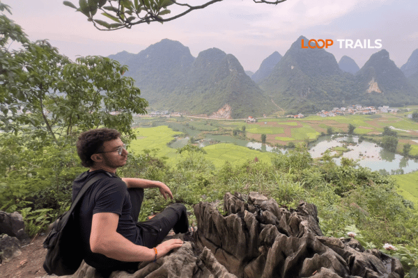
What makes the geology special is not just its age but the way it reads like a book. The limestone here records a full cycle of tropical karst, from the towers and cones you see poking out of the rice fields to the caves, sinkholes and underground rivers hidden below them. Add in fossils, ancient marine sediments and old volcanic rock, and you get a landscape that quietly tells the story of an ocean that came and went hundreds of millions of years ago. You do not need a geology degree to feel it. Standing under a limestone tower that predates the dinosaurs does the job on its own.
One map note. In the 2025 provincial reshuffle that merged Ha Giang into Tuyen Quang, Cao Bang stayed exactly as it was, its own province with its own name. So while the map around it changed, Cao Bang did not, and neither did the geopark.
Quick clarification, because people mix these up. A national park protects a defined patch of wilderness. A UNESCO Global Geopark is bigger and broader: it protects a whole living landscape where the geology, the ecology, the history and the people who live there are treated as one connected story. In practice, that means Cao Bang is not a fenced attraction you drive into. It is a region you travel through, with villages, working farms and towns woven right into the protected zone. That is a big part of the charm.
Learn more: Cao Bang Loop 3 Days best kept secret
To help visitors make sense of such a large area, the province organised the geopark into four themed heritage routes, each stitching together a set of geosites, viewpoints and cultural stops. Route names and details do get updated, so check the latest local information, but here is the shape of them and what each is really about.
If you only have time for one route, this is it. The eastern route, sometimes called experiencing the indigenous culture in a land of fairytales, is the classic Cao Bang circuit and holds the headline sights: Ban Gioc waterfall, the Nguom Ngao cave, and the Thang Hen lake complex around Tra Linh. This is where most first time visitors spend their days, and for good reason
The northern route leans into history, both ancient and modern. Its centrepiece is Pac Bo, the cave and stream where Ho Chi Minh returned to Vietnam in 1941, set among some of the oldest inhabited land in the country. It is a quieter, more reflective loop, heavy on heritage and light on crowds.
Head west and the landscape climbs and cools. This route centres on Phia Oac and Phia Den, a misty highland of cloud forest, old French colonial villas slowly returning to the jungle, and, on the coldest winter nights, the occasional dusting of frost. It is the route for anyone who likes their scenery moody and their air thin.
The southern route runs through the border districts and ties into the region’s wartime history. It sees the fewest travellers of the four, which is exactly why some people seek it out.
Most guests, whether they ride, sit behind a driver or travel by jeep, end up doing the east plus a slice of the north, since that combination packs in the waterfalls, the caves and the history. If you would rather someone else handle the logistics on roads you do not know, our [Cao Bang loop tours] are built around exactly this routing.
Learn more: Ha Giang Cao Bang 5 Days 4 Nights
Here are the places worth planning your days around.
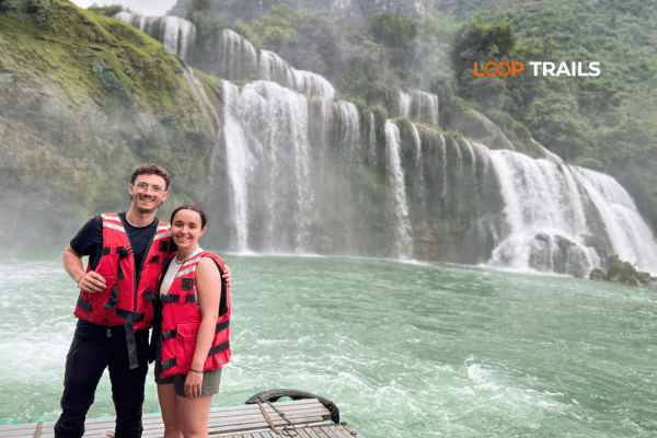
This is the one on the postcard, and it earns it. Ban Gioc sits right on the border with China, roughly 30 metres tall and about 300 metres wide, spilling over stepped limestone into a wide jade river. It is one of the largest waterfalls in Vietnam and among the biggest sitting on any national border anywhere.
You view it from the Vietnamese side, and for a small extra fee you can take a bamboo raft out toward the base for the close up, spray in the face version. Climb the hill to the Phat Tich Truc Lam Ban Gioc pagoda above the falls for the wide angle that most people miss. The waterfall is at its most powerful after the rainy season, roughly September into October, when the volume is high and the whole thing roars.
A couple of practical notes. Morning light tends to be kinder for photos, and arriving early also means beating the tour buses that roll in around midday. Give yourself a couple of hours here rather than a quick photo stop, since the site is bigger than it looks and the raft and pagoda are worth the extra time. This is a working border, so keep your documents handy and stick to the marked visitor areas.
Learn more: Ha Giang Cao Bang Ba Be Lake 6 Days 5 Nights
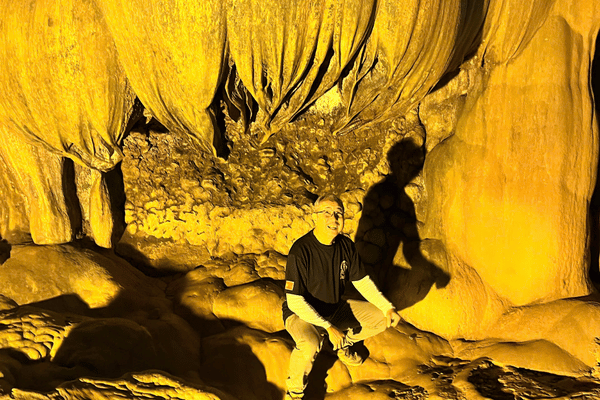
A short hop from Ban Gioc, Nguom Ngao is a huge, atmospheric cave system with the usual cast of stalactites and stalagmites lit up along a walkable path, plus a few genuinely enormous chambers. It pairs naturally with the waterfall as a half day, and the cool air inside is a welcome break on a hot afternoon.
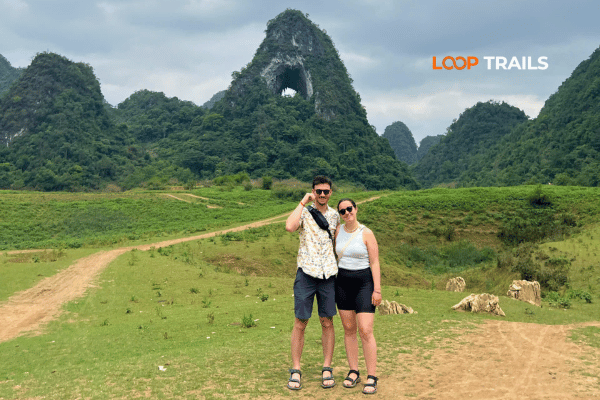
Over near Tra Linh, the Thang Hen lake complex is a cluster of small mountain lakes that rise and fall with the seasons, ringed by karst peaks. Nearby is Mat Than, the eye of the mountain, a natural hole punched clean through a limestone ridge that frames the sky like a giant stone eye. It photographs beautifully and sees far fewer people than Ban Gioc.
Learn more: Pac Bo Historical Site
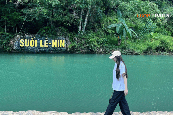
On the northern route, Pac Bo is where modern Vietnamese history and ancient landscape meet. The clear blue Lenin stream, the limestone cave, and the peaks Ho Chi Minh named for Marx and Lenin make it a place people come to for the story as much as the scenery. Even if the history is not your main draw, the setting is lovely and calm.
Up on the western route, this cool highland region is all cloud, pine and quiet. In the right season you get seas of mist rolling over the ridges, the crumbling romance of the old French villas, and temperatures low enough to want a jacket. It is the geopark’s antidote to the humid lowlands.
The geopark is a lived in place, and the human side is a highlight in its own right. You will pass Tay and Nung stilt house villages, catch rotating local markets if you time it right, and can visit traditional crafts like the Nung An handmade paper making near Phia Thap, where tree bark becomes paper by methods handed down for generations. Homestays across the region are the best way to eat well and understand what you are actually looking at.
The food deserves its own mention. Cao Bang has a regional take on banh cuon, steamed rice rolls served in a warm bone broth rather than dipped in sauce, which is exactly the breakfast you want on a cold morning. In autumn, look out for the Trung Khanh chestnuts, a local speciality people travel for, roasted warm from roadside stalls. Add hearty highland dishes, smoky grilled meats and whatever the homestay cook puts in front of you, and eating well here is easy and cheap.
Learn more: Ha Giang Loop 3 Days 2 Nights
Cao Bang has a highland climate with a clear wet and dry split, and the best time depends a little on what you are chasing.
Autumn, roughly September to November, is the sweet spot for most people: clearer skies, comfortable temperatures, golden rice around the karst, and Ban Gioc at full strength just after the rains. Spring, around March to May, is green, mild and pretty. Summer, roughly June to August, is the wet season, so expect lush scenery, heavier rain, and the fullest, most dramatic waterfalls, along with the odd slippery road. Winter, December to February, is dry but genuinely cold up here, especially around Phia Oac, so pack warm layers.
| Season | Months | What to expect |
|---|---|---|
| Spring | Mar to May | Green, mild, fewer crowds |
| Summer | Jun to Aug | Wet, lush, powerful waterfalls, some slippery roads |
| Autumn | Sep to Nov | Clear skies, rice harvest, Ban Gioc at its fullest |
| Winter | Dec to Feb | Dry but cold, misty highlands, frost possible on the heights |
Seasons drift from year to year, so check local conditions close to your dates rather than banking on the calendar.
Learn more: Hanoi to Cao Bang
Cao Bang town is the natural base, and everything above radiates out from there.
From Hanoi, it is roughly 280 to 300 kilometres by road, generally around 6 to 8 hours depending on traffic and conditions. Sleeper buses and limousine vans run this route, and they are the usual choice for independent travellers. There is no passenger train and no local commercial airport, so the road is how you arrive.
From Ha Giang, it is roughly 240 kilometres and often around 7 hours over winding mountain roads, which is why so many travellers link the two into one trip rather than backtracking to Hanoi in between. If that appeals, our [Ha Giang and Cao Bang combined tours] connect the Loop and the geopark into a single seamless route.
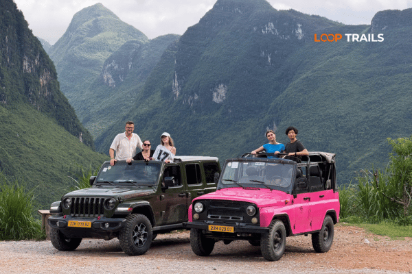
Once you are in Cao Bang, the sites are spread out, so you need wheels. Options are a motorbike, a jeep, or a car with a driver, and which one suits you is the next big decision. If you want to ride your own, take a look at [motorbike rental in Ha Giang] to sort a bike before you head east.

Learn more: Ha Giang Loop Price
Cao Bang is affordable, and because it sees fewer tourists than the big names, your money often goes further. Everything below is a rough 2026 estimate in US dollars to help you plan. Prices change, so confirm the current figures when you book.
| Trip style | Length | Ballpark per person |
|---|---|---|
| Backpacker, Cao Bang only | 3 days | roughly 120 to 220 dollars |
| Mid range, guided Cao Bang loop | 3 days | roughly a few hundred dollars |
| Ha Giang plus Cao Bang combined | 5 to 6 days | budget for a full week of northern travel |
ATMs are in Cao Bang town but thin once you head out to the sites, so carry cash for entrance fees, rafts, homestays and small restaurants. Card acceptance is patchy outside the town. Keep small notes handy for markets and roadside stops.
Learn more: Ha Giang Motorbike Rental
Cao Bang’s roads are quieter and, in many spots, gentler than the wildest passes of the Ha Giang Loop, but this is still real mountain country with weather that turns. Pick the travel style that matches your experience and who you are travelling with.
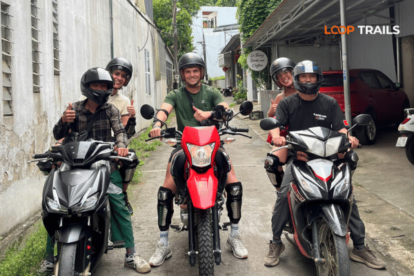
You ride your own bike and go where you like. It is the most flexible and the most rewarding way to link the scattered geosites, and Cao Bang’s lighter traffic makes it a touch more forgiving than the busiest parts of the Loop. It still suits confident, experienced riders only. Mountain roads plus rain plus unfamiliar terrain is not a place to learn.
You sit behind an experienced local driver and simply look around. You get the open air riding feeling and the freedom to stop for photos without steering through hairpins yourself. This is the easy, low stress way to enjoy the ride if you do not want to drive.
You travel in comfort with a roof over your head when the weather turns, which matters in the wet season and in the cold western highlands. This is the natural pick for couples, families, older travellers, groups, and anyone who wants to see the geopark without exposure or effort. You reach the same waterfalls, caves and viewpoints, just from a comfortable seat.

Learn more: Ha Giang Loop by Wrangler Rubicon Jeep
Not sure which fits? Tell us who is coming and how you like to travel and we will point you at the right format. You can weigh up the options on our [Cao Bang loop tours] page, or grab a bike through [motorbike rental in Ha Giang] if you would rather ride solo.
Learn more: Ha Giang Loop Mistake to Avoid
A few honest pointers to keep your trip smooth, framed as general caution rather than worry.
None of this is meant to scare you off. A little preparation removes almost all of it, and Cao Bang rewards the effort.
Learn more: Things to do in Cao Bang
Rough shapes to build from, not rigid schedules.
Day one, travel up from Hanoi and settle in. Day two, hit the eastern route: Nguom Ngao cave in the morning, Ban Gioc waterfall and the pagoda viewpoint after lunch, then back to town. Tight, but it captures the headliners.
Day one, arrive and relax. Day two, the eastern route: Ban Gioc, Nguom Ngao and the Thang Hen lakes with the Angel Eye mountain. Day three, the northern route to Pac Bo and the quieter heritage sites before heading back. This is the sweet spot for a first visit.
The trip serious northern travellers dream about: ride or roll the Ha Giang Loop, cross east through the mountains, and finish in the Cao Bang geopark, linking Vietnam’s two UNESCO geoparks into one journey without doubling back. Five to six days is a sensible window. Our [Ha Giang and Cao Bang combined tours] are designed around this exact route so you do not have to plan the hard part.
Ready to see it for yourself? Browse our [Cao Bang loop tours] and [Ha Giang and Cao Bang combined tours], sort a bike with [motorbike rental in Ha Giang], or just [message us on WhatsApp] with your dates and we will help you shape the trip. Straight answers, every time.
Learn more: Phia Thap Insense Village
Very much so, especially if you like your travel a little off the main trail. Cao Bang delivers Ban Gioc waterfall, huge caves, mountain lakes and rich local culture with a fraction of the crowds you get at the better known spots. For travellers who want the northern mountains without the busiest scenes, it is hard to beat.
It is a UNESCO Global Geopark, recognised in 2018, known for over 500 million years of geological heritage, more than 130 geosites and 200 caves. The star attractions are Ban Gioc waterfall, Nguom Ngao cave, the Thang Hen lakes, and the historic Pac Bo site, all wrapped in the culture of eight ethnic groups.
For the fullest, most powerful flow, aim for just after the rainy season, roughly September into October. Autumn overall brings clear skies and comfortable weather. The waterfall runs year round, but it is at its quietest in the dry late winter and spring months. Conditions vary, so check close to your dates.
Two days covers the main sights in a rush. Three days is the comfortable sweet spot, letting you do both the waterfall and cave circuit and the historic northern route without exhausting yourself. If you are combining with Ha Giang, plan for five to six days total.
By road, since there is no train or local airport. It is roughly 280 to 300 kilometres and around 6 to 8 hours by sleeper bus or limousine van, depending on traffic and conditions. Many travellers arrive overnight or early and start exploring the same day.
Yes, and it is one of the best trips in the north. The two are roughly 240 kilometres apart, around 7 hours over mountain roads, and linking them lets you connect Vietnam’s two UNESCO geoparks without backtracking to Hanoi. Combined tours are built for exactly this.
Ban Gioc sits on the border, and border area rules and any permit requirements can change. Keep your passport with you and check the current requirements locally or with your operator rather than assuming, so there are no surprises on the day.
It is excellent riding, often quieter and a little gentler than the busiest parts of the Ha Giang Loop, but it is still real mountain terrain. It is done safely by plenty of riders every year. If you are not confident and experienced, take an easy rider, jeep or car instead.
Ha Giang is the more dramatic, better known motorbike loop. Cao Bang is quieter, greener, and built around waterfalls, caves and history. Neither is better, they are different moods, and the ideal answer for many people is to do both on one combined route.
Absolutely. Travel by jeep, by car with a driver, or behind an easy rider and you reach the same waterfalls, caves and viewpoints with zero riding required. Plenty of guests who have never ridden a motorbike explore the geopark this way.
Independent travellers often manage on roughly 25 to 40 dollars a day at the budget end, more with private rooms and guiding. A guided multi day loop typically lands in the low to mid hundreds of dollars per person. Check the current tour page for exact pricing.
Yes. Ban Gioc is a transnational border waterfall, with Vietnam on one side and China on the other. You visit and raft it from the Vietnamese side, and the shared setting is part of what makes it so striking.
Contact information for Loop Trails
Website: Loop Trails Official Website
Email: looptrailshostel@gmail.com
Hotline & WhatSapp:
+84862379288
+84938988593
Social Media:
Facebook: Loop Trails Tours Ha Giang
Instagram: Loop Trails Tours Ha Giang
TikTok: Loop Trails
Office Address: 54A Tran Phu, Ha Giang 2, Tuyen Quang
Address: 54A Tran Phu, Ha Giang 2, Tuyen Quang
Facebook X Reddit Table of Contents Two of the best landscapes in northern Vietnam sit about a province apart, and most people

Facebook X Reddit Table of Contents Short answer: mostly no, and it depends entirely on what you mean by two days. That
Facebook X Reddit Table of Contents Twelve days is the length at which northern Vietnam stops being a highlights tour and starts