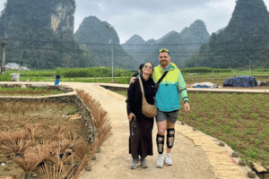
Picture of  triệu thúy kiều

triệu thúy kiều

Thúy Kiều (Grace) is a travel blogger and content contributor for Loop Trails Tours Ha Giang. She holds a bachelor’s degree in Sustainable Tourism from Vietnam National University, Hanoi, and has a strong passion for exploring and promoting responsible travel experiences in Vietnam’s northern highlands.

Vietnam Off the Beaten Path: 12 Regions Most Travellers Skip

Facebook
X
Reddit

Table of Contents

ha giang loop for a group with looptrails Vietnam Off the Beaten Path

Most people see the same Vietnam. Hanoi, Ha Long, Hoi An, maybe Sapa, then a flight south to Ho Chi Minh City and a day trip into the Mekong. It is a good route. It is also the route that roughly everyone takes, which means you spend a fortnight looking at Vietnam through a fairly narrow window.

The country is long and mostly mountainous, and the parts that get skipped are not skipped because they are worse. They are skipped because they are awkward. No airport, no train, a bus that leaves at an unhelpful hour, and nobody on your feed has posted about them yet.

This is a list of twelve of those regions, built from riding and driving around the north for years and from travelling the rest of the country the slow way. For each one you get what it is actually for, why people miss it, roughly when to go and how much effort it takes to reach.

One thing up front: we run trips in two of these twelve. The other ten we have no commercial interest in whatsoever. They are on the list because they are good.

What off the beaten path actually means here

ha giang loop with looptrails in quan ba twin mountain

It does not mean undiscovered. Every place on this list has people living in it who have been there a very long time, and most of them see Vietnamese travellers even when they see almost no foreign ones. Ta Xua is packed with Hanoi weekenders in cloud season. An Giang has a domestic pilgrimage circuit that dwarfs anything foreign tourism does there.

What it means is off the international route. Fewer English menus, fewer people trying to sell you a boat trip, and a much higher chance that you are the only foreigner in the room.

That comes with obligations. You are a guest somewhere that is not set up to absorb bad behaviour. Ask before photographing people, learn five words of Vietnamese, pay the asking price without grinding somebody down over the equivalent of a coffee, and do not treat a village as a backdrop. The reason these places are pleasant to visit is that nobody has ruined them yet.

A note on names and maps

ha giang loop for a group with easy riders vietnam adventure travel cost

Vietnam reorganised its provincial map in 2025, cutting the number of provinces and centrally run cities from sixty three to thirty four and removing the district level of administration. Several of the regions in this list now sit inside larger provinces with different official names.

Nothing has moved. The mountains, the lakes and the villages are exactly where they were, and locals still use the old regional names in conversation, as does most travel writing including this article. But if a booking form, a bus ticket or an official map shows a province name you do not recognise, that is why. Check current maps when you plan, and do not be surprised if signage is inconsistent for a while.

The twelve at a glance

tourists of looptrails in ma pi leng pass


RegionWhat it is forRoughly whenEffort to reach
Cao BangWaterfall, caves, river valleys, craft villagesSep to Nov, Mar to MayModerate
The quiet half of Ha GiangRice terraces, remote passes, marketsSep for harvestModerate
Ba Be and Bac KanLake, boats, stilt house homestaysMar to May, Sep to NovEasy
Bac Son and Lang SonValley viewpoints, border marketsJul and Oct for gold riceEasy
Sin Ho and Lai ChauHigh plateau markets, big treksOct to AprCommitted
Ta Xua and Son LaCloud seas, ridge walks, tea hillsOct to AprModerate
Pu Luong, Thanh HoaTerraces, water wheels, slow daysMay to Jun, Sep to OctEasy
Western Quang BinhCaves, jungle road, river villagesFeb to AugModerate
Quang TriWar history, tunnels, empty beachesFeb to AugEasy
Kon Tum and Mang DenHighland villages, pine forest, cool airNov to AprModerate
Quy Nhon and Phu YenCoast, Cham towers, seafoodFeb to AugEasy
An GiangFlooded forest, mountains, Cham and Khmer cultureSep to Nov floodsModerate

Seasons here are general patterns rather than promises. Vietnamese weather varies enormously by region and year, so check a forecast close to your dates.

Cao Bang

god's eyes mountain in cao bang

The northeastern corner, up against the Chinese border, and the most complete province on this list. In three days you can see a waterfall spread across an international border, walk through a cave system with a kilometre of lit walkway, follow a jade green river through rice fields into a valley ringed by karst, watch families forge knives by hand, and stand under a limestone ridge with a hole punched clean through it.

Why it gets skipped. No airport, no train, and it sits in the shadow of Ha Giang. Most travellers with limited time pick one northern loop and Ha Giang has better marketing.

What you actually do. Ban Gioc waterfall and the bamboo rafts that run out to the base of it. Nguom Ngao Cave. The Quay Son river upstream through Trung Khanh into Phong Nam valley, with swim stops. The craft villages around Quang Uyen where the blacksmiths and incense makers are still working. God’s Eye Mountain out on the grassland at Tra Linh. The whole province is part of a UNESCO Global Geopark, which tells you something about the rock.

Roughly when. Late September through November is the best all round window: dry ground, gold rice, clear water. June to September brings the most water over the falls and the wettest roads.

Getting there. Night buses and limousine vans from Hanoi, around seven hours. Or ride in from Ha Giang through Bao Lac, which is far better than any bus.

This is one of the two on this list we actually run. The full breakdown sits in our three day guides: Day 1 from Cao Bang City to Ban Gioc, Day 2 through Nguom Ngao and Phong Nam, and Day 3 to the craft villages and God’s Eye Mountain.

The quiet half of Ha Giang

ma pi leng pass on sunny days

Ha Giang has stopped being off the beaten path and there is no honest way to claim otherwise. The main loop through Quan Ba, Dong Van and Meo Vac now carries thousands of riders in high season, and Ma Pi Leng in October is not a quiet road.

But the loop is one route through a big province, and the western and southern halves are barely touched.

Why it gets skipped. Everyone rides the same circuit because that is the circuit the hostels sell, and it takes three days, which is exactly how long most people have.

What you actually do. Hoang Su Phi, in the west, has some of the most dramatic rice terraces in Vietnam, stacked up mountainsides above villages of Dao, Nung and La Chi people. Xin Man, further west again, is quieter still and has proper markets where trade is the point rather than the performance. Du Gia in the south is technically on the four day loop and gets missed entirely on the two and three day versions, which is a shame because it has a waterfall you can swim in and the best homestay evenings in the province. Bac Me, on the road in from Hanoi, gets passed at speed by everybody.

Roughly when. September for the terraces at Hoang Su Phi, when the rice turns gold. Harvest timing moves each year, so ask before you commit to a date.

Getting there. Night bus from Hanoi to Ha Giang City, then ride. Hoang Su Phi and Xin Man need their own days rather than being bolted onto a standard loop.

Thinking about the north? The quiet half of Ha Giang is exactly the sort of thing a longer itinerary buys you. Our Ha Giang Loop tours run as two, three and four day trips, and the four day version is the one that includes Du Gia and the swimming. If you want both provinces, the Ha Giang and Cao Bang route covers the connecting road most people never see.

Ba Be and the Bac Kan lakes

A large natural freshwater lake sitting in limestone mountains, with forest coming right down to the water and Tay villages of wooden stilt houses along the shore.

Why it gets skipped. It is a few hours off the main road north and it is not on the way to anywhere. People heading for Ha Giang or Cao Bang drive straight past the turn.

What you actually do. Take a boat out on the lake for a few hours, which is the whole point. Puong Cave, where the river runs through a limestone tunnel with bats in the roof. Dau Dang waterfall at the far end. Then stay in a stilt house homestay at one of the lakeside villages, eat with the family and do very little. There is kayaking, and there are walks into the forest if you want them.

Roughly when. Spring and autumn. Summer is hot and brings the heaviest rain, though the forest is at its best.

Getting there. Buses from Hanoi to the Bac Kan area, then local transport in, or ride. It combines naturally with Cao Bang if you are heading that way and gives you an easy first night out of the city.

Bac Son valley and Lang Son

Bac Son valley at sunrise in the Lang Son UNESCO Global Geopark

A flat valley floor of rice fields divided into a patchwork by irrigation channels, ringed by limestone peaks, viewed from a hilltop above it. When the rice turns, it is one of the best views in northern Vietnam and there are usually more Vietnamese photographers up there than foreign visitors in the whole valley.

Why it gets skipped. Lang Son is a border trade province and most foreigners only pass through it on the way to China. Nobody markets it as a destination.

What you actually do. Climb the staircase up Na Lay peak for the valley view, ideally at sunrise. It is a genuinely stiff climb and worth every step. Then ride the valley floor and the surrounding villages. Lang Son city has caves inside the hills, an old market and a border town atmosphere that is worth an afternoon. Mau Son, the mountain above the city, occasionally gets frost in deep winter, which Vietnamese travellers drive a long way to see.

Roughly when. The valley has two rice crops, so there are two windows of gold, broadly around July and again around October or November. Timing shifts, so check locally.

Getting there. Straightforward buses from Hanoi. This is one of the easiest entries on this list and one of the least visited by foreigners, which is a strange combination.

Sin Ho and the Lai Chau highlands

The far northwest, past Sapa and over the top. Lai Chau is the province almost nobody adds to a trip, and Sin Ho is a small town on a high plateau with one of the best markets in the country.

Why it gets skipped. It is a long way from anything, the roads are demanding, and Sapa absorbs almost all the attention in this corner of Vietnam.

What you actually do. The Sin Ho weekend market, where Dao, H’Mong and Lu communities come in to trade and the clothing alone is worth the trip. Herbal baths, a Dao tradition, which after a cold day on a bike is close to a religious experience. Serious trekking: this region has several of Vietnam’s highest peaks and the multi day walks are the real draw for people who want them. And the O Quy Ho pass, which you cross coming over from Sapa, is one of the great roads in the country.

Roughly when. October to April for clear air and market season. Summer brings heavy rain and landslides are a genuine consideration on these roads.

Getting there. Committed. Bus to Sapa or Lai Chau, then ride. This is the entry on the list that asks the most of you, and it rewards riders more than anyone else.

Ta Xua and the Son La ridges

ta xua in son la, viet nam

A narrow ridge in the mountains of Son La where, in the right months, you wake above a sea of cloud that fills the valleys below you and burns off by mid morning.

Why it gets skipped. It is famous in Vietnam and almost unknown outside it. Foreign travellers heading northwest go to Sapa or Mai Chau instead.

What you actually do. Get up before dawn for the cloud. Walk the ridge that everyone photographs, a thin spine of rock with drops either side. Drink the local tea, which comes from very old trees on these slopes. Then continue to the Moc Chau plateau for tea hills, dairy farms and, around the turn of the year, hillsides of plum and apricot blossom.

Roughly when. Cloud season runs broadly from October to April, best on cold clear mornings after rain. Blossom around January and February. Cloud is weather, so nobody can promise it.

Getting there. Buses from Hanoi towards Son La, then local transport up. Riding it is better: the roads through this region are quiet and consistently good fun.

Pu Luong and western Thanh Hoa

Terraced fields, bamboo water wheels turning on the irrigation channels, and valleys where the standard activity is walking between villages and then not doing very much.

Why it gets skipped. It no longer is, entirely, and we should be honest about that. Pu Luong has a growing resort scene and weekend traffic from Hanoi. It has kept its shape better than most places that happen to, and go five kilometres from the main cluster of accommodation and it is still quiet.

What you actually do. Walk. The trekking between villages is the reason to come, through terraces and forest, with Thai and Muong communities living in stilt houses along the way. Hieu village has a waterfall you can swim in. Kho Muong sits in a hidden valley with a cave at the end of it. Bamboo rafting on the river when the water is right.

Roughly when. May and June for green terraces and full water wheels, September and October for the harvest.

Getting there. Easy. It is one of the closest places on this list to Hanoi, which is exactly why it is filling up. Go now rather than in five years

Western Quang Binh, past Phong Nha

Trekking into the entrance of Hang En cave in Phong Nha Ke Bang National Park caving in vietnam

Phong Nha itself is well established. The caves brought the crowds and the town has a backpacker street. What almost nobody does is go west from it.

Why it gets skipped. People come for one or two caves, spend two nights and get on a bus to Hue.

What you actually do. The western branch of the Ho Chi Minh Road runs south through the national park, and it is one of the emptiest and most beautiful roads in Vietnam: limestone, jungle, almost no traffic and villages that see very few visitors. Ride or drive it. The Tu Lan cave system near Tan Hoa is wet caving with swimming through river passages, run as guided trips. Tan Hoa village itself has become known for a floating house model that lets it survive the annual floods, and it picked up international recognition for community tourism a couple of years back. Son Doong, the enormous one, is permit limited, booked far ahead and expensive enough that if you have to ask, it is not this trip.

Roughly when. Roughly February to August. Autumn brings serious flooding to this region and cave trips shut down.

Getting there. Train or bus to Dong Hoi, then transfer inland. Straightforward. It is the going west afterwards that nobody does.

Quang Tri: the DMZ, Khe Sanh and an empty coast

The narrowest part of Vietnam, and for most travellers a stretch of highway between Phong Nha and Hue with a bus window in front of it.

Why it gets skipped. It has a reputation as a war history stop rather than a destination, and history stops get done as a day trip from Hue.

What you actually do. The Vinh Moc tunnels, where an entire village lived underground for years, are more affecting than the better known tunnels near Ho Chi Minh City and you will often have them nearly to yourself. The Hien Luong bridge over the Ben Hai river, which marked the division of the country. Khe Sanh, up in the hills near the Laos border, with the road out there being the best part. The Truong Son national cemetery, which is a quiet and serious place. And a long, almost empty coastline with beaches nobody photographs.

Treat all of it with the seriousness it deserves. People come here to visit relatives, not landmarks.

Roughly when. Spring through summer. Autumn is the wet season on this coast and it is severe.

Getting there. Easy. Trains and buses stop at Dong Ha. Almost nobody gets off.

Kon Tum and Mang Den

Volcanic lava cave in the Dak Nong UNESCO Global Geopark, Vietnam

The northern end of the Central Highlands, which is the region of Vietnam that international travellers skip most comprehensively of all.

Why it gets skipped. Everyone goes coastal. The highlands have no beach, no world heritage site and very little marketing.

What you actually do. Kon Tum town has a wooden cathedral built by French missionaries and Bahnar villages on the edge of town with communal rong houses, tall thatched buildings with steep pointed roofs that are the centre of village life. Kon K’tu, on the river, is the easy one to visit. Then head to Mang Den, a small town up in pine forest at altitude, which is cool, quiet and completely unlike the rest of the country: lakes, waterfalls, pine, mist. Vietnamese travellers have found it. Foreign ones have not.

Roughly when. The dry months, broadly November to April. The highlands get properly wet in the middle of the year.

Getting there. Fly to Pleiku and drive, or come up from the coast at Quy Nhon on a good mountain road.

Quy Nhon and Phu Yen

A stretch of the south central coast between the two places everyone stops, Hoi An and Nha Trang, with better beaches than either and a fraction of the people.

Why it gets skipped. It is a bus ride between two famous towns and most itineraries do not have a spare two days in the middle.

What you actually do. Swim. The coastline around Quy Nhon has small bays, headlands and a coast road worth riding for its own sake. Cham towers stand around the area, brick temple structures from a civilisation most visitors to Vietnam never learn about, and they are usually empty. South in Phu Yen, the basalt columns at Ganh Da Dia are a natural rock formation of interlocking hexagons pushing out into the sea, and there is a lighthouse on a headland that people drive out to for sunrise. Seafood is the best value on the whole coast.

Roughly when. Roughly February to August for the calmest sea. Autumn brings storms to this coast.

Getting there. Trains and flights both serve the area. Genuinely easy.

An Giang and the western Mekong

The Mekong Delta as most travellers see it is a day trip from Ho Chi Minh City with a coconut candy workshop attached. An Giang, up against the Cambodian border, is a different country.

Why it gets skipped. The delta is treated as a day trip rather than a region, and An Giang is a long way west of where the day trips go.

What you actually do. Tra Su, a flooded melaleuca forest you cross by boat through a green surface of duckweed, best in the flood months. Actual mountains, which the delta is not supposed to have, at Cam Mountain and Sam Mountain, with pagodas and long views over rice fields into Cambodia. Ta Pa, where a flooded quarry sits above patchwork fields. Cham Muslim villages along the river with mosques and hand weaving, and Khmer communities with their own pagodas further south. Chau Doc has floating houses and a working river market that exists for trade rather than for tourists.

Roughly when. The flood season, roughly September to November, is when the delta is at its most alive and Tra Su is at its best.

Getting there. Buses from Ho Chi Minh City to Chau Doc, then local transport. Moderate effort, mostly because of distance.

Which of these we actually run

cao bang loop with looptrails in ba quang

We are in the north, we ride these two provinces constantly, and we know which lane leads to the good swimming spot and which homestay does the better dinner. Everywhere else on this list we have travelled as visitors, which is why the entries above tell you what to do and how to get there rather than pointing you at a booking button.

If your trip is heading north, here is what we run:

TripEasy rider, per personSelf drive, per personJeep, whole vehicle for 2 guests
Ha Giang Loop, 2 days3,490,000 VNDnot offered on the 2 day15,990,000 VND
Ha Giang Loop, 3 days4,490,000 VND3,790,000 VND19,990,000 VND
Ha Giang Loop, 4 days5,890,000 VND4,990,000 VND25,990,000 VND
Cao Bang Loop, 3 days6,490,000 VND5,990,000 VND19,990,000 VND
Ha Giang and Cao Bang, 5 days10,990,000 VND10,590,000 VND36,990,000 VND

Jeep prices are for the whole vehicle rather than per seat, shown here for two guests. Rates for one, three and four guests differ, so check the tour page. Everything includes dormitory style accommodation and all tour inclusions, and excludes private room upgrades and the bus tickets to and from the start and end points. These figures were current when this page went up.

Which option is best for you: self drive, easy rider or jeep

cao bang loop by jeep Cao Bang Loop Day 3

Self drive if you ride at home and want the freedom to stop wherever you like. You need your passport, a valid motorbike licence from your country and an International Driving Permit issued under the 1968 Vienna Convention. The 1949 style permit is not recognised in Vietnam, which catches out a lot of well prepared travellers, and riding without correct documents can result in a fine. Rules change, so verify the current position before you travel. Our motorbike rental in Ha Giang covers riders who want a bike without a tour.

Easy rider if you want to be on a bike without being responsible for one. You ride pillion behind an experienced local rider and spend the day looking at the country instead of the road surface. No licence needed. It is the most popular thing we run and by some distance the one guests are happiest with.

Jeep if you are a couple or a family, if somebody in the group does not ride, if you are travelling with children or older parents, or if it is the wet season. Nothing on either route needs two wheels. You get shelter, luggage space and the ability to talk to each other, which matters more over five days than people expect. We use Wrangler jeeps on the Ha Giang routes and an army jeep on the Cao Bang loop, and because the price covers the vehicle rather than the seat, a group of four is where it makes the most sense.

Once your dates are set, book early. Most guests book one to three months ahead and jeep availability is tighter than motorbikes.

Practical notes for going off the standard route

explore nguom ngao cave in cao bang

Learn more: Caving in Vietnam

Accommodation. Homestays rather than hotels in most of these regions. Book ahead in autumn and around Vietnamese public holidays, when domestic travel fills everything. Outside those periods you can often turn up.

Cash. ATMs are in towns, not villages. Carry more than you think you need, in small notes. Card payment and app transfers are widespread in cities and patchy everywhere else.

Language. English drops off fast outside tourist areas. A translation app that works offline is worth setting up before you go, and a handful of Vietnamese words gets you a long way, mostly because people appreciate the attempt.

Border areas. Several regions on this list sit against the Chinese, Lao or Cambodian border. Carry your passport, stay on marked roads near the boundary and ask locally before approaching border markers. Access rules are set locally and can change without notice.

Riding. Fog on the passes in winter, gravel on corners after rain, livestock everywhere and trucks on the national roads. Finish every day before dark. That one habit removes most of the risk on any of these routes.

Weather. The country is long enough that the north and south have opposite seasons. Autumn floods the central coast while it is the best month in Cao Bang. Plan around the region, not around Vietnam as a whole.

How to build a trip out of two or three of these

tourists of looptrails in thai an waterfall Vietnam for Adrenaline Seekers

Trying to see all twelve would be a bad trip. Pick a corner.

Two weeks in the north: Ha Giang Loop, then across to Cao Bang on the Bao Lac road, then down to Ba Be for two slow nights and back to Hanoi. Mountains, water, villages, no repeats.

Ten days in the northwest: Ta Xua and the Moc Chau plateau, up through Son La and Dien Bien, over to Lai Chau and Sin Ho, back through Sapa. Demanding riding and the emptiest roads in the country.

A week in the centre: Phong Nha, then west on the Ho Chi Minh Road, down through Quang Tri and out to Khe Sanh, finishing at the coast. Caves, jungle road and history in one line.

A week in the south: Quy Nhon and Phu Yen for the coast, then up into Kon Tum and Mang Den for the highlands. Two completely different climates a few hours apart.

Deciding where to start? Message us on WhatsApp with your dates and what kind of trip you are after. If it is the north, we will tell you exactly what fits. If it is anywhere else on this list, we will still tell you what we know, and then point you at somebody who actually operates there.

faq

It means off the international tourist route rather than undiscovered. Most places on this list see plenty of Vietnamese travellers and almost no foreign ones, so you get fewer English menus and a much better chance of being the only visitor in the village.

Cao Bang, if you want one answer. It has a border waterfall, major caves, a jade green river valley, working craft villages and a mountain with a hole through it, all within three days, and it sees a fraction of the visitors Ha Giang does.

The main loop is not. It carries thousands of riders in high season and Ma Pi Leng in October is busy. The western and southern parts of the province, including Hoang Su Phi, Xin Man and Du Gia, are still genuinely quiet.

Broadly yes, and the main risks are practical rather than personal: road conditions, weather, distance from medical care and riding after dark. Carry your passport near borders, tell someone your plan and finish each riding day before nightfall.

Not usually, but a guide changes what you get out of a place where nobody speaks English, particularly in craft villages and at markets. For the harder riding regions, the value is as much about support if something goes wrong as it is about translation.

Roughly September to November for gold rice, dry roads and clear air, and March to May for green fields and warm weather. June to August is the wet season with the most dramatic waterfalls and the slipperiest roads. Winter is cold and often foggy on the passes.

Yes, with your passport, a valid motorbike licence from home and an International Driving Permit issued under the 1968 Vienna Convention. The 1949 style permit is not valid in Vietnam. Check your travel insurance wording too, because many policies exclude motorbike accidents unless you were correctly licensed.

Vietnam reorganised its provincial map in 2025, reducing the number of provinces and centrally run cities from sixty three to thirty four and removing the district level. The places have not moved, but official names may differ from the regional names used by locals and in travel writing.

Two or three, comfortably, if they are in the same corner of the country. Vietnam is long, internal travel eats days and the classic mistake is treating a list like this as a checklist rather than a menu.

Ba Be, Bac Son and Pu Luong are all straightforward, with buses from Hanoi and no complicated connections. Any of them works as a first trip off the standard route.

No. We operate in Ha Giang and Cao Bang only. The other ten are recommendations rather than products, which is why those sections tell you how to get there yourself.

Layers for mountain mornings, rain gear regardless of season, closed shoes for walking, cash in small notes, a power bank and an offline map. If you are riding, add gloves and a helmet you trust.

Contact information for Loop Trails
Website: Loop Trails Official Website

Email: looptrailshostel@gmail.com

Hotline & WhatSapp:
+84862379288
+84938988593

Social Media:
Facebook: Loop Trails Tours Ha Giang
Instagram: Loop Trails Tours Ha Giang
TikTok: Loop Trails

Office Address: 54A Tran Phu, Ha Giang 2, Tuyen Quang
Address: 54A Tran Phu, Ha Giang 2, Tuyen Quang

More to explorer