
Ha Giang Loop with Toddlers & Very Young Children: Family Jeep Guide
Facebook X Reddit Table of Contents Learn more: Ha Giang Loop Tours Most people picture the Ha Giang Loop as a motorbike

Thúy Kiều (Grace) is a travel blogger and content contributor for Loop Trails Tours Ha Giang. She holds a bachelor’s degree in Sustainable Tourism from Vietnam National University, Hanoi, and has a strong passion for exploring and promoting responsible travel experiences in Vietnam’s northern highlands.

Learn more: Ha Giang Loop Tours
There’s a version of the Ha Giang Loop that gets done in three days — bleary-eyed, saddle-sore, phone full of blurry photos, and a nagging feeling that you missed something important. Then there’s the version where you actually live the thing.
One week on the Ha Giang Loop is that second version.
This guide is for travelers who want to do it properly: stay an extra night in Dong Van, wake up early for the light on Ma Pi Leng Pass, sit in a homestay drinking corn wine with a family who doesn’t speak your language but somehow communicates plenty. Seven days gives you that breathing room — and in a place this remote and this beautiful, breathing room is the whole point.
Whether you’re a nervous first-timer trying to figure out the logistics, or you’ve done Vietnam before and want something genuinely off-script, here’s how to spend a week on the Ha Giang Loop without rushing a single kilometer.
")
Learn more: Ha Giang Loop 2 Days 1 Night
Most people who come to Ha Giang have one eye on their flight out of Hanoi. They ride hard, sleep fast, post the mandatory Ma Pi Leng shot, and leave. That’s fine — the loop at any pace is more memorable than most trips you’ll take. But there’s a ceiling to what you can actually absorb when you’re covering 120 kilometers a day and your knees are screaming.
The 3-day loop is essentially: Ha Giang → Dong Van → Meo Vac → back. You hit the big passes and the highlight towns, but Du Gia barely gets a mention, Lung Cu gets a rushed hour, and you probably skip every single village stop, roadside market, and terraced rice field view that would have cost you nothing but time.
A 7-day itinerary doesn’t mean seven days of intense riding. Quite the opposite. You’re averaging 60–90 kilometers on driving days, with two full exploration days built in — one in Dong Van, one in Meo Vac or Du Gia. You stop when something looks interesting. You eat breakfast properly instead of grabbing bánh mì from a moving handlebar.
The Ha Giang province sits on the Dong Van Karst Plateau UNESCO Global Geopark — one of only a handful of geoparks in Southeast Asia. The landscape is genuinely other-worldly: jagged limestone karsts erupting from the earth like broken teeth, deep river gorges, ethnic minority villages clinging to hillsides. A week here means you actually see it instead of driving through it.

Learn more: Ha Giang Loop 3 Days 2 Nights
Let’s be direct: the Ha Giang Loop is not easy. The roads are mountain roads — narrow, sometimes unpaved on side detours, often with sheer drops that don’t have guardrails. The main loop route (Quang Ba → Yen Minh → Dong Van → Meo Vac → Du Gia) has improved significantly in recent years, but conditions change with weather and season. The hairpin climbs are relentless on some sections, and even experienced riders find certain passes demanding.
If you haven’t ridden a motorbike in a while, or you’ve never ridden one in mountainous terrain, be honest with yourself about that. Renting a bike and learning the loop is not the same as renting a bike at the beach.
Honest note: Road conditions, construction, and accessibility can change — always check with your guesthouse or tour operator for current updates before setting out each morning.
Foreign nationals riding motorbikes in Vietnam enter a complicated area of local regulation. Requirements around international driving licenses, bike registration papers, and checkpoints on the Ha Giang Loop have changed over the years and will likely continue to evolve.
This is not the place to guess or rely on outdated forum posts. Before you rent or book, confirm current requirements with your rental provider or tour operator directly. Checkpoints exist on this route. Having the wrong paperwork — or no paperwork — can derail a trip fast.
If riding yourself sounds like too much hassle, there are very good reasons to go with an Easy Rider guide or a jeep tour — and that’s not a cop-out.
The Ha Giang Loop has two distinct personalities depending on when you go:
The window matters more on a 7-day trip than a 3-day sprint, because you’re investing real time.

Learn more: Ha Giang Loop 4 Days 3 Nights
Before we get into the day-by-day, you need to decide how you’re doing this — because that affects everything from daily distances to accommodation logistics.
")
Learn more: Ha Giang Loop Easy Rider
You ride pillion on the back of a local guide’s motorbike. Your guide drives, navigates, speaks Vietnamese (essential at checkpoints and small eateries), and usually knows the area well enough to take you to places that don’t appear on Google Maps. This is the most stress-free version of the loop.
For slow travel specifically, a good Easy Rider guide is invaluable — they know which villages have good homestays, when the roadside markets happen, and which sections are best ridden in the morning light.
Best for: First-timers, non-riders, solo travelers who want local context, anyone who wants to relax and look at the scenery.

Learn more: Ha Giang Loop Self-Drive & hire a motorbike
You rent a bike in Ha Giang city and ride the loop yourself. More freedom, more responsibility. You set your own pace, stop wherever you want, and nobody’s waiting on you.
The catch: navigation, logistics, and mechanical issues are yours to sort. Ha Giang has improved its signage over the years, but mountain roads don’t always behave. If you’re a confident rider with experience on mixed terrain, this is deeply satisfying. If you’re not — genuinely, honestly — consider the Easy Rider option first.
[→ See our motorbike rental options in Ha Giang for available bikes and daily rates.]
Best for: Experienced riders, couples who want total freedom, travelers who’ve done similar mountain routes before.

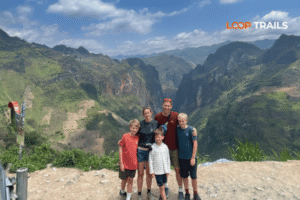
Learn more: Ha Giang Loop by Jeep for Families & Groups
A 4WD jeep with a driver and optional guide. You get the scenery without the riding, more luggage capacity, and a more comfortable seat. Jeep tours can cover the same route and stop at the same spots — they just do it from inside a vehicle.
This isn’t the “soft option” it might sound like. On foggy days or wet roads, a jeep is often the smarter choice. And if you’re traveling with older family members or people with physical limitations, it’s the only option that makes sense.
Best for: Non-riders, groups with mixed fitness/experience levels, bad weather contingency, anyone who just wants the views without the gear.

Learn more: Ha Giang Cao Bang Ba Be Lake 6 Days 5 Nights
This itinerary assumes you arrive in Ha Giang city at the start of Day 1. Most travelers come from Hanoi — either by overnight bus (roughly 6–7 hours) or by booking a limousine van transfer.
Driving: None.
Your first day isn’t a driving day — it’s a logistics and acclimatization day, and that’s intentional.
Ha Giang city is a gateway, not a destination. It’s a pleasant Vietnamese provincial town with a river running through it and a few decent spots to eat, but you’re not here for the city. Use this day to:
If you’re renting a motorbike, pick it up this afternoon and take it for a short test ride around town. Better to discover problems on flat urban roads than on a mountain pass at kilometer 30 of the next day.
A decent bowl of pho and an early night will serve you better than any “Day 1 highlights” content you’ll find online.
Approximate distance: 45–55 km Riding time: 2–3 hours (slow pace with stops)
This first day eases you in gently — and that’s a feature, not a bug. The road from Ha Giang city to Tam Son passes through the Tay ethnic minority villages of the lower valley before the landscape starts climbing toward the karst plateau.
The Quan Ba district is where the geology starts getting serious. Stop at the Quan Ba Heaven Gate — a viewpoint at a mountain pass overlooking the twin “Fairy Bosom” hills, which are exactly what they sound like, and yes, everyone stops for the same photo. The view across the valley below is genuinely arresting, especially in morning light.
Tam Son is your overnight base. It’s a small town but has a weekly Sunday market (Dong Van Karst Plateau markets rotate through the week — worth timing your route around one). There are comfortable homestays and guesthouses here. Have dinner, explore on foot, rest up.
Don’t miss: The sunset light on the limestone hills from the road between Ha Giang and Quan Ba — keep your camera accessible.
Approximate distance: 40–50 km Riding time: 2 hours (allow more for stops)
A shorter riding day, which gives you time to properly explore the valleys between Tam Son and Yen Minh. This stretch passes through some of the most photogenic agricultural landscape on the route — corn terraces, wooden H’mong houses, children walking to school on roads that see maybe 20 vehicles a day.
Yen Minh itself is a quiet town where the guesthouses are cheap and the food is honest. There’s a Sunday market here too (check the current schedule locally). If you want to explore nearby villages on foot or motorbike, this afternoon is perfect for that.
Slow travel bonus: This is a good place to do nothing in particular for an afternoon. Walk around. Drink iced coffee. Watch the town move at its own pace.

Learn more: Ha Giang Cao Bang 5 Days 4 Nights
Approximate distance: 50–60 km Riding time: 2.5–3 hours
The road from Yen Minh to Dong Van passes through the Sung La Valley — a bowl-shaped valley surrounded by limestone mountains that was used as a filming location in the Vietnamese war film Chuyện của Pao. Whether or not that means anything to you, the scenery here is worth stopping for. Pull over when the valley opens up. Take your time.
Arrive in Dong Van town by early afternoon. This gives you the rest of the day to explore the Dong Van Old Quarter — a block of preserved traditional houses from the early 20th century, mostly wooden with tiled roofs, now home to guesthouses, coffee shops, and a handful of restaurants. It’s small, walkable, and genuinely charming in the early evening.
Book a guesthouse with a rooftop or terrace if possible — waking up to the mountains around Dong Van on a clear morning is one of those moments that earns its place in the memory bank.
Driving: Up to Lung Cu and back = roughly 50 km round trip, or skip the drive and stay local
This is your full day in the Dong Van area, and it earns its place in the itinerary. Two main options:
Option A — Lung Cu Flag Tower
The northernmost point of Vietnam. The road from Dong Van to Lung Cu is about 25 km each way — winding mountain road, H’mong villages, more karst landscape. The flag tower itself sits on a hill and the views extend into China. The climb is steep but short. This is a meaningful spot — not just because it’s the top of Vietnam’s map, but because the landscape around it is genuinely remote.
Get there early. Mid-morning, the tour groups start arriving.
Option B — Go nowhere in particular
This sounds like a joke but it isn’t. Dong Van’s weekly market happens on Sundays — the Dong Van market draws Hmong, Lo Lo, and Giay traders from surrounding villages. If your Day 5 falls on a Sunday, do not miss this.
Even on a non-market day, Dong Van rewards wandering. Walk up to the Dong Van Citadel ruins above the town. Find a café with a view and drink coffee for an hour. Walk into the side streets behind the Old Quarter where actual residents live.
[→ Interested in combining your Ha Giang trip with Cao Bang? Our Ha Giang–Cao Bang combined tour adds Ban Gioc Waterfall and Phia Oac to your route — a serious upgrade for anyone with 10+ days.]
Approximate distance: 25 km (but you’ll want to stop every 5 minutes) Riding time: 1.5–2.5 hours depending on stops
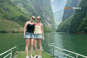
This is the day everyone talks about. The road from Dong Van to Meo Vac crosses Ma Pi Leng Pass — arguably the most spectacular mountain road in Vietnam, and a serious contender for Southeast Asia overall.
The pass hugs a cliff edge above the Nho Que River, which runs a color that shouldn’t exist in nature — a deep, saturated turquoise-green, set against the grey limestone walls of the gorge. The road was carved by hand over several years by ethnic minority villagers. There are plaques at the summit commemorating this. Take a moment to actually read them.
Stop at every layby. Don’t rush this 25-kilometer stretch. You have nowhere else to be today.
Arrive in Meo Vac by noon and spend the afternoon exploring. The Meo Vac Sunday market is one of the largest ethnic minority markets in the province — a loud, colorful, thoroughly un-touristy affair if you catch it on the right day. The town itself is livelier than Dong Van, with more guesthouses and restaurants geared toward Vietnamese tourists and backpackers.
Optional: The Happiness Road (Con Duong Hanh Phuc) signage runs along parts of this route. Worth understanding the history — the road was built between 1959–1965 by thousands of young volunteers working in difficult conditions. The name is not ironic.
Approximate distance: 100–120 km total Riding time: 4–5 hours with stops
The final day is the longest in terms of distance, but the route through Du Gia is different in character from the previous days — lower elevation, greener, more lush river valley scenery versus the stark limestone plateau.
The road from Meo Vac descends toward the Nho Que River before heading northeast toward Du Gia. This section is less-traveled by the fast loop crowd, which makes it quieter and, frankly, more enjoyable. Du Gia village sits at the mouth of a valley with a waterfall, a river for swimming, and some of the best homestays on the entire loop route.
If your energy allows, stop at Du Gia Waterfall (a short walk from the main road). It’s not dramatic in the Niagara sense, but the setting — forest, river, rocks, almost nobody else there — is the kind of thing you don’t photograph correctly but remember clearly.
From Du Gia, the road back to Ha Giang city runs along the Lo River valley. It’s pretty. You’re also tired. That’s fine. You’ve earned it.

Learn more: Tu San Canyon & Nho Que River Boat Trip
Already covered in the itinerary, but worth saying again: this is one of the most genuinely extraordinary pieces of road in the region. The combination of the pass elevation, the cliff face, and the Nho Que River color below creates something that photographs can’t fully capture. Give it time.
A boat trip on the Nho Que from Meo Vac is available and worth considering — the gorge from water level looks completely different than from the road above.
The plateau is a UNESCO-recognized geopark — over 2,300 square kilometers of ancient seabed that was pushed upward over millions of years. The limestone formations you’re riding through are genuinely old in a geological sense. Dong Van Old Quarter preserves a row of traditional Sino-Vietnamese shop-houses that survived the 20th century more or less intact. Drink coffee here. Eat here. Don’t just pass through.

Learn more: Lung Cu Flag Tower
The symbolism matters to Vietnamese visitors in a way that might take a moment to appreciate as an international traveler. The northernmost point of the country, the flag, the view toward China — it has weight. The surrounding villages are ethnically Lo Lo, and the drive there passes through landscape you won’t see elsewhere on the standard loop.
Du Gia is the underrated leg of the loop. The accommodation here skews toward homestays run by Tay ethnic families — simple but warm, with home-cooked meals that will be among the best things you eat in northern Vietnam. The village life here is more visible and more accessible than in some of the plateau towns. If you can stay a night in Du Gia rather than using it as a pass-through, do it.

Learn more: Ha Giang Loop Easy Rider
Still deciding how to tackle the loop? Here’s the honest breakdown:
Choose the Easy Rider tour if:
Choose self-drive motorbike rental if:
Choose the Jeep tour if:
Not sure? That’s what we’re here for — reach out via WhatsApp and describe your situation. We’ll tell you honestly which option makes the most sense, even if it’s not the most expensive one.
[→ View our Ha Giang Loop tour options — Easy Rider, Self-Drive, and Jeep — and find the right fit.]

Learn more: Ha Giang Loop route and itinerary
This section intentionally avoids specific prices, because they change. What I can give you is a framework.
Main cost categories for a 7-day loop:
| Category | Notes |
|---|---|
| Accommodation | Homestays are generally cheapest; guesthouses in Dong Van and Meo Vac range more |
| Food | Eating local (pho, banh mi, com binh dan) keeps this very low; tourist restaurants cost more |
| Transport | Tour fee / rental cost is the biggest variable — get quotes directly |
| Fuel | Relevant if self-driving; budget for mountain terrain which uses more per km |
| Entry fees | Some viewpoints and the Lung Cu tower have small fees — check latest updates |
| Extras | Boat trips, market purchases, tips for homestay hosts |
For current tour pricing and rental rates, [check the Loop Trails booking page] or send a WhatsApp message — we’ll give you accurate quotes without the runaround.
Booking logistics: Ha Giang is not the kind of place you want to figure out on arrival during peak season (October especially). Book accommodation for Dong Van and Meo Vac at least a week in advance during Sept–Nov. For tour packages, 2–4 weeks notice is smart.

Learn more: Ha Giang Packing list
This isn’t a comprehensive packing list — the internet has plenty of those. These are the things people consistently regret not having:
Riding/safety:
Practical:
Health/comfort:
Leave behind: Anything you don’t absolutely need. Luggage storage can be arranged in Ha Giang city before you set out.

Learn more: Ha Giang Loop Mistake to Avoid
Underestimating the riding difficulty. The Ha Giang Loop is not a beginner motorbike route. This is worth saying clearly. If you’re not a confident rider, go with a guide.
Skipping the morning starts. Almost every viewpoint on the loop is better before 10am. The light is different, the mist is either gone or beautifully present, and you beat the other travelers to the layby. Set your alarm.
Over-trusting Google Maps. GPS and satellite coverage in Ha Giang can be inconsistent. Download offline maps before you leave Ha Giang city, and always confirm your route with your guesthouse each morning.
Not checking the market schedule. The Sunday markets at Dong Van, Meo Vac, and Yen Minh are extraordinary and worth timing your itinerary around. The schedule rotates — confirm locally or with your operator.
Trying to do everything. A 7-day itinerary is already an achievement. Don’t add a 12-hour detour to Ban Gioc Waterfall on Day 5 and then wonder why you’re exhausted. If you want Ban Gioc, build a separate trip — or look at a combined Ha Giang–Cao Bang route from the start.
Booking nothing in advance during peak season. October and the buckwheat flower period (late Oct–early Nov) fills up. Don’t assume you can find a homestay in Dong Van on arrival.

Learn more: Ha Giang Loop Photography Guide
Three days is the absolute minimum to see the main highlights. Four to five days is what most travelers do. Seven days is for people who want to travel slowly, explore off the main stops, and actually absorb the place. If you only have three days, you’ll still have an incredible experience — but you’ll likely want to come back.
Not recommended. The roads are mountain terrain — narrow, often steep, sometimes unpaved on side routes. If you’re not a confident rider, book an Easy Rider guide and ride pillion. It’s not a lesser experience; the guides know the route and the culture in ways you simply can’t replicate alone.
As of recent years, foreign nationals have needed a tourist permit to access the Dong Van Karst Plateau area. Requirements can change — always confirm current rules with your tour operator or guesthouse before your trip, and carry your passport.
September to November for the buckwheat flowers and dry roads; March to May for lush greenery and fewer crowds. Avoid the rainy season (June–August) if you can, especially if you’re self-driving.
Many solo travelers do it every year. That said, going with a guide — Easy Rider or as part of a small group tour — significantly reduces the risk and logistical stress. If you go solo on a self-drive, tell people your route, check in daily, and don’t ride after dark.
Rental options typically include semi-automatic bikes and manual options like the Honda XR150. Availability, rates, and bike condition vary by operator. Check with Loop Trails directly for current stock and pricing before assuming availability
It’s one of only a few UNESCO-recognized geoparks in Southeast Asia — a 2,356 sq km area containing ancient geological formations, fossils, and unique karst landscapes. The designation comes with some tourism infrastructure, but it’s still very much a working landscape where ethnic minority communities live.
Overnight sleeper bus is the most common option — roughly 6–7 hours. Limousine vans (more comfortable, slightly more expensive) also run this route. Some travelers rent bikes in Hanoi and ride — possible but a significant additional undertaking. Check current transport options on arrival platforms or with your tour operator.
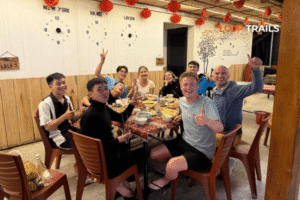
Yes, particularly in homestays and local restaurants. Try thắng cố (a traditional H’mong stew), corn rice, and the locally brewed corn wine (cẩm rượu). Dong Van’s market has excellent street food. Don’t expect menus in English outside of the handful of guesthouses that cater specifically to international travelers.
It’s the road connecting Ha Giang city to Dong Van, completed in 1965 after years of construction by an estimated 1,300 young volunteers — many of them teenagers — working without heavy machinery in difficult mountain conditions. The name was given after the road was finished. Riding it with that context changes how it feels.
Yes, and it’s an exceptional combination if you have 10+ days. Cao Bang adds Ban Gioc Waterfall (one of the most impressive waterfalls in Vietnam), the Nguom Ngao cave system, Phia Oac mountain, and a very different landscape. Loop Trails runs a combined Ha Giang–Cao Bang tour for exactly this purpose.
Easy Rider is typically a private arrangement — you and your guide on one bike. A group tour has multiple riders and guides traveling together. Both can be good; it depends whether you want total privacy and flexibility or the social dynamic of a small group.
Contact information for Loop Trails
Website: Loop Trails Official Website
Email: looptrailshostel@gmail.com
Hotline & WhatSapp:
+84862379288
+84938988593
Social Media:
Facebook: Loop Trails Tours Ha Giang
Instagram: Loop Trails Tours Ha Giang
TikTok: Loop Trails
Office Address: 48 Nguyen Du, Ha Giang 1, Tuyen Quang
Address: 48 Nguyen Du, Ha Giang 1, Tuyen Quang
Facebook X Reddit Table of Contents Learn more: Ha Giang Loop Tours Most people picture the Ha Giang Loop as a motorbike
Facebook X Reddit Table of Contents Learn more: Ha Giang Loop Tours Riding the Ha Giang Loop during Tet is one of
Facebook X Reddit Table of Contents Learn more: Ha Giang Loop Tours Dong Van sits at the far northern tip of Vietnam,