
Ha Giang Loop Responsible Travel Guide: How to Visit Ethically
Facebook X Reddit Table of Contents Learn more: Ha Giang Loop Tours The Ha Giang Loop in 2010 had around 2,000 foreign

Thúy Kiều( Grace) is a travel blogger and content contributor for Loop Trails Tours Ha Giang. She holds a bachelor’s degree in Sustainable Tourism from Vietnam National University, Hanoi, and has a strong passion for exploring and promoting responsible travel experiences in Vietnam’s northern highlands.

Learn more: Ha Giang Loop Tours
If you have spent any time researching northern Vietnam, you have probably seen the photos: black limestone peaks stacked into the horizon, a turquoise river slicing a thousand metres below the road, a Hmong woman in indigo walking a buffalo home at dusk. Almost all of those photos were taken inside the same place. It is called the Dong Van Karst Plateau Geopark, and it covers most of what travellers loosely call “Ha Giang.”
This guide is the version I wish someone had handed me before my first trip up. It is long because the geopark is large and the road conditions, weather, and best stops change from one valley to the next. Skim the table of contents, jump to what you need, and come back later for the planning bits.
A quick disclaimer up front: rules around foreign driving licences, road closures, and tourist permits in this region change without much notice. Where things shift often, I will say so and point you to current sources rather than pretending I have the final answer.
")
Learn more: Ha Giang Loop 2 Days 1 Night
The Dong Van Karst Plateau Geopark is a UNESCO Global Geopark in the far north of Vietnam, sitting right against the Chinese border. It was the first place in Vietnam to receive UNESCO Global Geopark status, recognised in 2010, and it has been re-validated by UNESCO at each four-year review since.
In plain terms: it is a roughly 2,300 square kilometre block of dramatic limestone landscape, with karst formations that geologists date back hundreds of millions of years. Inside, you get cliffs, canyons, sinkholes, conical peaks, fossil beds, and one of the most ethnically diverse pockets of Southeast Asia.
A “Global Geopark” is not the same thing as a World Heritage Site. UNESCO uses the geopark label for landscapes where the geology itself is exceptional and where local communities are actively involved in protecting and benefiting from it.
Dong Van qualifies on both counts. The plateau preserves rock formations from multiple geological eras, including some of the oldest exposed limestone in Vietnam. You can literally see hundreds of millions of years of compression and erosion in the shape of the peaks. On top of that, the area is home to seventeen or so ethnic groups, mostly Hmong, Dao, Tay, Lo Lo, and Pu Peo, and many of the geopark’s stops double as living cultural sites.
The geopark spans four districts of Ha Giang Province:
Almost every classic stop on the Ha Giang Loop sits inside this boundary. When travellers talk about “doing the Loop,” they are essentially doing a circuit through the geopark, often without realising they are on a UNESCO-protected plateau the whole time.

Learn more: Ha Giang Loop 3 Days 2 Nights
The geopark begins about 45 kilometres north of Ha Giang City and continues all the way to the Chinese border. Ha Giang City itself is your launch pad, and getting there from Hanoi is the first logistical question to solve
There are three common ways to cover the roughly 300 kilometres:
Most travellers leave Hanoi in the late afternoon or evening, arrive in Ha Giang City around dawn, and start the Loop the same morning. If you have the budget, breaking the journey into a daytime van and a night in Ha Giang City is gentler on the body.
From Ha Giang City you climb north on QL4C, a paved highway that gains altitude fast. Within an hour you hit Quan Ba Heaven Gate, which is the official southern entrance to the geopark. From there the road rolls north through Yen Minh, on to Dong Van town, east along Ma Pi Leng to Meo Vac, and finally south again through Du Gia or Mau Due back to Ha Giang City.
The full loop is roughly 350 kilometres of riding, give or take depending on the side trips you add. Three days is the most popular pace. Four days is far more relaxed, and where the geopark really opens up.
")
Learn more: Ha Giang Loop 4 Days 3 Nights
You could spend a week here and still miss things. These are the stops most travellers prioritise, in the order you usually meet them along the standard route.
Quan Ba Heaven Gate is your first proper viewpoint, sitting at around 1,500 metres. On a clear day you look down on the Tam Son valley and out toward the Twin Mountains, two near-symmetrical conical peaks that look almost too geometric to be real. Locals call them “Núi Đôi Cô Tiên,” or the Fairy Twin Mountains, and there is a Hmong legend involving a fairy mother leaving her breasts behind to feed her child.
Geologically, the peaks are erosion remnants. The story is more fun.
The stretch between Quan Ba and Yen Minh is the geopark’s gentle green section. Pine trees, rolling hills, less of the dramatic karst that comes later. Most riders stop here for lunch in Yen Minh town, refuel, and grab coffee. It is also a useful overnight option in a four-day itinerary if you want shorter daily distances.
A few kilometres past Yen Minh, the road climbs into the Sung La basin, one of the most photographed valleys in Vietnam. Stone-walled fields, traditional Hmong adobe houses with curved tile roofs, and in late autumn, sheets of buckwheat flowers in pink and white.
Pao’s House in the village of Lung Cam was the filming location for the Vietnamese movie The Story of Pao, and the house is now open to visitors for a small entrance fee. Even if you do not know the film, the building is a textbook example of traditional Hmong architecture and worth a 30-minute wander.
")
Learn more: Ha Giang Cao Bang 5 Days 4 Nights
A short detour off the main road brings you to Vuong Palace, the former residence of Vuong Chinh Duc, a wealthy Hmong leader who controlled much of the opium trade in this region in the early 20th century. The compound is a fascinating fusion of Chinese, French, and Hmong architecture, built from greenish stone and dark hardwood, surrounded by ancient sa moc trees.
Allow 45 minutes for a proper visit. Hire one of the on-site guides if you want context: the building is more interesting once you know who Vuong Chinh Duc was and how he negotiated his way through the French colonial period.
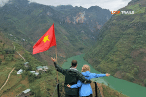
Lung Cu is the northernmost point of Vietnam, marked by a 33-metre flag tower flying a six-by-nine-metre Vietnamese flag. You climb a stone path, then a spiral staircase inside the tower, and emerge on a platform that looks straight into China.
It is touristy, no question. But it is also the kind of geographical extreme that gets under your skin. On a clear day you can see the Lo Lo Chai village below, where the Lo Lo ethnic minority still lives in earth-walled houses with red-clay roofs. If you have time for one more village, Lo Lo Chai is the one.
Soft CTA: If you are not on a motorbike and the idea of climbing those stone steps in the heat sounds tough, a jeep tour through the geopark drops you closer to the tower base and gives your legs a break before the next stretch.
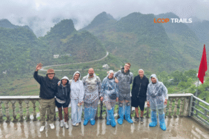
Dong Van town itself is small, but its Old Quarter is genuinely special. Around forty traditional houses built between the late 19th and early 20th centuries, with French, Chinese, and Hmong influences mixed together. The central square hosts a weekend market on Saturday night and Sunday morning, where minority groups from surrounding villages come down to trade.
The Sunday market is one of the most rewarding cultural experiences on the entire Loop, but only if you happen to be in town on a weekend. If you can, time your itinerary so that you sleep in Dong Van on Saturday night.
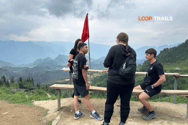
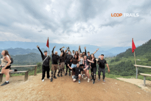
If the geopark has one signature image, it is Ma Pi Leng. The pass is roughly 20 kilometres of road carved into a limestone cliff face, with the Nho Que River nearly a kilometre below. Vietnamese travellers call it one of the country’s “Four Great Passes,” and once you ride it, you understand why.
There are several pullouts along the route. The main viewpoint sits near the eastern end, where a stone plaque marks the spot and a row of cafés have set up viewing terraces. Pay the small admission, get a coffee, walk to the railing, and just stop. This is the moment most people remember from the entire trip.
If you want to push further, the Ma Pi Leng Skywalk is a more recent addition: a precarious stone path bolted along the cliff edge that takes you out for an even more dramatic view. Conditions on the path change with weather, and not everyone is comfortable with the exposure. Skip it if you have any wobble about heights.

Learn more: Tu San Canyon & Nho Que River Boat Trip
The turquoise water you see from Ma Pi Leng is the Nho Que, and the deepest section it cuts through is Tu San Canyon, the deepest canyon in Southeast Asia. From the pass road, a switchback descent drops you to a small pier at Ta Lang. From there, electric boats run regular trips up the canyon, around 30 to 40 minutes each way.
The boat ride is genuinely one of the best things in northern Vietnam. The cliffs rise so high above the water that sound bounces strangely off the rock, and at full sun the water turns an almost impossible green. Even on a half-day schedule, it is worth the detour.
A practical note: boat operations depend on water levels and weather. After heavy rain the cruise may be cancelled, and dam release schedules occasionally affect the section. Build flexibility into your day if you really want to do it.
Meo Vac is the small town on the eastern end of the pass, and the standard overnight stop after Ma Pi Leng. It has a growing handful of homestays and a few simple restaurants. If you are travelling with a guided tour, your night here is usually a communal dinner with rice wine and singing, which is one of those local-host experiences that tends to land harder than expected.
About 20 kilometres further out, the village of Khau Vai hosts the famous Khau Vai Love Market once a year, on the 27th day of the third lunar month. The market is traditionally a place where former lovers who married other people can meet again for a single day. It is a real event, not a tourist staging, and if your dates align it is worth the detour. Most years it falls in late April or early May.

Learn more: Ha Giang in September & October
The geopark is open year-round, but each month feels like a different place. Here is the honest version:
For first-time visitors with flexible dates, October and November are hard to beat. If you want emerald rice fields, aim for late May or September. If you want quiet and atmospheric mist, March is your month.

Learn more: Ha Giang Motorbike Rental
There is no single “best” way to do the Loop. There is a best way for you, and it depends on what kind of traveller you are, how confident you are on two wheels, and how much comfort matters.
You sit on the back of a semi-automatic or manual motorbike, and a local rider does the driving. Your luggage rides on top, you have nothing to worry about except taking photos and chatting, and your driver doubles as guide, translator, and dinner-table buddy.
This is the option I recommend most often to first-time visitors. You get the full open-air motorbike experience without any of the risk of riding on roads you do not know.
You rent a motorbike, you drive it yourself, you cover the full Loop on your own or with a small group. The freedom is real, and so is the responsibility. You need to be comfortable on a manual or semi-automatic motorbike, comfortable with steep mountain passes, and aware that Vietnam’s rules on foreign driving licences are strict and inconsistently enforced. If you do choose self-drive, make sure your travel insurance actually covers you, and that you understand the licence situation in your own case. This is one of the areas where the rules can change, so check current sources before you commit.
If you want to self-drive but do not want to deal with logistics, motorbike rental in Ha Giang through a proper outfit gets you a maintained bike, full gear, and a route map without surprises.
")
Learn more: Ha Giang Jeep Tours
A jeep tour means an open-air four-wheel-drive vehicle with a local driver and, usually, a guide. You still get the wind, the views, the open sky, but with a roof in case of rain, seats with backrests, and zero risk of being the one who has to brake on a wet hairpin.
Jeep is the right call if:
It is not a “lesser” version of the Loop. You see exactly the same stops, eat at the same places, sleep in the same homestays. The trade-off is that jeep availability is more limited than motorbike, so booking a few weeks ahead is wise.
A quick decision framework:
| If you… | Pick |
|---|---|
| Are a confident rider with an appropriate licence | Self-drive |
| Want the motorbike experience without the stress | Easy Rider |
| Are a non-rider, travelling with family, or want comfort | Jeep |
| Want flexibility to roam after the tour ends | Motorbike rental |
If you are still on the fence, message us. We will ask three questions and tell you honestly which one fits

Learn more: Ha Giang Cao Bang Ba Be Lake 6 Days 5 Nights
The geopark scales from a fast three-day sprint to a much fuller two-week adventure when combined with Cao Bang. The three options below cover most travellers.
The most popular itinerary, and a tight but doable circuit:
Good for travellers on a tight schedule, but skips the deeper villages and the Du Gia detour.
Adds one more night and slows everything down. You sleep in Yen Minh, Dong Van, and Du Gia, with proper time at Lung Cu, the Sunday market in Dong Van if dates align, and a full afternoon at the Nho Que. This is what most experienced travellers recommend.
For travellers who want both UNESCO geoparks in one trip, the Ha Giang to Cao Bang combine route continues east from Meo Vac, crosses into Cao Bang Province, and reaches Ban Gioc Waterfall and Nguom Ngao Cave. The road between the two provinces is genuinely off the beaten path, with limited tourist infrastructure but huge landscape rewards.
If this is the kind of trip you want, the Ha Giang–Cao Bang combine tour is built exactly for it.

Learn more: Ha Giang Homestay Guide
Accommodation inside the geopark splits into three rough categories:
For most travellers, a mix is ideal: one homestay night for the experience, the rest in a guesthouse or boutique stay where you can actually sleep deeply after a long riding day.
A practical note on Dong Van vs Meo Vac: Dong Van town is bigger and has more food and accommodation options, but Meo Vac sits closer to Ma Pi Leng Pass. If your route plan has you doing the pass on Day 2 morning, sleep in Dong Van. If you ride it on Day 3, Meo Vac saves you doubling back.

Learn more: Ha Giang Packing list
Geopark weather flips fast. The plateau averages about 1,000 to 1,500 metres of altitude, so even in summer the evenings cool down significantly. A short, honest list:
Tour operators usually provide helmets, gloves, knee pads, and rain ponchos. If you are travelling with your own gear, bring it: rentals are functional but rarely sized for tall riders.
One thing many travellers forget: a packable down jacket or warm midlayer, even if you are visiting in summer. Cold rain at altitude is a real thing.
Learn more: Ha Giang Road Conditions 2026
The geopark is safer than its reputation suggests, but there are a handful of pitfalls that catch first-time visitors every season.
QL4C, the main highway through the geopark, is fully paved and generally in good condition. Side roads into villages or down to the Nho Que pier can be steep, rough, and occasionally flooded after heavy rain. Roadworks happen with little warning, so a tour or a guide who knows current conditions is helpful in the wet months.
Visibility on Ma Pi Leng can drop fast when fog rolls in. If you are riding self-drive and the cloud closes in, slow down, use your hazard lights, and pull off at the next viewpoint until it clears. There is no prize for pushing through.
This region is overwhelmingly safe, but a few small issues come up often:
A short list of things first-time visitors regularly regret:

Learn more: Lo Lo Chai Village
You are travelling through living communities, not a theme park. A few basics:
You do not need to be a cultural expert to travel respectfully here. A bit of attention, a bit of patience, and the willingness to follow your guide’s lead covers almost everything.

Learn more: Cao Bang Loop 3 Days best kept secret
Loop Trails runs small-group and private departures across the geopark year-round, in all three modes: Easy Rider, self-drive motorbike, and jeep. Group sizes are kept small, our guides speak working English, and our motorbike fleet is replaced on a regular cycle so you are not the first guest on a tired bike.
A few quick pointers for booking:
The fastest way to get a real answer for your trip is to send us a message with your dates, your travel style, and how many people you are travelling with. We will reply with a clean recommendation, no pressure.
Ready to plan? Check the Ha Giang Loop tours page for current departures, or jump straight to WhatsApp if you would rather just chat through your dates with a human.

Learn more: Ha Giang Loop Photography Guide
Almost. The Ha Giang Loop is the road circuit that travellers ride, and most of that circuit runs inside the geopark boundary. The geopark is the protected landscape itself; the Loop is the way most people experience it.
There is no separate geopark permit for foreigners at the moment. However, Ha Giang Province has historically required a small tourist permit for travel beyond Ha Giang City. Most tour operators handle this for you. If you self-drive, ask your rental company directly, since requirements can change.
Yes, if you are an experienced rider with the correct paperwork. Many backpackers do. Whether it is the right choice depends on your riding experience, your insurance, and how comfortable you are managing logistics in a region with limited English support.
Three days is the minimum for a real visit. Four days is the comfortable sweet spot. Anything less and you end up rushing past stops you came to see.
Yes. It is one of the most memorable hours of the whole trip. Just keep your itinerary flexible since cancellations happen in bad weather or low water.
Cold, especially at altitude. Daytime temperatures often sit in the single digits Celsius, with occasional frost above 1,500 metres. Beautiful, atmospheric, but layer up and pack a real jacket.
Yes, in the main towns, but they are not always reliable and tend to dispense smaller denominations. Take out enough cash in Ha Giang City before you head north.
Stick to bottled or filtered water. Homestays usually provide a kettle for hot water, which doubles as a way to refill a filter bottle.
Honest answer: yes, if you have never ridden before. The combination of mountain passes, weather changes, and other traffic is a steep learning curve. Easy Rider or jeep is the safer call for a true beginner.
Mostly authentic. The Sunday market in Dong Van, the smaller weekday markets, and the homestay dinners are real community events. A few photo-stop villages lean staged. Your guide knows the difference.
The plateau averages around 1,000 to 1,500 metres. Real altitude sickness is unlikely, but you may feel slightly more tired than usual on the first day.
Possible, but the geography is awkward. Most travellers do one or the other on a single trip, since you have to return to Hanoi between them. Ha Giang to Cao Bang is a much more natural combination if you want a second region.
Contact information for Loop Trails
Website: Loop Trails Official Website
Email: looptrailshostel@gmail.com
Hotline & WhatSapp:
+84862379288
+84938988593
Social Media:
Facebook: Loop Trails Tours Ha Giang
Instagram: Loop Trails Tours Ha Giang
TikTok: Loop Trails
Office Address: 48 Nguyen Du, Ha Giang 1, Tuyen Quang
Address: 48 Nguyen Du, Ha Giang 1, Tuyen Quang
Facebook X Reddit Table of Contents Learn more: Ha Giang Loop Tours The Ha Giang Loop in 2010 had around 2,000 foreign
Facebook X Reddit Table of Contents Learn more: Ha Giang Loop Tours Most travelers do the Ha Giang Loop in three days.
Facebook X Reddit Table of Contents Learn more: Ha Giang Loop Tours I’ve been bringing a camera up the Ha Giang Loop