
Cao Bang Loop Day 2: Nguom Ngao, Quay Son & Phong Nam
Facebook X Reddit Table of Contents Learn more: Ha Giang Loop Tours Day 1 in Cao Bang is the highlight reel. Passes,
Thúy Kiều (Grace) is a travel blogger and content contributor for Loop Trails Tours Ha Giang. She holds a bachelor’s degree in Sustainable Tourism from Vietnam National University, Hanoi, and has a strong passion for exploring and promoting responsible travel experiences in Vietnam’s northern highlands.
Learn more: Ha Giang Loop Tours
Day 3 is the one that surprises people. On paper it reads like a travel day: leave the valley, ride back towards Cao Bang City, catch a bus. In practice you spend the morning in villages where families are still forging blades and rolling incense by hand, and the afternoon standing under a mountain with a hole punched clean through it.
God’s Eye Mountain is the headline, and it deserves to be. But the craft villages around Quang Uyen are the part guests bring up first when they message us months later, usually with a photo of a knife they are still using.
This is the closing day of the loop. It covers roughly 100 to 120 km depending on your route, ends back in Cao Bang City, and can either wrap up your trip or hand you straight into a longer one heading west towards Ha Giang.
Coming in cold? Read Day 1: Cao Bang City to Ban Gioc and Day 2: Nguom Ngao, Quay Son and Phong Nam first.
Learn more: Ha Giang Loop 2 Days 1 Night
| Start | Phong Nam valley or Trung Khanh town |
| Finish | Cao Bang City |
| Rough distance | 100 to 120 km depending on the order you ride it |
| Big stops | Phuc Sen, Phia Thap, the paper village, Thang Hen lakes, God’s Eye Mountain, Ma Phuc Pass |
| Character | Craft villages in the morning, wide open grassland in the afternoon |
| Difficulty on two wheels | Moderate. Good main roads with one rough access track |
| Suits | Anyone interested in how things are made, photographers, families |
The longest riding day of the three, but still nowhere near a hard one. The only section that asks anything of you is the track in to God’s Eye Mountain.
The order matters more than the distance, because the light at the end of the day is worth planning around.
Villages first, mountain second. Ride from Trung Khanh down to the Quang Uyen area, do Phuc Sen and Phia Thap in the late morning while people are actually working, then head north to Thang Hen and God’s Eye Mountain for the afternoon, then back over Ma Phuc Pass into Cao Bang City. This is the version we run and the one this article follows.
Mountain first, villages second. Works if you slept in Trung Khanh and want to be at the grassland before the day heats up, or if the forecast says the afternoon will be wet. The trade off is that you hit the villages when families may have finished the morning’s work, and you get flat midday light on the mountain.
| Villages first | Mountain first | |
|---|---|---|
| Best light at God’s Eye | Yes, late afternoon | No, flat midday light |
| See craftspeople working | Usually yes | Sometimes finished |
| Bad weather plan | Villages are covered work, mountain can wait | Get the mountain done before rain |
| Arrival in Cao Bang City | Early evening | Late afternoon |
If you only have half a day and have to choose one, choose the mountain. The villages are wonderful. The mountain is unlike anything else in Vietnam.
The road out of Trung Khanh heading south west is easy riding: sealed, wide enough, with the karst thinning out into rolling farmland. It is the least dramatic stretch of the whole loop, which after two days of constant stopping is not a complaint.
Fill up in Trung Khanh before you leave. Fuel stations exist further along but they are spread out, and the detour to God’s Eye Mountain later runs away from the main road.
Grab coffee somewhere on the way. Vietnamese roadside coffee in this province tends to be strong enough to remove enamel and costs almost nothing, and you will want it before the first village.
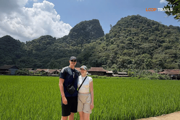
Learn more: Ha Giang Cao Bang 5 Days 4 Nights
You hear Phuc Sen before you see it. Hammering, from several directions at once, at a rhythm that does not stop.
The village sits along the main road in the Quang Uyen area and the Nung An families here have been forging metal for a very long time. Ask locally how long and you will be told several hundred years, which is the figure everyone quotes and nobody has a document for. What is not in doubt is that this is a working village, not an exhibition of one.
Open fronted workshops facing the road, one after another. A charcoal forge, a bellows, an anvil, usually two or three people working: someone holding, someone striking, someone at the grinder. Steel goes in dull and comes out orange. There is a lot of noise and no safety signage whatsoever.
Nobody is performing for tourists. If you stand quietly in a doorway you will be ignored in the friendliest possible way, and then eventually someone will hold up a finished blade and grin at you.
The steel is recycled. Leaf springs from trucks and buses are the standard material, cut into lengths and heated in the charcoal forge until they are workable. Everything after that is done by hand and by eye: the shaping, the taper, the edge.
The part worth watching is the hardening. There are no thermometers. The smith judges the temperature by the colour of the steel and the light in the workshop, which is why the doorways are often shaded, and then quenches. Get it wrong and the blade is either soft or brittle. Get it right and it holds an edge for years.
That is the whole reason these knives have a reputation across northern Vietnam. It is not marketing. It is that somebody spent thirty years learning to read a colour.
A blade from here is the best souvenir in Cao Bang and one of the few that will still be in use in a decade.
Ask before photographing faces. Do not touch anything metal near a forge, because you cannot tell by looking what is hot. Keep children close. And if you are just watching rather than buying, that is completely fine, but stay out of the swing radius of a hammer.
Want this day without the logistics? Our Cao Bang loop tours build in the craft village stops with a guide who can translate, which changes the experience from watching to talking. If you would rather ride this as the finish to a bigger trip, the Ha Giang and Cao Bang combined tour ends on exactly this ground.
A short ride off the main road, Phia Thap is the quiet counterpart to Phuc Sen. No hammering. Just yards full of colour.
The Nung An families here make incense, and on a dry day the drying racks are out everywhere: bundles of sticks fanned open into circles, pink and red at the base, standing in rows outside the houses and along the lanes. It is one of the most photogenic places in the province and it requires no effort from you whatsoever.
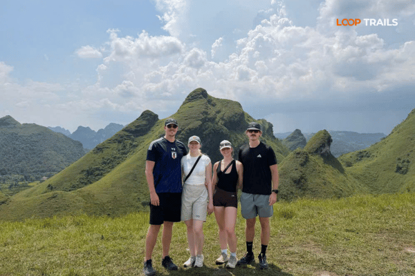
Learn more: Ha Giang Cao Bang 6 Days 5 Nights
The process runs through the whole village. Bamboo is split by hand into thin sticks. The sticks are dipped, rolled in a mixture of sawdust and a natural binder made from the ground bark and leaves of a local tree, then dipped and rolled again until they build up. Then they go out into the sun.
If a family is working, they will usually let you watch and often hand you a stick to try rolling yourself, which is harder than it looks and produces something visibly worse than theirs.
This is the one stop on the loop where weather changes what you see.
If you arrive to empty yards, do not be disappointed. Walk in a bit further. There is usually somebody splitting bamboo under a roof somewhere.
Bundles are cheap, light and pack flat, which makes them a far better souvenir than most things you can carry out of a mountain province. Buy from the house, not from a stall on the main road, and buy more than you think you need because they are the easiest gifts you will bring home.
Also in this cluster is a village that still makes traditional paper by hand: bark soaked, beaten to pulp, lifted on a frame, pressed and dried in sheets against a wall. Most of it is made for ritual use rather than for tourists, which is exactly why it is worth ten minutes.
There are other small workshops scattered around the same area, and the honest advice is that you do not need to see all of them. Two villages properly, at a walking pace, beats four villages from the seat of a bike.
If you are running short on time, prioritise like this: Phuc Sen if you want to buy something, Phia Thap if you want photographs, the paper village if you have twenty spare minutes.
Learn more: Cao Bang Loop 3 Days best kept secret
Depending on your route you will cross Ma Phuc Pass again today, this time in the opposite direction from Day 1. The twin limestone blocks above the road are still there and it is still worth pulling in at the top, particularly in the afternoon when the light comes from the other side and the valley looks like a different place.
If you missed it on the way out, there is more on the pass in the Day 1 guide
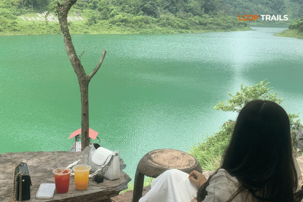
Learn more: Ha Giang Loop 3 Days 2 Nights
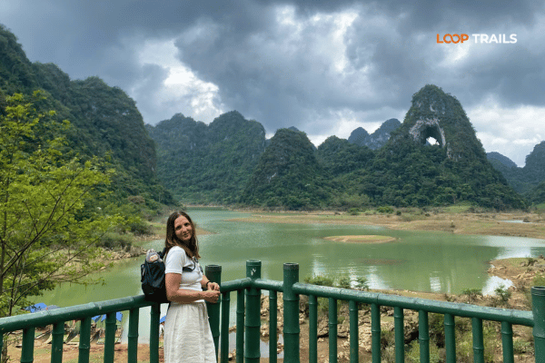
North of the main road, in the Tra Linh area, sits a system of linked lakes sitting in limestone basins. Thang Hen is the best known of them. Local sources usually describe the system as around thirty six connected lakes, and they behave in a way that catches visitors out.
The water level rises and falls dramatically through the year. In the wet season the basins fill and you get proper lakes with steep green walls around them. In the dry season some of them drain almost completely and become flat grazing land with a stream running through. Neither version is the wrong one to see, but they photograph nothing like each other.
The whole area is part of the Non Nuoc Cao Bang UNESCO Global Geopark, and there is usually somebody offering boats or kayaks when the water is up. Availability depends on season and demand, so ask on the day rather than planning around it.
Give it half an hour unless you are getting on the water. The main event is ten minutes further on
Learn more: Ha Giang Loop 4 Days 3 Nights
You approach across open ground and it takes a moment to process what you are looking at. A limestone ridge, and punched straight through the top of it, a hole with sky on the other side.
Locals call it the God’s Eye or Angel’s Eye. In Tay it is known as the pierced mountain, which is the more literal and somehow better name. The opening is usually quoted at around fifty metres across, and it was formed the way most things here were formed: water, limestone, a very long time.
You park at the edge of the grassland and walk. It takes somewhere between twenty and forty minutes depending on where the track ends that season and how much you stop, across flat open ground with horses and cattle grazing.
Wear real shoes. The ground is uneven, there are stones under the grass, and in the wet season parts of it turn to mud or standing water. In the dry months it is easy walking.
Do the walk. Photographing the mountain from the parking area is like photographing a cathedral from the car park.
Late afternoon is the answer. The low sun rakes across the grassland, the ridge goes into partial silhouette and you can shoot straight through the hole with sky behind it. Midday is flat and harsh and the hole loses its shape.
If you want the version with mist sitting in the basin, that is an early morning shot, which means camping or staying nearby the night before.
People camp on the grassland below the mountain and it is popular with Vietnamese travellers on weekends. If you are equipped for it, it is one of the better places in the north to put a tent down. Take everything out with you, do not camp in the middle of somebody’s grazing land without asking, and be aware that there are no facilities of any kind.
From the mountain it is a straightforward run back to Cao Bang City, and you will probably arrive with the light going.
The city is not a destination in itself and nobody pretends otherwise, but it is a good place to finish. There is a proper night market, a river running through the middle of it and the best food you will have had in three days.
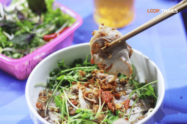
Worth eating if you find it: the local rolled rice sheets served in bone broth rather than with a dipping sauce, the sour noodle dish the region is known for, and roast duck. In autumn, buy Trung Khanh chestnuts from a street roaster.
From here, night buses and limousine vans run to Hanoi and take somewhere around seven hours, and there is a limousine service west to Ha Giang with morning departures. Schedules move around, so book the day before rather than turning up.

Learn more: Cao Bang Road Conditions
Learn more: Best time to visit Cao Bang
| Time | What |
|---|---|
| Early morning | Breakfast in the valley, ride out through Trung Khanh |
| Late morning | Phuc Sen, then Phia Thap |
| Midday | Lunch in the Quang Uyen area, paper village if you have time |
| Early afternoon | Ride north towards Tra Linh, stop at the lakes |
| Mid to late afternoon | Walk in to God’s Eye Mountain |
| Early evening | Ma Phuc Pass and into Cao Bang City |
| Night | Night market, then a bus onward if you are leaving |
A shape, not a schedule. If the light is good at the mountain, stay longer and eat later.
Roughly February to April. Cool and often misty. The lakes are usually low. Fewer visitors at the mountain and softer light. Bring layers for the pass.
Roughly May to July. Green and hot. The grassland below the mountain is at its best, the lakes are filling, and the incense yards are busy on the dry days between afternoon storms.
Roughly August to September. Wettest period. The lakes are full, the grassland can be waterlogged, and the access track to the mountain gets difficult after heavy rain. The villages are unaffected, which makes this a good time to lead with them.
Roughly late September to October. The best all round window. Dry ground, gold light, chestnut season, and the mountain at its most photogenic. Also the busiest, so book accommodation early.
Roughly November to January. Cold and quiet, with fog on the pass in the mornings. Harvested fields, low lakes, hard clear light in the afternoons. Bring genuinely warm clothing, because the passes here are colder than the forecast for the city suggests.
Conditions change year to year. Ask locally a couple of days ahead rather than committing to a plan built around a photo with a date on it.
Food. Quang Uyen has roadside com binh dan places that will feed you well for very little. Cao Bang City has the range. Between the two, options thin out, so eat when you see somewhere rather than when you get hungry.
Fuel. Fill in Trung Khanh and top up in Quang Uyen. The run out to the mountain and back is the stretch where people get caught out.
Cash. ATMs in the district towns and Cao Bang City. The craft villages, the local access fee at the mountain and small kitchens all want cash, in small notes.
Signal. Fine on QL3, unreliable out on the grassland. Download offline maps for the Tra Linh area before you leave the main road
Learn more: Ha Giang Loop by Wrangler Rubicon Jeep
Self drive works well today, with one honest caveat: the access track to God’s Eye Mountain is the roughest surface of the loop and it is the one place where inexperienced riders sometimes drop a bike at walking pace. If you are riding yourself you need your passport, a valid motorbike licence from home and an International Driving Permit issued under the 1968 Vienna Convention. The 1949 style permit is not recognised in Vietnam, and riding without the correct documents can result in a fine. Rules and enforcement change, so verify the current position before you travel rather than relying on any article.
Easy rider is the choice most guests make and Day 3 shows why. The craft villages are far better with someone who can translate a conversation with a blacksmith, and the difference between watching a village and talking to somebody in it is the whole trip.
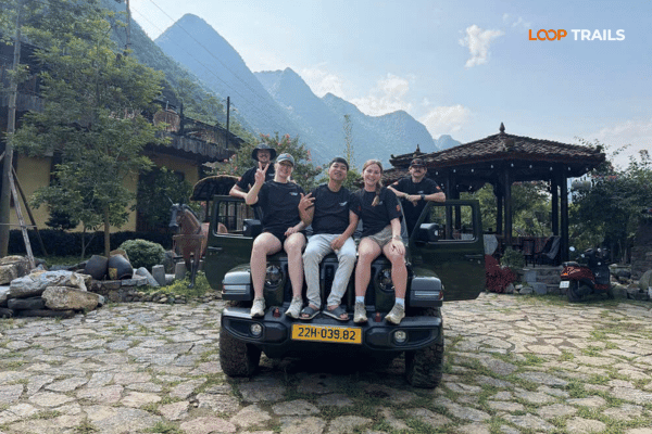
A jeep takes the rough track out of the equation entirely, keeps luggage dry, and means a family with a grandparent or a small child can do the same day everyone else is doing. Non riders lose nothing on this route: same villages, same walk across the grassland, same view up through the hole in the mountain.
Our combined Ha Giang and Cao Bang route is priced as follows:
| Ha Giang and Cao Bang, 5 days 4 nights | Price |
|---|---|
| Easy rider, per person | 10,990,000 VND |
| Self drive, per person | 10,590,000 VND |
| Jeep, 2 guests, whole vehicle | 31,990,000 VND |
| Jeep, 3 guests, whole vehicle | 36,490,000 VND |
| Jeep, 4 guests, whole vehicle | 40,990,000 VND |
Rates cover dormitory style accommodation and everything included on the tour. They do not cover private room upgrades or the bus tickets to and from the start and end points. These figures were current at publication, so check the tour page for today’s rate.
Book once your dates are set. Most guests book one to three months ahead, and jeep availability is limited compared with motorbikes.
Learn more: Ha Giang Cao Bang Packing List
Learn more: Things to do in Cao Bang
Doing the mountain at midday. The most common one, and it costs you the entire point of going. Plan the day backwards from late afternoon light.
Photographing God’s Eye from the car park. Twenty to forty minutes of flat walking gets you underneath it. Walk.
Riding through the craft villages instead of stopping. People slow to twenty, look at the workshops, and keep going. Park. Get off. Stand in a doorway for five minutes.
Buying the first knife you see on a roadside table. Find a workshop with a forge behind it and buy there.
Underestimating the track after rain. If it has been raining hard, ask before you commit. Nobody local will lie to you about it.
Leaving no time for Cao Bang City. People arrive at 19:30 with a 21:00 bus and eat nothing. The night market is worth an hour.
Learn more: Cao Bang Homestay Guide
Three days closes the classic Cao Bang loop and you will have seen the province’s best: the waterfall, the cave, the river valley, the craft villages and the mountain.
If you have a fourth day, head north to Ha Quang and the Pac Bo historical site near the border, where the country gets steep and quiet again.
If you have longer, ride west. The road towards Bao Lac and over the Khau Coc Cha pass is one of the best in the north and it connects Cao Bang directly to Ha Giang, which means you can carry straight on into the Ha Giang Loop without going anywhere near Hanoi in between. That is exactly what our Ha Giang and Cao Bang tour does, in the opposite direction: Ha Giang first with Bac Sum, Tham Ma, the Dong Van karst plateau, Lung Cu and Ma Pi Leng above the Nho Que river, then east into Cao Bang, finishing on the ground this article covers.
And if Cao Bang was your warm up, the Ha Giang Loop runs as a two, three or four day trip by motorbike or jeep and is the reason most people come north in the first place.
Working out which version fits? Message us on WhatsApp with your dates, group size and whether anyone in the group rides. We will give you a straight answer, including when the answer is that a different route suits you better.
Learn more: Cao Bang Food Guide
It is a limestone peak in the Tra Linh area with a natural hole punched through the ridge, usually quoted at around fifty metres across. Locals call it the God’s Eye or Angel’s Eye, and in Tay it is known as the pierced mountain. It sits above open grassland that is grazed by horses and cattle.
It is reached on a turnoff heading north from the main road between Quang Uyen and Cao Bang City, past the Thang Hen lake area. The final access track is dirt and stone, then you park and walk across the grassland for roughly twenty to forty minutes.
The main roads are easy, and the last access track is the roughest surface on the whole Cao Bang Loop. It is manageable ridden slowly in dry conditions and considerably harder after heavy rain. If the weather has been bad, ask locally before committing.
Late afternoon. The low sun rakes across the grassland and puts the ridge into partial silhouette so you can shoot through the hole with sky behind. Midday light is flat and the shape gets lost.
Yes, and it is a working village rather than a tourist attraction. The Nung An families forge blades by hand from recycled leaf spring steel and judge the hardening by the colour of the metal. A knife bought at a workshop here is the best souvenir in the province.
Prices depend on size and type and are modest by international standards, but they change over time, so ask at the workshop rather than budgeting from an article. Buy from a place where you can see the forge, and light bargaining is fine while hard haggling is not.
In checked luggage, yes, packed and wrapped properly. It cannot go in hand luggage. If the rest of your trip is hand luggage only, buy your knife at the very end.
It is a quiet Nung An village where families make incense by hand from split bamboo, sawdust and a natural binder from a local tree. On dry days the yards are full of drying bundles fanned open in circles, which is one of the best photo stops in Cao Bang.
Nothing dries, so the racks stay in and the yards look ordinary. The village is still pleasant and someone is usually working under cover, but if photographs are your priority, plan this stop for a dry day.
Around 100 to 120 km of riding spread across a full day. The distance is easy, the time goes on the two craft villages, the lakes and the walk in to the mountain. Aim to be at the mountain in the late afternoon and in Cao Bang City by early evening.
Yes, and it is the easiest way to handle the rough access track and the afternoon weather. Non riders see exactly the same villages, the same lakes and the same view up through the hole in the ridge.
There is a night market, a river through the middle of town and the best food of the trip. Try the local rolled rice sheets served in bone broth and the regional sour noodle dish. Night buses and limousine vans run to Hanoi in around seven hours, and there is a morning limousine west to Ha Giang
Contact information for Loop Trails
Website: Loop Trails Official Website
Email: looptrailshostel@gmail.com
Hotline & WhatSapp:
+84862379288
+84938988593
Social Media:
Facebook: Loop Trails Tours Ha Giang
Instagram: Loop Trails Tours Ha Giang
TikTok: Loop Trails
Office Address: 54A Tran Phu, Ha Giang 2, Tuyen Quang
Address: 54A Tran Phu, Ha Giang 2, Tuyen Quang
Facebook X Reddit Table of Contents Learn more: Ha Giang Loop Tours Day 1 in Cao Bang is the highlight reel. Passes,
Facebook X Reddit Table of Contents Learn more: Ha Giang Loop Tours The ride from Cao Bang City to Ban Gioc looks
Facebook X Reddit Table of Contents The first time I watched someone drop a rolled rice pancake into a bowl of hot