


Thúy Kiều (Grace) is a travel blogger and content contributor for Loop Trails Tours Ha Giang. She holds a bachelor’s degree in Sustainable Tourism from Vietnam National University, Hanoi, and has a strong passion for exploring and promoting responsible travel experiences in Vietnam’s northern highlands.
Learn more: Ha Giang Loop Tours
The first question almost every traveller asks us about Cao Bang is some version of “are the roads bad?” It is the wrong question, and it took us a few seasons of running this route to work out why. Cao Bang does not have one road condition. It has about ten, they sit next to each other, and the difference between a beautiful day and a miserable one is usually knowing which one you are about to ride onto.
This guide breaks the region down the way we actually plan it: segment by segment, in the order most travellers ride them, with what the surface tends to be like, what tends to go wrong, and what that means for your timing. Everything here reflects how the roads have behaved on our recent runs. Mountain roads change after every big rain, so treat this as a planning baseline and check the latest updates locally before you commit to a route.
Learn more: Ha Giang Loop 2 Days 1 Night
Cao Bang is, on average, easier than people expect and harder than the photos suggest.
The main arteries are sealed asphalt. You are not riding jungle tracks. Most of the route between Cao Bang City, Trung Khanh and Ban Gioc Waterfall is comfortable two lane road that a nervous beginner can handle. Traffic is light. Trucks exist but they are not constant.
The difficulty sits in three specific places: the long western run on QL34 between Bao Lac and Cao Bang City, which is genuinely mountainous and the most landslide prone road in the province; the small back roads and village shortcuts, which range from good concrete to broken stone; and any road at all during heavy rain, when a fine surface becomes a slippery one and a hillside can decide to arrive on it.
So the honest summary: Cao Bang road conditions in 2026 are good on the tourist spine, mixed on the crossover from Ha Giang, and weather dependent everywhere. Nobody needs an enduro bike. Everybody needs to plan hours instead of kilometres.
Learn more: Ha Giang Loop 3 Days 2 Nights
The same 60 km can take two hours in March and five hours in August. Rainy season in northern Vietnam runs roughly May to September, with the heaviest, most persistent rain usually in July and August. That is when QL34 collects slides. Dry season, roughly October to April, gives you firmer surfaces, better visibility and far fewer surprises, at the cost of thick fog on the high passes in the cold months.
Road conditions are relative to what you are sitting on. A patch of loose gravel is a non event in a 4×4 and a heart rate spike on a semi automatic scooter with worn tyres. Riders on a proper 150cc trail bike with fresh knobblies describe the same road completely differently from a couple two up on a rented automatic with luggage. When you read “rough section” below, calibrate it against your own setup.
Two administrative details cause a surprising amount of confusion in 2026, and neither one changes the tarmac.
First, Ha Giang province was merged into Tuyen Quang province in mid 2025, and the district level was reorganised into communes and wards. Ha Giang City, Meo Vac and Dong Van still exist exactly where they always were, they just carry new administrative labels. If your hotel booking or a government website lists a Tuyen Quang address for a place you thought was in Ha Giang, nothing has moved. Cao Bang remains its own province.
Second, the Dong Dang to Tra Linh expressway (CT.07) has been under construction since 2024 and the first phase reached its through route milestone in 2026, with official operation targeted for later in the year. When it opens it will meaningfully cut the Hanoi to Cao Bang road journey. Because opening dates on projects this size move, check the latest updates rather than planning a tight schedule around it.
What it will not do is change a single metre of the mountain roads inside the loop. The expressway is an approach corridor. Ban Gioc, Ma Phuc and QL34 stay exactly as they are.
Planning a Cao Bang trip and not sure how it fits with Ha Giang? Most people who reach Cao Bang arrive overland from Meo Vac, and the two regions read as one long ride rather than two separate trips. Our Ha Giang and Cao Bang combination tours are built around that crossover, with the QL34 section split so nobody has to do it in one exhausting push. Have a look, or send us a message on WhatsApp and we will tell you honestly whether the combination suits your dates.
Learn more: Ha Giang Loop 4 Days 3 Nights
Route: QL3 north through Thai Nguyen and Bac Kan, over Deo Gio and the Cao Bac Pass, into Cao Bang City. Surface: Sealed the whole way. Generally good, with worn patches and roadworks that move around. Difficulty for riders: Low technically, high on fatigue.
This is the boring segment, and we say that with affection. It is a long haul on a national road shared with trucks and buses, and the scenery only starts earning its keep in the last third once you climb into Bac Kan and Ngan Son.
Almost nobody should ride it. There is nothing here that you will not see better later, and arriving in Cao Bang City with a numb backside and six hours of truck exhaust behind you is a poor way to start. The standard approach is a sleeper bus or a limousine van overnight from Hanoi, or arriving overland from Ha Giang, which is the ride worth doing.
Watch for: sustained roadworks associated with the expressway project, especially on the Lang Son side of the region. Delays here are about queueing, not danger.

Learn more: Ha Giang Cao Bang 5 Days 4 Nights
Route: Meo Vac, then south east on the road toward Khau Vai and Bao Lac, joining QL34 at the Bao Lac junction. Surface: Mostly sealed, narrow, with patched sections and occasional broken edges. Difficulty for riders: Moderate. Constant curves, very little straight road.
This is where the Ha Giang Loop becomes a Cao Bang trip, and it is one of the most underrated rides in the north. You drop out of the limestone plateau into a softer, greener, more open landscape following river valleys. Villages are further apart. Traffic thins out to almost nothing.
The road is narrow, roughly one and a half vehicles wide in places, with blind corners and no barrier on the drop side for long stretches. Nothing about it is technically hard, but it punishes inattention. Local vehicles cut corners because they know the road and assume you are not there.
Two practical notes. Fuel gets sparse between Meo Vac and Bao Lac, so fill up before you leave. And mobile signal comes and goes in the valleys, which matters if you are riding independently and something goes wrong.
Timing wise, most people underestimate this leg badly. On the map it looks like a short hop. In practice, with photo stops and a lunch break, it eats a large chunk of a day.
Learn more: Cao Bang Loop 3 Days best kept secret
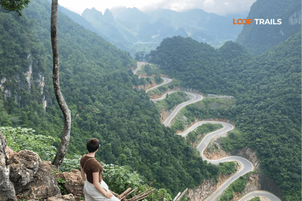
Route: North from Bao Lac toward Xuan Truong, on the smaller provincial road. Surface: Sealed but narrow, with tight stacked switchbacks. Difficulty for riders: Moderate to high, purely because of the geometry.
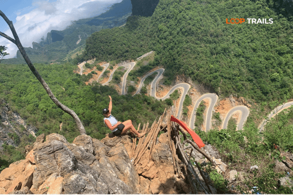
Khau Coc Cha, also written Me Pia, is the pass everybody has now seen on a drone shot: a ribbon of road folded back on itself up a near vertical hillside, commonly counted as fifteen bends, though locals will tell you fourteen depending on where you start counting.
The surface itself is usually fine. What makes it demanding is that the corners are tight, steep and stacked with almost no run off. On a fully loaded bike in first gear it is a slow, deliberate climb. In a jeep it is a series of careful three point manoeuvres at the sharpest hairpins, and it is genuinely more comfortable as a passenger than as a driver.
This is a detour, not a through route for most itineraries. Ride up, take the photograph from the viewpoint, come back down. Budget more time than the distance suggests. And skip it in heavy fog, because the whole point of the pass is the view, and blind hairpins on a wet slope with no visibility is a bad trade.
Learn more: Ha Giang Cao Bang 6 Days 5 Nights
Route: QL34 east along the Gam River, then climbing through Ca Thanh and Nguyen Binh, then down into Cao Bang City. Surface: Sealed, variable. Good stretches, tired stretches, and repair work most years. Difficulty for riders: The hardest sustained section in the province.
If one road defines Cao Bang road conditions, this is it.
QL34 is the artery linking Cao Bang City with the western communes, and it does the hard work: river gorges, high sided cuttings, long climbs and descents. It is also the road most affected by landslides, because it runs beneath steep unstable slopes and alongside water. Cao Bang authorities deal with slips on this corridor almost every rainy season, sometimes clearing the surface within hours, occasionally holding traffic for most of a day. The stretch through the Nguyen Binh and Bao Lac communes has historically produced the most incidents.
There is also heavy truck traffic in places, connected to mining in the Nguyen Binh area, which chews up the surface faster than it gets repaired. Expect patched asphalt, gravel scatter on corners and sections where the edge of the road has crumbled toward the drop.
How to ride it well:
Done in one go from Bao Lac, this segment is a full riding day, not a morning. Splitting it, usually with a night around Bao Lac or up near Phia Oac, is the single best decision most travellers make on this route.
Learn more: Best time to visit Cao Bang
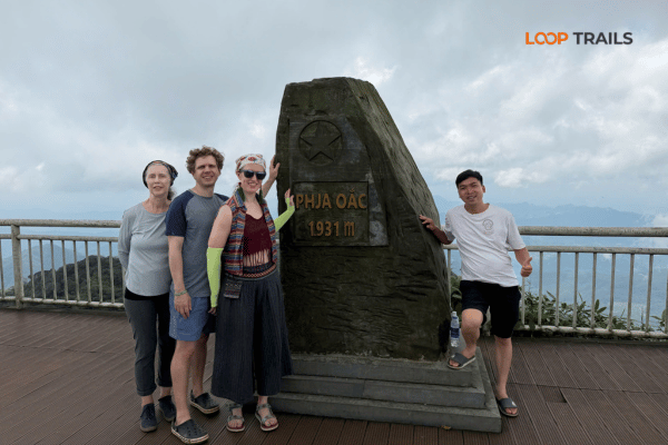
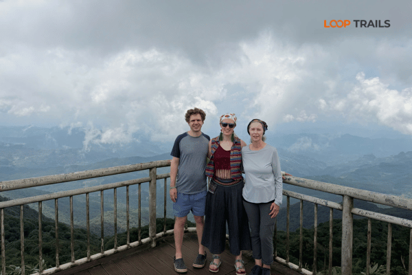
Route: Off QL34 near Nguyen Binh, climbing into the Phia Oac and Phia Den mountain area. Surface: Sealed mountain road, narrower and steeper than QL34, damp much of the year. Difficulty for riders: Moderate, with weather as the deciding factor.
Phia Oac is the odd one out in northern Vietnam: a cold, mossy, cloud forest mountain with old French era ruins scattered around it, and a road that climbs steadily into fog. On a clear day it is one of the best short detours in the province. In thick cloud it is a slow crawl through white nothing, and the surface stays wet even when it is not raining.
The climb itself is fine in the dry. Watch for moss on the shaded edges of the tarmac, damp leaf litter in the corners and the fact that temperature drops sharply as you gain altitude. Riders who left Bao Lac in shorts have a rough afternoon up here. In December and January it can be genuinely cold, and frost is not unheard of.

Learn more: Things to do in Cao Bang
Route: East from Cao Bang City on QL3 over Ma Phuc Pass, then north toward Trung Khanh. Surface: Good sealed road, wide by regional standards, well used. Difficulty for riders: Low. This is the easy, enjoyable part.
After QL34, this feels like a holiday. Ma Phuc Pass is a proper pass with a proper viewpoint, a set of open sweeping bends between limestone towers, and a surface that is generally in decent shape because this is the main tourist corridor in the province.
Around the pass you pass through the Non Nuoc Cao Bang UNESCO Global Geopark landscapes, with the classic view of terraced fields wrapped around karst peaks. Thang Hen Lake sits on a side road in this area and makes a natural short stop.
Things to watch here are ordinary rather than dramatic: buses stopping at the viewpoint, livestock on the road in villages, and the usual weekend traffic. If you have been intimidated by everything you read about Cao Bang road conditions, this segment is where you relax.
Learn more: Pac Bo Historical Site
Route: North east from Trung Khanh to the falls, on the main access road. Surface: Sealed and generally the best road in the region, since it carries the tourist traffic. Difficulty for riders: Low.
The run out to Ban Gioc is easy riding through wide farmland valleys, with the road following flat bottomed fields between karst hills. Late September and early October, when the rice turns gold, this is the prettiest stretch in Cao Bang.
Two things matter more than surface condition here.
First, Ban Gioc sits directly on the border with China. Border area rules apply, they are enforced, and they can change. Carry your passport, expect the possibility of a document check, and follow signage and staff instructions at the falls. Do not improvise routes along the border for a better photograph.
Second, water level dictates the experience. The falls are at their most powerful in and just after the rainy season, roughly late summer into early autumn, which is exactly when the roads getting you there are at their worst. That trade off is real and worth thinking about when you pick dates.
Parking, ticketing and boat operations at the falls are managed on site and prices change, so check current information rather than trusting an old blog post, including this one.
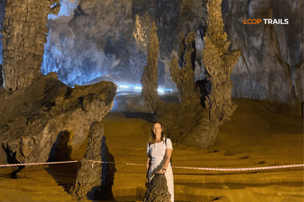
Learn more: Nguom Ngao Cave
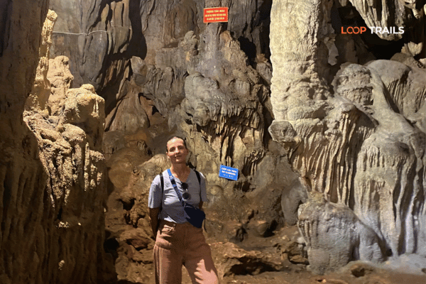
Route: Nguom Ngao Cave sits a short distance from Ban Gioc. From there, smaller roads run back toward Quang Uyen and the blacksmith village of Phuc Sen. Surface: Mixed. Sealed main road, then narrower rural roads with variable quality. Difficulty for riders: Low to moderate, depending on which back road you take.
Nguom Ngao is a five minute ride from the falls on good road, so there is no reason to skip it.
The interesting part is the return. Instead of retracing the main road, there are quieter rural routes threading back through villages toward Quang Uyen and Phuc Sen. These are the roads where the region actually shows itself: buffalo in the road, kids shouting hello, women carrying rice bundles, a blacksmith hammering a blade out of a leaf spring.
They are also where surface quality becomes unpredictable. You will find fresh concrete, older cracked concrete, packed dirt and short broken sections in the same hour. None of it is difficult in the dry. All of it is slower than the main road, and some of it turns to grease after rain. If you are riding independently and short on time, take the main road. If you have a spare half day, the back roads are the best thing you will do in Cao Bang.
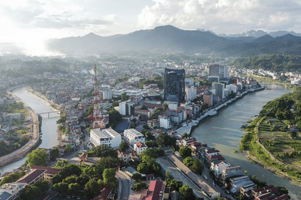
Learn more: Explore just the Cao Bang Loop
Route: North west from Cao Bang City toward Ha Quang and the Pac Bo historical site. Surface: Sealed, mostly good, quieter than the eastern corridor. Difficulty for riders: Low.
Pac Bo is where Ho Chi Minh based himself after returning to Vietnam in 1941, and it is a genuinely significant site for Vietnamese visitors. For foreign travellers the appeal is partly historical and partly the ride: an easy, pleasant run through limestone country with far less traffic than the Ban Gioc road.
The road is straightforward. The reason to think twice is time. Pac Bo is a there and back detour from Cao Bang City, and on a three day Cao Bang itinerary it usually competes with the Phia Oac loop or a slower morning at Ban Gioc. Pick one.
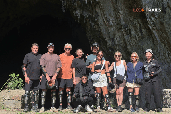
Learn more: Caving in Vietnam
Route: South east from Cao Bang City through Dong Khe and That Khe toward Lang Son. Surface: Sealed, decent, with active construction in the corridor. Difficulty for riders: Low to moderate.
Most travellers finish in Cao Bang City and take a night bus back to Hanoi. If you are continuing overland toward Lang Son and the Chinese border area, QL4A is the historic route: a road with a heavy military past, running through valleys that saw serious fighting in the colonial era.
The important 2026 caveat is that the Dong Dang to Tra Linh expressway is being built through roughly this corridor, with tunnels at Dong Khe and That Khe in the first phase. Construction traffic, temporary diversions and dust are all part of the experience for now. Check current conditions before choosing this as your exit route.

Learn more: Visiting God’s Eye Mountain
Use this as a planning frame, not a forecast. Northern Vietnamese weather does what it wants.
| Period | Typical road conditions | What to plan for |
|---|---|---|
| October to November | Usually the best of the year. Dry surfaces, clear air, comfortable temperatures | Peak riding season. Book accommodation early, especially around the rice harvest |
| December to February | Dry but cold. Surfaces good, high passes foggy, Phia Oac genuinely cold | Serious warm layers. Shorter daylight. Fog delays on high sections |
| March to April | Dry to mixed. Increasing chance of afternoon showers late in the period | Good general conditions. Watch for early rain on QL34 |
| May to June | Rainy season starting. Slippery surfaces, first slides possible | Ride mornings, rest afternoons. Build a buffer day |
| July to August | Wettest and least predictable. Landslide risk highest on QL34. Waterfalls at their most powerful | Flexible itinerary, waterproof everything, no tight connections |
| September | Transitional. Often excellent late in the month, still capable of heavy rain | The sweet spot for people who want both green landscape and drier roads |
The pattern that matters: the months when Ban Gioc looks the most spectacular are the months when the road to reach it is at its most temperamental. That is not a reason to avoid summer. It is a reason not to build a summer itinerary with zero slack in it.

Learn more: Ban Gioc Waterfall Guide
| Surface | Where you meet it | How to treat it |
|---|---|---|
| Good asphalt | QL3, the Ban Gioc corridor, most of the tourist spine | Normal riding. Enjoy it |
| Patched asphalt | Long sections of QL34 | Read the surface ahead. Patches change grip mid corner |
| Gravel scatter | Corners below cuttings, after any rain or slide clearance | Brake before, not during. Look through the corner |
| Concrete village road | Back roads around Quang Uyen, Phuc Sen, small villages | Fine when dry, slick when wet or mossy |
| Mud and spoil | Active slide clearance, roadworks, farm access | Stop. Assess. If machinery is working, wait for the crew to wave you through |
Note what is not on this list: deep sand, river crossings and genuine off road. The Cao Bang tourist route does not require them. If a route is sending you into that terrain, you have taken a wrong turn or a mapping app has invented a shortcut.
Learn more: Cao Bang Homestay Guide
The single most useful adjustment you can make is to stop thinking in kilometres.
On good road in Cao Bang you cover ground at a reasonable pace. On QL34 in the wet, with a slide clearance and a truck convoy, you might average less than half that. Two riders can do the same distance in three hours or in six and both be riding sensibly.
A few planning rules we use internally:
Learn more: Ha Giang Motorbike Rental
Cao Bang does not demand technical skill. It demands consistent attention over long hours, which is a different and rarer thing.
The specific skills that matter here:
If you have never ridden a manual or semi automatic motorbike, a mountain route is a bad place to learn. That is not a sales line, it is the honest answer, and it is why easy rider and jeep options exist.

Learn more: Ha Giang Border Area Permit 2026
Trusting a mapping app over local advice. Navigation apps in this region will happily route you onto farm tracks and closed roads to save a few kilometres. If a route looks suspiciously direct compared with the road everyone else is using, it is.
Booking the bike with the lowest price and no questions asked. Rental quality varies enormously. Ask about tyre condition, brakes, when it was last serviced, what happens if it breaks down two hours from anywhere, and who pays for what if it does. A cheap bike with bald tyres on a wet QL34 descent is not a saving.
Riding without valid documentation or insurance. Licence and insurance requirements for foreigners riding in Vietnam are a real subject with real consequences, and the details can change. Get current information before you ride, and understand what your travel insurance actually covers. Do not rely on a forum post from three years ago.
Handing over a passport as rental deposit. You need your passport, particularly in the border area near Ban Gioc. Sort out a deposit arrangement that does not involve leaving it behind.
Trying to do Cao Bang in one day from Ha Giang. It appears on itineraries. It should not. The result is a long day on the hardest road in the province, arriving after dark, having seen almost nothing.
Underestimating cold. Riding wind plus altitude plus winter equals genuinely cold. Every season we meet people in a single layer at Phia Oac wondering why they are miserable.
Riding your own bike and want it done properly? If you are self driving, the machine matters more here than it does on flatter routes. Our motorbike rental in Ha Giang is set up for exactly this kind of trip, with bikes maintained for mountain use and honest advice about what your route needs. If you would rather not think about any of it, our easy rider and jeep options cover the same ground with someone else reading the road. Message us on WhatsApp with your dates and we will tell you which one fits.

Learn more: Ha Giang Loop by Wrangler Rubicon Jeep
Everything above is easier to act on once you know how you are travelling. Here is the plain version.
Choose it if: you have real riding experience, ideally on mountain roads, and you want full control over your pace and stops. Skip it if: this would be your first week ever on a motorbike, or you are riding two up with luggage and no experience of loaded handling. Cao Bang rewards self drive riders more than almost anywhere in Vietnam, because the traffic is light and the back roads are open to you. It also punishes overconfidence, particularly on QL34.
Choose it if: you want the motorbike experience without the responsibility of navigating, reading surfaces and handling a loaded bike on unfamiliar mountain roads. Skip it if: you are a strong rider who will spend the whole trip wishing you were on the controls. This is the option we recommend most often for first time visitors to northern Vietnam. You sit on the back, your driver deals with the trucks and the gravel, and you actually look at the landscape instead of the road surface.
Choose it if: you are travelling with family, with someone who does not ride, in the rainy season, or you simply want to be comfortable and dry. Skip it if: the physical sensation of riding is the whole point of the trip for you. A jeep changes the calculation on Cao Bang road conditions completely. Rain stops being a problem and becomes scenery. Long QL34 days are tiring in a jeep, not punishing.
Choose it if: you have five or six days and want the trip that most people wish they had booked. Skip it if: you are on a tight schedule where a weather delay would cost you a flight. Ha Giang gives you the drama of the limestone plateau and Ma Pi Leng Pass above the Nho Que River. Cao Bang gives you space, water and villages. Ridden together, with the QL34 crossover split sensibly across days, they make more sense than either does alone.

Learn more: Ha Giang Cao Bang Packing List
Specific to the conditions described above, not a general packing list.
Learn more: Ha Giang Loop Self-Drive
Nothing beats local, current information. In order of usefulness:
If a road is closed, it is usually closed for hours, not days. The correct response is a longer lunch, not a heroic detour on a track your phone invented.
Ready to plan it properly? Tell us your dates, your riding experience and how much time you have, and we will map a Cao Bang route that matches the roads instead of fighting them. Message us on WhatsApp for a straight answer, or browse our Cao Bang and combination tours to see how the segments above fit into a real itinerary.
The main tourist corridor between Cao Bang City, Trung Khanh and Ban Gioc is comfortable for cautious beginners. QL34 between Bao Lac and Cao Bang City is not a beginner road. If your experience is limited, an easy rider or jeep covers the same route without the risk.
QL34 through the Nguyen Binh and Bao Lac area. It is mountainous, carries mining traffic in places and is the most landslide prone road in the province during rainy season. It is also one of the most beautiful, which is why it stays on itineraries.
Yes. The access road from Trung Khanh to the falls is sealed and is generally among the best maintained roads in the region, since it carries the tourist traffic. Getting to Trung Khanh from Cao Bang City is also easy sealed road over Ma Phuc Pass.
October and November are usually the best combination of dry roads, clear air and comfortable temperature. Late September is excellent if you want green landscape as well. December and January are dry but cold, especially at Phia Oac.
Yes, with a flexible itinerary. Ride in the mornings, keep buffer time, and accept that QL34 can be delayed by slide clearance. The waterfalls are at their most impressive in this period, which is a genuine reason to accept the trade off.
Realistically it is a full day of riding from Meo Vac to Cao Bang City, and most travellers enjoy it far more split across two days with a night in Bao Lac. Times vary widely with weather, so treat any single figure with suspicion.
No. The route is sealed road with occasional rough sections. A well maintained 150cc trail style bike is more than enough, and comfort and tyre condition matter more than engine size.
When the Dong Dang to Tra Linh expressway opens it will shorten the approach from Hanoi and the Lang Son side. It does not change any of the mountain roads inside the loop. Opening timelines on projects like this move, so check the latest updates.
Ha Giang province was merged into Tuyen Quang province in 2025 and administrative names were reorganised. The destinations, roads and routes are unchanged. Some booking systems and official sites now show Tuyen Quang addresses for places you know as Ha Giang.
Carry it. Ban Gioc sits on the border with China, border area rules apply and document checks are possible. Never leave your passport as a rental deposit if your route includes the border area.
Local crews clear the main routes quickly, often within hours. The safe response is to wait rather than attempt to cross loose material. This is why we build buffer time into rainy season itineraries.
It depends on your experience and the season. Confident riders get more out of self driving. Non riders, families, anyone travelling in heavy rain and anyone who wants to look at the scenery rather than the road surface are better served by a jeep or an easy rider.
Contact information for Loop Trails
Website: Loop Trails Official Website
Email: looptrailshostel@gmail.com
Hotline & WhatSapp:
+84862379288
+84938988593
Social Media:
Facebook: Loop Trails Tours Ha Giang
Instagram: Loop Trails Tours Ha Giang
TikTok: Loop Trails
Office Address: 54A Tran Phu, Ha Giang 2, Tuyen Quang
Address: 54A Tran Phu, Ha Giang 2, Tuyen Quang

Facebook X Reddit Table of Contents Learn more: Ha Giang Loop Tours The Ha Giang Loop has a reputation problem with older

Facebook X Reddit Table of Contents The passes get the photos. The homestay nights get the stories. Ask anyone who’s done the